Bryn
Hill, Mountain in Brecknockshire
Wales
Bryn

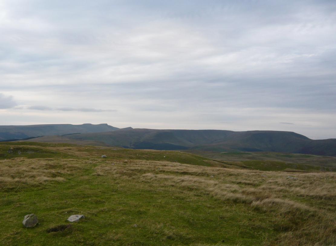
Bryn is a prominent hill located in Brecknockshire, Wales. Rising to an elevation of approximately 1,027 feet (313 meters), it offers stunning panoramic views of the surrounding countryside. Situated near the town of Brecon, Bryn is a popular destination for outdoor enthusiasts and nature lovers.
The hill is characterized by its rugged terrain, covered with a diverse range of vegetation, including heather, grasses, and scattered trees. Its slopes are dotted with rocky outcrops, adding to the picturesque landscape. Bryn is part of the Brecon Beacons National Park, which is renowned for its natural beauty and rich biodiversity.
The hill is easily accessible by foot, with numerous walking trails and paths leading to its summit. These trails cater to different skill levels, providing options for both casual walkers and experienced hikers. The journey to the top is often rewarded with breathtaking views of the surrounding countryside, including the nearby Black Mountains and Brecon Beacons.
Bryn also holds historical significance, with remnants of ancient settlements and landmarks scattered across its slopes. Archaeological sites, such as burial mounds and stone circles, can be discovered while exploring the hill. These remnants offer a glimpse into the area's rich history and add an element of intrigue to the overall experience.
Overall, Bryn is a captivating natural landmark that showcases the beauty and diversity of the Brecknockshire region. Whether it's for a leisurely stroll or a challenging hike, visitors to Bryn are sure to be captivated by its stunning vistas and its connection to the rich heritage of the area.
If you have any feedback on the listing, please let us know in the comments section below.
Bryn Images
Images are sourced within 2km of 51.895666/-3.3488164 or Grid Reference SO0722. Thanks to Geograph Open Source API. All images are credited.


Bryn is located at Grid Ref: SO0722 (Lat: 51.895666, Lng: -3.3488164)
Unitary Authority: Powys
Police Authority: Dyfed Powys
What 3 Words
///sinkhole.willpower.tripped. Near Brecon, Powys
Nearby Locations
Related Wikis

Coed Nant Menascin
Coed Nant Menascin is a Site of Special Scientific Interest (SSSI), around the Nant Menasgin, near Llanfrynach in the Brecon Beacons National Park, Powys...

Llanfrynach
Llanfrynach is a village and community in the county of Powys, Wales, and the historic county of Brecknockshire. The population of the community as taken...
Waun Rydd
Waun Rydd is a mountain in the Brecon Beacons National Park, in southern Powys, Wales. Its height is 769 m (2,523 ft) and it tops a large boggy plateau...

Bwlch y Ddwyallt
Bwlch y Ddwyallt is the name commonly applied to the high point of the plateau of Gwaun Cerrig Llwydion in the eastern part of the Brecon Beacons in south...
Pencelli
Pencelli is a small village within the community of Talybont-on-Usk in the county of Powys, Wales, and the historic county of Brecknockshire. The Welsh...
Nant Menasgin
The Nant Menasgin is a short river in Powys, Wales whose headwaters rise in Cwm Oergwm, beneath Fan y Bîg, in the central Brecon Beacons, and flow northeastwards...
Caerfanell
The Caerfanell is a river which rises in the central section of the Brecon Beacons National Park in Powys, Wales. It rises as Blaen Caerfanell on the plateau...

Aber Village
Aber Village or Aber Clydach is a hamlet within the Brecon Beacons National Park in Powys, Wales. It is centred on the minor road which runs south from...
Nearby Amenities
Located within 500m of 51.895666,-3.3488164Have you been to Bryn?
Leave your review of Bryn below (or comments, questions and feedback).