Carn a' Chlarsaich

Hill, Mountain in Perthshire

Scotland

Carn a' Chlarsaich

Glas Tulaichean and Loch nan Eun View from An Socach.  I have skied across the loch which is over 780m above sea level.  When not iced up, an island provides safe nesting for gulls, either common or black headed, don't know which, I have only been there in Winter.
Glas Tulaichean and Loch nan Eun Credit: Richard Webb

Carn a' Chlarsaich is a prominent hill located in the county of Perthshire, Scotland. Standing at an elevation of approximately 1,021 meters (3,350 feet), it is classified as a Corbett, which refers to a Scottish mountain between 2,500 and 3,000 feet in height.

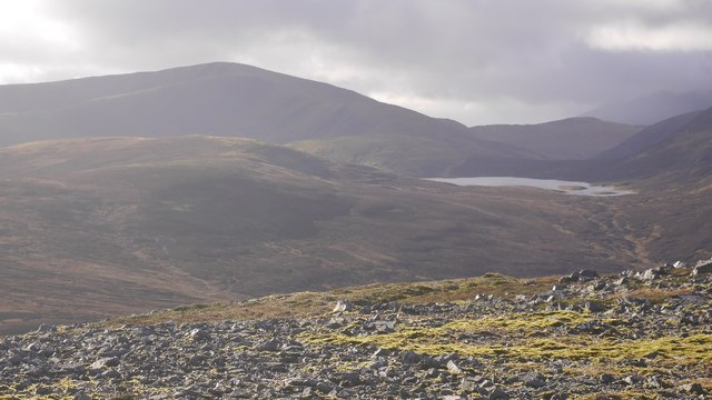
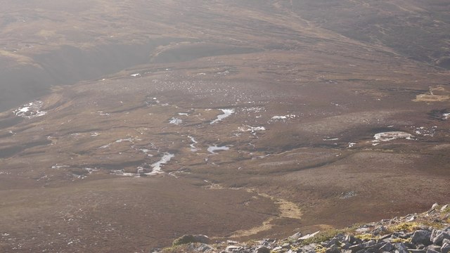
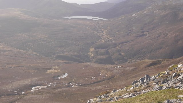
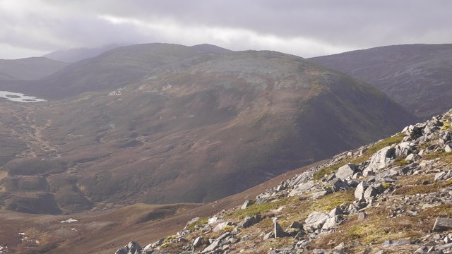
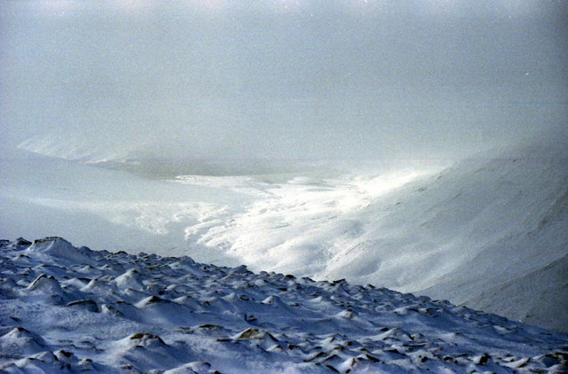
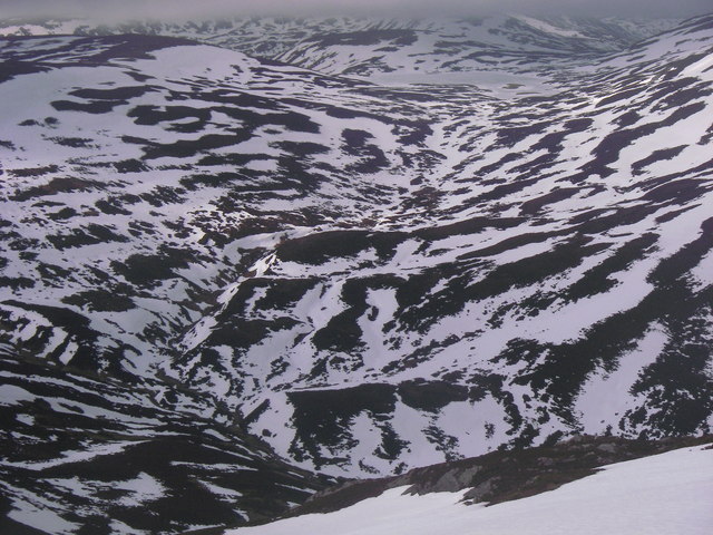
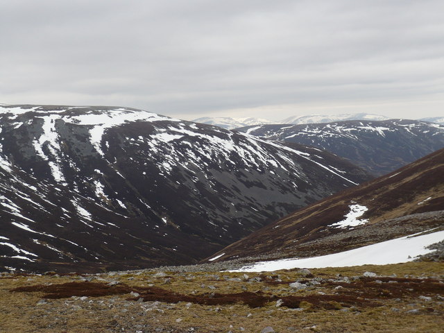
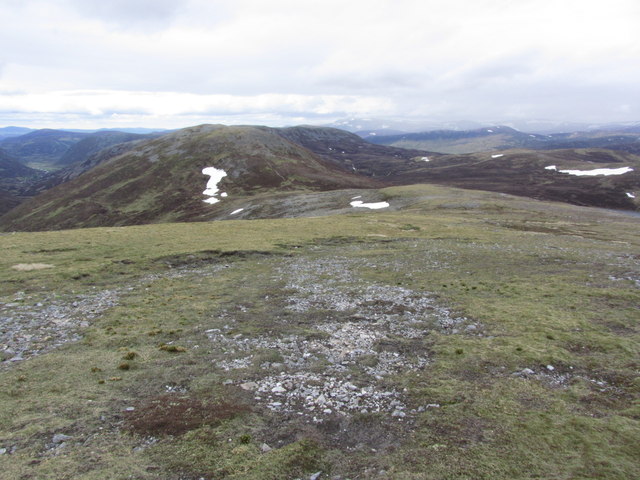
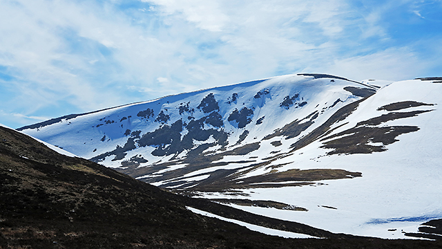
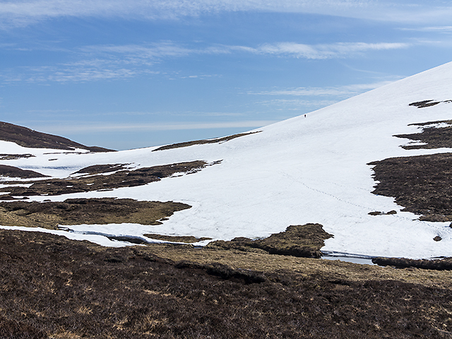
Situated in the southern part of the Cairngorms National Park, Carn a' Chlarsaich offers breathtaking panoramic views of the surrounding landscape. Its location in the Grampian Mountains provides visitors with the opportunity to witness stunning vistas of rolling hills, deep valleys, and remote glens. On clear days, it is possible to see as far as the distant peaks of the Cairngorms and Ben Nevis.

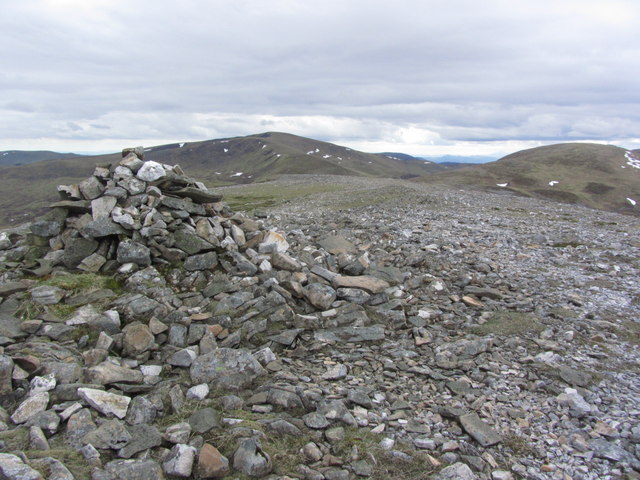
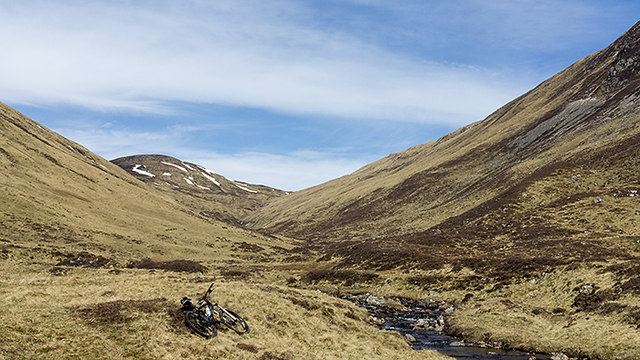
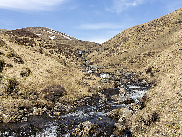
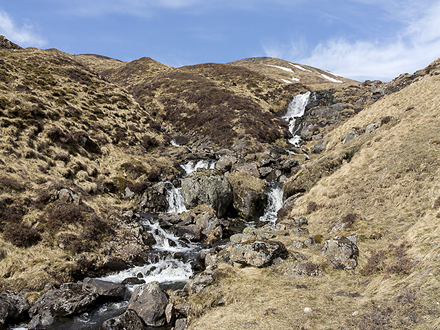
The ascent to the summit of Carn a' Chlarsaich is suitable for experienced hikers and mountaineers due to its steep and rugged terrain. The route typically begins from the village of Blair Atholl and follows a path that leads through heather-covered slopes and rocky outcrops. As climbers make their way up, they may encounter several streams and small waterfalls cascading down the hillside.

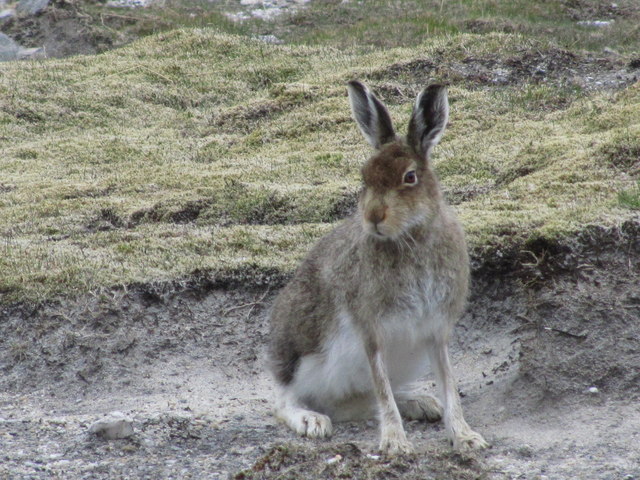
Wildlife enthusiasts will find Carn a' Chlarsaich particularly appealing, as the area is home to a diverse range of flora and fauna. Red deer, mountain hares, and golden eagles are among the species that inhabit the region, and lucky visitors may even catch a glimpse of these magnificent creatures during their visit.

Overall, Carn a' Chlarsaich is a captivating destination for outdoor enthusiasts and nature lovers alike, offering an exhilarating climb and stunning views of the picturesque Perthshire countryside.

If you have any feedback on the listing, please let us know in the comments section below.

Carn a' Chlarsaich Images

Images are sourced within 2km of 56.883201/-3.5293158 or Grid Reference NO0677. Thanks to Geograph Open Source API. All images are credited.

Glas Tulaichean and Loch nan Eun View from An Socach.  I have skied across the loch which is over 780m above sea level.  When not iced up, an island provides safe nesting for gulls, either common or black headed, don't know which, I have only been there in Winter.
Glas Tulaichean and Loch nan Eun
View from An Socach. I have skied across the loch which is over 780m above sea level. When not iced up, an island provides safe nesting for gulls, either common or black headed, don't know which, I have only been there in Winter.
Bog beneath An Socach A boggy col at the head of the Baddoch Glen. Fortunately the only time that I have crossed it was on skis.
Bog beneath An Socach
A boggy col at the head of the Baddoch Glen. Fortunately the only time that I have crossed it was on skis.
Allt Cac Dubh Draining into Glen Ey.  Not sure which way Loch an Eun normally drains. Into Glen Ey, or Glen Taitnaich.  Anyone walking the area in the wet will appreciate the name.
Allt Cac Dubh
Draining into Glen Ey. Not sure which way Loch an Eun normally drains. Into Glen Ey, or Glen Taitnaich. Anyone walking the area in the wet will appreciate the name.
Beinn Iutharn Bheag View from An Socach of one of Sir Hugh's originals, downgraded to a top in the 1920s.  I've been up there, but it was full on snow, so did not return with a photo.
Beinn Iutharn Bheag
View from An Socach of one of Sir Hugh's originals, downgraded to a top in the 1920s. I've been up there, but it was full on snow, so did not return with a photo.
View south west from west top of An Socach To a frozen Loch nan Eun. Beinn Iutharn Bheag on the right.
View south west from west top of An Socach
To a frozen Loch nan Eun. Beinn Iutharn Bheag on the right.
Descending from An Socach Into Glen Ey with Loch nan Eun in the centre.
Descending from An Socach
Into Glen Ey with Loch nan Eun in the centre.
Allt Cac Dubh and Loch nan Eun View of upland between An Socachn and Loch nan Eun, with snow filled stream bed.
Allt Cac Dubh and Loch nan Eun
View of upland between An Socachn and Loch nan Eun, with snow filled stream bed.
South-eastern slopes of Beinn Iutharn Mhòr A typical view in this remote and peaceful area - high rounded vegetated hills with grey screes, more fertile than the high Cairngorms to the north which can be glimpsed in this photograph.
South-eastern slopes of Beinn Iutharn Mhòr
A typical view in this remote and peaceful area - high rounded vegetated hills with grey screes, more fertile than the high Cairngorms to the north which can be glimpsed in this photograph.
Mountain hare near summit of Mam nan Carn
Ridge NE towards Beinn Iutharn Bheag from Mam nan Carn
On Beinn Iutharn Bheag with view towards Mam nan Carn
South of Loch nan Eun Late lying snow on the southern shore of Loch nan Eun, with a just a few hillwalkers leaving footprints in this remote area.
South of Loch nan Eun
Late lying snow on the southern shore of Loch nan Eun, with a just a few hillwalkers leaving footprints in this remote area.
Loch nan Eun Loch nan Eun, still fringed by snow in mid-April.
Loch nan Eun
Loch nan Eun, still fringed by snow in mid-April.
View towards Glas Choire Beag Late lying snow in Glas Choire Beag, situated to the north east of the Munro Glas Tulaichean.
View towards Glas Choire Beag
Late lying snow in Glas Choire Beag, situated to the north east of the Munro Glas Tulaichean.
Moorland west of Loch nan Eun Snow patches on moorland situated to the west of Loch nan Eun.
Moorland west of Loch nan Eun
Snow patches on moorland situated to the west of Loch nan Eun.
By the Allt Easgaidh Moorland by the Allt Easgaidh in upper Glen Taitneach. The track through the glen ends here, and progress towards Loch nan Eun becomes more difficult on a bicycle - often used to speed up access to the Munros in this area which are remote, requiring a lengthy approach.
By the Allt Easgaidh
Moorland by the Allt Easgaidh in upper Glen Taitneach. The track through the glen ends here, and progress towards Loch nan Eun becomes more difficult on a bicycle - often used to speed up access to the Munros in this area which are remote, requiring a lengthy approach.
The Allt Easgaidh The course of the Allt Easgaidh, tumbling from Loch nan Eun towards Glen Taitneach.
The Allt Easgaidh
The course of the Allt Easgaidh, tumbling from Loch nan Eun towards Glen Taitneach.
Waterfalls on the Allt Easgaidh Waterfalls on the steep upper section of the Allt Easgaidh. A path follows the banks of this burn leading towards Loch nan Eun.
Waterfalls on the Allt Easgaidh
Waterfalls on the steep upper section of the Allt Easgaidh. A path follows the banks of this burn leading towards Loch nan Eun.
Show me another place!

Carn a' Chlarsaich is located at Grid Ref: NO0677 (Lat: 56.883201, Lng: -3.5293158)

Unitary Authority: Perth and Kinross

Police Authority: Tayside

What 3 Words

///hockey.jousting.having. Near Inverey, Aberdeenshire

Related Wikis

Loch nan Eun

Loch nan Eun is a remote freshwater loch, located in Gleann Taitneach in the Grampian Mountains, Perth and Kinross, some 4.5 miles west of The Cairnwell...

An Socach (Glen Ey)

An Socach is a Scottish mountain situated some three miles (5 km) west of the A93 road from Perth to Braemar. It is located at grid ref. 080800 on Ordnance...

Glas Tulaichean

Glas Tulaichean (Scottish Gaelic: An Glas-Thulchan) is a large, complex mountain in the Mounth, Scotland. It is about 18 kilometres (11 mi) south of Braemar...

Beinn Iutharn Mhòr

Beinn Iutharn Mhor (1,045 m) is a mountain in the Grampian Mountains of Scotland. It lies north of Glen Shee on the Aberdeenshire and Perthshire border...

Nearby Amenities

Located within 500m of 56.883201,-3.5293158
Càrn a'Chlarsaich
Ele: 867
Natural: peak
Lat/Long: 56.8836168/-3.5292509
Waterway: waterfall
Lat/Long: 56.8824468/-3.537194
Waterway: waterfall
Lat/Long: 56.8818147/-3.5369037
The data included in this document is from www.openstreetmap.org. The data is made available under ODbL.

Have you been to Carn a' Chlarsaich?

Leave your review of Carn a' Chlarsaich below (or comments, questions and feedback).