Beinn Iutharn Bheag

Hill, Mountain in Aberdeenshire

Scotland

Beinn Iutharn Bheag

Loch nan Eun Nestled amongst the hills the loch is quite remote though hill access paths skirt around it.
Loch nan Eun Credit: Iain Russell

The requested URL returned error: 429 Too Many Requests

If you have any feedback on the listing, please let us know in the comments section below.

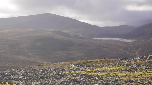
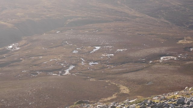
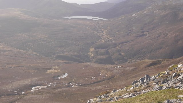
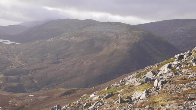
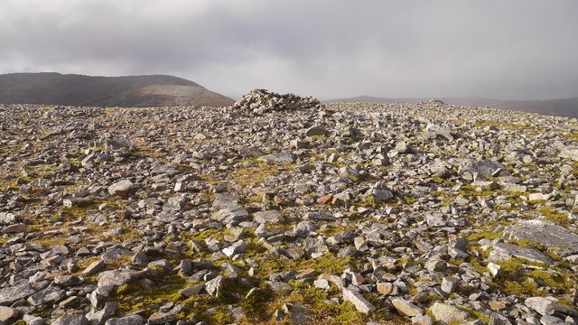
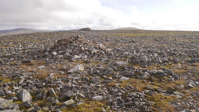
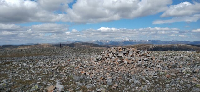
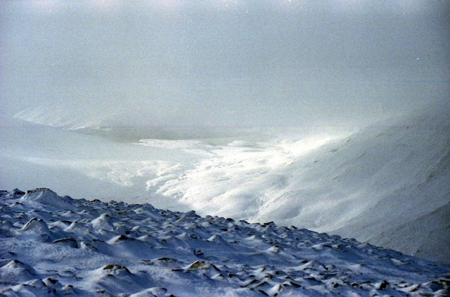
Beinn Iutharn Bheag Images

Images are sourced within 2km of 56.894016/-3.5360782 or Grid Reference NO0679. Thanks to Geograph Open Source API. All images are credited.

Loch nan Eun Nestled amongst the hills the loch is quite remote though hill access paths skirt around it.
Loch nan Eun
Nestled amongst the hills the loch is quite remote though hill access paths skirt around it.
Summit of Beinn Iutharn Mhor A Munro defined as a mountain in Scotland with a height over 3,000 feet (914.4 m), and which is on the Scottish Mountaineering Club (SMC) official list of Munros; there is no explicit topographical prominence requirement.
Summit of Beinn Iutharn Mhor
A Munro defined as a mountain in Scotland with a height over 3,000 feet (914.4 m), and which is on the Scottish Mountaineering Club (SMC) official list of Munros; there is no explicit topographical prominence requirement.
Loch nan Eun A quiet spot for reflection
Loch nan Eun
A quiet spot for reflection
Boggy ground ahead north-east of Glas Tulaichean Looking north-east from the ridge of Glas Tulaichean to boggy ground on the col, with Being Iutharn Bheag and Loch nan Eun in the distance.
Boggy ground ahead north-east of Glas Tulaichean
Looking north-east from the ridge of Glas Tulaichean to boggy ground on the col, with Being Iutharn Bheag and Loch nan Eun in the distance.
Peninsula on Loch nan Eun Peninsula jutting out onto the south-western edge of Loch nan Eun.
Peninsula on Loch nan Eun
Peninsula jutting out onto the south-western edge of Loch nan Eun.
Glas Tulaichean and Loch nan Eun View from An Socach.  I have skied across the loch which is over 780m above sea level.  When not iced up, an island provides safe nesting for gulls, either common or black headed, don't know which, I have only been there in Winter.
Glas Tulaichean and Loch nan Eun
View from An Socach. I have skied across the loch which is over 780m above sea level. When not iced up, an island provides safe nesting for gulls, either common or black headed, don't know which, I have only been there in Winter.
Bog beneath An Socach A boggy col at the head of the Baddoch Glen. Fortunately the only time that I have crossed it was on skis.
Bog beneath An Socach
A boggy col at the head of the Baddoch Glen. Fortunately the only time that I have crossed it was on skis.
Allt Cac Dubh Draining into Glen Ey.  Not sure which way Loch an Eun normally drains. Into Glen Ey, or Glen Taitnaich.  Anyone walking the area in the wet will appreciate the name.
Allt Cac Dubh
Draining into Glen Ey. Not sure which way Loch an Eun normally drains. Into Glen Ey, or Glen Taitnaich. Anyone walking the area in the wet will appreciate the name.
Beinn Iutharn Bheag View from An Socach of one of Sir Hugh's originals, downgraded to a top in the 1920s.  I've been up there, but it was full on snow, so did not return with a photo.
Beinn Iutharn Bheag
View from An Socach of one of Sir Hugh's originals, downgraded to a top in the 1920s. I've been up there, but it was full on snow, so did not return with a photo.
An Socach summit cairn A very flat moss and quartzite summit, but the view is very fine.

There are a few An Socachs in the Highlands, three of them in Munro's Tables. (One is also called Meall a' Chraisg which could reduce confusion).  This one is in the rolling hill country at the head of Glen Ey, south of Braemar and like its neighbours has a quartzite cap. The rock is frost shattered giving angular boulder fields, but the walking is easy, this is no Schiehallion or Sgùrr Bàn.  The highest point is at the western end, switching the original Munro's tables which had the eastern top as the highest. 
The hill is often done from the Baddoch Glen, but can also be visited from Glen Ey.  Apart from it not being exactly a roadside hill, this is one of the easier munros.
An Socach summit cairn
A very flat moss and quartzite summit, but the view is very fine. There are a few An Socachs in the Highlands, three of them in Munro's Tables. (One is also called Meall a' Chraisg which could reduce confusion). This one is in the rolling hill country at the head of Glen Ey, south of Braemar and like its neighbours has a quartzite cap. The rock is frost shattered giving angular boulder fields, but the walking is easy, this is no Schiehallion or Sgùrr Bàn. The highest point is at the western end, switching the original Munro's tables which had the eastern top as the highest. The hill is often done from the Baddoch Glen, but can also be visited from Glen Ey. Apart from it not being exactly a roadside hill, this is one of the easier munros.
Cairns, An Socach A pair of cairns on the west top of the Mar An Socach. The distant cairn is the summit.
Cairns, An Socach
A pair of cairns on the west top of the Mar An Socach. The distant cairn is the summit.
Cairn on An Socach One of two cairns on the summit area of the Munro. The app on my phone was happier with the cairn in the background to the left as being the actual summit.
Cairn on An Socach
One of two cairns on the summit area of the Munro. The app on my phone was happier with the cairn in the background to the left as being the actual summit.
Loch nan Eun Loch at the head of Gleann Taitneach, very much a landmark amongst these rolling hills.
Loch nan Eun
Loch at the head of Gleann Taitneach, very much a landmark amongst these rolling hills.
Loch nan Eun The loch and its gullery islands seen from near the summit of Glas Tulaichean.
Loch nan Eun
The loch and its gullery islands seen from near the summit of Glas Tulaichean.
Summit cairn of An Socach A perfect winter day with the ice crystals singing across the frozen surface as you strode along the summit ridge.
Summit cairn of An Socach
A perfect winter day with the ice crystals singing across the frozen surface as you strode along the summit ridge.
View south west from west top of An Socach To a frozen Loch nan Eun. Beinn Iutharn Bheag on the right.
View south west from west top of An Socach
To a frozen Loch nan Eun. Beinn Iutharn Bheag on the right.
Descending from An Socach Into Glen Ey with Loch nan Eun in the centre.
Descending from An Socach
Into Glen Ey with Loch nan Eun in the centre.
An Socach summit cairn in mist
Show me another place!

Beinn Iutharn Bheag is located at Grid Ref: NO0679 (Lat: 56.894016, Lng: -3.5360782)

Unitary Authority: Aberdeenshire

Police Authority: North East

What 3 Words

///unhelpful.loafing.hospitals. Near Inverey, Aberdeenshire

Nearby Locations

Beinn Iutharn Bheag

Related Wikis

Loch nan Eun

Loch nan Eun is a remote freshwater loch, located in Gleann Taitneach in the Grampian Mountains, Perth and Kinross, some 4.5 miles west of The Cairnwell...

An Socach (Glen Ey)

An Socach is a Scottish mountain situated some three miles (5 km) west of the A93 road from Perth to Braemar. It is located at grid ref. 080800 on Ordnance...

Beinn Iutharn Mhòr

Beinn Iutharn Mhor (1,045 m) is a mountain in the Grampian Mountains of Scotland. It lies north of Glen Shee on the Aberdeenshire and Perthshire border...

Glas Tulaichean

Glas Tulaichean (Scottish Gaelic: An Glas-Thulchan) is a large, complex mountain in the Mounth, Scotland. It is about 18 kilometres (11 mi) south of Braemar...

Nearby Amenities

Located within 500m of 56.894016,-3.5360782
Beinn Iutharn Bheag
Ele: 951
Natural: peak
Lat/Long: 56.8934835/-3.5360468
The data included in this document is from www.openstreetmap.org. The data is made available under ODbL.

Have you been to Beinn Iutharn Bheag?

Leave your review of Beinn Iutharn Bheag below (or comments, questions and feedback).