Darlees Rig

Hill, Mountain in Lanarkshire

Scotland

Darlees Rig

West Water Reservoir from the air Viewed over Harrows Law from a Prague bound flight from Edinburgh.
West Water Reservoir from the air Credit: Thomas Nugent

Darlees Rig, located in Lanarkshire, Scotland, is a prominent hill/mountain standing at an elevation of approximately 630 meters (2,067 feet) above sea level. It forms part of the Southern Uplands range and is situated near the town of Abington.

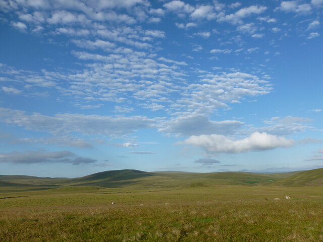
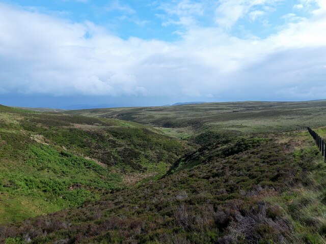
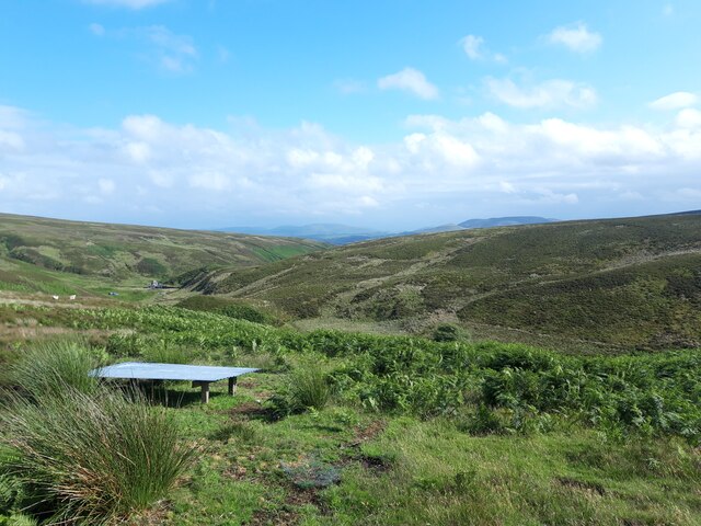
The hill/mountain is characterized by its distinctive shape and rugged terrain, making it a popular destination for hikers, mountaineers, and outdoor enthusiasts. It offers breathtaking panoramic views of the surrounding countryside, including the picturesque valleys, rolling hills, and distant peaks of the Southern Uplands.

The ascent to Darlees Rig can be challenging, with steep slopes and uneven surfaces, requiring a moderate level of fitness and hiking experience. However, the efforts are rewarded with stunning vistas at the summit, making it a fulfilling experience for adventurers.

The hill/mountain is also home to a diverse range of flora and fauna, including heather, grasses, and various species of birds and small mammals. Its remote location and relatively untouched environment provide a haven for wildlife, attracting nature enthusiasts and birdwatchers.

Darlees Rig is easily accessible, with several hiking trails and paths leading to its summit. The surrounding area offers ample parking facilities and amenities for visitors, ensuring a comfortable and enjoyable experience.

Overall, Darlees Rig in Lanarkshire is a scenic and challenging destination for outdoor enthusiasts, offering stunning views, diverse wildlife, and a rewarding hiking experience.

If you have any feedback on the listing, please let us know in the comments section below.

Darlees Rig Images

Images are sourced within 2km of 55.762535/-3.4914413 or Grid Reference NT0653. Thanks to Geograph Open Source API. All images are credited.

West Water Reservoir from the air Viewed over Harrows Law from a Prague bound flight from Edinburgh.
West Water Reservoir from the air
Viewed over Harrows Law from a Prague bound flight from Edinburgh.
Long Pond on Adder Burn This pond is one of two (the other is far smaller and a short distance downstream) not marked on the newest freely available online OS map from the early 1960s. I reckon it must have been dammed for shooting purposes as it's in the right area for it - not far NorthWest of here is a smallish fenced-off shooting 'estate', that may or may not still be operational. There is a hard slightly overgrown track leading from there to the spot at which this picture was taken.
It would be a nice peaceful place to pitch a tent, though there was no obvious sigh of life in the water, just a few small birds flying out of the heather as I approached.
Long Pond on Adder Burn
This pond is one of two (the other is far smaller and a short distance downstream) not marked on the newest freely available online OS map from the early 1960s. I reckon it must have been dammed for shooting purposes as it's in the right area for it - not far NorthWest of here is a smallish fenced-off shooting 'estate', that may or may not still be operational. There is a hard slightly overgrown track leading from there to the spot at which this picture was taken. It would be a nice peaceful place to pitch a tent, though there was no obvious sigh of life in the water, just a few small birds flying out of the heather as I approached.
Black Birn A 'birn' is either something to do with a clarinet mouthpiece, an old Scots contraction of 'burden', or a stem of heather left after the rest of the plant has disappeared due to muirburning. The heather gets burnt in order to promote new growth: this is said to provide more nourishment than the older heathers - some of which get left for shelter - to the grouse in gameshooting areas. It obviously must be the third meaning that gives this small flat-topped hill its name. The Dictionaries of the Scots Language website is often a handy resource for getting to the bottom of old topographical names in Central Scotland..
It is rather hard to determine exactly where the top of the hill is, and I notice it has crossed grid-squares within the last 60 years. The surface is a mix of heather, grass and large round clumps of bouncy moss, and the hill behind the lone conifer is Harrow's Law.
Black Birn
A 'birn' is either something to do with a clarinet mouthpiece, an old Scots contraction of 'burden', or a stem of heather left after the rest of the plant has disappeared due to muirburning. The heather gets burnt in order to promote new growth: this is said to provide more nourishment than the older heathers - some of which get left for shelter - to the grouse in gameshooting areas. It obviously must be the third meaning that gives this small flat-topped hill its name. The Dictionaries of the Scots Language website is often a handy resource for getting to the bottom of old topographical names in Central Scotland.. It is rather hard to determine exactly where the top of the hill is, and I notice it has crossed grid-squares within the last 60 years. The surface is a mix of heather, grass and large round clumps of bouncy moss, and the hill behind the lone conifer is Harrow's Law.
Altocumulus clouds over Craigengar Some striking altocumulus (I think) clouds over rolling moorland at the south-western end of the Pentland Hills.
Altocumulus clouds over Craigengar
Some striking altocumulus (I think) clouds over rolling moorland at the south-western end of the Pentland Hills.
Marker post, Black Law Looking towards the two summits of Green Side and Bleak Law. The post marks a path coming up from the waterworks road contouring the south side of the hill.
Marker post, Black Law
Looking towards the two summits of Green Side and Bleak Law. The post marks a path coming up from the waterworks road contouring the south side of the hill.
Nearing the summit, Black Law On the waymarked route over the hills to Crosswood on the west side of the Pentlands. It passes close by the Covenanter's Grave.
Nearing the summit, Black Law
On the waymarked route over the hills to Crosswood on the west side of the Pentlands. It passes close by the Covenanter's Grave.
Path on Black Law A sketchy path with marker posts on the ridge, nearing the Covenanter's Grave. Darlees Rig is ahead.
Path on Black Law
A sketchy path with marker posts on the ridge, nearing the Covenanter's Grave. Darlees Rig is ahead.
The Covenanter's Grave, Black Law The stone commemorates the last resting place of John Carphin, a man wounded in the Battle of Rullion Green, November 1666,  between government troops and  the Covenanters who supported a Presbyterian Church of Scotland. He found his way to the cottage of Adam Sanderson, a shepherd from nearby Blackhill, but died soon afterwards. Sanderson buried the Covenanter on the hill within sight of his native Ayrshire.

(Source: Discovering the Pentland Hills by Jim Crumley, John Donald Publishers 1991)
The Covenanter's Grave, Black Law
The stone commemorates the last resting place of John Carphin, a man wounded in the Battle of Rullion Green, November 1666, between government troops and the Covenanters who supported a Presbyterian Church of Scotland. He found his way to the cottage of Adam Sanderson, a shepherd from nearby Blackhill, but died soon afterwards. Sanderson buried the Covenanter on the hill within sight of his native Ayrshire. (Source: Discovering the Pentland Hills by Jim Crumley, John Donald Publishers 1991)
Covenanter's Gravestone, Black Law The stone commemorates the last resting place of John Carphin, a man wounded in the Battle of Rullion Green, November 1666,  between government troops and  the Covenanters who supported a Presbyterian Church of Scotland. He found his way to the cottage of Adam Sanderson, a shepherd from nearby Blackhill, but died soon afterwards. Sanderson buried the Covenanter on the hill within sight of his native Ayrshire.

(Source: Discovering the Pentland Hills by Jim Crumley, John Donald Publishers 1991)

This stone was set up in 1841, in place of the original which is now in Dolphinton church. It is inscribed as follows:

Sacred
To the Memory of
a Covenanter
who fought and was wounded
at Rullion Green
Nov 28th 1666
and who died at Oaken Bush
the day after the Battle
and was buried here
by Adam Sanderson
of Blackhill.
Covenanter's Gravestone, Black Law
The stone commemorates the last resting place of John Carphin, a man wounded in the Battle of Rullion Green, November 1666, between government troops and the Covenanters who supported a Presbyterian Church of Scotland. He found his way to the cottage of Adam Sanderson, a shepherd from nearby Blackhill, but died soon afterwards. Sanderson buried the Covenanter on the hill within sight of his native Ayrshire. (Source: Discovering the Pentland Hills by Jim Crumley, John Donald Publishers 1991) This stone was set up in 1841, in place of the original which is now in Dolphinton church. It is inscribed as follows: Sacred To the Memory of a Covenanter who fought and was wounded at Rullion Green Nov 28th 1666 and who died at Oaken Bush the day after the Battle and was buried here by Adam Sanderson of Blackhill.
Looking west from the Covenanter's Grave, Black Law The stone faces the native hills of Ayrshire of John Carphin, who died after the Battle of Rullion Green in November 1666. The hill on the left is Bleak Law.

See <a href="https://www.geograph.org.uk/photo/7527648">NT0752 : Covenanter's Gravestone, Black Law</a> for more details of this historic grave.
Looking west from the Covenanter's Grave, Black Law
The stone faces the native hills of Ayrshire of John Carphin, who died after the Battle of Rullion Green in November 1666. The hill on the left is Bleak Law. See NT0752 : Covenanter's Gravestone, Black Law for more details of this historic grave.
Cotton grass on Black Law A moorland species at about 400m just off the line of the path crossing the hills from Garvald to Crosswood.
Cotton grass on Black Law
A moorland species at about 400m just off the line of the path crossing the hills from Garvald to Crosswood.
Ravens Cleugh A burn draining into the Medwin Water, at the south-western end of the Pentland Hills.
Ravens Cleugh
A burn draining into the Medwin Water, at the south-western end of the Pentland Hills.
View down the Medwin Water The building shown on the map, by the small dam, is visible in the middle distance.
View down the Medwin Water
The building shown on the map, by the small dam, is visible in the middle distance.
Black Law Pentlands in bloom.
Black Law
Pentlands in bloom.
Water intake, West Water Gathering water for West Water (another one) Reservoir.
Water intake, West Water
Gathering water for West Water (another one) Reservoir.
Under Bleak Law Upper reaches of West Water.
Under Bleak Law
Upper reaches of West Water.
Headwaters of the West Water Moorland under Darlees Rig.
Headwaters of the West Water
Moorland under Darlees Rig.
Burnt ground, Pentland Hills Site of a muir burn in the previous Spring.
Burnt ground, Pentland Hills
Site of a muir burn in the previous Spring.
Show me another place!

Darlees Rig is located at Grid Ref: NT0653 (Lat: 55.762535, Lng: -3.4914413)

Unitary Authority: South Lanarkshire

Police Authority: Lanarkshire

What 3 Words

///lifted.stunt.soda. Near West Linton, Scottish Borders

Nearby Locations

Darlees Rig

Related Wikis

Tarbrax

Tarbrax (Scottish Gaelic: "An Tòrr Breac" - meaning "the speckled tor") is a small village in the Parish of Carnwath, South Lanarkshire, Scotland. It...

Little Sparta

Little Sparta is a garden at Dunsyre in the Pentland Hills in South Lanarkshire, Scotland, created by artist and poet Ian Hamilton Finlay and his wife...

Dunsyre

Dunsyre (Scottish Gaelic: Dùn Saghair) is a village in South Lanarkshire, Scotland. It is 10 kilometres (6 mi) from Carnwath. Dunsyre is associated with...

Garvald, South Lanarkshire

Garvald is a small settlement on the boundary between the Scottish Borders and South Lanarkshire, Scotland. == References == The geographic coordinates...

Nearby Amenities

Located within 500m of 55.762535,-3.4914413
Darlees Rig
Natural: peak
Source: NLS-OS-1st_Series
Wikidata: Q24661186
Lat/Long: 55.7625396/-3.4914207
The data included in this document is from www.openstreetmap.org. The data is made available under ODbL.

Have you been to Darlees Rig?

Leave your review of Darlees Rig below (or comments, questions and feedback).