Big Dod

Hill, Mountain in Peeblesshire

Scotland

Big Dod

Quarry, Tweeddale In the vast forests beside the A701. In recent years there has been a lot of clear felling. An older photo: <a href="https://www.geograph.org.uk/photo/163740">NT0518 : Disused Quarry</a>.
Quarry, Tweeddale Credit: Richard Webb

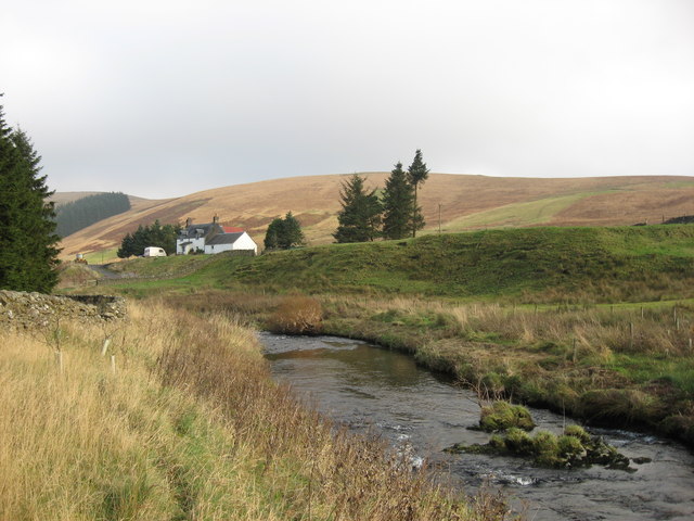
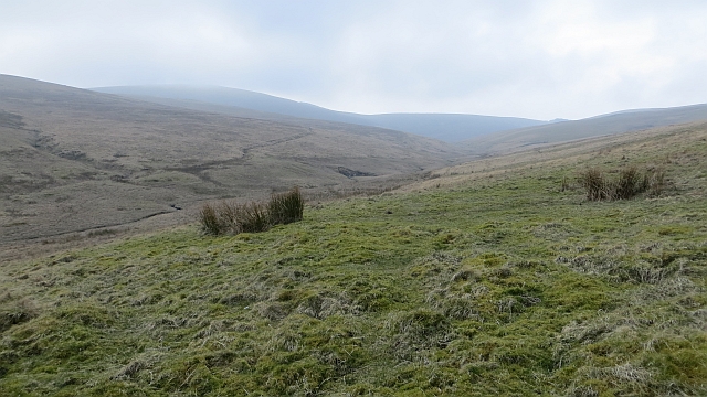
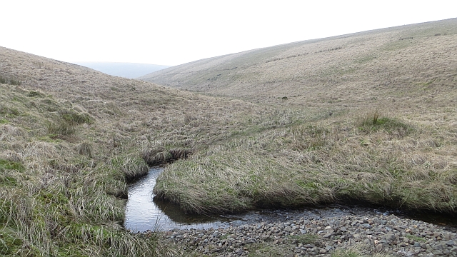
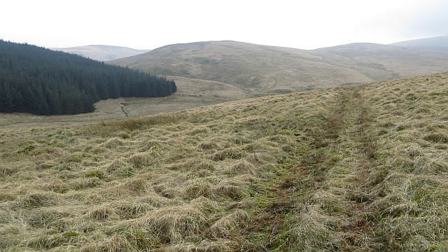
Big Dod is a prominent hill located in the region of Peeblesshire, Scotland. It is part of the picturesque Southern Uplands, which are renowned for their stunning natural landscapes. Rising to an elevation of approximately 587 meters (1,926 feet), Big Dod offers breathtaking views of the surrounding countryside.

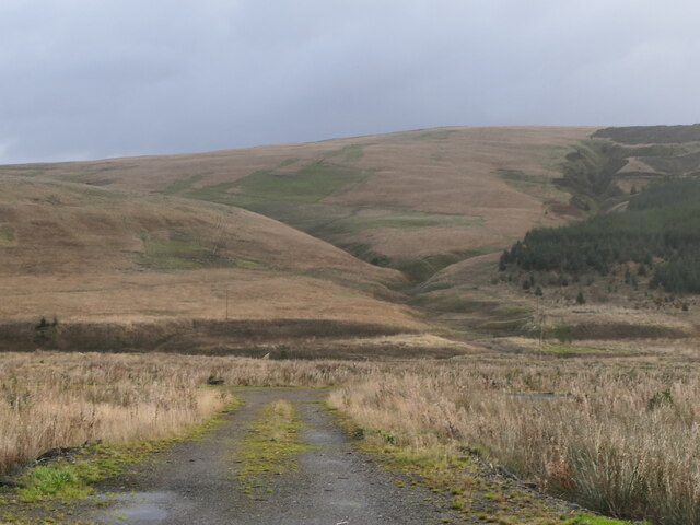
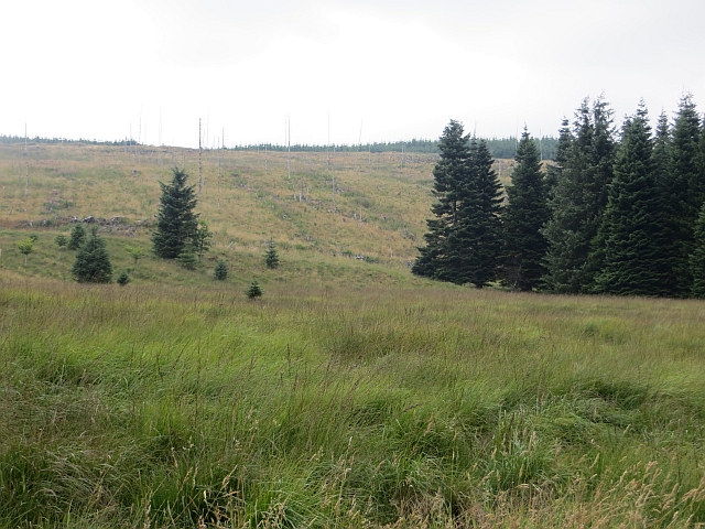
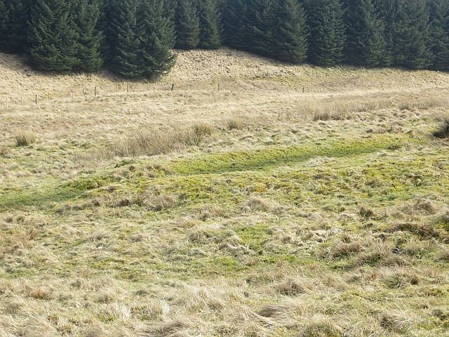
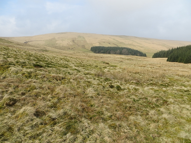
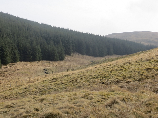
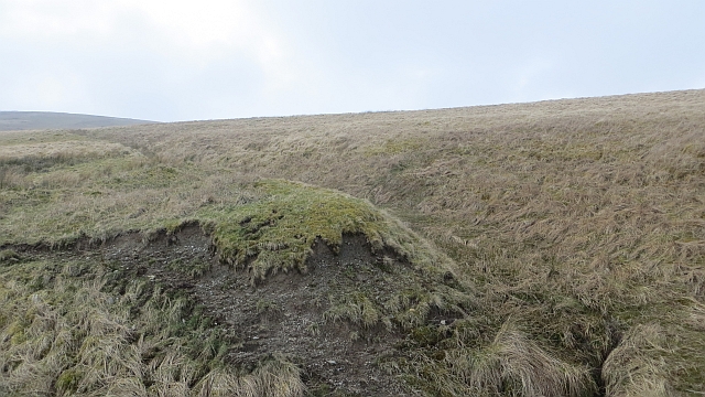
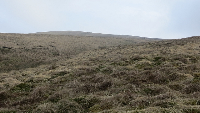
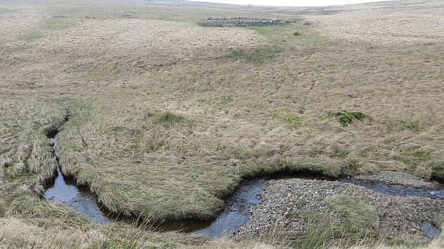
The hill is characterized by its gentle slopes and rolling terrain, making it a popular destination for hikers and nature enthusiasts. Its location within the Southern Uplands provides an ideal setting for outdoor activities such as walking, hill climbing, and bird watching. The diverse flora and fauna found in this area add to its appeal, attracting a variety of wildlife.

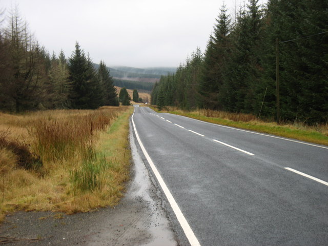
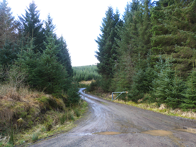
Big Dod is easily accessible via a well-established network of paths and trails, making it suitable for both beginners and experienced hikers. The ascent to the summit is relatively moderate, with sections of the trail offering more challenging terrain. Along the way, visitors can enjoy the beauty of the surrounding heather-covered moorland and the tranquility of the natural surroundings.

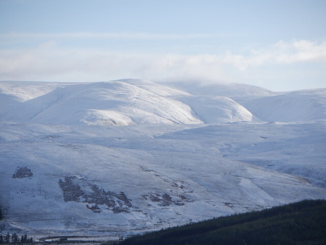
At the top of Big Dod, visitors are rewarded with panoramic views of the surrounding countryside, including the rolling hills, valleys, and distant peaks. On clear days, it is even possible to catch a glimpse of the Scottish Borders and the nearby Tweed Valley. The summit provides an excellent vantage point for photography and a peaceful spot to relax and take in the awe-inspiring scenery.

Overall, Big Dod in Peeblesshire is a captivating hill that offers a memorable outdoor experience. Whether visitors seek a challenging hike or a peaceful walk in nature, this picturesque mountain provides a range of opportunities for exploration and appreciation of Scotland's natural beauty.

If you have any feedback on the listing, please let us know in the comments section below.
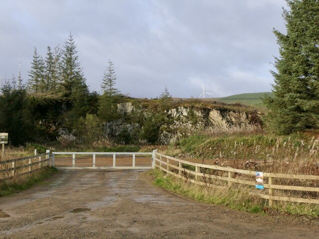
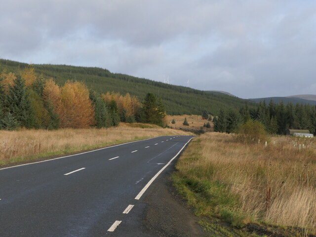
Big Dod Images

Images are sourced within 2km of 55.467928/-3.4861808 or Grid Reference NT0620. Thanks to Geograph Open Source API. All images are credited.

Quarry, Tweeddale In the vast forests beside the A701. In recent years there has been a lot of clear felling. An older photo: <a href="https://www.geograph.org.uk/photo/163740">NT0518 : Disused Quarry</a>.
Quarry, Tweeddale
In the vast forests beside the A701. In recent years there has been a lot of clear felling. An older photo: NT0518 : Disused Quarry.
Second generation conifers, Tweeddale The next crop growing beside the A701.
Second generation conifers, Tweeddale
The next crop growing beside the A701.
Young trees, Tweeddale
View towards Hart Fell One of the last largish areas in upper Tweeddale which has not been covered in turbines or conifers - for now.  The big hill is Hart Fell.
View towards Hart Fell
One of the last largish areas in upper Tweeddale which has not been covered in turbines or conifers - for now. The big hill is Hart Fell.
River Tweed near Fingland The Tweed upstream of Fingland with Little Dodd in the background.
River Tweed near Fingland
The Tweed upstream of Fingland with Little Dodd in the background.
The A701 descends through the forest
An unplanted area A small patch of ground beside the A701 which has avoided the spruce planters.
An unplanted area
A small patch of ground beside the A701 which has avoided the spruce planters.
Disused forest quarry beside the A701 See also <a href="https://www.geograph.org.uk/photo/163740">NT0518 : Disused Quarry</a>.
Disused forest quarry beside the A701
Forestry road below Neth Hill See also <a href="https://www.geograph.org.uk/photo/1751291">NT0519 : Forestry track on High Hogg Hill</a>.
Forestry road below Neth Hill
Old field boundary, Fingland Burn A corner in a group of mossy banks which would once have been enclosures.
Old field boundary, Fingland Burn
A corner in a group of mossy banks which would once have been enclosures.
Fingland Burn There are the remains of several enclosures here.
Fingland Burn
There are the remains of several enclosures here.
Along the Fingland Burn Edge of woodland which covers Glengonnor Hill.
Along the Fingland Burn
Edge of woodland which covers Glengonnor Hill.
Fingland Burn The burn drains the north side of Craigmaid.
Fingland Burn
The burn drains the north side of Craigmaid.
Cross drain dogleg What appears to be erosion deepened drains, now grassed over. The striking bend in the watercourse was mapped in the mid 19th century.
Cross drain dogleg
What appears to be erosion deepened drains, now grassed over. The striking bend in the watercourse was mapped in the mid 19th century.
Slopes of Whitelaw Brae Rough grassland with Glack Knowe on the skyline.
Slopes of Whitelaw Brae
Rough grassland with Glack Knowe on the skyline.
Fingland Burn The upper reaches of the Fingland Burn and a stell which is not shown on mid 19th century maps but appears around 1900.
Fingland Burn
The upper reaches of the Fingland Burn and a stell which is not shown on mid 19th century maps but appears around 1900.
Fingland Burn
Fingland Burn
Fingland Burn Quadbike track on Peat Hill above the Fingland Burn.
Fingland Burn
Quadbike track on Peat Hill above the Fingland Burn.
Show me another place!

Big Dod is located at Grid Ref: NT0620 (Lat: 55.467928, Lng: -3.4861808)

Unitary Authority: The Scottish Borders

Police Authority: The Lothians and Scottish Borders

What 3 Words

///twitches.spruced.swells. Near Moffat, Dumfries & Galloway

Nearby Locations

Fingland Hill Big Dod

Related Wikis

Hawkshaw, Scottish Borders

Hawkshaw is a pair of semi-detached houses on the River Tweed, two miles southwest of Tweedsmuir in the Scottish Borders. Historically part of Peeblesshire...

Fruid Water

Fruid Water is a river in the Scottish Borders area of Scotland. The valley it occupies has been dammed to form the Fruid Reservoir. The river is a tributary...

Fruid Reservoir

Fruid is a small reservoir in the Scottish Borders area of Scotland, UK, near Menzion. It is formed by damming the Fruid Water, and supplements the contents...

Menzion

Menzion, sometimes Minzion is a small settlement in southern Scotland near Tweedsmuir in the Scottish Borders, in the valley of the River Tweed. ��2...

Victoria Lodge railway station

Victoria Lodge railway station served the village of Tweedsmuir, Scottish Borders, Scotland from 1897 to 1905 on the Symington, Biggar and Broughton Railway...

Gathersnow Hill

Gathersnow Hill is a hill in the Culter Hills range, part of the Southern Uplands of Scotland. It lies west of the village of Tweedsmuir on the border...

Tweedsmuir

Tweedsmuir (Scottish Gaelic: Sliabh Thuaidh) is a village and civil parish in Tweeddale, the Scottish Borders Council district, southeastern Scotland....

Talla Reservoir

Talla Reservoir, located a mile from Tweedsmuir, Scottish Borders, Scotland, is an earth-work dam fed by Talla Water. The reservoir is supplemented by...

Nearby Amenities

Located within 500m of 55.467928,-3.4861808
Big Dod
Ele: 458
Munro: no
Natural: peak
Lat/Long: 55.46832/-3.4862342
Power: pole
Lat/Long: 55.47002/-3.4928962
Power: pole
Lat/Long: 55.4693953/-3.49304
Power: pole
Lat/Long: 55.4687418/-3.4931923
Power: pole
Lat/Long: 55.4680019/-3.4931267
Power: pole
Lat/Long: 55.4672789/-3.4930675
Power: pole
Lat/Long: 55.4665965/-3.4930252
Power: pole
Lat/Long: 55.4658806/-3.4929892
The data included in this document is from www.openstreetmap.org. The data is made available under ODbL.

Have you been to Big Dod?

Leave your review of Big Dod below (or comments, questions and feedback).