Burch Hill

Hill, Mountain in Somerset Somerset West and Taunton

England

Burch Hill

View from NCN344 near Stawley Mill Photograph taken looking north west from the NCN344 just north of Stawley Mill.
View from NCN344 near Stawley Mill Credit: Kevin Pearson

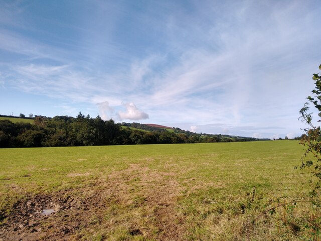
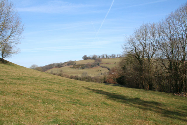
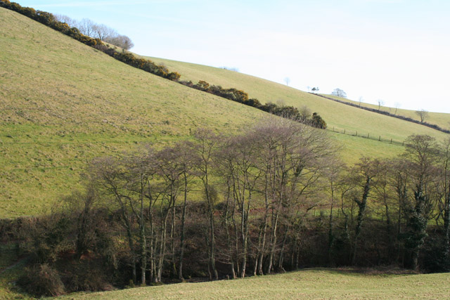
Burch Hill is a prominent hill located in the county of Somerset, England. It is situated in the Mendip Hills, a range of limestone hills known for their natural beauty and geological significance. Burch Hill stands at an elevation of approximately 293 meters (961 feet) above sea level, making it one of the higher points in the region.

The hill offers breathtaking panoramic views of the surrounding countryside, with its summit providing an ideal vantage point to appreciate the rolling landscapes, green fields, and charming villages that characterize the Somerset countryside. On clear days, it is possible to see as far as the Bristol Channel and the South Wales coastline.

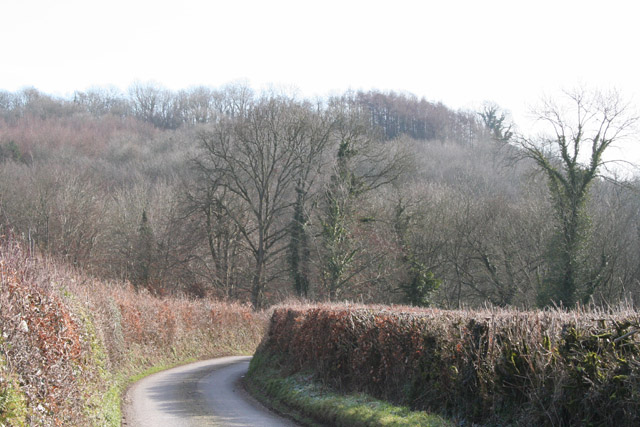
Burch Hill is a popular destination for outdoor enthusiasts, hikers, and nature lovers. There are several well-marked footpaths and trails that allow visitors to explore the hill and its surroundings. The diverse flora and fauna found in the area make it an attractive spot for birdwatching and wildlife spotting.

The hill is also steeped in history, with ancient burial mounds and prehistoric sites scattered throughout its slopes. Archaeological remains suggest that the hill has been inhabited for thousands of years, with evidence of human activity dating back to the Neolithic period.

Access to Burch Hill is relatively easy, with nearby parking facilities and public transportation options available. It is an ideal place for a day trip, offering a serene and picturesque escape from the hustle and bustle of city life.

If you have any feedback on the listing, please let us know in the comments section below.

Burch Hill Images

Images are sourced within 2km of 50.995703/-3.3423727 or Grid Reference ST0522. Thanks to Geograph Open Source API. All images are credited.

View from NCN344 near Stawley Mill Photograph taken looking north west from the NCN344 just north of Stawley Mill.
View from NCN344 near Stawley Mill
Photograph taken looking north west from the NCN344 just north of Stawley Mill.
Stawley: barns at Kittisford Barton On the lane known as Cockland Hill
Stawley: barns at Kittisford Barton
On the lane known as Cockland Hill
Bathealton: Hurstone Local Nature Reserve A field in the process of being restored to pasture – part is still an orchard. It is now part of a circular walk of a little under half a mile by the banks of the river Tone and a disused railway. A small car park at the entrance to the reserve is at ST054247, by Pouch Bridge. Managed by Taunton Deane Borough Council
Bathealton: Hurstone Local Nature Reserve
A field in the process of being restored to pasture – part is still an orchard. It is now part of a circular walk of a little under half a mile by the banks of the river Tone and a disused railway. A small car park at the entrance to the reserve is at ST054247, by Pouch Bridge. Managed by Taunton Deane Borough Council
Bathealton: disused railway Track of the Taunton-Barnstaple railway, opened in November 1873 and closed in the 1960s. Looking east in the direction of Bathealton Tunnel, Wiveliscombe and Taunton
Bathealton: disused railway
Track of the Taunton-Barnstaple railway, opened in November 1873 and closed in the 1960s. Looking east in the direction of Bathealton Tunnel, Wiveliscombe and Taunton
Stawley: near Stawley Mill In the Tone valley. Stawley Mill is now a private house. The bridge in the foreground crosses a small tributary of the Tone. The latter runs to the right of the image, beyond the gate and field
Stawley: near Stawley Mill
In the Tone valley. Stawley Mill is now a private house. The bridge in the foreground crosses a small tributary of the Tone. The latter runs to the right of the image, beyond the gate and field
Stawley: The Globe In the hamlet of Appley, this public house has a good reputation for food. Looking north
Stawley: The Globe
In the hamlet of Appley, this public house has a good reputation for food. Looking north
Stawley: St Michael’s Church Robin Bush, who wrote ‘Somerset, The Complete Guide’ [The Dovecote Press, 1994], regards Stawley church as one of his favourites. It stands somewhat remote above the valley of the river Tone. Looking north
Stawley: St Michael’s Church
Robin Bush, who wrote ‘Somerset, The Complete Guide’ [The Dovecote Press, 1994], regards Stawley church as one of his favourites. It stands somewhat remote above the valley of the river Tone. Looking north
Ashbrittle: in the Tone valley On the West Deane Way, below Hagley Wood and looking north towards
Hagley Bridge. The West Deane Way is a 45-mile circular walk – details from Somerset County Council.
Ashbrittle: in the Tone valley
On the West Deane Way, below Hagley Wood and looking north towards Hagley Bridge. The West Deane Way is a 45-mile circular walk – details from Somerset County Council.
Ashbrittle: Pockeridge Bottom Seen from the lane between Combe and Norman’s Farm. Looking east
Ashbrittle: Pockeridge Bottom
Seen from the lane between Combe and Norman’s Farm. Looking east
Ashbrittle: Waldron’s Farm The formal entrance, looking north
Ashbrittle: Waldron’s Farm
The formal entrance, looking north
Ashbrittle: towards the Tone valley Looking east on the lane from Waldron’s Cross, on a bright February day
Ashbrittle: towards the Tone valley
Looking east on the lane from Waldron’s Cross, on a bright February day
Ashbrittle: the Ashbrittle Yew Reputed to be 3000 years old, this tree was standing when Stonehenge was in use. Clearly it predates the adjoining church by millennia and it may mark a holy place or commemorate a battle site. Whatever its origins, it is thought to be one of the oldest living things in Britain. Looking east
Ashbrittle: the Ashbrittle Yew
Reputed to be 3000 years old, this tree was standing when Stonehenge was in use. Clearly it predates the adjoining church by millennia and it may mark a holy place or commemorate a battle site. Whatever its origins, it is thought to be one of the oldest living things in Britain. Looking east
Holcombe Rogus: the Tone at Tracebridge Confluence of the river Tone with its tributary the Morecombe Lake just downstream from the bridge, with wild garlic in flower. Three parishes meet here: Holcombe Rogus, Ashbrittle and Stawley. Looking west-south-west
Holcombe Rogus: the Tone at Tracebridge
Confluence of the river Tone with its tributary the Morecombe Lake just downstream from the bridge, with wild garlic in flower. Three parishes meet here: Holcombe Rogus, Ashbrittle and Stawley. Looking west-south-west
Ashbrittle: Pool Hill Looking north from Golden Gate. Pool Hill leads to Waldrons Cross
Ashbrittle: Pool Hill
Looking north from Golden Gate. Pool Hill leads to Waldrons Cross
Ashbrittle: cattle in a field near Greedys A herd of Friesians. Looking east from the lane to Northcott Farm
Ashbrittle: cattle in a field near Greedys
A herd of Friesians. Looking east from the lane to Northcott Farm
Ashbrittle: Waldron’s Farm Looking north-north-west along the avenue
Ashbrittle: Waldron’s Farm
Looking north-north-west along the avenue
Stawley: Tracebridge A hamlet which was once home to two mills: a corn mill, which then worked as a saw mill in the last quarter of the 19th century and a slate cutting mill which served the nearby Tracebridge Quarries, established by 1894 and closed by 1935. For a full history of the hamlet see Eric G Rodwell. Tracebridge. A History of the Hamlet, its Houses, The Quarries and the Mill. A copy is available at the Somerset Studies Library, Paul Street, Taunton
Stawley: Tracebridge
A hamlet which was once home to two mills: a corn mill, which then worked as a saw mill in the last quarter of the 19th century and a slate cutting mill which served the nearby Tracebridge Quarries, established by 1894 and closed by 1935. For a full history of the hamlet see Eric G Rodwell. Tracebridge. A History of the Hamlet, its Houses, The Quarries and the Mill. A copy is available at the Somerset Studies Library, Paul Street, Taunton
Stawley: Bullockfield Hill Horse and rider breast the top of the hill. Looking south east
Stawley: Bullockfield Hill
Horse and rider breast the top of the hill. Looking south east
Show me another place!

Burch Hill is located at Grid Ref: ST0522 (Lat: 50.995703, Lng: -3.3423727)

Administrative County: Somerset

District: Somerset West and Taunton

Police Authority: Avon and Somerset

What 3 Words

///colleague.solutions.mint. Near Wiveliscombe, Somerset

Related Wikis

Stawley

Stawley is a village and civil parish in Somerset, England, situated 10 miles (16.1 km) west of Taunton. The parish has a population of 279 and includes...

Hill Farm, Stawley

Hill Farm in Stawley, Somerset, England was built in the late 16th century. It is a Grade II* listed building. == History == The farmhouse was built in...

Ashbrittle

Ashbrittle is a village and civil parish in Somerset, England, situated nine miles west of Taunton and close to the River Tone and the route of the Grand...

Church of St John the Baptist, Ashbrittle

The Church of St John the Baptist is a Church of England parish church in Ashbrittle, Somerset. It was built in the 15th century, and is a Grade II* listed...

Kittisford

Kittisford is a village and former civil parish and manor, now in the parish of Stawley in the Somerset district, in the ceremonial county of Somerset...

Castles Camp

Castles Camp is a univallate Iron Age hill fort in the Taunton Deane district of Somerset, England. The hill fort is situated approximately 1 mile (1.6...

Church of St Nicholas, Kittisford

The Anglican Church of St Nicholas in Kittisford, Somerset, England was built around 1500. It is a Grade II* listed building. == History == The church...

Bathealton

Bathealton is a village and civil parish in Somerset, England, situated 3 miles (4.8 km) west of Wellington and 8 miles (12.9 km) west of Taunton. The...

Nearby Amenities

Located within 500m of 50.995703,-3.3423727
Stawley
Is In: Somerset, England, UK
Place: village
Wikidata: Q2359040
Wikipedia: en:Stawley
Lat/Long: 50.9961449/-3.3382702
Ford: yes
Lat/Long: 50.9957476/-3.3450267
The data included in this document is from www.openstreetmap.org. The data is made available under ODbL.

Have you been to Burch Hill?

Leave your review of Burch Hill below (or comments, questions and feedback).