Gathersnow Hill
Hill, Mountain in Lanarkshire
Scotland
Gathersnow Hill

Gathersnow Hill is a prominent geographical feature located in Lanarkshire, Scotland. Standing at an elevation of approximately 420 meters (1,378 feet), it is classified as a hill rather than a mountain. The hill is situated near the town of Lesmahagow, about 40 kilometers (25 miles) southeast of Glasgow.
The name "Gathersnow" is derived from the old Scots term "gat an snaw," which means "got some snow." This name reflects the hill's propensity to accumulate snow during the winter months due to its exposed position. The hill's summit offers breathtaking views of the surrounding countryside, including the Clyde Valley and the Tinto Hills to the east.
Gathersnow Hill is a popular destination for outdoor enthusiasts, attracting hikers, walkers, and nature lovers throughout the year. Several well-marked trails lead to the summit, offering a range of difficulty levels suitable for all abilities. The hill's diverse terrain features heather-covered slopes, rocky outcrops, and patches of woodland, providing a rich habitat for various plant and animal species.
In addition to its natural beauty, Gathersnow Hill also holds historical significance. The remains of an Iron Age hillfort can be found on its slopes, providing evidence of human activity in the area dating back thousands of years. This archaeological site adds an extra layer of interest for visitors seeking to explore the hill's cultural heritage.
Overall, Gathersnow Hill is a picturesque and historically significant landmark in Lanarkshire, offering visitors a chance to immerse themselves in Scotland's natural beauty and rich history.
If you have any feedback on the listing, please let us know in the comments section below.
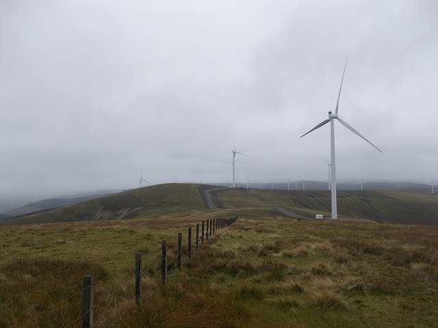
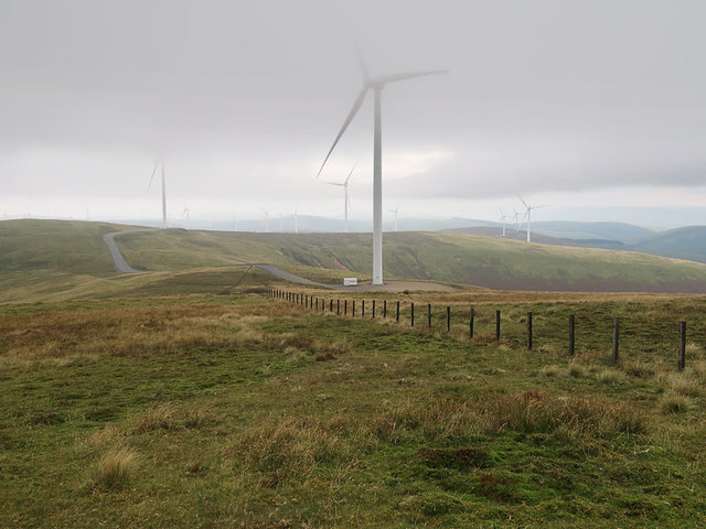
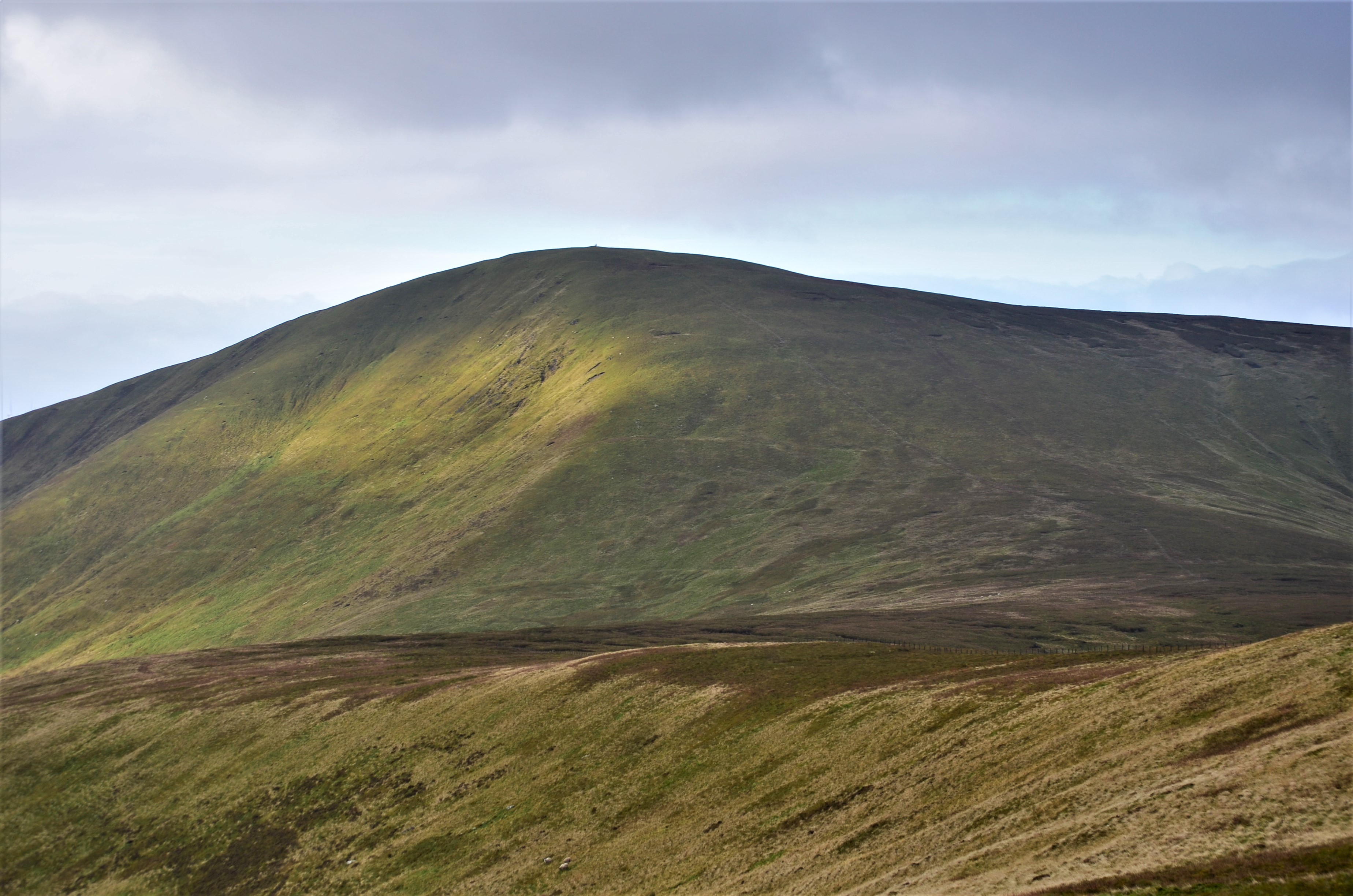
Gathersnow Hill Images
Images are sourced within 2km of 55.515951/-3.492156 or Grid Reference NT0525. Thanks to Geograph Open Source API. All images are credited.


Gathersnow Hill is located at Grid Ref: NT0525 (Lat: 55.515951, Lng: -3.492156)
Unitary Authority: South Lanarkshire
Police Authority: Lanarkshire
What 3 Words
///throwaway.practical.parks. Near Biggar, South Lanarkshire
Nearby Locations
Related Wikis

Gathersnow Hill
Gathersnow Hill is a hill in the Culter Hills range, part of the Southern Uplands of Scotland. It lies west of the village of Tweedsmuir on the border...
Culter Fell
Culter Fell is a hill in the Culter Hills range, part of the Southern Uplands of Scotland. It is the county top of the historic county of Lanarkshire,...

Hawkshaw, Scottish Borders
Hawkshaw is a pair of semi-detached houses on the River Tweed, two miles southwest of Tweedsmuir in the Scottish Borders. Historically part of Peeblesshire...

Menzion
Menzion, sometimes Minzion is a small settlement in southern Scotland near Tweedsmuir in the Scottish Borders, in the valley of the River Tweed. ��2...

Oliver Castle
Oliver Castle was a medieval tower house, located in upper Tweedsdale in the Scottish Borders. The site of the hillfort known as Oliver Castle is to the...
Tweedsmuir
Tweedsmuir (Scottish Gaelic: Sliabh Thuaidh) is a village and civil parish in Tweeddale, the Scottish Borders Council district, southeastern Scotland....

Fruid Water
Fruid Water is a river in the Scottish Borders area of Scotland. The valley it occupies has been dammed to form the Fruid Reservoir. The river is a tributary...

Crook Inn
The Crook Inn is an inn in the Scottish Borders, near the village of Tweedsmuir on the A701 road between Broughton and Moffat. It is one of many claimants...
Nearby Amenities
Located within 500m of 55.515951,-3.492156Have you been to Gathersnow Hill?
Leave your review of Gathersnow Hill below (or comments, questions and feedback).