Cold Fell

Hill, Mountain in Cumberland Copeland

England

Cold Fell

Monks Bridge Crossing the River Calder, Cold Fell, Cumbria The oldest packhorse bridge in Cumbria. Wainwright described it as "The most charming of Lakeland's packhorse bridges" and My Cousin told me we were going to see a "Wonder". Both were correct! As to a build date I would think it's Late 1600's maybe using stone from the nearby Abbey (closed 1536) But if it was built by the Monks then this would give a lot earlier date.  

It's also listed as Matty Benn's Bridge. Martha "Matty" Benn (1831-1888), who used the bridge to get to and from market on horseback. She was known to return in a state of inebriation but still managed to cross the bridge!
Monks Bridge Crossing the River Calder, Cold Fell, Cumbria Credit: Brian Deegan

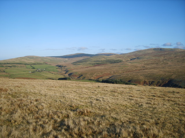
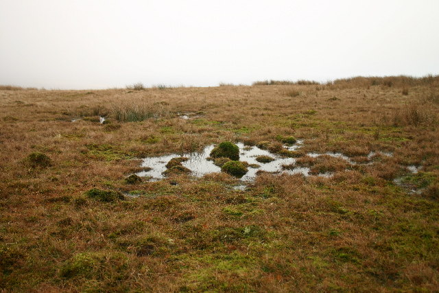
Cold Fell, also known as Cold Fell Hill or simply Cold Fell, is a prominent hill and mountain located in Cumberland, a historic county in northwest England. Situated in the Lake District National Park, Cold Fell stands at an elevation of 621 meters (2,037 feet) above sea level, making it one of the highest points in the region.

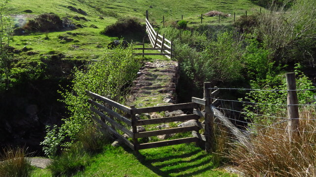
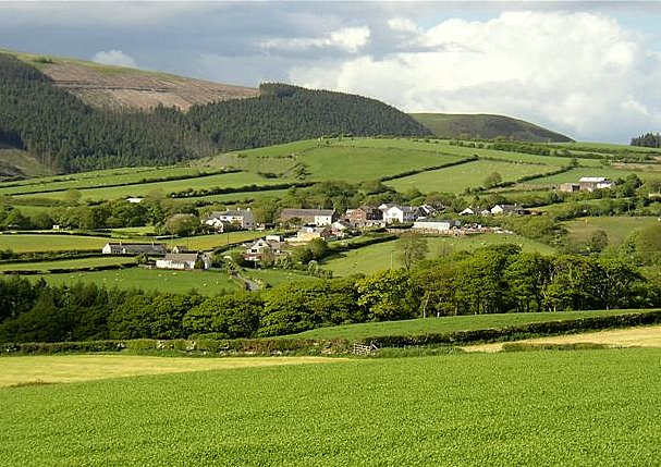
The hill is characterized by its sweeping slopes and rugged terrain, covered in a combination of heather, grass, and scattered rocks. Cold Fell offers breathtaking panoramic views of the surrounding landscape, including the nearby Lake District fells and the Solway Firth to the north.

The hill is a popular destination for hikers and outdoor enthusiasts, offering various routes and trails for exploration. One of the most popular routes is the Cold Fell Loop, a circular walk that takes visitors across the summit and provides stunning vistas along the way.

Wildlife is abundant on Cold Fell, with sightings of various bird species, such as the red grouse and golden plover, being common. The hill also supports a variety of flora, including heather and bilberry bushes, which add color to the landscape during the summer months.

Cold Fell is not only a natural attraction but also holds historical significance. It is believed to have been an important route for ancient travelers and was used by the Romans as a road during their occupation of Britain.

Overall, Cold Fell offers a unique and captivating experience for those seeking outdoor adventures, natural beauty, and a glimpse into the region's rich history.

If you have any feedback on the listing, please let us know in the comments section below.

Cold Fell Images

Images are sourced within 2km of 54.469263/-3.454747 or Grid Reference NY0509. Thanks to Geograph Open Source API. All images are credited.

Monks Bridge Crossing the River Calder, Cold Fell, Cumbria The oldest packhorse bridge in Cumbria. Wainwright described it as "The most charming of Lakeland's packhorse bridges" and My Cousin told me we were going to see a "Wonder". Both were correct! As to a build date I would think it's Late 1600's maybe using stone from the nearby Abbey (closed 1536) But if it was built by the Monks then this would give a lot earlier date.  

It's also listed as Matty Benn's Bridge. Martha "Matty" Benn (1831-1888), who used the bridge to get to and from market on horseback. She was known to return in a state of inebriation but still managed to cross the bridge!
Monks Bridge Crossing the River Calder, Cold Fell, Cumbria
The oldest packhorse bridge in Cumbria. Wainwright described it as "The most charming of Lakeland's packhorse bridges" and My Cousin told me we were going to see a "Wonder". Both were correct! As to a build date I would think it's Late 1600's maybe using stone from the nearby Abbey (closed 1536) But if it was built by the Monks then this would give a lot earlier date. It's also listed as Matty Benn's Bridge. Martha "Matty" Benn (1831-1888), who used the bridge to get to and from market on horseback. She was known to return in a state of inebriation but still managed to cross the bridge!
Bridge over River Calder below Monk's Bridge near Egremont
Monk's Bridge on the R Calder, E of Egremont Monk’s Bridge on Cold Fell is the oldest packhorse bridge in Cumbria, and crosses Friar Gill where it passes through a narrow deep chasm. It was built for the monks of Calder Abbey, who would have crossed it on their many journeys. Iron ore would have been carried over it from Ennerdale to smithies on the fells to be smelted. The bridge is also known as Matty Benn’s Bridge, after the family Benn who lived nearby.
Monk's Bridge on the R Calder, E of Egremont
Monk’s Bridge on Cold Fell is the oldest packhorse bridge in Cumbria, and crosses Friar Gill where it passes through a narrow deep chasm. It was built for the monks of Calder Abbey, who would have crossed it on their many journeys. Iron ore would have been carried over it from Ennerdale to smithies on the fells to be smelted. The bridge is also known as Matty Benn’s Bridge, after the family Benn who lived nearby.
Cattle Grid
Cattle Grid
Bridge over the Calder The footbridge doubles as a farm bridge over the Calder near Friar Gill and is close to the much more photogenic Monks Bridge See<a href="https://www.geograph.org.uk/photo/3027194">NY0610 : Monks Bridge</a>
Bridge over the Calder
The footbridge doubles as a farm bridge over the Calder near Friar Gill and is close to the much more photogenic Monks Bridge SeeNY0610 : Monks Bridge
Monks Bridge Wainwright called it the most charming of Lakeland's packhorse bridges. Also known as Matty Benn's Bridge it is the oldest packhorse bridge in Cumbria. 
It was built by the monks of Calder Abbey (dissolved in 1536)
See <a href="https://www.geograph.org.uk/photo/3027147">NY0610 : Bridge over the Calder</a>
Monks Bridge
Wainwright called it the most charming of Lakeland's packhorse bridges. Also known as Matty Benn's Bridge it is the oldest packhorse bridge in Cumbria. It was built by the monks of Calder Abbey (dissolved in 1536) See NY0610 : Bridge over the Calder
Coldfell Gate
Coldfell Gate
Heading north from Cold Fell
Coldfell gate. approaching the Coldfell road.
Coldfell gate.
approaching the Coldfell road.
The top of Cold Fell 10 minutes' walk from the road.
The top of Cold Fell
10 minutes' walk from the road.
Old Milestone near Castley Hill Carved stone post by the UC road, in parish of HAILE (COPELAND District), Cold Fell, Castley Hill, T-junction 50m West of cattle grid, on North East side of road. Egremont stone, erected by the Egremont to Salthouse turnpike trust in the 19th century. 

Inscription reads:-
: To / Haile / 1 / Mile : : To / Wilton / (1½) Miles / To Egremont / (3) Miles : 

Grade II Listed. List Entry Number: 1084320
<span class="nowrap"><a title="https://historicengland.org.uk/listing/the-list/list-entry/1084320" rel="nofollow ugc noopener" href="https://historicengland.org.uk/listing/the-list/list-entry/1084320">Link</a><img style="margin-left:2px;" alt="External link" title="External link - shift click to open in new window" src="https://s1.geograph.org.uk/img/external.png" width="10" height="10"/></span>

Milestone Society National ID: CU_HLEG01.
Old Milestone near Castley Hill
Carved stone post by the UC road, in parish of HAILE (COPELAND District), Cold Fell, Castley Hill, T-junction 50m West of cattle grid, on North East side of road. Egremont stone, erected by the Egremont to Salthouse turnpike trust in the 19th century. Inscription reads:- : To / Haile / 1 / Mile : : To / Wilton / (1½) Miles / To Egremont / (3) Miles : Grade II Listed. List Entry Number: 1084320 LinkExternal link Milestone Society National ID: CU_HLEG01.
Access road for Gill Farm The farm access leaving a minor hill road which connects Calder Bridge with Ennerdale Bridge. The sign spells Gill Farm so; OS mapping has it as Ghyll Farm.
Access road for Gill Farm
The farm access leaving a minor hill road which connects Calder Bridge with Ennerdale Bridge. The sign spells Gill Farm so; OS mapping has it as Ghyll Farm.
Worm Gill Ford This ford at Worm Gill on the River Calder is found below Thornholme.
Worm Gill Ford
This ford at Worm Gill on the River Calder is found below Thornholme.
River Calder Ford This ford is found on the River Calder just down stream of Monks Bridge: 
<a title="https://www.geograph.org.uk/photo/161722" href="https://www.geograph.org.uk/photo/161722">Link</a>
<span class="nowrap"><a title="https://youtu.be/J0gOn9itHrY" rel="nofollow ugc noopener" href="https://youtu.be/J0gOn9itHrY">Link</a><img style="margin-left:2px;" alt="External link" title="External link - shift click to open in new window" src="https://s1.geograph.org.uk/img/external.png" width="10" height="10"/></span>
River Calder Ford
This ford is found on the River Calder just down stream of Monks Bridge: Link LinkExternal link
Small cairn at summit of Cold Fell Cold Fell is a minor summit on the eastern side of the minor road connecting Ennerdale Bridge with Calder Bridge; its flat summit area is marked by the small cairn in the image.
Lank Rigg is the hill to the right of centre, above the trees.
Small cairn at summit of Cold Fell
Cold Fell is a minor summit on the eastern side of the minor road connecting Ennerdale Bridge with Calder Bridge; its flat summit area is marked by the small cairn in the image. Lank Rigg is the hill to the right of centre, above the trees.
Hill road descending near to Friar Gill The road acts as the access route for Farthwaite but descends beyond that to the valley of the River Calder.
The hill in the distance is Lank Rigg.
Hill road descending near to Friar Gill
The road acts as the access route for Farthwaite but descends beyond that to the valley of the River Calder. The hill in the distance is Lank Rigg.
Monk's Bridge across River Calder An old packhorse bridge built by the monks of Calder Abbey many centuries ago. It stands close to a public footpath but crossing the bridge takes one only to a field. Perry Dark's image from 2012 shows the bridge in a vegetated state - <a title="https://www.geograph.org.uk/photo/3027194" href="https://www.geograph.org.uk/photo/3027194">Link</a>.
Monk's Bridge across River Calder
An old packhorse bridge built by the monks of Calder Abbey many centuries ago. It stands close to a public footpath but crossing the bridge takes one only to a field. Perry Dark's image from 2012 shows the bridge in a vegetated state - Link.
Enclosure on west side of River Calder The large area at the centre of the image appears not to be cultivated in any particular way. There's dead bracken and a large number of small trees many of which seem to have been uprooted, presumably by wind.
Enclosure on west side of River Calder
The large area at the centre of the image appears not to be cultivated in any particular way. There's dead bracken and a large number of small trees many of which seem to have been uprooted, presumably by wind.
Show me another place!

Cold Fell is located at Grid Ref: NY0509 (Lat: 54.469263, Lng: -3.454747)

Administrative County: Cumbria

District: Copeland

Police Authority: Cumbria

What 3 Words

///signature.care.requiring. Near Egremont, Cumbria

Nearby Locations

Cold Fell Cold Fell

Related Wikis

Cold Fell (Calder Bridge)

Cold Fell is a hill in the west of the English Lake District. It is easily climbed from the road between Ennerdale Bridge and Calder Bridge. This road...

Haile, Cumbria

Haile is a small village and civil parish in Copeland district, in the county of Cumbria, England. It had a population of 617 at the 2011 Census.Nearby...

Wilton, Cumbria

Wilton is a hamlet in the Copeland district, in the county of Cumbria, England. It is near the small town of Egremont. In 1870-72 it had a population of...
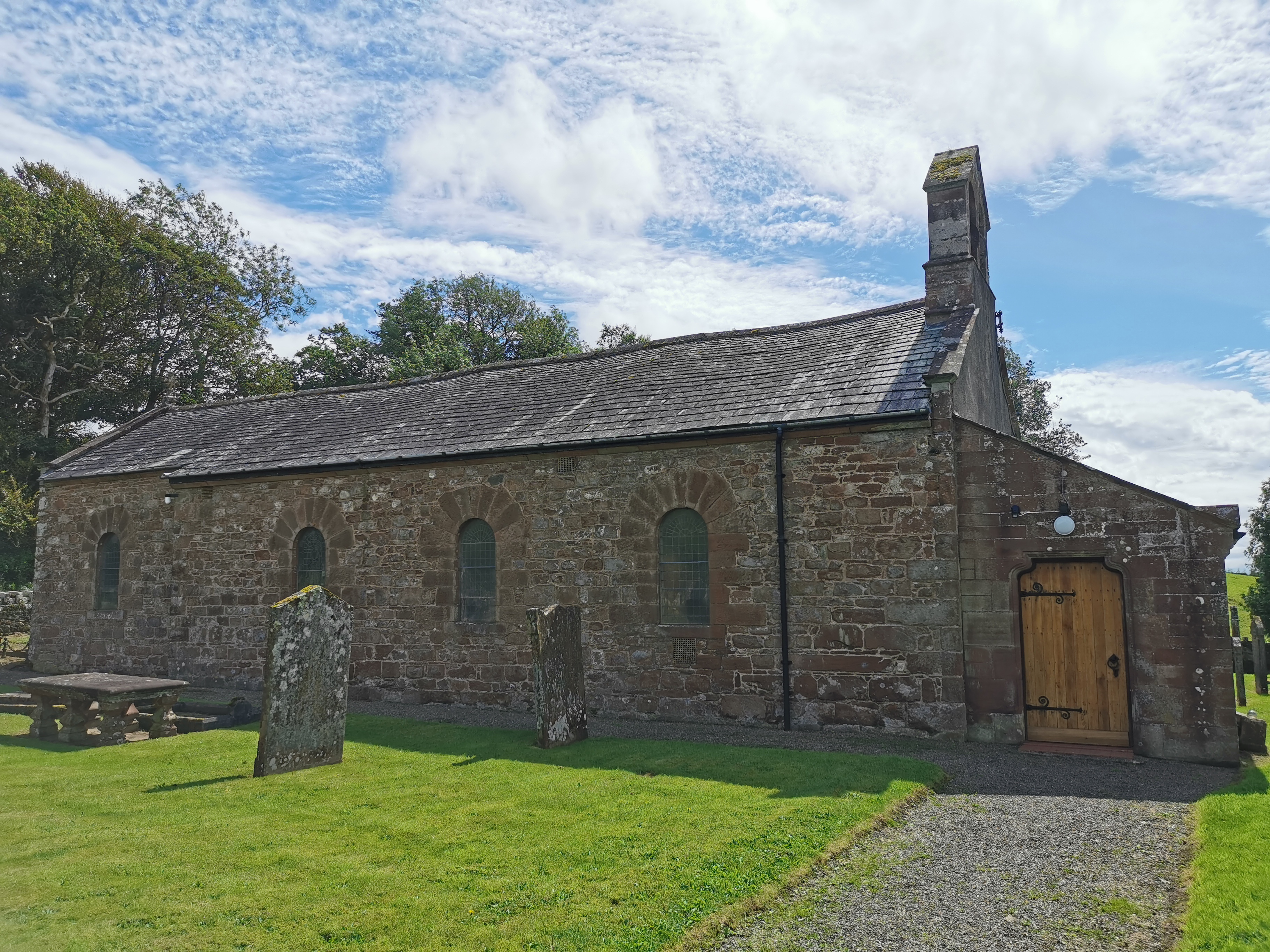
Haile Parish Church

Haile Parish Church is near Haile, Cumbria, England. It is an active Anglican parish church in the deanery of Calder, and the diocese of Carlisle. Its...

Calder Abbey

Calder Abbey in Cumbria was a Savigniac monastery founded in 1134 by Ranulph de Gernon, 2nd Earl of Chester, and moved to this site following a refoundation...

Ponsonby Fell

Ponsonby Fell is a hill in the west of the English Lake District, near Gosforth, in the Borough of Copeland, Cumbria. It is the subject of a chapter of...

Beckermet Mines railway station

Beckermet Mines railway station was situated at Pit No.1 of the mine of the same name. It was used by workmen's trains which travelled along a branch which...

St Bridget's Church, Calder Bridge

St Bridget's Church is on the north side of the A595 road in the village of Calder Bridge, near Beckermet, Cumbria, England. It is an active Anglican parish...

Nearby Amenities

Located within 500m of 54.469263,-3.454747
Cold Fell
Ele: 293
Natural: peak
Source: NPE
Wikidata: Q5142252
Wikipedia: en:Cold Fell (Calder Bridge)
Lat/Long: 54.4696044/-3.4547336
Natural: spring
Lat/Long: 54.4649939/-3.4529817
The data included in this document is from www.openstreetmap.org. The data is made available under ODbL.

Have you been to Cold Fell?

Leave your review of Cold Fell below (or comments, questions and feedback).