Bwlch-y-sarnau Hill

Hill, Mountain in Radnorshire

Wales

Bwlch-y-sarnau Hill

Looking across Borfa to Glan-yr-afon
Looking across Borfa to Glan-yr-afon Credit: David Medcalf

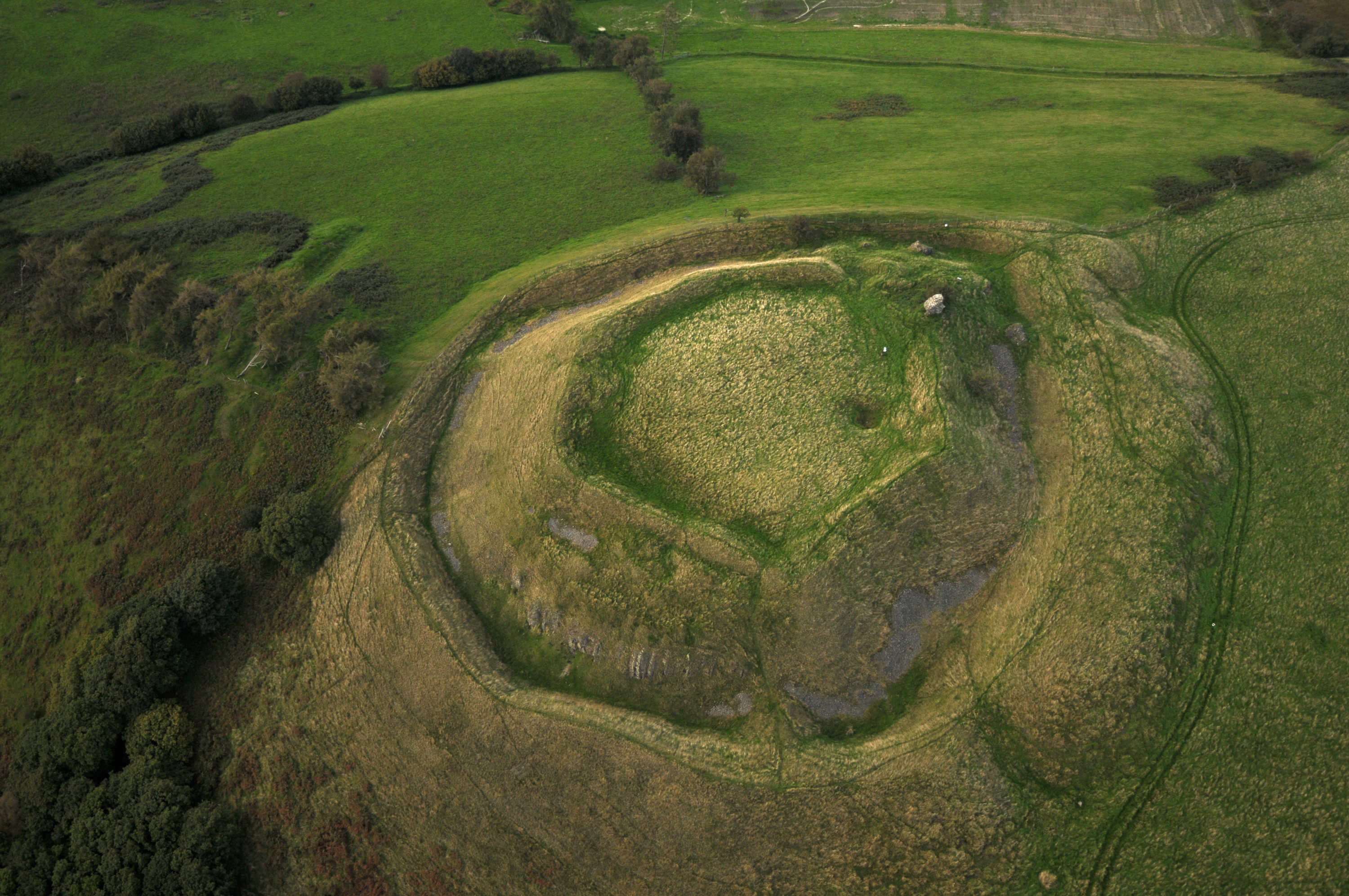
Bwlch-y-sarnau Hill, located in Radnorshire, Wales, is a prominent geographical feature that stands as a testament to the region's natural beauty. Rising to an elevation of approximately 489 meters (1,604 feet), it is classified as a hill or mountain depending on the definition used.

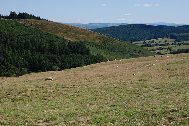
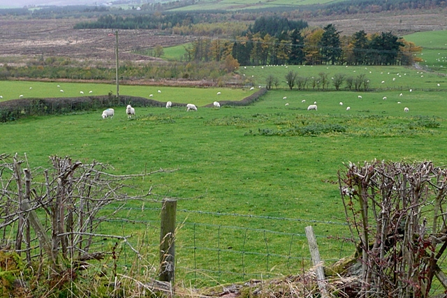
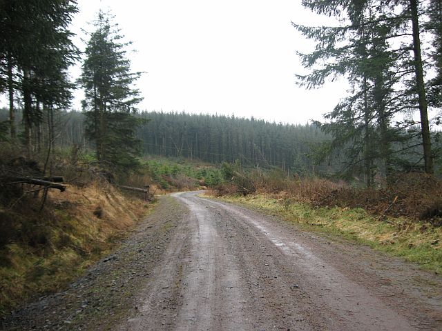
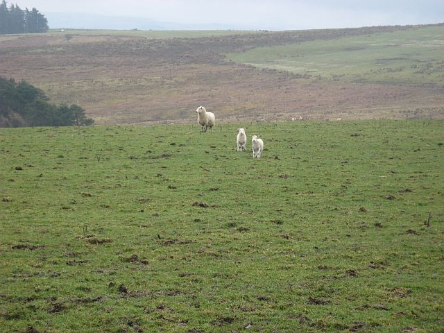
This hill is situated within the Cambrian Mountains, a range known for its picturesque landscapes and stunning views. Bwlch-y-sarnau Hill offers panoramic vistas of the surrounding countryside, with its slopes covered in lush green vegetation during the warmer months. The hill is a popular destination for hikers and nature enthusiasts, who are drawn to its tranquil atmosphere and peaceful surroundings.

In terms of geology, Bwlch-y-sarnau Hill is primarily composed of sedimentary rocks, including sandstone and mudstone, which were formed during the Paleozoic era. These rocks have been shaped and sculpted over millions of years by various geological processes, resulting in the distinct features seen today.

The hill is also home to a diverse range of plant and animal species, including rare and protected species. It provides a habitat for various birds, mammals, and insects, making it an important site for ecological research and conservation efforts.

Overall, Bwlch-y-sarnau Hill is a stunning natural landmark that showcases the beauty and diversity of Radnorshire's countryside. It offers a unique opportunity for visitors to connect with nature and experience the tranquility of the Cambrian Mountains.

If you have any feedback on the listing, please let us know in the comments section below.

Bwlch-y-sarnau Hill Images

Images are sourced within 2km of 52.377912/-3.4006501 or Grid Reference SO0476. Thanks to Geograph Open Source API. All images are credited.

Looking across Borfa to Glan-yr-afon
Newhouse farm
Newhouse farm
Forest on Brondre-fawr Hill
Farmland looking towards Upper Nant-hir
Unfinished business Sadly it looks as if the project to restore this house at Ffordd-las has serious problems - there is a new roof, and new double-glazed windows, but it's all falling into disrepair.
Unfinished business
Sadly it looks as if the project to restore this house at Ffordd-las has serious problems - there is a new roof, and new double-glazed windows, but it's all falling into disrepair.
Road and quarry on Bailey Hill The road climbs up from Bwlch-y-sarnau. The quarry is now disused.
Road and quarry on Bailey Hill
The road climbs up from Bwlch-y-sarnau. The quarry is now disused.
Farmland on Bailey Hill Unimproved land nearby, decent grazing beyond.
Farmland on Bailey Hill
Unimproved land nearby, decent grazing beyond.
Farmland below Banc y Dolau Mixed grazing in a sheltered valley, which may soon be overshadowed by yet another mid-Wales windfarm.
Farmland below Banc y Dolau
Mixed grazing in a sheltered valley, which may soon be overshadowed by yet another mid-Wales windfarm.
Field on Borfa Rather poor-looking grazing land.
Field on Borfa
Rather poor-looking grazing land.
Field on the south of Bailey Hill Steep but good-looking grazing. Beyond lies the broad valley of the Afon Marteg.
Field on the south of Bailey Hill
Steep but good-looking grazing. Beyond lies the broad valley of the Afon Marteg.
Forestry at Brondre-fawr There is extensive forestry in the area, but this section is currently being felled.
Forestry at Brondre-fawr
There is extensive forestry in the area, but this section is currently being felled.
Sheep pasture below Brondre Fawr The sheep pasture is interspersed with forestry planting.  Substantial areas have been cleared in this square, as seen beyond the pasture.
Sheep pasture below Brondre Fawr
The sheep pasture is interspersed with forestry planting. Substantial areas have been cleared in this square, as seen beyond the pasture.
Not quite the footpath This rather tussocky way through is the best way through given the footpath to the south doesn't appear to exist on the ground.
Not quite the footpath
This rather tussocky way through is the best way through given the footpath to the south doesn't appear to exist on the ground.
Plantation and sheep upland Shows the two main uses of upland in the area - forestry and sheep grazing.
Plantation and sheep upland
Shows the two main uses of upland in the area - forestry and sheep grazing.
Spruce plantation The forest is managed in stages. At the rear are more mature trees, but in front of them some much younger ones. The foreground is mainly bracken and the odd tree.
Spruce plantation
The forest is managed in stages. At the rear are more mature trees, but in front of them some much younger ones. The foreground is mainly bracken and the odd tree.
Branches along footpath The footpath has been used as a dumping ground for small branches, which makes it extremely difficult to traverse, particularly in wet weather...
Branches along footpath
The footpath has been used as a dumping ground for small branches, which makes it extremely difficult to traverse, particularly in wet weather...
Cows Unusually not sheep. I think the high point at the centre in the background is Gors Lydan, about 4 miles away.
Cows
Unusually not sheep. I think the high point at the centre in the background is Gors Lydan, about 4 miles away.
Staring lambs These lambs kept their eyes on me the whole time I walked past... maybe they haven't seen a human before.
Staring lambs
These lambs kept their eyes on me the whole time I walked past... maybe they haven't seen a human before.
Show me another place!

Bwlch-y-sarnau Hill is located at Grid Ref: SO0476 (Lat: 52.377912, Lng: -3.4006501)

Unitary Authority: Powys

Police Authority: Dyfed Powys

What 3 Words

///drizzly.contents.slant. Near Rhayader, Powys

Nearby Locations

Bwlch-y-sarnau Hill

Related Wikis

Red Lion Hill

Red Lion Hill (Welsh: Bryn Llew Goch) or Banc y Dolau is a hill in Powys, Wales, with a summit 484.6 metres (1,590 ft) above sea level. It is located in...

Tinboeth Castle

Tinboeth Castle (Welsh: Castell Dinbod) was a medieval castle situated midway between Llanbister and Llanbadarn Fynydd in Wales, on a bend in the River...

Llanbadarn Fynydd

Llanbadarn Fynydd (meaning Church of Padarn in the mountain) is a village and community in Radnorshire, Powys, Wales, and is 63 miles (101 km) from Cardiff...

St Anno's Church, Llananno

The Church of St Anno in Llananno, Powys, Wales, is a redundant church dating from the 14th century. Its medieval rood screen is considered "one of the...

Related Videos

A lap With (Pro Class) Gethin Humphreys @saintswell Motoduro race 2✊🏼 #enduro #dirtbike #motocross

1 lap of race 2 in the Saintwell Motoduro. Brillians day all around. Alex Walton took the win from Dan Mundell. The footage is from ...

Nearby Amenities

Located within 500m of 52.377912,-3.4006501
Place: farm
Lat/Long: 52.3753256/-3.3971906
Building: yes
Lat/Long: 52.3777228/-3.3935428
The data included in this document is from www.openstreetmap.org. The data is made available under ODbL.

Have you been to Bwlch-y-sarnau Hill?

Leave your review of Bwlch-y-sarnau Hill below (or comments, questions and feedback).