Sal-Vaich

Hill, Mountain in Caithness

Scotland

Sal-Vaich

North slope of Smean Heathery col between Smean and Sal-vaich
North slope of Smean Credit: Andrew Spenceley

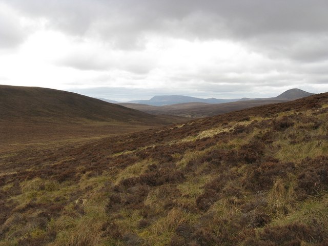
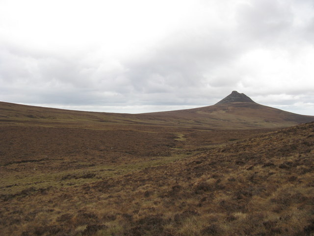
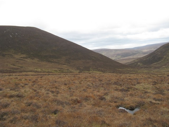
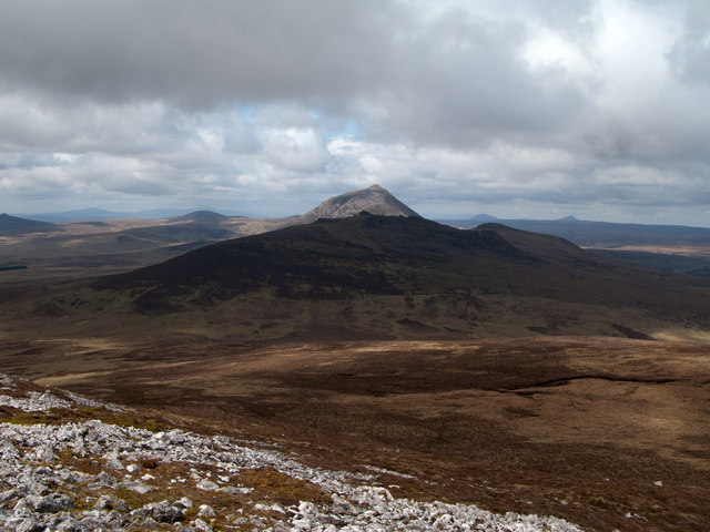
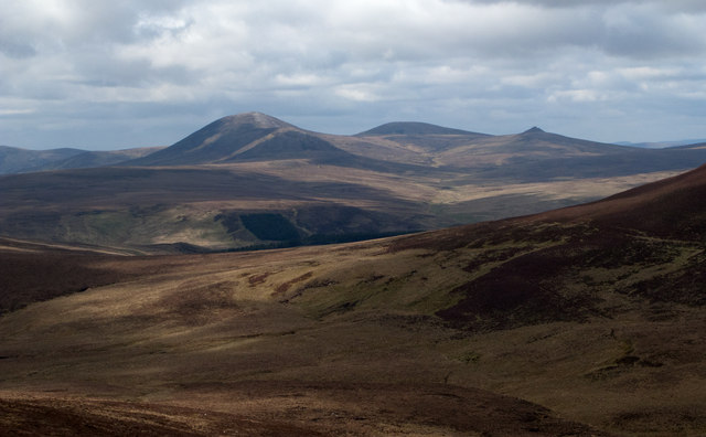
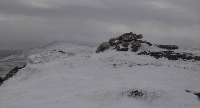
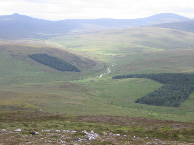
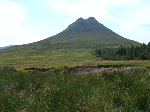
Sal-Vaich is a hill located in the picturesque region of Caithness, Scotland. Standing at an elevation of approximately 378 meters (1,240 feet), it is considered one of the prominent peaks in the area. Situated near the village of Reay, Sal-Vaich offers breathtaking panoramic views of the surrounding Caithness countryside, including stunning vistas of the North Sea.

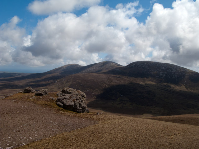
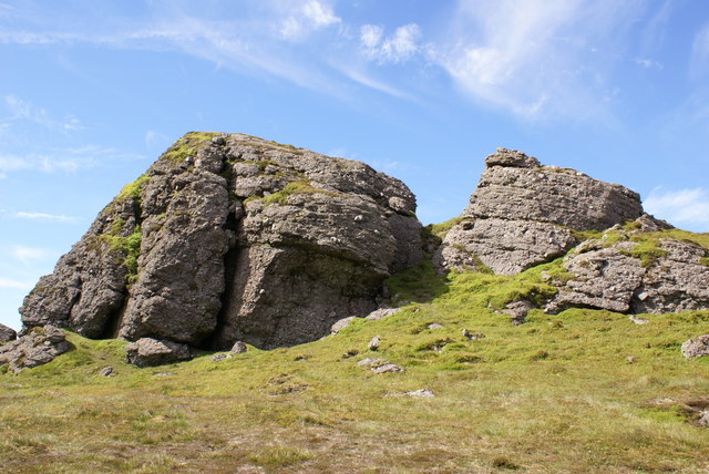
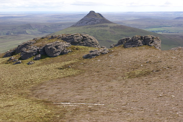
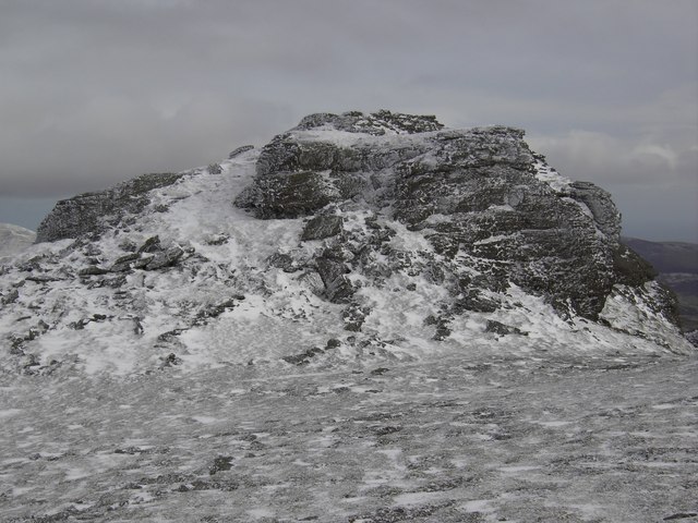
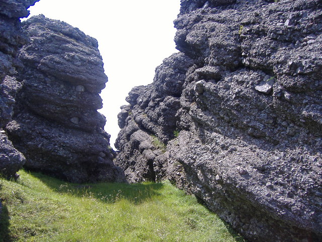
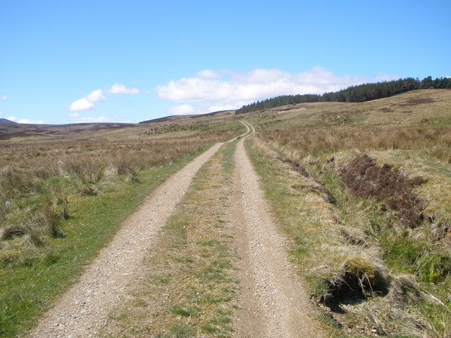
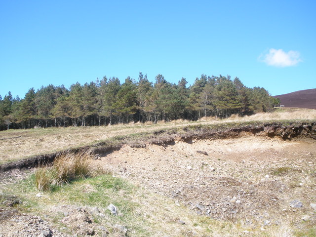
The hill is characterized by its gentle slopes and rugged terrain, making it a popular destination for hikers and nature enthusiasts. Its distinctive geological features, including exposed rock formations and heather-covered slopes, add to its allure. The ascent to the summit is relatively moderate, making it accessible to both experienced climbers and casual visitors.

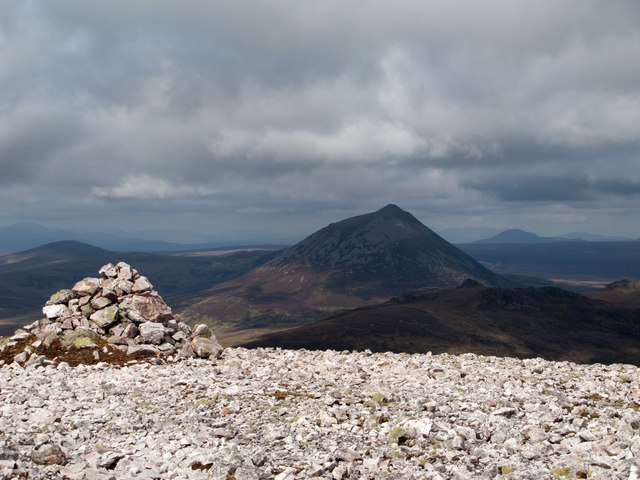
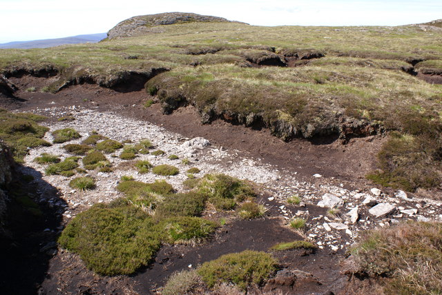
The summit of Sal-Vaich rewards visitors with a commanding view of the sweeping landscapes below. On a clear day, one can see the distant Orkney Islands and the rugged coastline stretching along the horizon. The hill is also home to a rich variety of flora and fauna, with wildflowers, mosses, and lichens adorning its slopes, and birds and small mammals inhabiting its diverse ecosystems.

Sal-Vaich is an ideal location for outdoor activities such as hillwalking, bird-watching, and photography. Its tranquil and unspoiled setting provides a peaceful retreat for those seeking a connection with nature. With its exceptional natural beauty and captivating vistas, Sal-Vaich offers an unforgettable experience for visitors exploring the remarkable Caithness region.

If you have any feedback on the listing, please let us know in the comments section below.

Sal-Vaich Images

Images are sourced within 2km of 58.212971/-3.642256 or Grid Reference ND0326. Thanks to Geograph Open Source API. All images are credited.

North slope of Smean Heathery col between Smean and Sal-vaich
North slope of Smean
Heathery col between Smean and Sal-vaich
Col between Smean and Scaraben The aptly named Maiden Pap is seen well across this boggy col.
Col between Smean and Scaraben
The aptly named Maiden Pap is seen well across this boggy col.
West ridge of Sron Gharbh West ridge of Sron Gharbh, which is an outlier of Scaraben.
West ridge of Sron Gharbh
West ridge of Sron Gharbh, which is an outlier of Scaraben.
Summit area of west top of Scaraben The west top of Scaraben has a covering of quarzite stones many of which have been gathered to form the summit cairn; 609m according to the OS. Smean is the shadowed hill at the centre-right of the image with Morven the dominating cone beyond.
Summit area of west top of Scaraben
The west top of Scaraben has a covering of quarzite stones many of which have been gathered to form the summit cairn; 609m according to the OS. Smean is the shadowed hill at the centre-right of the image with Morven the dominating cone beyond.
Rocks and heather on north side of west top of Scaraben The rocks of the higher north side of Scaraben's west top peter out as heather blankets the ground below 450m. Smean lies directly ahead, dark with shadowed heather; Morven shows above it.
Rocks and heather on north side of west top of Scaraben
The rocks of the higher north side of Scaraben's west top peter out as heather blankets the ground below 450m. Smean lies directly ahead, dark with shadowed heather; Morven shows above it.
Heathery ridge descending towards Toll Beag The ridge descends from the north side of Scaraben's west top towards Toll Beag which appears to name a location just south of the col between the west top and Smean, which rises to the right out of the image. Creag Scalabsdale and Creag nan Gearr are among the hills seen distantly.
Heathery ridge descending towards Toll Beag
The ridge descends from the north side of Scaraben's west top towards Toll Beag which appears to name a location just south of the col between the west top and Smean, which rises to the right out of the image. Creag Scalabsdale and Creag nan Gearr are among the hills seen distantly.
Summit area of Smean Smean is a remarkable hill for the conglomerate tors outcropping over its summit area; one is seen in this image from near to the top of the highest of them. Seemingly these features or the hills possessing them are known as Inselbergs <span class="nowrap"><a title="http://www.landforms.eu/Caithness/inselberg.htm" rel="nofollow ugc noopener" href="http://www.landforms.eu/Caithness/inselberg.htm">Link</a><img style="margin-left:2px;" alt="External link" title="External link - shift click to open in new window" src="https://s1.geograph.org.uk/img/external.png" width="10" height="10"/></span> . The three topped mountain in the distance is Scaraben.
Summit area of Smean
Smean is a remarkable hill for the conglomerate tors outcropping over its summit area; one is seen in this image from near to the top of the highest of them. Seemingly these features or the hills possessing them are known as Inselbergs LinkExternal link . The three topped mountain in the distance is Scaraben.
Wag, Caithness This ruin is the only thing that remains at Wag.  It is situated at the end of an estate track in the Langwell Valley, Caithness.
Wag, Caithness
This ruin is the only thing that remains at Wag. It is situated at the end of an estate track in the Langwell Valley, Caithness.
Smean Smean is a surprisingly complex and much neglected mountain. Only collectors of the Relative Hills of Britain are likely to enjoy the coarse conglomerate scramble to its summit.
Smean
Smean is a surprisingly complex and much neglected mountain. Only collectors of the Relative Hills of Britain are likely to enjoy the coarse conglomerate scramble to its summit.
Smean Summit Plateau View from the summit towards Maiden Pap
Smean Summit Plateau
View from the summit towards Maiden Pap
Peat Haggs between Smean and Carn Mor
Peat Haggs
between Smean and Carn Mor
Smean Summit The rocky summit of Smean.
Smean Summit
The rocky summit of Smean.
The Cairn A small cairn near the summit of Smean.
The Cairn
A small cairn near the summit of Smean.
Descending from Sal-vaich towards Wag, Highland, Scotland Descending from Sal-vaich towards Wag, whilst walking from Braemore to Baile an Or
Descending from Sal-vaich towards Wag, Highland, Scotland
Descending from Sal-vaich towards Wag, whilst walking from Braemore to Baile an Or
Conglomerate Tors on Carn Mor Among the sandstone conglomerate tors atop Smean in Caithness.
Conglomerate Tors on Carn Mor
Among the sandstone conglomerate tors atop Smean in Caithness.
Suspension bridge over Langwell Water
Estate road to Wag
Estate road to Wag
Small plantation in Langwell Forest
Show me another place!

Sal-Vaich is located at Grid Ref: ND0326 (Lat: 58.212971, Lng: -3.642256)

Unitary Authority: Highland

Police Authority: Highlands and Islands

What 3 Words

///tamed.campus.back. Near Dunbeath, Highland

Nearby Locations

Sal-Vaich

Related Wikis

Scaraben

Scaraben (626 m) is a hill in the Northwest Highlands of Scotland. It lies in the Caithness region, in the far north. Taking the form of a long ridge over...

Maiden Pap, Caithness

The Maiden Pap is a hill located in Caithness, Scotland. It is an inselberg, formed of Devonian conglomerates, rising steeply out of the surrounding plain...

Morven, Caithness

Morven (Scottish Gaelic: A' Mhòr Bheinn) is a mountain in Sutherland, in the Highland Region of Scotland. The mountain is classed as a Graham and, at 706...

Braemore

Braemore (Scottish Gaelic: Am Bràigh Mòr) is a location in Berriedale in the Highland council area of Scotland. It can be approached from the A9 road at...

Nearby Amenities

Located within 500m of 58.212971,-3.642256
Sal-vaich
Ele: 410
Natural: peak
Lat/Long: 58.212463/-3.6423989
The data included in this document is from www.openstreetmap.org. The data is made available under ODbL.

Have you been to Sal-Vaich?

Leave your review of Sal-Vaich below (or comments, questions and feedback).