Cairn Eney

Hill, Mountain in Morayshire

Scotland

Cairn Eney

Bantrach Cutting One of many cuttings as the Inverness and Perth Junction railway climbed from Forres towards Dava.
Bantrach Cutting Credit: Anne Burgess

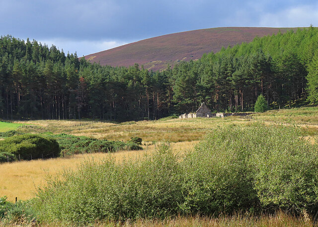
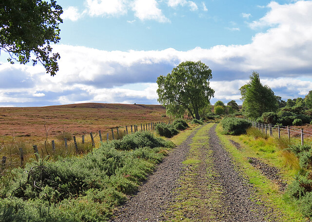
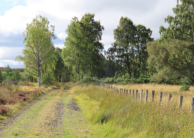
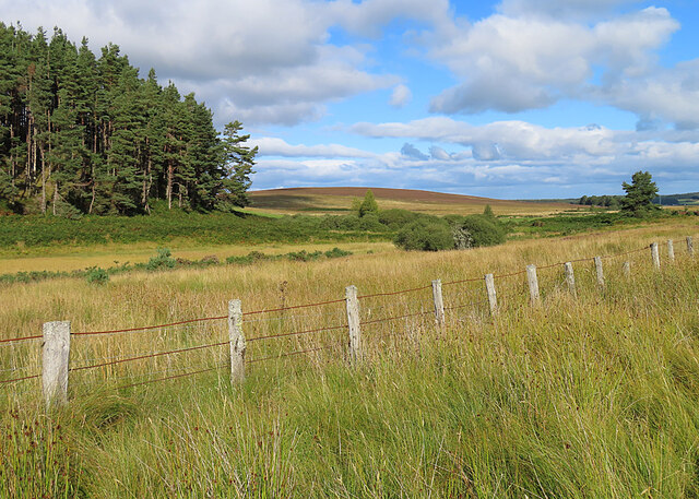
Cairn Eney is a prominent hill located in Morayshire, Scotland. It stands at an elevation of approximately 440 meters (1,444 feet) and is situated in the picturesque countryside of the Scottish Highlands. The hill is part of the larger range known as the Cairngorm Mountains, which are renowned for their stunning natural beauty.

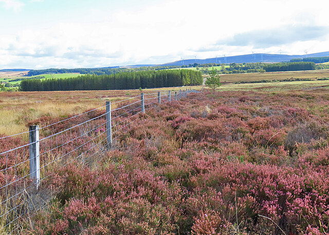
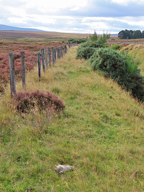
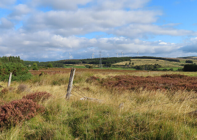
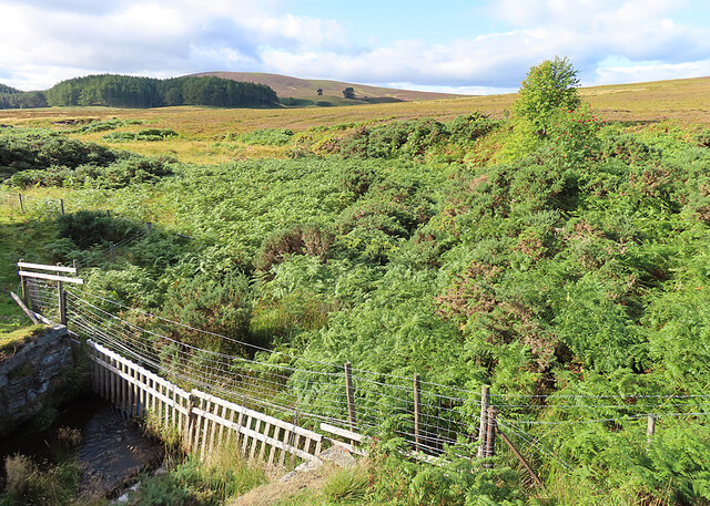
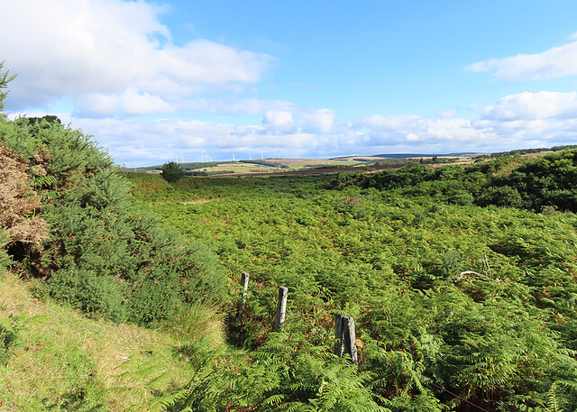
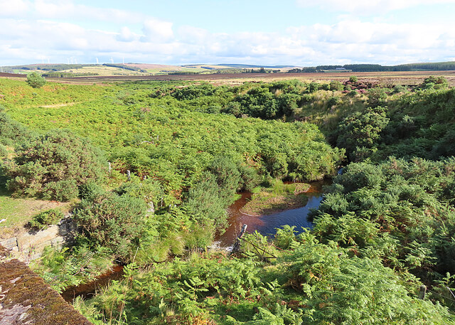
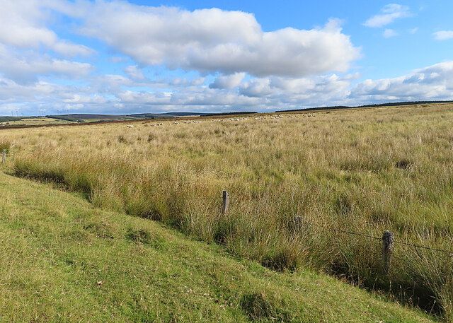
Cairn Eney is characterized by its distinctive summit, which is marked by a large cairn or pile of stones, from which it derives its name. The cairn serves as a navigational marker and has likely been used as such for centuries. It offers breathtaking panoramic views of the surrounding landscape, including the rolling hills, glens, and lochs that make up the Morayshire region.

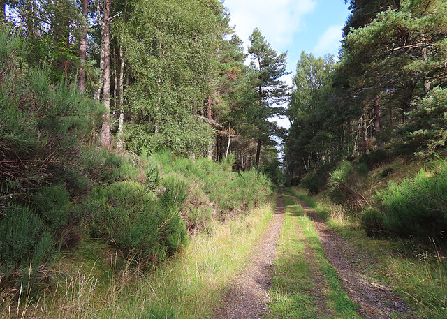
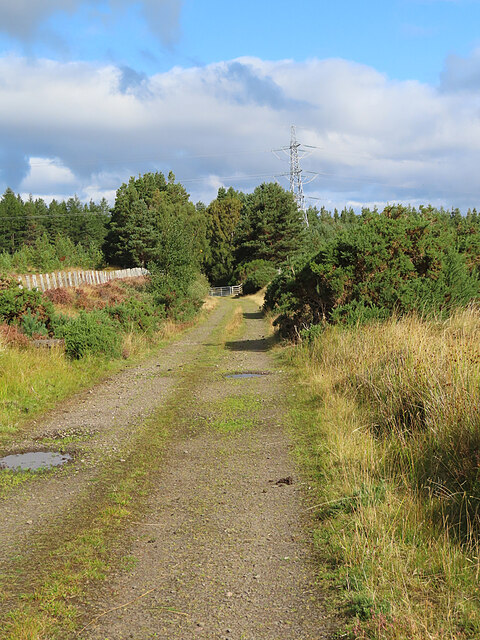
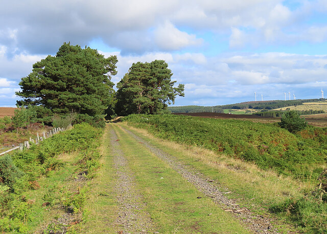
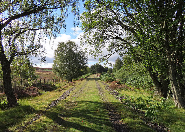
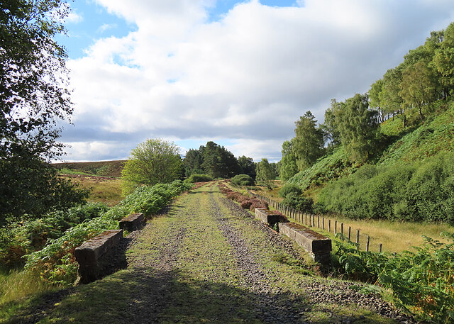
The hill is relatively accessible, with several walking trails leading to its summit. These trails are popular among hikers and nature enthusiasts, who are drawn to the area's tranquility and stunning vistas. It is also a popular spot for birdwatching, as the hill is home to various species of birds, including the iconic golden eagle.

Cairn Eney is steeped in history and folklore. It is believed to have been a site of ancient rituals and ceremonies, as evidenced by the presence of stone circles and other archaeological remains in the vicinity. The hill continues to be a place of intrigue and fascination, attracting visitors from near and far who are eager to explore its natural wonders and uncover its secrets.

If you have any feedback on the listing, please let us know in the comments section below.

Cairn Eney Images

Images are sourced within 2km of 57.478555/-3.635774 or Grid Reference NJ0244. Thanks to Geograph Open Source API. All images are credited.

Bantrach Cutting One of many cuttings as the Inverness and Perth Junction railway climbed from Forres towards Dava.
Bantrach Cutting
One of many cuttings as the Inverness and Perth Junction railway climbed from Forres towards Dava.
Moor near Bantrach Looking east across the moor to Bridge of Newton, with the wind turbines at Berryburn in the distance.
Moor near Bantrach
Looking east across the moor to Bridge of Newton, with the wind turbines at Berryburn in the distance.
Old Fence The fence is on the top of the cutting north of Bantrach Wood.
Old Fence
The fence is on the top of the cutting north of Bantrach Wood.
The View towards Berryburn Although the foreground is in this square, the view is dominated by the Berryburn wind farm.
The View towards Berryburn
Although the foreground is in this square, the view is dominated by the Berryburn wind farm.
Dava Way Looking north towards Bantrach Wood along the trackbed of the former Inverness and Perth Junction Railway.
Dava Way
Looking north towards Bantrach Wood along the trackbed of the former Inverness and Perth Junction Railway.
At Bogeney Bridge Looking upstream from Bogeney Bridge, with the Knock of Braemoray in the distance.
At Bogeney Bridge
Looking upstream from Bogeney Bridge, with the Knock of Braemoray in the distance.
Railway Trackbed The former Inverness and Perth Junction Railway trackbed is now the Dava Way.
Railway Trackbed
The former Inverness and Perth Junction Railway trackbed is now the Dava Way.
Bogeney Bridge Thanks to dense vegetation it's not easy to get a good view of the downstream side of the bridge. The information board says that a grassy platform was built under the bridge to allow sheep to pass safely beneath the railway. It also says that the last wolf in the parish of Edinkillie was killed in the 18th century in the ravine where the burn rises..
Bogeney Bridge
Thanks to dense vegetation it's not easy to get a good view of the downstream side of the bridge. The information board says that a grassy platform was built under the bridge to allow sheep to pass safely beneath the railway. It also says that the last wolf in the parish of Edinkillie was killed in the 18th century in the ravine where the burn rises..
Shian Dou According to the maps this low-lying area beside the Burn of Newton is called Shian Dou.
Shian Dou
According to the maps this low-lying area beside the Burn of Newton is called Shian Dou.
Burn of Newton Looking downstream from Bogeney Bridge.
Burn of Newton
Looking downstream from Bogeney Bridge.
Rough Grazing According to a nearby information board, a flock of 500 sheep grazes the moor. Their primary purpose is to aid grouse tick reduction on the moor. The sheep are washed for ticks six times a year between April and October, and during the rest of the year they are taken down to winter on lowland fields. See <span class="nowrap"><a title="https://www.gwct.org.uk/game/research/species/red-grouse/does-treating-sheep-for-ticks-reduce-red-grouse-tick-burdens/" rel="nofollow ugc noopener" href="https://www.gwct.org.uk/game/research/species/red-grouse/does-treating-sheep-for-ticks-reduce-red-grouse-tick-burdens/">Link</a><img style="margin-left:2px;" alt="External link" title="External link - shift click to open in new window" src="https://s1.geograph.org.uk/img/external.png" width="10" height="10"/></span> for a discussion of this.
Rough Grazing
According to a nearby information board, a flock of 500 sheep grazes the moor. Their primary purpose is to aid grouse tick reduction on the moor. The sheep are washed for ticks six times a year between April and October, and during the rest of the year they are taken down to winter on lowland fields. See LinkExternal link for a discussion of this.
Bogeney The ruins here are the most recently occupied of the crofts in this area. They were inhabited until after the Second World War, though it must have been a hard struggle to work the land here. In 1881 the place supported two households, comprising 11 people. The last family to live here was that of George McDonald. Later, the house was used by the Boy Scouts for a time.
Bogeney
The ruins here are the most recently occupied of the crofts in this area. They were inhabited until after the Second World War, though it must have been a hard struggle to work the land here. In 1881 the place supported two households, comprising 11 people. The last family to live here was that of George McDonald. Later, the house was used by the Boy Scouts for a time.
Dava Way The former trackbed of the Inverness and Perth Junction Railway is now the Dava Way, and it is well maintained by volunteers. See <span class="nowrap"><a title="https://davaway.org.uk/" rel="nofollow ugc noopener" href="https://davaway.org.uk/">Link</a><img style="margin-left:2px;" alt="External link" title="External link - shift click to open in new window" src="https://s1.geograph.org.uk/img/external.png" width="10" height="10"/></span>.
Dava Way
The former trackbed of the Inverness and Perth Junction Railway is now the Dava Way, and it is well maintained by volunteers. See LinkExternal link.
Jess the Collie When Mrs Macdonald, the last occupant of Bogeney, required supplies she sent a note to grocers at Forres or Grantown. They would make up the order in a parcel with a string loop, and the parcel would be taken on the next train. When Mrs Macdonald's collie Jess heard the train, she would go out to the line, collect the parcel and carry it home using the loop to hold it. 'You shop, we drop' is nothing new!
Jess the Collie
When Mrs Macdonald, the last occupant of Bogeney, required supplies she sent a note to grocers at Forres or Grantown. They would make up the order in a parcel with a string loop, and the parcel would be taken on the next train. When Mrs Macdonald's collie Jess heard the train, she would go out to the line, collect the parcel and carry it home using the loop to hold it. 'You shop, we drop' is nothing new!
Dava Way This is, I think, the most attractive part of the Dava Way, where it curves gently through open woodlands beside the moorland.
Dava Way
This is, I think, the most attractive part of the Dava Way, where it curves gently through open woodlands beside the moorland.
Burn of Aulthaunachan Not the you can actually see the burn, which is hidden amongst the long grass, but it flows north from here and eventually becomes part of the Burn of Newton. The low hill is Cairn Eney.
Burn of Aulthaunachan
Not the you can actually see the burn, which is hidden amongst the long grass, but it flows north from here and eventually becomes part of the Burn of Newton. The low hill is Cairn Eney.
Dava Way This stretch is partially shaded by Silver Birches which have grown up since the closure of the railway in 1965. No doubt the line itself would be obstructed by trees if it were not for the maintenance work done by the Dava Way Association volunteer. See <span class="nowrap"><a title="https://davaway.org.uk/" rel="nofollow ugc noopener" href="https://davaway.org.uk/">Link</a><img style="margin-left:2px;" alt="External link" title="External link - shift click to open in new window" src="https://s1.geograph.org.uk/img/external.png" width="10" height="10"/></span>
Dava Way
This stretch is partially shaded by Silver Birches which have grown up since the closure of the railway in 1965. No doubt the line itself would be obstructed by trees if it were not for the maintenance work done by the Dava Way Association volunteer. See LinkExternal link
Inverness and Perth Junction Railway The trackbed is now in use as the Dava Way. We became intrigued to notice several bridges with gaps in the middle of the parapets, some of them, as here, with an iron edge and others with masonry edges.
Inverness and Perth Junction Railway
The trackbed is now in use as the Dava Way. We became intrigued to notice several bridges with gaps in the middle of the parapets, some of them, as here, with an iron edge and others with masonry edges.
Show me another place!

Cairn Eney is located at Grid Ref: NJ0244 (Lat: 57.478555, Lng: -3.635774)

Unitary Authority: Moray

Police Authority: North East

What 3 Words

///increment.unusable.pioneered. Near Forres, Moray

Nearby Locations

Cairn Eney

Related Wikis

Dorback Burn, Findhorn

The Dorback Burn (Scottish Gaelic: Dorbag / Uisge Dhorbaig) is a right-bank tributary of the River Findhorn in northeast Scotland. It emerges from the...

Edinkillie House

Edinkillie House is a country house in Edinkillie in Moray, Scotland, built in 1822–1823 by John Paterson as a manse for the nearby Edinkillie Church....

Dunphail House

Dunphail House is an Italianate country house in Moray, Scotland. It was designed by William Henry Playfair for Charles Lennox Cumming-Bruce, and was completed...

Dunphail railway station

Dunphail railway station was opened with the Inverness and Perth Junction Railway in 1863. == Station layout == The station layout was double platform...

Nearby Amenities

Located within 500m of 57.478555,-3.635774
Cairn Eney
Ele: 276
Natural: peak
Lat/Long: 57.4786453/-3.6352581
The data included in this document is from www.openstreetmap.org. The data is made available under ODbL.

Have you been to Cairn Eney?

Leave your review of Cairn Eney below (or comments, questions and feedback).