Little Cairngorm

Hill, Mountain in Aberdeenshire

Scotland

Little Cairngorm

Scots Pine, Glen Derry This Scots Pine still looks the same as in this picture taken over 20 years ago:-
<a title="https://www.geograph.org.uk/photo/494083" href="https://www.geograph.org.uk/photo/494083">Link</a>
It is also interesting to see that it was a track here in 2001, and is now a much narrower - but very good - path.
Scots Pine, Glen Derry Credit: Adam Ward

Little Cairngorm is a prominent hill located in Aberdeenshire, Scotland. Standing at an elevation of 835 meters (2,740 feet), it is part of the larger Cairngorm Mountain range within the Cairngorms National Park.

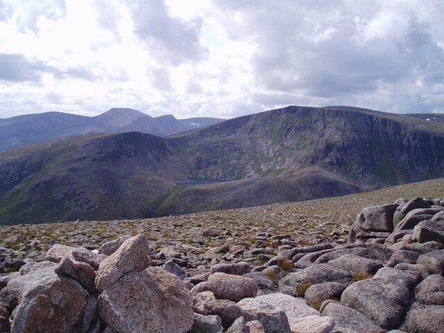
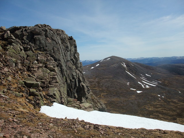
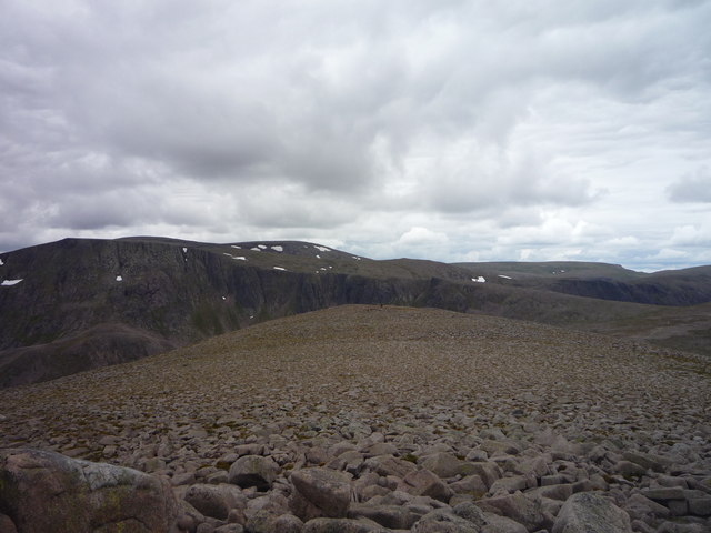
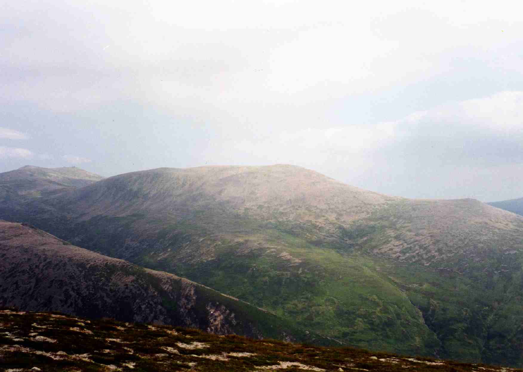
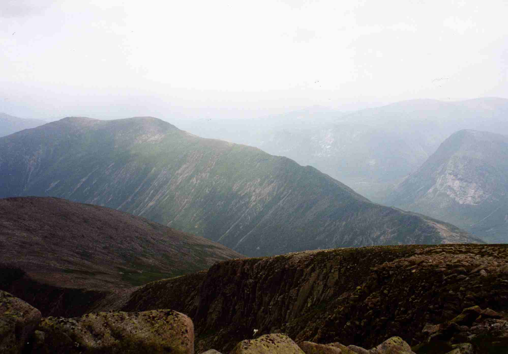
Situated near the town of Braemar, Little Cairngorm offers breathtaking panoramic views of the surrounding landscape. Its distinctive shape and rocky terrain make it a popular destination for hikers, mountaineers, and nature enthusiasts.

The hill is characterized by its rugged slopes, scattered with granite outcrops and heather-covered moorland. Its summit provides a vantage point from which visitors can admire the stunning vistas of the Scottish Highlands, including the neighboring peaks of Ben Macdui and Cairn Toul.

Little Cairngorm is home to a diverse range of wildlife, including red deer, mountain hares, and various bird species such as ptarmigans and golden eagles. The hillside is also dotted with small streams and lochs, adding to its picturesque appeal.

Access to Little Cairngorm is facilitated by a network of well-established paths, making it accessible to both experienced climbers and casual walkers. However, visitors are advised to come prepared with appropriate hiking gear and clothing, as the weather conditions can be unpredictable and change rapidly.

In conclusion, Little Cairngorm is a captivating hill in Aberdeenshire, offering stunning views, unique geological features, and a chance to experience the untamed beauty of the Scottish Highlands.

If you have any feedback on the listing, please let us know in the comments section below.

Little Cairngorm Images

Images are sourced within 2km of 57.055761/-3.617049 or Grid Reference NO0297. Thanks to Geograph Open Source API. All images are credited.

Scots Pine, Glen Derry This Scots Pine still looks the same as in this picture taken over 20 years ago:-
<a title="https://www.geograph.org.uk/photo/494083" href="https://www.geograph.org.uk/photo/494083">Link</a>
It is also interesting to see that it was a track here in 2001, and is now a much narrower - but very good - path.
Scots Pine, Glen Derry
This Scots Pine still looks the same as in this picture taken over 20 years ago:- Link It is also interesting to see that it was a track here in 2001, and is now a much narrower - but very good - path.
Summit slopes of Sgurr an Lochan Uaine Lochnagar on the horizon.
Summit slopes of Sgurr an Lochan Uaine
Lochnagar on the horizon.
Above Coire an Lochan Uaine About one third of the square visible above the cliffs separateing the ground from Coire an Lochan Uaine, below.
Above Coire an Lochan Uaine
About one third of the square visible above the cliffs separateing the ground from Coire an Lochan Uaine, below.
Burn on Derry Cairngorm Burn draining the shallow corrie between Derry Cairngorm and Sgurr an Lochan Uaine.
Burn on Derry Cairngorm
Burn draining the shallow corrie between Derry Cairngorm and Sgurr an Lochan Uaine.
The steep slopes above Glen Derry Derry Burn meanders across the glacial floor of the glen.
The steep slopes above Glen Derry
Derry Burn meanders across the glacial floor of the glen.
On top of Derry Cairngorm Looking towards Beinn Mheadhoin.
On top of Derry Cairngorm
Looking towards Beinn Mheadhoin.
View from summit of Derry Cairngorm
Derry Cairngorm Derry Cairngorm viewed from the top of the cliffs above Coire Sputan Dearg
Derry Cairngorm
Derry Cairngorm viewed from the top of the cliffs above Coire Sputan Dearg
Waterfall, Luibeg Burn This burn flows between Ben Macdui and Derry Cairngorm.
Waterfall, Luibeg Burn
This burn flows between Ben Macdui and Derry Cairngorm.
SW slopes of Derry Cairngorm Looking up towards the hill from Luibeg Burn.
SW slopes of Derry Cairngorm
Looking up towards the hill from Luibeg Burn.
Allt Carn a' Mhaim Looking towards Ceann Crionn Carn a' Mhaim, a long ridge going north.
Allt Carn a' Mhaim
Looking towards Ceann Crionn Carn a' Mhaim, a long ridge going north.
Sgurr an Lochan Uaine A subsidiary top of Derry Cairngorm, looking across to Stob Coire Etchachan <a title="https://www.geograph.org.uk/photo/2598305," href="https://www.geograph.org.uk/photo/2598305,">Link</a> a subsidiary top of Bheinn Mheadoin.
Sgurr an Lochan Uaine
A subsidiary top of Derry Cairngorm, looking across to Stob Coire Etchachan Link a subsidiary top of Bheinn Mheadoin.
View north west from Derry Cairngorm Looking across the high, barren granite summit plateau towards Beinn Macdui.
View north west from Derry Cairngorm
Looking across the high, barren granite summit plateau towards Beinn Macdui.
Carn Crom from the hillside above Coire na Saobhaidh Carn Crom is a prominent rise near the southern end of the long ridge leading to Derry Cairngorm
Carn Crom from the hillside above Coire na Saobhaidh
Carn Crom is a prominent rise near the southern end of the long ridge leading to Derry Cairngorm
Glen Derry One of many small watercourses feeding the Derry Burn (G. Uisge an Doire, "Water of the Copse"). A short distance ahead is a forestry plantation, fenced off to protect it from the many deer which roam the Cairngorms.
Glen Derry
One of many small watercourses feeding the Derry Burn (G. Uisge an Doire, "Water of the Copse"). A short distance ahead is a forestry plantation, fenced off to protect it from the many deer which roam the Cairngorms.
Glen Derry A small group of pine trees growing amidst the rocks and scree of Coire an Fhir Bhogha ("Corrie of the Archer").
Glen Derry
A small group of pine trees growing amidst the rocks and scree of Coire an Fhir Bhogha ("Corrie of the Archer").
Uisge an Doire ("Water of the Copse")
Crossing place on the Luibeg Burn One of many places to cross the river on the way to Ben Macdui
Crossing place on the Luibeg Burn
One of many places to cross the river on the way to Ben Macdui
Show me another place!

Little Cairngorm is located at Grid Ref: NO0297 (Lat: 57.055761, Lng: -3.617049)

Unitary Authority: Aberdeenshire

Police Authority: North East

What 3 Words

///cabbages.hoped.spacing. Near Inverey, Aberdeenshire

Nearby Locations

Little Cairngorm

Related Wikis

Derry Cairngorm

Derry Cairngorm (Scottish Gaelic: Càrn Gorm an Doire) is a Scottish mountain in the Cairngorms range, 14 kilometres (8.7 mi) north west of Braemar in the...

Càrn a' Mhàim

Càrn a' Mhàim is a Scottish mountain situated in the inner part of the Cairngorms range, some 15 kilometres west of Braemar in the county of Aberdeenshire...

Loch Etchachan

Loch Etchachan is a remote freshwater loch set deep within the central Cairngorms plateau, in the Cairngorms National Park, located in the eastern Highlands...

Ben Macdui

Ben Macdui (Scottish Gaelic: Beinn MacDuibh, meaning "MacDuff's mountain") is the second-highest mountain in Scotland and all of the British Isles, after...

Have you been to Little Cairngorm?

Leave your review of Little Cairngorm below (or comments, questions and feedback).