Bank Heath

Settlement in Lancashire

England

Bank Heath

A573 Warrington Road
A573 Warrington Road Credit: Steven Brown

Bank Heath is a small village located in the county of Lancashire, England. Situated approximately 5 miles northeast of the town of Burnley, Bank Heath is nestled in a picturesque rural setting, surrounded by rolling hills and lush green landscapes.

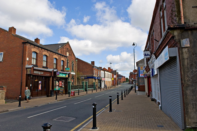
With a population of around 500 residents, Bank Heath is a close-knit community known for its friendly and welcoming atmosphere. The village primarily consists of residential properties, with a few small businesses and amenities such as a local convenience store and a pub.

Bank Heath boasts a rich history, with records dating back to the 17th century. The village is home to several historic buildings, including the Grade II listed St. John the Evangelist Church, which was constructed in 1841 and continues to serve as a place of worship for the local community.

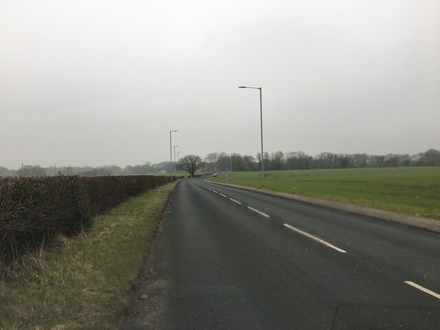
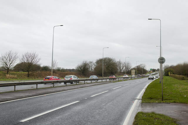
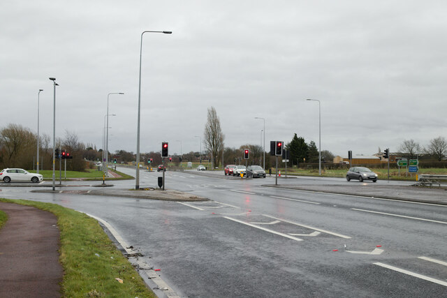
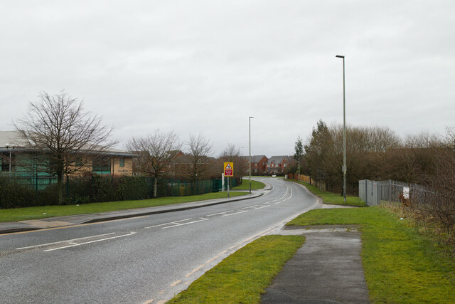
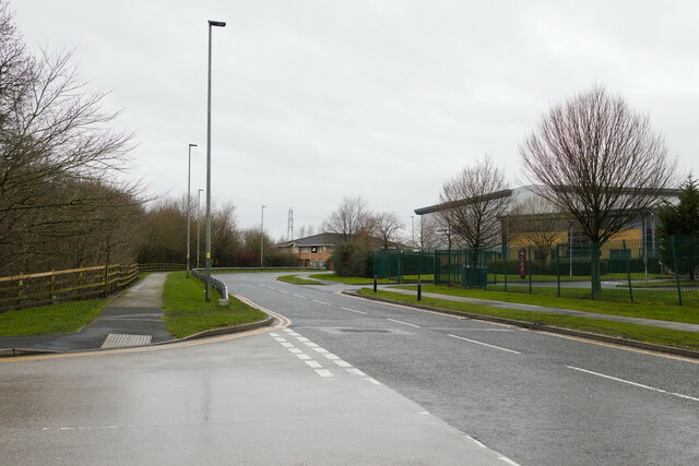
The village is well-connected to surrounding areas by a network of roads, making it easily accessible for both residents and visitors. It also benefits from excellent transport links, with regular bus services and nearby railway stations providing connections to nearby towns and cities.

Surrounded by beautiful countryside, Bank Heath offers ample opportunities for outdoor activities and exploration. The village is located close to the popular Forest of Bowland, an Area of Outstanding Natural Beauty, where visitors can enjoy scenic walks, cycling, and birdwatching.

Bank Heath provides a peaceful and idyllic setting for those seeking a rural lifestyle, while still offering convenient access to nearby amenities and attractions.

If you have any feedback on the listing, please let us know in the comments section below.

Bank Heath Images

Images are sourced within 2km of 53.474946/-2.603385 or Grid Reference SJ6097. Thanks to Geograph Open Source API. All images are credited.

A573 Warrington Road
A580 East Lancashire Road
Traffic lights on the A580 At the junction with Stone Cross Lane North.
Traffic lights on the A580
At the junction with Stone Cross Lane North.
Stone Cross Lane North
Yew Tree Way, Golborne
Vision Bus Carlton Road, Lowton
Vision Bus
Carlton Road, Lowton
Mast by railway
Mast by railway
Matrix board  - M6 northbound
Matrix board - M6 northbound
Junction 23 signage  - M6 northbound
Junction 23 signage - M6 northbound
Junction 23 signage  - M6 northbound
Junction 23 signage - M6 northbound
St Helens : The M6 Motorway Heading northbound through Merseyside on the M6 Motorway.
St Helens : The M6 Motorway
Heading northbound through Merseyside on the M6 Motorway.
St Helens : The M6 Motorway Looking along the northbound carriage of the M6 Motorway as it heads through the St Helens area of Merseyside.
St Helens : The M6 Motorway
Looking along the northbound carriage of the M6 Motorway as it heads through the St Helens area of Merseyside.
St Helens : Motorway Roadside The roadside scenery including a wind turbine.
St Helens : Motorway Roadside
The roadside scenery including a wind turbine.
St Helens : The M6 Motorway Heading north through Merseyside on the M6 Motorway.
St Helens : The M6 Motorway
Heading north through Merseyside on the M6 Motorway.
St Helens : The M6 Motorway Heading northbound on the M6 Motorway.
St Helens : The M6 Motorway
Heading northbound on the M6 Motorway.
Access to M6 works unit near Haydock Park The M6 motorway runs from junction 19 of the M1 at the Catthorpe Interchange, near Rugby to the Gretna junction (J45). Here it becomes the A74(M) and M74 which continues to Glasgow.

The M6 is the longest motorway in the United Kingdom (232 miles) and one of the busiest. It incorporates the first length of motorway opened in the UK (the Preston bypass in 1958) and forms part of a motorway "Backbone of Britain", running north-south between London and Glasgow via the industrial north of England. It is also part of the east-west route between the Midlands and the east coast ports.
Access to M6 works unit near Haydock Park
The M6 motorway runs from junction 19 of the M1 at the Catthorpe Interchange, near Rugby to the Gretna junction (J45). Here it becomes the A74(M) and M74 which continues to Glasgow. The M6 is the longest motorway in the United Kingdom (232 miles) and one of the busiest. It incorporates the first length of motorway opened in the UK (the Preston bypass in 1958) and forms part of a motorway "Backbone of Britain", running north-south between London and Glasgow via the industrial north of England. It is also part of the east-west route between the Midlands and the east coast ports.
Pipe & Subway Beneath M6 At north end of Newton Lake
Pipe & Subway Beneath M6
At north end of Newton Lake
M6 Junction 23 roundabout near Haydock Park
Show me another place!

Bank Heath is located at Grid Ref: SJ6097 (Lat: 53.474946, Lng: -2.603385)

Unitary Authority: Wigan

Police Authority: Greater Manchester

What 3 Words

///search.face.prices. Near Golborne, Manchester

Nearby Locations

Bank Heath Golborne

Related Wikis

Golborne

Golborne (pronounced go:lbə:n or go:bə:n) is a town in the Metropolitan Borough of Wigan, in Greater Manchester, England. It lies 5 miles (8.0 km) south...

Golborne South railway station

Golborne South railway station was one of two stations serving the town of Golborne, to the south of Wigan. == The early line and station to 1849 == The...
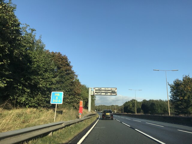
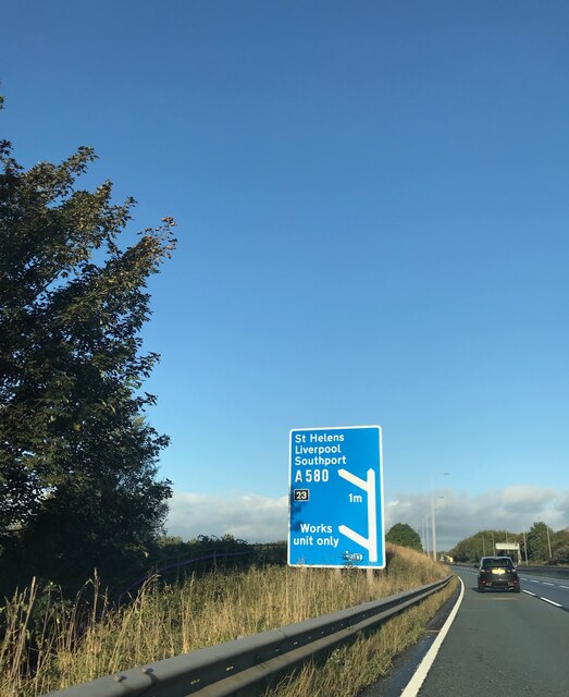
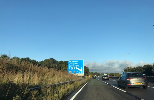
A580 road

The A580 (officially the Liverpool–East Lancashire Road, colloquially the East Lancs) is the United Kingdom's first purpose-built inter-city highway. The...

Golborne and Lowton West (ward)

Golborne and Lowton West is an electoral ward in Leigh, England. It forms part of Wigan Metropolitan Borough Council, as well as the parliamentary constituency...

Nearby Amenities

Located within 500m of 53.474946,-2.603385
Golborne
Is In: Wigan, Greater Manchester, England, UK
Is In District: Wigan
Place: town
Population: 24169
Population Date: 2011
Source: npe
Source Population: wikipedia
Wikidata: Q1615957
Wikipedia: en:Golborne
Lat/Long: 53.4756118/-2.5994277
Turning Circle
Lat/Long: 53.4717816/-2.6014824
Crossing
Button Operated: yes
Crossing: traffic_signals
Crossing Island: no
Crossing Markings: dots
Source: survey
Start Date: 2022-12
Tactile Paving: yes
Lat/Long: 53.4724406/-2.5985166
Turning Circle
Lat/Long: 53.4773219/-2.5994604
Bus Stop
Tanners Lane/Golborne Library (Stop F)
Bus: yes
Local Ref: F
Naptan AtcoCode: 1800WK00221
Naptan Bearing: SE
Naptan CommonName: Tanners Lane/Golborne Library (Stop F)
Naptan Indicator: Stop F
Naptan Landmark: LIBRARY
Naptan NaptanCode: manpmdwd
Naptan PlusbusZoneRef: MNCRPIC
Naptan ShortCommonName: Golborne Library
Naptan Street: TANNERS LANE
Naptan Verified: no
Network: TfGM
Public Transport: platform
Source: naptan_import
Lat/Long: 53.4756498/-2.596231
Bus Stop
Tanners Lane/Golborne Library (Stop E)
Bus: yes
Local Ref: E
Naptan AtcoCode: 1800WK00231
Naptan Bearing: NW
Naptan CommonName: Tanners Lane/Golborne Library (Stop E)
Naptan Indicator: Stop E
Naptan Landmark: LIBRARY
Naptan NaptanCode: manpmdwg
Naptan PlusbusZoneRef: MNCRPIC
Naptan ShortCommonName: Golborne Library
Naptan Street: TANNERS LANE
Naptan Verified: no
Network: TfGM
Public Transport: platform
Source: naptan_import
Lat/Long: 53.4757279/-2.5967896
Bus Stop
Bridge Street/School Street
Bus: yes
Departures Board: timetable
Naptan AtcoCode: 1800WK00241
Naptan Bearing: S
Naptan CommonName: Bridge Street/School Street
Naptan Indicator: Nr Weir
Naptan Landmark: Industrial Estateate
Naptan NaptanCode: manpmdwj
Naptan PlusbusZoneRef: MNCRPIC
Naptan ShortCommonName: School Street
Naptan Street: BRIDGE STREET
Naptan Verified: no
Network: TfGM
Public Transport: platform
Shelter: yes
Source: naptan_import
Lat/Long: 53.4732497/-2.5980355
Bus Stop
Harvey Lane/Bridge
Bus: yes
Naptan AtcoCode: 1800WK08971
Naptan Bearing: W
Naptan CommonName: Harvey Lane/Bridge
Naptan Indicator: Opp. Park
Naptan Landmark: PARK
Naptan NaptanCode: manpwdmt
Naptan PlusbusZoneRef: MNCRPIC
Naptan ShortCommonName: Bridge
Naptan Street: HARVEY LANE
Naptan Verified: no
Network: TfGM
Public Transport: platform
Source: naptan_import
Lat/Long: 53.4775473/-2.606775
Bus Stop
High Street/John Street (Stop D)
Bus: yes
Departures Board: timetable
Local Ref: D
Naptan AtcoCode: 1800WK38041
Naptan Bearing: S
Naptan CommonName: High Street/John Street (Stop D)
Naptan Indicator: Stop D
Naptan Landmark: OP BUILDING 30
Naptan NaptanCode: mantdmdj
Naptan PlusbusZoneRef: MNCRPIC
Naptan ShortCommonName: John Street
Naptan Street: HIGH STREET
Naptan Verified: no
Network: TfGM
Public Transport: platform
Shelter: no
Source: naptan_import
Lat/Long: 53.4748678/-2.5978245
Bus Stop
Bridge Street/School Street
Bench: yes
Bus: yes
Departures Board: timetable
Naptan AtcoCode: 1800WK38051
Naptan Bearing: N
Naptan CommonName: Bridge Street/School Street
Naptan Indicator: Grass Verge
Naptan Landmark: INDUSTRIAL Estate
Naptan NaptanCode: mantdmdm
Naptan PlusbusZoneRef: MNCRPIC
Naptan ShortCommonName: School Street
Naptan Street: BRIDGE STREET
Naptan Verified: no
Network: TfGM
Public Transport: platform
Shelter: yes
Source: naptan_import
Lat/Long: 53.4734554/-2.5982493
Bus Stop
High Street/John Street (Stop C)
Bench: yes
Bin: yes
Bus: yes
Departures Board: timetable
Lit: yes
Local Ref: C
Naptan AtcoCode: 1800WK38091
Naptan Bearing: N
Naptan CommonName: High Street/John Street (Stop C)
Naptan Indicator: Stop C
Naptan Landmark: OS BUILDING 56
Naptan NaptanCode: mantdmdw
Naptan PlusbusZoneRef: MNCRPIC
Naptan ShortCommonName: John Street
Naptan Street: HIGH STREET
Naptan Verified: no
Network: TfGM
Public Transport: platform
Shelter: no
Source: naptan_import
Tactile Paving: no
Lat/Long: 53.4753089/-2.5977868
Bus Stop
Bank Street/Royal Hotel
Bench: no
Bus: yes
Naptan AtcoCode: 1800WK44011
Naptan Bearing: S
Naptan CommonName: Bank Street/Royal Hotel
Naptan Indicator: Royal Hotel
Naptan Landmark: OS BUILDING 43
Naptan NaptanCode: mantdmwd
Naptan PlusbusZoneRef: MNCRPIC
Naptan ShortCommonName: Royal Hotel
Naptan Street: BANK STREET
Naptan Verified: no
Network: TfGM
Public Transport: platform
Shelter: yes
Source: naptan_import
Wheelchair: yes
Lat/Long: 53.478336/-2.6019041
Bus Stop
Bank Street/Royal Hotel
Bench: yes
Bus: yes
Naptan AtcoCode: 1800WK44021
Naptan Bearing: N
Naptan CommonName: Bank Street/Royal Hotel
Naptan Indicator: Os House 40
Naptan Landmark: HOUSE 40
Naptan NaptanCode: mantdmwg
Naptan PlusbusZoneRef: MNCRPIC
Naptan ShortCommonName: Royal Hotel
Naptan Street: BANK STREET
Naptan Verified: no
Network: TfGM
Public Transport: platform
Shelter: yes
Source: naptan_import
Wheelchair: yes
Lat/Long: 53.4782455/-2.6020234
Bus Stop
Heath Street/Salisbury Street (Stop A)
Bus: yes
Local Ref: A
Naptan AtcoCode: 1800WK44031
Naptan Bearing: E
Naptan CommonName: Heath Street/Salisbury Street (Stop A)
Naptan Indicator: Stop A
Naptan Landmark: BUILDING 19
Naptan NaptanCode: mantdmwj
Naptan PlusbusZoneRef: MNCRPIC
Naptan ShortCommonName: Salisbury Street
Naptan Street: HEATH STREET
Naptan Verified: no
Network: TfGM
Public Transport: platform
Source: naptan_import
Lat/Long: 53.4765906/-2.5986399
Bus Stop
Heath St/Golborne Post Office (Stop B)
Bus: yes
Local Ref: B
Naptan AtcoCode: 1800WK44041
Naptan Bearing: W
Naptan CommonName: Heath St/Golborne Post Office (Stop B)
Naptan Indicator: Stop B
Naptan Landmark: BUILDING 30
Naptan NaptanCode: mantdmwm
Naptan PlusbusZoneRef: MNCRPIC
Naptan ShortCommonName: Golborne PO
Naptan Street: HEATH STREET
Naptan Verified: no
Network: TfGM
Public Transport: platform
Source: naptan_import
Lat/Long: 53.4765709/-2.5989711
Historic: memorial
Memorial: war_memorial
Wheelchair: no
Lat/Long: 53.4737508/-2.604371
Barrier: bollard
Bollard: rising
Lat/Long: 53.4729062/-2.6015446
Barrier: bollard
Bollard: fixed
Motor Vehicle: no
Lat/Long: 53.477423/-2.6050375
Legh Street Park
Leisure: playground
Lat/Long: 53.4723731/-2.6027006
Parking
Lat/Long: 53.4751921/-2.597437
Parking
Lat/Long: 53.4726607/-2.5978922
Parking
Lat/Long: 53.4772489/-2.6042753
Clock
Lat/Long: 53.4764035/-2.5972087
Post Box
Operator: Royal Mail
Operator Wikidata: Q638098
Post Box Type: wall
Ref: WA3 259
Royal Cypher: EIIR
Lat/Long: 53.4769979/-2.5966747
Parking
Lat/Long: 53.4755796/-2.5978791
Post Box
Operator: Royal Mail
Operator Wikidata: Q638098
Post Box Type: pillar
Ref: WA3 253
Royal Cypher: GR
Lat/Long: 53.4766217/-2.5993828
Parking
Lat/Long: 53.4751127/-2.5992234
Generator Method: photovoltaic
Generator Output Electricity: yes
Generator Source: solar
Generator Type: solar_photovoltaic_panel
Power: generator
Lat/Long: 53.4786624/-2.6074382
Generator Method: photovoltaic
Generator Output Electricity: yes
Generator Source: solar
Generator Type: solar_photovoltaic_panel
Power: generator
Lat/Long: 53.4786608/-2.607339
Generator Method: photovoltaic
Generator Output Electricity: yes
Generator Source: solar
Generator Type: solar_photovoltaic_panel
Power: generator
Lat/Long: 53.4783846/-2.6073148
Generator Method: photovoltaic
Generator Output Electricity: yes
Generator Source: solar
Generator Type: solar_photovoltaic_panel
Power: generator
Lat/Long: 53.4783766/-2.6072102
Generator Method: photovoltaic
Generator Output Electricity: yes
Generator Source: solar
Generator Type: solar_photovoltaic_panel
Power: generator
Lat/Long: 53.4783431/-2.6065451
Generator Method: photovoltaic
Generator Output Electricity: yes
Generator Source: solar
Generator Type: solar_photovoltaic_panel
Power: generator
Lat/Long: 53.4784118/-2.6077762
Generator Method: photovoltaic
Generator Output Electricity: yes
Generator Source: solar
Generator Type: solar_photovoltaic_panel
Power: generator
Lat/Long: 53.4780973/-2.6075053
Generator Method: photovoltaic
Generator Output Electricity: yes
Generator Source: solar
Generator Type: solar_photovoltaic_panel
Power: generator
Lat/Long: 53.4780829/-2.60728
Generator Method: photovoltaic
Generator Output Electricity: yes
Generator Source: solar
Generator Type: solar_photovoltaic_panel
Power: generator
Lat/Long: 53.4780781/-2.6071807
Generator Method: photovoltaic
Generator Output Electricity: yes
Generator Source: solar
Generator Type: solar_photovoltaic_panel
Power: generator
Lat/Long: 53.4780558/-2.6068428
Crossing
Crossing: traffic_signals
Crossing Island: no
Crossing Ref: puffin
Tactile Paving: yes
Lat/Long: 53.4761054/-2.5972579
Stop
Direction: backward
Stop: minor
Lat/Long: 53.4763025/-2.5971766
Traffic Signals
Traffic Signals: crossing
Traffic Signals Direction: backward
Lat/Long: 53.4760695/-2.5972831
Traffic Signals
Traffic Signals: crossing
Traffic Signals Direction: forward
Lat/Long: 53.4761399/-2.5972336
Barrier: cycle_barrier
Bicycle: no
Horse: no
Motor Vehicle: no
Lat/Long: 53.4786187/-2.5992696
Post Box
Operator: Royal Mail
Operator Wikidata: Q638098
Post Box Type: wall
Ref: WA3 256
Royal Cypher: GVIR
Lat/Long: 53.4771271/-2.6016837
Barrier: bollard
Lat/Long: 53.4774851/-2.6063684
Barrier: bollard
Motor Vehicle: no
Lat/Long: 53.4769819/-2.6007574
Barrier: bollard
Motor Vehicle: no
Lat/Long: 53.477816/-2.6012118
Addr City: Golborne
Addr Housenumber: 2
Addr Street: Harvey Lane
Lat/Long: 53.4770503/-2.6023752
Addr City: Golborne
Addr Housenumber: 16
Addr Street: Harvey Lane
Lat/Long: 53.4770985/-2.6028178
Addr City: Golborne
Addr Housenumber: 7
Addr Street: Harvey Lane
Lat/Long: 53.4772942/-2.6024665
Addr City: Golborne
Addr Housenumber: 9
Addr Street: Harvey Lane
Lat/Long: 53.4773047/-2.6025359
Addr City: Golborne
Addr Housenumber: 11
Addr Street: Harvey Lane
Lat/Long: 53.4773145/-2.6026062
Addr City: Golborne
Addr Housenumber: 18
Addr Street: Harvey Lane
Lat/Long: 53.4771205/-2.6029053
Addr City: Golborne
Addr Housenumber: 26
Addr Street: Harvey Lane
Lat/Long: 53.4771538/-2.6032491
Addr City: Golborne
Addr Housenumber: 28
Addr Street: Harvey Lane
Lat/Long: 53.477166/-2.6033458
Addr City: Golborne
Addr Housenumber: 19
Addr Street: Harvey Lane
Lat/Long: 53.4773404/-2.6029188
Addr City: Golborne
Addr Housenumber: 15
Addr Street: Harvey Lane
Lat/Long: 53.4773275/-2.6027842
Addr City: Golborne
Addr Housenumber: 17
Addr Street: Harvey Lane
Lat/Long: 53.4773355/-2.6028474
Addr City: Golborne
Addr Housenumber: 13
Addr Street: Harvey Lane
Lat/Long: 53.4773225/-2.6027149
Addr City: Golborne
Addr Housenumber: 1
Addr Street: Springfield Avenue
Lat/Long: 53.47714/-2.60523
Addr City: Golborne
Addr Housenumber: 62
Addr Street: Harvey Lane
Lat/Long: 53.4773941/-2.6049204
Addr City: Golborne
Addr Housenumber: 88
Addr Street: Harvey Lane
Lat/Long: 53.4774418/-2.6058783
Addr City: Golborne
Addr Housenumber: 66
Addr Street: Harvey Lane
Lat/Long: 53.4774079/-2.6051482
Addr City: Golborne
Addr Housenumber: 26
Addr Street: Highfield Avenue
Lat/Long: 53.4767943/-2.6043961
Addr City: Golborne
Addr Housenumber: 2
Addr Street: Highfield Avenue
Lat/Long: 53.4771299/-2.6049639
Addr City: Golborne
Addr Housenumber: 82
Addr Street: Heath Street
Lat/Long: 53.4768885/-2.6013265
Addr City: Golborne
Addr Housenumber: 68
Addr Street: Heath Street
Lat/Long: 53.4768177/-2.6008981
Addr City: Golborne
Addr Housenumber: 32
Addr Street: Bank Street
Lat/Long: 53.4780763/-2.6021659
Addr City: Golborne
Addr Housenumber: 54
Addr Street: Bank Street
Lat/Long: 53.4789149/-2.6023105
Addr City: Golborne
Addr Housenumber: 64
Addr Street: Bank Street
Lat/Long: 53.4791322/-2.602349
Addr City: Golborne
Addr Housenumber: 42B
Addr Street: Bank Street
Lat/Long: 53.4784603/-2.6022394
Addr City: Golborne
Addr Housenumber: 59
Addr Street: Bank Street
Lat/Long: 53.4786525/-2.6018807
Addr City: Golborne
Addr Housenumber: 51
Addr Street: Bank Street
Lat/Long: 53.4784825/-2.6018403
Addr City: Golborne
Addr Housenumber: 52
Addr Street: Bank Street
Lat/Long: 53.478772/-2.6022786
Addr City: Golborne
Addr Housenumber: 2
Addr Street: Barton Street
Lat/Long: 53.4772659/-2.6012988
Addr City: Golborne
Addr Housenumber: 47
Addr Street: Heath Street
Lat/Long: 53.4768367/-2.5996566
Addr City: Golborne
Addr Housenumber: 33
Addr Street: Heath Street
Lat/Long: 53.4767584/-2.5992061
Addr City: Golborne
Addr Housenumber: 42
Addr Street: Bank Street
Lat/Long: 53.4785267/-2.6022375
Addr City: Golborne
Addr Housenumber: 26
Addr Street: Bank Street
Lat/Long: 53.4778012/-2.602086
Addr City: Golborne
Addr Housenumber: 66
Addr Street: Bank Street
Lat/Long: 53.4791835/-2.6023549
Addr City: Golborne
Addr Housenumber: 40
Addr Street: Bank Street
Lat/Long: 53.4782604/-2.6022065
Addr City: Golborne
Addr Housenumber: 48
Addr Street: Heath Street
Lat/Long: 53.4766476/-2.5999691
Addr City: Golborne
Addr Housenumber: 45
Addr Street: Bank Street
Lat/Long: 53.4783893/-2.6017405
Addr City: Golborne
Addr Housenumber: 43
Addr Street: Bank Street
Lat/Long: 53.4783486/-2.6017359
Addr City: Golborne
Addr Housenumber: 41
Addr Street: Bank Street
Lat/Long: 53.4783066/-2.6017301
Addr City: Golborne
Addr Housenumber: 59
Addr Street: Heath Street
Lat/Long: 53.4769538/-2.6005382
Addr City: Golborne
Addr Housenumber: 57
Addr Street: Heath Street
Lat/Long: 53.4769443/-2.600312
Addr City: Golborne
Addr Housenumber: 26A
Addr Street: Bank Street
Lat/Long: 53.4778677/-2.6021028
Addr City: Golborne
Addr Housenumber: 30
Addr Street: Barton Street
Lat/Long: 53.4778652/-2.6011944
Addr City: Golborne
Addr Housenumber: 51
Addr Street: Heath Street
Lat/Long: 53.4768964/-2.5999728
Addr City: Golborne
Addr Housenumber: 28
Addr Street: Barton Street
Lat/Long: 53.4777751/-2.6012149
Addr City: Golborne
Addr Housenumber: 30
Addr Street: Bank Street
Lat/Long: 53.4779341/-2.6021128
Addr City: Golborne
Addr Housenumber: 28
Addr Street: Bank Street
Lat/Long: 53.4778989/-2.6021077
Addr City: Golborne
Addr Housenumber: 18
Addr Street: Bank Street
Lat/Long: 53.4776153/-2.6020445
Addr City: Golborne
Addr Housenumber: 12
Addr Street: Bank Street
Lat/Long: 53.4774976/-2.6020227
Addr City: Golborne
Addr Housenumber: 75
Addr Street: Heath Street
Lat/Long: 53.4771112/-2.6013561
Addr City: Golborne
Addr Housenumber: 9
Addr Street: Grimshaw Street
Lat/Long: 53.4784138/-2.6005
Addr City: Golborne
Addr Housenumber: 7
Addr Street: Grimshaw Street
Lat/Long: 53.4785021/-2.6006923
Addr City: Golborne
Addr Housenumber: 123
Addr Street: Harvey Lane
Lat/Long: 53.4778202/-2.6089609
Addr City: Golborne
Addr Housenumber: 31
Addr Street: Charles Street
Lat/Long: 53.4776052/-2.598168
Addr City: Golborne
Addr Housenumber: 1
Addr Street: Charles Street
Lat/Long: 53.4773217/-2.5971003
Addr City: Golborne
Addr Housenumber: 23
Addr Street: Charles Street
Lat/Long: 53.4775046/-2.5977538
Addr City: Golborne
Addr Housenumber: 2
Addr Street: Charles Street
Lat/Long: 53.4772046/-2.5974663
Addr City: Golborne
Addr Housenumber: 14
Addr Street: Charles Street
Lat/Long: 53.4773199/-2.5978893
Addr City: Golborne
Addr Housenumber: 13
Addr Street: Salisbury Street
Lat/Long: 53.477165/-2.5979721
Addr City: Golborne
Addr Housenumber: 4
Addr Street: Salisbury Street
Lat/Long: 53.4769863/-2.5983728
Addr City: Golborne
Addr Housenumber: 12
Addr Street: Salisbury Street
Lat/Long: 53.4771359/-2.5982685
Addr City: Golborne
Addr Housenumber: 22
Addr Street: Charles Street
Lat/Long: 53.4774274/-2.5983155
Addr City: Golborne
Addr Housenumber: 16
Addr Street: Salisbury Street
Lat/Long: 53.4773759/-2.5980785
Addr City: Golborne
Addr Housenumber: 24
Addr Street: Lowe Street
Lat/Long: 53.4773577/-2.5988382
Addr City: Golborne
Addr Housenumber: 6
Addr Street: Lowe Street
Lat/Long: 53.4769999/-2.5990696
Addr City: Golborne
Addr Housenumber: 15
Addr Street: Lowe Street
Lat/Long: 53.4772969/-2.5985743
Addr City: Golborne
Addr Housenumber: 5
Addr Street: Lowe Street
Lat/Long: 53.4770673/-2.5987335
Addr City: Golborne
Addr Housenumber: 1
Addr Street: Rigby Street
Lat/Long: 53.4769752/-2.5995799
Addr City: Golborne
Addr Housenumber: 40
Addr Street: Charles Street
Lat/Long: 53.4776232/-2.5992237
Addr City: Golborne
Addr Housenumber: 34
Addr Street: Charles Street
Lat/Long: 53.4775749/-2.5989777
Addr City: Golborne
Addr Housenumber: 14
Addr Street: Peter Street
Lat/Long: 53.4764705/-2.6013911
Addr City: Golborne
Addr Housenumber: 7
Addr Street: Talbot Street
Lat/Long: 53.4764484/-2.6010718
Addr City: Golborne
Addr Housenumber: 14
Addr Street: Turton Street
Lat/Long: 53.4761011/-2.5994721
Addr City: Golborne
Addr Housenumber: 22
Addr Street: Turton Street
Lat/Long: 53.4756815/-2.5996201
Addr City: Golborne
Addr Housenumber: 28
Addr Street: Turton Street
Lat/Long: 53.4755298/-2.5996637
Addr City: Golborne
Addr Housenumber: 26
Addr Street: Worsley Street
Lat/Long: 53.4757653/-2.5985064
Addr City: Golborne
Addr Housenumber: 8
Addr Street: Worsley Street
Lat/Long: 53.4761385/-2.5983392
Addr City: Golborne
Addr Housenumber: 2
Addr Street: Worsley Street
Lat/Long: 53.4762298/-2.5983101
Addr City: Golborne
Addr Housenumber: 13
Addr Street: Barn Lane
Lat/Long: 53.4765476/-2.6028099
Addr City: Golborne
Addr Housenumber: 7
Addr Street: Barn Lane
Lat/Long: 53.4766385/-2.6024981
Addr City: Golborne
Addr Housenumber: 9
Addr Street: Wood Street
Lat/Long: 53.4754546/-2.5964689
Addr City: Golborne
Addr Housenumber: 3
Addr Street: Wood Street
Lat/Long: 53.4755978/-2.5965098
Addr City: Golborne
Addr Housenumber: 23
Addr Street: Barn Lane
Lat/Long: 53.4764343/-2.6030808
Addr City: Golborne
Addr Housenumber: 29
Addr Street: Harvey Lane
Lat/Long: 53.4775482/-2.6046248
Bench
Lat/Long: 53.4765329/-2.5972879
Bench
Lat/Long: 53.4765164/-2.5972027
Bench
Lat/Long: 53.4764518/-2.5974752
Bench
Lat/Long: 53.4765093/-2.597438
Addr City: Golborne
Addr Housenumber: 28
Addr Street: John Street
Lat/Long: 53.4753576/-2.5965972
Addr City: Golborne
Addr Housenumber: 4
Addr Street: John Street
Lat/Long: 53.4754281/-2.5974355
Addr City: Warrington
Addr Housenumber: 38
Addr Street: High Street
Addr Suburb: Golborne
Lat/Long: 53.4750854/-2.598008
Addr City: Warrington
Addr Housenumber: 26
Addr Street: High Street
Addr Suburb: Golborne
Lat/Long: 53.4748515/-2.598098
Addr City: Warrington
Addr Housenumber: 18
Addr Street: High Street
Addr Suburb: Golborne
Lat/Long: 53.4746772/-2.5981399
Access: no
Barrier: bollard
Motor Vehicle: no
Lat/Long: 53.474671/-2.5978702
Addr City: Golborne
Addr Housenumber: 23
Addr Street: Mill Street
Lat/Long: 53.474613/-2.5977751
Parking
Lat/Long: 53.4735204/-2.5989714
Bridge Street sign
Information: guidepost
Tourism: information
Lat/Long: 53.4727266/-2.598191
Addr City: Golborne
Addr Housenumber: 88
Addr Street: Bridge Street
Lat/Long: 53.4727547/-2.5985678
Addr City: Golborne
Addr Housenumber: 94
Addr Street: Bridge Street
Lat/Long: 53.4728794/-2.5984983
Addr City: Golborne
Addr Housenumber: 82
Addr Street: Bridge Street
Lat/Long: 53.4726048/-2.5986688
Addr City: Golborne
Addr Housenumber: 16
Addr Street: School Street
Lat/Long: 53.4732254/-2.5987487
Barrier: height_restrictor
Lat/Long: 53.4734771/-2.5989106
Addr City: Golborne
Addr Housenumber: 2
Addr Street: School Terrace
Lat/Long: 53.4736529/-2.5990024
Addr City: Golborne
Addr Housenumber: 16
Addr Street: School Terrace
Lat/Long: 53.4739545/-2.5989045
Addr City: Golborne
Addr Housenumber: 16
Addr Street: Brook Street
Lat/Long: 53.4726967/-2.6014398
Addr City: Golborne
Addr Housenumber: 30
Addr Street: Brook Street
Lat/Long: 53.4724476/-2.6015889
Addr City: Golborne
Addr Housenumber: 1
Addr Street: Legh Street
Lat/Long: 53.472852/-2.5989163
Addr City: Golborne
Addr Housenumber: 1A
Addr Street: Legh Street
Lat/Long: 53.4728605/-2.5989571
Addr City: Golborne
Addr Housenumber: 15
Addr Street: Legh Street
Lat/Long: 53.4729508/-2.5993781
Addr City: Golborne
Addr Housenumber: 2
Addr Street: Mitchell Street
Lat/Long: 53.4733486/-2.6020852
Addr City: Golborne
Addr Housenumber: 2A
Addr Street: Mitchell Street
Lat/Long: 53.4733267/-2.6020968
Addr City: Golborne
Addr Housenumber: 4
Addr Street: Mitchell Street
Lat/Long: 53.4733022/-2.6021084
Addr City: Golborne
Addr Housenumber: 14
Addr Street: Mitchell Street
Lat/Long: 53.4730787/-2.6022431
Addr City: Golborne
Addr Housenumber: 18
Addr Street: School Street
Lat/Long: 53.473237/-2.5989324
Addr City: Golborne
Addr Housenumber: 32
Addr Street: School Street
Lat/Long: 53.4732873/-2.5993942
Addr City: Golborne
Addr Housenumber: 2A
Addr Street: Brook Street
Lat/Long: 53.4730151/-2.6012433
Addr City: Golborne
Addr Housenumber: 2
Addr Street: Brook Street
Lat/Long: 53.4729777/-2.6012624
Addr City: Golborne
Addr Housenumber: 14
Addr Street: Brook Street
Lat/Long: 53.472759/-2.6013979
Addr City: Golborne
Addr Housenumber: 11
Addr Street: Brook Street
Lat/Long: 53.4727321/-2.601829
Addr City: Golborne
Addr Housenumber: 7
Addr Street: Brook Street
Lat/Long: 53.4727302/-2.6021368
Addr City: Golborne
Addr Housenumber: 1
Addr Street: Brook Street
Lat/Long: 53.4725138/-2.6021878
Addr City: Golborne
Addr Housenumber: 39
Addr Street: Stirrup Field
Lat/Long: 53.4754552/-2.5994493
Addr City: Golborne
Addr Housenumber: 38
Addr Street: Stirrup Field
Lat/Long: 53.4754438/-2.5993185
Addr City: Golborne
Addr Housenumber: 16
Addr Street: Wakefield Street
Lat/Long: 53.4722579/-2.6007887
Addr City: Golborne
Addr Housenumber: 2
Addr Street: Wakefield Street
Lat/Long: 53.472386/-2.6013351
Addr City: Golborne
Addr Housenumber: 10
Addr Street: Legh Street
Lat/Long: 53.4727736/-2.5993521
Addr City: Golborne
Addr Housenumber: 23
Addr Street: Grundy Street
Lat/Long: 53.4724626/-2.6006265
Addr City: Golborne
Addr Housenumber: 21
Addr Street: Grundy Street
Lat/Long: 53.4724981/-2.6005984
Addr City: Golborne
Addr Housenumber: 13
Addr Street: Grundy Street
Lat/Long: 53.47267/-2.6005042
Addr City: Golborne
Addr Housenumber: 22
Addr Street: Legh Street
Lat/Long: 53.4728535/-2.5997199
Addr City: Golborne
Addr Housenumber: 22
Addr Street: Grundy Street
Lat/Long: 53.4723552/-2.6004204
Addr City: Golborne
Addr Housenumber: 14
Addr Street: Grundy Street
Lat/Long: 53.4724987/-2.600336
Addr City: Golborne
Addr Housenumber: 27
Addr Street: Grundy Street
Lat/Long: 53.4723783/-2.6006871
Addr City: Golborne
Addr Housenumber: 11
Addr Street: Springfield Avenue
Lat/Long: 53.4771613/-2.6055942
Addr City: Warrington
Addr Housenumber: 52
Addr Postcode: WA3 3NX
Addr Street: Barn Lane
Addr Suburb: Golborne
Lat/Long: 53.4740624/-2.6042802
Addr City: Golborne
Addr Housenumber: 127
Addr Street: Legh Street
Lat/Long: 53.4739755/-2.604249
Addr City: Golborne
Addr Housenumber: 93
Addr Street: Legh Street
Lat/Long: 53.4736485/-2.6026416
Addr City: Golborne
Addr Housenumber: 107
Addr Street: Legh Street
Lat/Long: 53.4737419/-2.6030678
Addr City: Golborne
Addr Housenumber: 121
Addr Street: Legh Street
Lat/Long: 53.4738907/-2.6037665
Addr City: Golborne
Addr Housenumber: 113
Addr Street: Legh Street
Lat/Long: 53.4738373/-2.6034882
Addr City: Golborne
Addr Housenumber: 91
Addr Street: Legh Street
Lat/Long: 53.4736028/-2.6026021
Addr City: Golborne
Addr Housenumber: 79
Addr Street: Legh Street
Lat/Long: 53.4735237/-2.6022135
Addr City: Golborne
Addr Housenumber: 75
Addr Street: Legh Street
Lat/Long: 53.4734595/-2.6019486
Addr City: Golborne
Addr Housenumber: 67
Addr Street: Legh Street
Lat/Long: 53.4734174/-2.6017067
Addr City: Golborne
Addr Housename: The Reading Room
Addr Housenumber: 2A
Addr Street: Cross Street
Lat/Long: 53.4726653/-2.5991716
Addr City: Golborne
Addr Housenumber: 35
Addr Street: Cross Street
Lat/Long: 53.4719835/-2.5999137
Addr City: Warrington
Addr Housenumber: 2
Addr Street: Cross Street
Addr Suburb: Golborne
Lat/Long: 53.4724432/-2.5993104
Addr City: Warrington
Addr Housenumber: 27
Addr Street: Barnham Close
Addr Suburb: Golborne
Source: survey;local knowledge
Lat/Long: 53.4738961/-2.5998136
Addr City: Warrington
Addr Housenumber: 20
Addr Street: Bridge Street
Addr Suburb: Golborne
Lat/Long: 53.4710524/-2.5997442
Addr City: Golborne
Addr Housenumber: 46
Addr Street: Bridge Street
Lat/Long: 53.4717323/-2.5993097
Addr City: Golborne
Addr Housenumber: 48
Addr Street: Bridge Street
Lat/Long: 53.4717651/-2.5992895
Addr City: Golborne
Addr Housenumber: 58
Addr Street: Bridge Street
Lat/Long: 53.4719699/-2.5990926
Addr City: Warrington
Addr Housenumber: 64
Addr Street: Bridge Street
Addr Suburb: Warrington
Lat/Long: 53.4721757/-2.5992704
Addr City: Warrington
Addr Housenumber: 62
Addr Street: Bridge Street
Addr Suburb: Warrington
Lat/Long: 53.4721358/-2.5992913
Addr City: Warrington
Addr Housenumber: 60
Addr Street: Bridge Street
Addr Suburb: Warrington
Lat/Long: 53.472082/-2.5993265
Milestone
Direction: forward
Lat/Long: 53.4712119/-2.5994467
Addr City: Golborne
Addr Housenumber: 66
Addr Street: Bridge Street
Lat/Long: 53.4721465/-2.5990185
Addr City: Golborne
Addr Housenumber: 76
Addr Street: Bridge Street
Lat/Long: 53.4723085/-2.5988421
Parking
Lat/Long: 53.4755367/-2.5970287
Atm
Operator: Post Office
Lat/Long: 53.4765968/-2.5992312
Give Way
Direction: forward
Lat/Long: 53.4756175/-2.5963821
Addr City: Golborne
Addr Housenumber: 2
Addr Street: Sankey Street
Lat/Long: 53.4765148/-2.6003345
Addr City: Golborne
Addr Housenumber: 22A
Addr Street: Grundy Street
Lat/Long: 53.4722731/-2.60037
Addr City: Warrington
Addr Housenumber: 14
Addr Street: Cross Street
Addr Suburb: Warrington
Lat/Long: 53.472059/-2.5994675
Addr City: Warrington
Addr Housenumber: 12
Addr Street: Cross Street
Addr Suburb: Golborne
Lat/Long: 53.472273/-2.5994079
Addr City: Golborne
Addr Housenumber: 13
Addr Street: Cross Street
Lat/Long: 53.4724401/-2.5996348
Addr City: Warrington
Addr Housenumber: 7
Addr Street: Barnham Close
Addr Suburb: Golborne
Source: survey;local knowledge
Lat/Long: 53.4737755/-2.6005909
Addr City: Warrington
Addr Housenumber: 17
Addr Street: Barnham Close
Addr Suburb: Golborne
Source: survey;local knowledge
Lat/Long: 53.4740022/-2.6004729
Addr City: Golborne
Addr Housenumber: 5
Addr Street: Worsley Street
Source: survey
Lat/Long: 53.4759523/-2.5988239
Addr City: Golborne
Addr Housenumber: 3
Addr Street: Talbot Street
Lat/Long: 53.4764363/-2.6009469
Addr City: Golborne
Addr Housenumber: 7
Addr Street: Beech Road
Source: survey
Lat/Long: 53.4780011/-2.5981888
Addr City: Golborne
Addr Housenumber: 1A-1B
Addr Street: Beech Road
Lat/Long: 53.4777287/-2.5983435
Addr City: Golborne
Addr Housenumber: 31A-31B
Addr Street: Charles Street
Source: survey
Lat/Long: 53.4776479/-2.5983951
Addr Housenumber: 1
Lat/Long: 53.4778037/-2.6035113
Addr Housenumber: 6
Lat/Long: 53.4777797/-2.6031411
Addr Housenumber: 4
Lat/Long: 53.4776073/-2.6037714
Addr City: Golborne
Addr Housenumber: 5
Addr Street: Peter Street
Lat/Long: 53.4768444/-2.6018362
Addr City: Golborne
Addr Housenumber: 95
Addr Street: Harvey Lane
Lat/Long: 53.4777597/-2.6076374
Addr City: Golborne
Addr Housenumber: 15
Addr Street: Worsley Street
Lat/Long: 53.4757166/-2.5989414
Addr City: Golborne
Addr Housenumber: 14
Addr Street: Rigby Street
Lat/Long: 53.477443/-2.5995001
Addr City: Golborne
Addr Housenumber: 13
Addr Street: Rigby Street
Source: survey
Lat/Long: 53.4772644/-2.5992936
Noexit: yes
Lat/Long: 53.4724549/-2.5987295
Description: External self-service laundry unit to side of pub. Noted late 2022.
Self Service: yes
Shop: laundry
Source: survey
Lat/Long: 53.4762636/-2.5967848
Post Box
Operator: Royal Mail
Operator Wikidata: Q638098
Post Box Type: lamp
Ref: WA3 261
Royal Cypher: EIIR
Lat/Long: 53.4714405/-2.605614
Entrance: main
Lat/Long: 53.4766036/-2.5992841
Give Way
Direction: forward
Lat/Long: 53.4771079/-2.6017767
Give Way
Direction: forward
Lat/Long: 53.4770284/-2.6016826
Barrier: bollard
Bollard: fixed
Colour: Black
Height: 1
Motor Vehicle: no
Source: survey
Lat/Long: 53.4722758/-2.5984809
Waste Basket
Colour: Black
Operator: Wigan Council
Source: survey
Lat/Long: 53.4722515/-2.598517
Parcel Locker
Brand: InPost
Brand Wikidata: Q3182097
Check Date: 2023-12-05
Operator: In Post
Parcel Mail In: yes
Parcel Pickup: yes
Source: survey
Lat/Long: 53.4724212/-2.5983913
Barrier: bollard
Bollard: fixed
Colour: Black
Height: 1
Motor Vehicle: no
Source: survey
Lat/Long: 53.472437/-2.5986839
Generator Method: photovoltaic
Generator Output Electricity: yes
Generator Source: solar
Generator Type: solar_photovoltaic_panel
Location: roof
Power: generator
Source: survey;aerial imagery
Lat/Long: 53.4713201/-2.6033772
Addr City: Warrington
Addr Housenumber: 1
Addr Street: High Street
Addr Suburb: Golborne
Lat/Long: 53.4741674/-2.5978848
Traffic Signals
Traffic Signals: crossing
Traffic Signals Direction: forward
Lat/Long: 53.4724877/-2.5984823
Traffic Signals
Traffic Signals: crossing
Traffic Signals Direction: backward
Lat/Long: 53.4723927/-2.598549
The data included in this document is from www.openstreetmap.org. The data is made available under ODbL.

Have you been to Bank Heath?

Leave your review of Bank Heath below (or comments, questions and feedback).