Black Creich Hill

Hill, Mountain in Perthshire

Scotland

Black Creich Hill

Earnieside One of the many recently planted conifer plantations in the Ochil Hill.
Earnieside Credit: Richard Webb

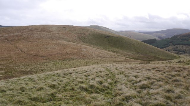
Black Creich Hill is a prominent hill situated in Perthshire, Scotland. With an elevation of approximately 499 meters (1637 feet), it is considered a significant landmark in the region. Located near the village of Bridge of Earn, it forms part of the Ochil Hills range.

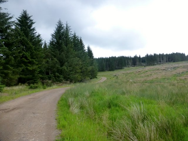
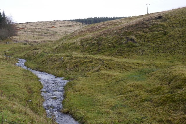
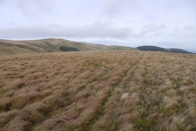
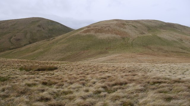
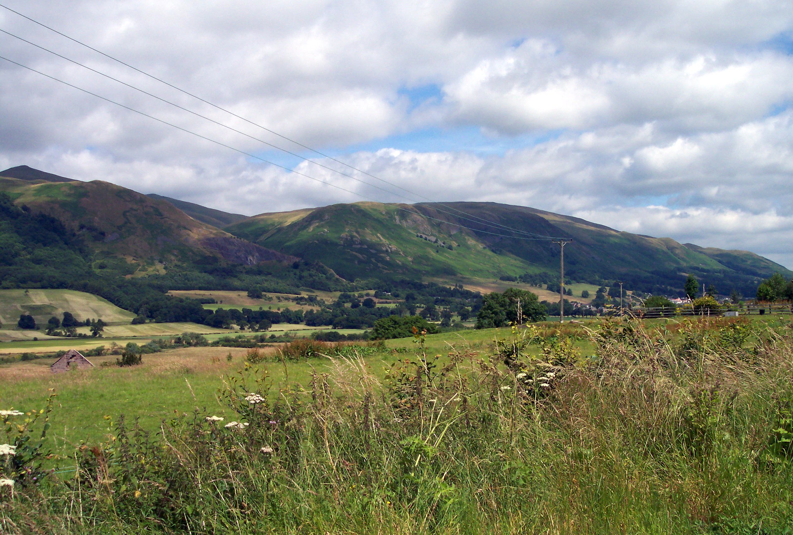
The hill is characterized by its distinctive black appearance, which is attributed to the presence of dense heather and peat covering its slopes. It offers a diverse range of habitats, including grassland, heathland, and woodland, making it a haven for a variety of flora and fauna. The hill is renowned for its outstanding natural beauty, attracting hikers, nature enthusiasts, and photographers from far and wide.

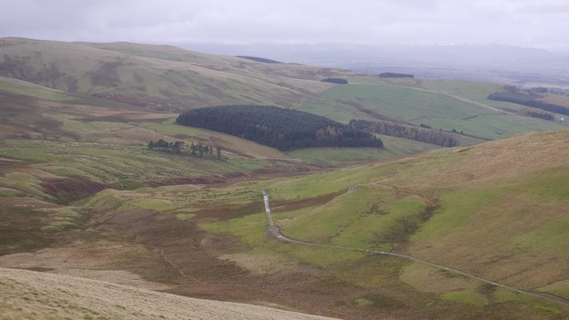
The ascent to Black Creich Hill is relatively moderate, with well-maintained footpaths and trails leading to the summit. From the top, visitors are rewarded with breathtaking panoramic views of the surrounding landscape, including the picturesque countryside, rolling hills, and nearby Loch Leven. On clear days, it is even possible to catch a glimpse of the stunning peaks of the Grampian Mountains in the distance.

Black Creich Hill offers a tranquil and peaceful escape from the hustle and bustle of everyday life. Its serene atmosphere, coupled with its stunning vistas, make it a popular destination for those seeking solace in nature. Whether it's a leisurely stroll or a challenging hike, the hill provides an opportunity for outdoor recreation and exploration.

If you have any feedback on the listing, please let us know in the comments section below.

Black Creich Hill Images

Images are sourced within 2km of 56.240732/-3.618754 or Grid Reference NN9906. Thanks to Geograph Open Source API. All images are credited.

Earnieside One of the many recently planted conifer plantations in the Ochil Hill.
Earnieside
One of the many recently planted conifer plantations in the Ochil Hill.
Ben Thrush I used the Green Knowe wind farm access road to bag Ben Thrust, Rowantree Craig and Steele's Knowe.
Name: Ben Thrush
Hill number: 12814
Height: 456m / 1496ft
Parent (Ma/M): 1662  Steele's Knowe
Section: 26A: Central Scotland from Dumbarton to Montrose
Area: Ochil Hills
County/UA: Perth and Kinross (UA)
Class: Tump (400-499m)
Grid ref: NN 98675 05816
Summit feature: cairn
Drop: 47m
Col: 409m  NN987064
Ben Thrush
I used the Green Knowe wind farm access road to bag Ben Thrust, Rowantree Craig and Steele's Knowe. Name: Ben Thrush Hill number: 12814 Height: 456m / 1496ft Parent (Ma/M): 1662 Steele's Knowe Section: 26A: Central Scotland from Dumbarton to Montrose Area: Ochil Hills County/UA: Perth and Kinross (UA) Class: Tump (400-499m) Grid ref: NN 98675 05816 Summit feature: cairn Drop: 47m Col: 409m NN987064
Rowantree Craig I used the Green Knowe wind farm access road to bag Ben Thrust, Rowantree Craig and Steele's Knowe.
Name: Rowantree Craig
Hill number: 12811
Height: 474m / 1555ft
Parent (Ma/M): 1662  Steele's Knowe
Section: 26A: Central Scotland from Dumbarton to Montrose
Area: Ochil Hills
County/UA: Perth and Kinross (UA)
Class: Unclassified
Grid ref: NN 98601 06986
Summit feature: no feature: ground by fence junction
Drop: 26m
Col: 448m  NN974075
Rowantree Craig
I used the Green Knowe wind farm access road to bag Ben Thrust, Rowantree Craig and Steele's Knowe. Name: Rowantree Craig Hill number: 12811 Height: 474m / 1555ft Parent (Ma/M): 1662 Steele's Knowe Section: 26A: Central Scotland from Dumbarton to Montrose Area: Ochil Hills County/UA: Perth and Kinross (UA) Class: Unclassified Grid ref: NN 98601 06986 Summit feature: no feature: ground by fence junction Drop: 26m Col: 448m NN974075
En Route To Innerdouny Hill I used this forestry track from Littlerig to find a trouble free route to Innerdouny Hill.
En Route To Innerdouny Hill
I used this forestry track from Littlerig to find a trouble free route to Innerdouny Hill.
Blair's Den Ochil reentrant revealed by clear felling.
Blair's Den
Ochil reentrant revealed by clear felling.
Logging road Entrance to the forest road network off the B934 Dunning Road.
Logging road
Entrance to the forest road network off the B934 Dunning Road.
South Queich Burn beside the B934.
South Queich
Burn beside the B934.
Littlerig Looking down to the B934 from the slopes of Lamb Hill.
Littlerig
Looking down to the B934 from the slopes of Lamb Hill.
Little Rig Recently felled conifers.
Little Rig
Recently felled conifers.
Fanny Hill Buried in conifers.
Fanny Hill
Buried in conifers.
Clear fell, Little Rig
Sim's Hill Looking up the Lamb Burn.
Sim's Hill
Looking up the Lamb Burn.
Lamb Hill summit
Lamb Hill summit
Sim's Hill and John's Hill Grassy hills in the Ochils.
Sim's Hill and John's Hill
Grassy hills in the Ochils.
Lamb Hill View from the slopes of John's Hill.
Lamb Hill
View from the slopes of John's Hill.
John's Hill A shoulder east of the summit.
John's Hill
A shoulder east of the summit.
North side of John's Hill View down the Coul Burn.
North side of John's Hill
View down the Coul Burn.
Track out of the Corb Glen View from John's Hill.
Track out of the Corb Glen
View from John's Hill.
Show me another place!

Black Creich Hill is located at Grid Ref: NN9906 (Lat: 56.240732, Lng: -3.618754)

Unitary Authority: Perth and Kinross

Police Authority: Tayside

What 3 Words

///touched.ship.starlight. Near Auchterarder, Perth & Kinross

Related Wikis

A823 road

The A823 is a road in Scotland which goes from south of Crieff to Dunfermline. It joins onto the A823(M) and the A822 which runs to Crieff.

Glendevon Castle

Glendevon Castle is a collection of conjoined structures dating from the 15th century. The property is now (2022) semi-derelict. It lies on a private road...

Strathdevon

Strathdevon is the strath of the River Devon in Clackmannanshire, Scotland. Strathdevon is associated with the parish of Muckhart and was up until 1971...

Ochil Hills

The Ochil Hills ( ; Scottish Gaelic: Monadh Ochail is a range of hills in Scotland north of the Forth valley bordered by the cities of Stirling, Perth...

Innerdouny Hill

Innerdouny Hill (497 m) is a hill in the Ochil Hills of Perth and Kinross, Scotland. It is located northwest of the town of Kinross. The second highest...

Roman Catholic Archdiocese of St Andrews and Edinburgh

The Archdiocese of Saint Andrews & Edinburgh (Latin: Archidioecesis Sancti Andreae et Edimburgensis) is an archdiocese of the Latin Church of the Catholic...

Muckhart

Muckhart (Scottish Gaelic: Muc-Ă€ird) commonly refers to two small villages in Clackmannanshire, Scotland, Pool of Muckhart (Scottish Gaelic: Poll Mhuc...

Ochil and South Perthshire (UK Parliament constituency)

Ochil and South Perthshire is a county constituency of the House of Commons of the Parliament of the United Kingdom. It elects one Member of Parliament...

Nearby Amenities

Located within 500m of 56.240732,-3.618754
Black Creich Hill
Natural: peak
Lat/Long: 56.241056/-3.6177614
The data included in this document is from www.openstreetmap.org. The data is made available under ODbL.

Have you been to Black Creich Hill?

Leave your review of Black Creich Hill below (or comments, questions and feedback).