Torr Dearg

Hill, Mountain in Inverness-shire

Scotland

Torr Dearg

Trees surrounding monument The trees and memorial stone stand on a knoll above a forest road to the west of the River Nethy and south of the unoccupied property at Rynettin. The stone is a memorial for Private J. H. Maxwell, killed near to Ypres in May 1915, and is not visible from the road.
Trees surrounding monument Credit: Trevor Littlewood

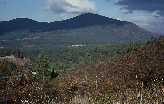
Torr Dearg is a prominent hill located in Inverness-shire, Scotland. Standing at an elevation of 1,656 feet (505 meters), it is a popular destination for hikers and outdoor enthusiasts seeking panoramic views of the surrounding landscape. The hill is characterized by its distinctive rocky outcrop at the summit, which provides a challenging yet rewarding climb for those willing to make the ascent.

Torr Dearg is situated within the Glen Affric National Nature Reserve, known for its rugged beauty and diverse wildlife. The hill is surrounded by ancient Caledonian pine forests, pristine lochs, and rolling moorlands, creating a picturesque backdrop for visitors to enjoy.

The ascent of Torr Dearg offers stunning views of the surrounding countryside, including the nearby peaks of Glen Shiel and the Great Glen. On a clear day, it is possible to see as far as the Isle of Skye and the Cuillin Mountains in the distance.

Overall, Torr Dearg is a must-visit destination for nature lovers and outdoor enthusiasts looking to experience the natural beauty of the Scottish Highlands.

If you have any feedback on the listing, please let us know in the comments section below.

Torr Dearg Images

Images are sourced within 2km of 57.205993/-3.6609296 or Grid Reference NH9914. Thanks to Geograph Open Source API. All images are credited.

Trees surrounding monument The trees and memorial stone stand on a knoll above a forest road to the west of the River Nethy and south of the unoccupied property at Rynettin. The stone is a memorial for Private J. H. Maxwell, killed near to Ypres in May 1915, and is not visible from the road.
Trees surrounding monument
The trees and memorial stone stand on a knoll above a forest road to the west of the River Nethy and south of the unoccupied property at Rynettin. The stone is a memorial for Private J. H. Maxwell, killed near to Ypres in May 1915, and is not visible from the road.
Boggy moorland with scattered conifers This is the southern end of the Abernethy Forest or other woodland adjacent to it.
Not far beyond the moorland is the River Nethy.
The distant, central hill is Carn Bheadhair.
Boggy moorland with scattered conifers
This is the southern end of the Abernethy Forest or other woodland adjacent to it. Not far beyond the moorland is the River Nethy. The distant, central hill is Carn Bheadhair.
Heather moorland on north-western slope of Cairn Rynettin Cairn Rynettin is a hill of modest height at the southern side of the Abernethy Forest. The summit is a short distance away, behind the camera position.
Heather moorland on north-western slope of Cairn Rynettin
Cairn Rynettin is a hill of modest height at the southern side of the Abernethy Forest. The summit is a short distance away, behind the camera position.
Heather moorland on south-western slope of Cairn Rynettin Cairn Rynettin is a hill of modest height at the southern side of the Abernethy Forest. The summit is a short distance away, more or less behind the camera position.
The distant ridge is on the north side of Glen More.
Heather moorland on south-western slope of Cairn Rynettin
Cairn Rynettin is a hill of modest height at the southern side of the Abernethy Forest. The summit is a short distance away, more or less behind the camera position. The distant ridge is on the north side of Glen More.
Track to Glenmore Looking toward Meall a' Bhuachaille from the Nethybridge to Ryvoan right of way.
Track to Glenmore
Looking toward Meall a' Bhuachaille from the Nethybridge to Ryvoan right of way.
Bynack More from Rynettin At 1090m, Bynack More is the most northerly of the 1000+ m peaks in the Cairngorms. Here the higher tops are clothed in a mixture of old snow patches and a more recent sprinkling.
Bynack More from Rynettin
At 1090m, Bynack More is the most northerly of the 1000+ m peaks in the Cairngorms. Here the higher tops are clothed in a mixture of old snow patches and a more recent sprinkling.
Walkers passing Rynettin On the track to Glenmore with a fine view of the northern corries opening up ahead.
Walkers passing Rynettin
On the track to Glenmore with a fine view of the northern corries opening up ahead.
Cairngorm northern corries from Rynettin Cairn Gorm is the highest snowy top on the left with Coire an t-Sneachda partly in view and Coire an Lochain showing up very clearly.
Cairngorm northern corries from Rynettin
Cairn Gorm is the highest snowy top on the left with Coire an t-Sneachda partly in view and Coire an Lochain showing up very clearly.
Track in Abernethy Forest Walkers on the track between Rynettin and Glenmore via Ryvoan.
Track in Abernethy Forest
Walkers on the track between Rynettin and Glenmore via Ryvoan.
Walkers in Abernethy Forest On the walk from Forest Lodge southwards to Glenmore via Ryvoan Bothy.
Walkers in Abernethy Forest
On the walk from Forest Lodge southwards to Glenmore via Ryvoan Bothy.
Track to Ryvoan The northern ridge of Cairn Gorm is ahead with the heathery slope of Creag nan Gall to the right.
Track to Ryvoan
The northern ridge of Cairn Gorm is ahead with the heathery slope of Creag nan Gall to the right.
Reindeer and calf
Reindeer and calf
Female Reindeer
Female Reindeer
Entering Abernethy Forest
Small Bridge Over the Allt Coire Eagan in Abernethy Forest.
Small Bridge
Over the Allt Coire Eagan in Abernethy Forest.
Track through Abernethy Forest
The track divides Left goes only to a couple of deadends and straight on goes to Glenmore.
The track divides
Left goes only to a couple of deadends and straight on goes to Glenmore.
Winding track in Abernethy Forest
Show me another place!

Torr Dearg is located at Grid Ref: NH9914 (Lat: 57.205993, Lng: -3.6609296)

Unitary Authority: Highland

Police Authority: Highlands and Islands

What 3 Words

///toads.brisk.keyboards. Near Aviemore, Highland

Nearby Locations

Torr Dearg

Related Wikis

Meall a' Bhuachaille

Meall a' Bhuachaille is a mountain in the Cairngorms in Scotland. It is situated 10 km east of Aviemore, to the north of Loch Morlich and Glenmore Forest...

Aundorach

Aundorach (Scottish Gaelic:) is a settlement one mile south of Loch Garten in Badenoch and Strathspey, Highland, Scotland. == References ==
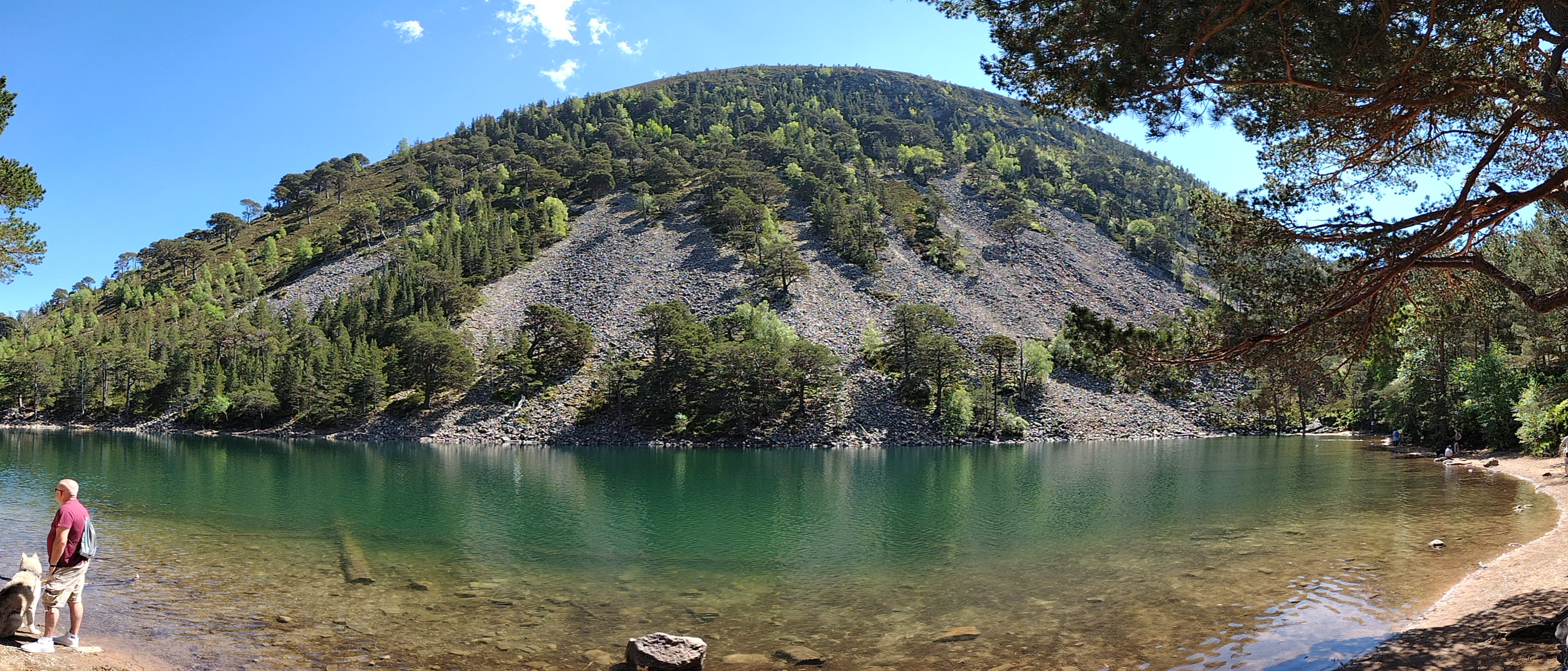
An Lochan Uaine

An Lochan Uaine is a small freshwater loch in the Highland council area of Scotland. == Etymology == Lochan Uaine can be translated from Scottish Gaelic...
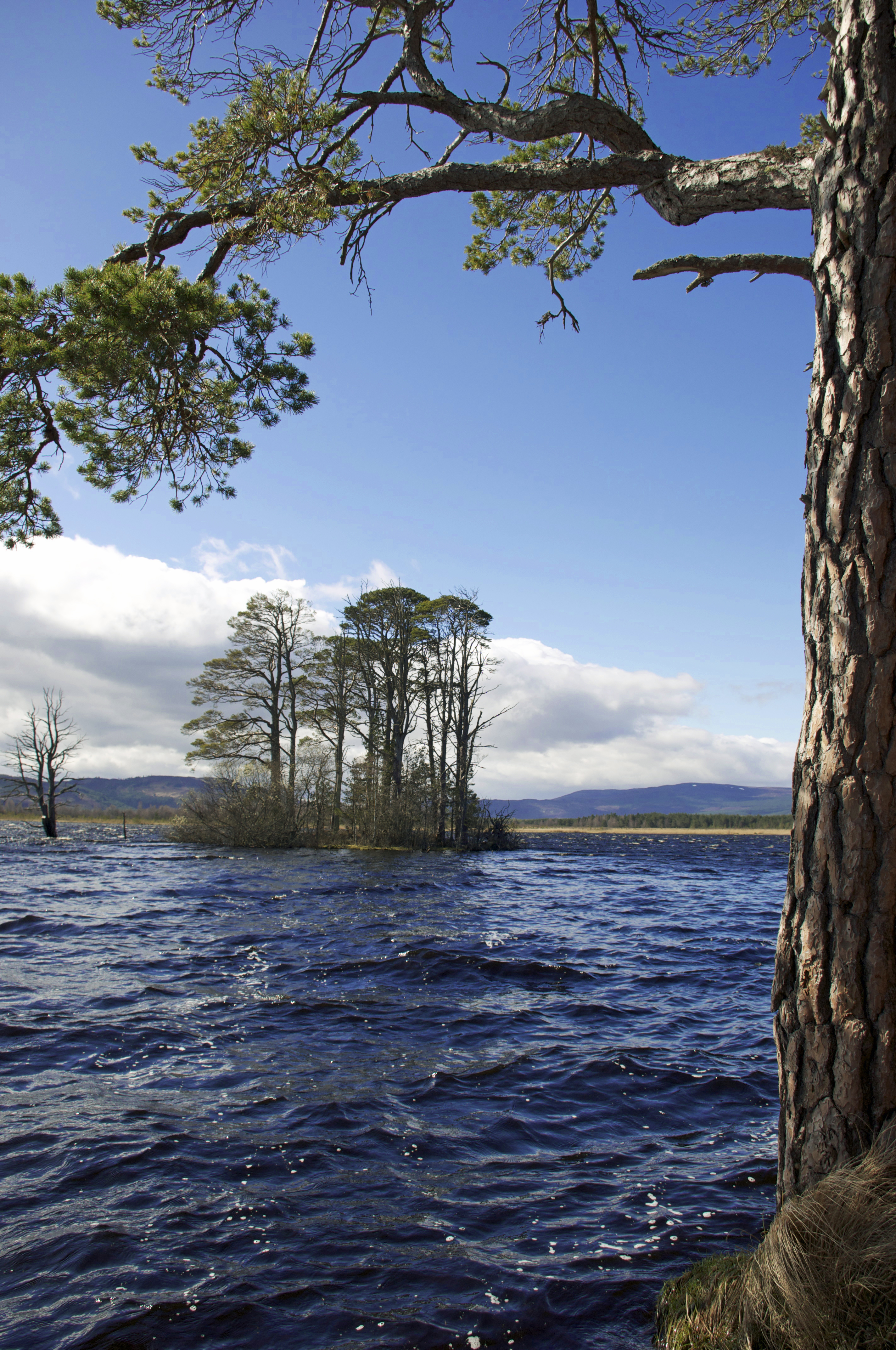
Loch Garten

Loch Garten (Scottish Gaelic: Loch a' Ghartain) is a large Highland freshwater loch near Boat of Garten, in the Strathspey area of the Cairngorms National...

Have you been to Torr Dearg?

Leave your review of Torr Dearg below (or comments, questions and feedback).