Cairn Geldie

Hill, Mountain in Aberdeenshire

Scotland

Cairn Geldie

Geldie Burn The burn looks like a veritable river here, wide, but shallow. This is the view towards the Geldie-Feshie watershed.
Geldie Burn Credit: Aleks Scholz

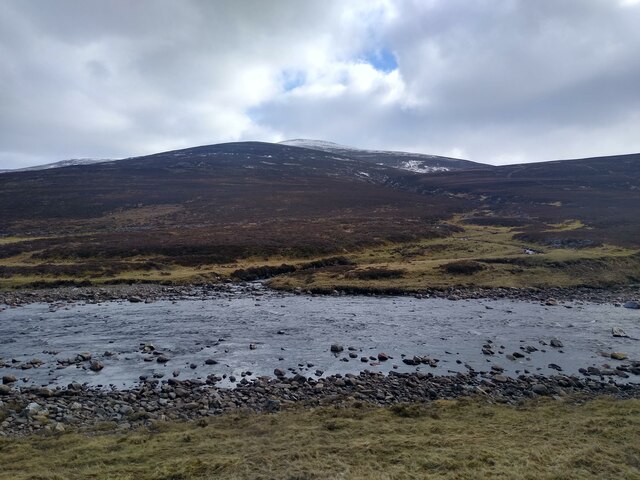
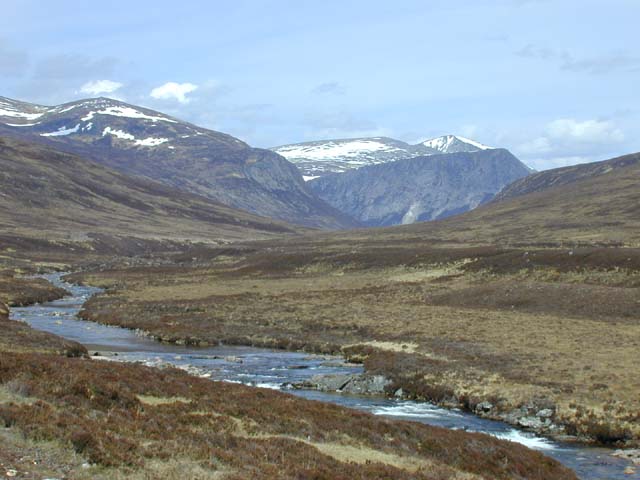
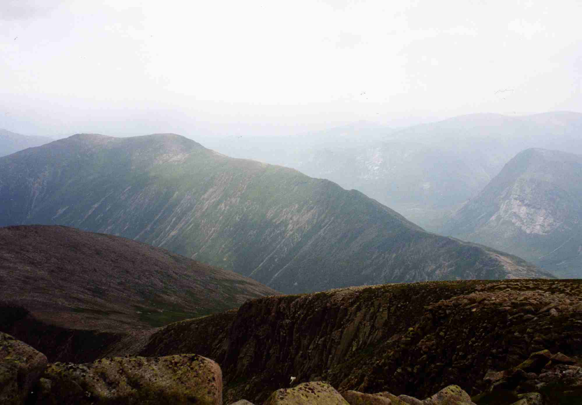
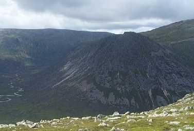
Cairn Geldie is a prominent hill located in Aberdeenshire, Scotland. It is part of the Cairngorms National Park and stands at an impressive height of 1,155 meters (3,789 feet) above sea level. This makes it one of the higher peaks in the region, offering breathtaking views of the surrounding landscape.

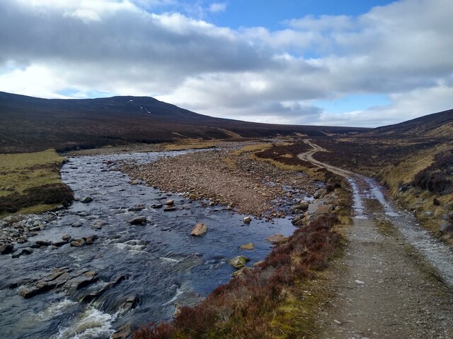
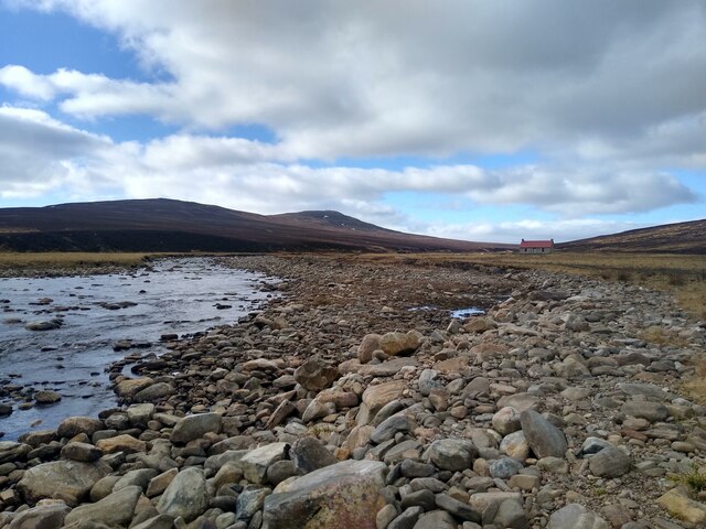
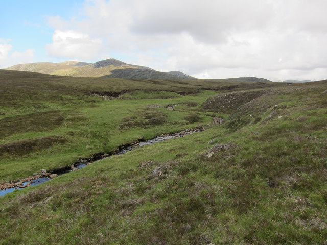
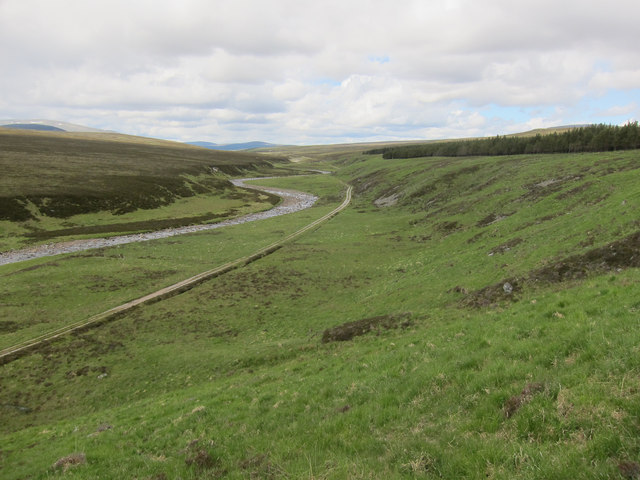
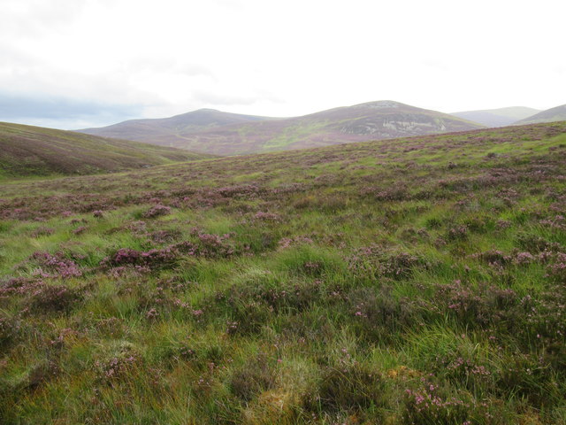
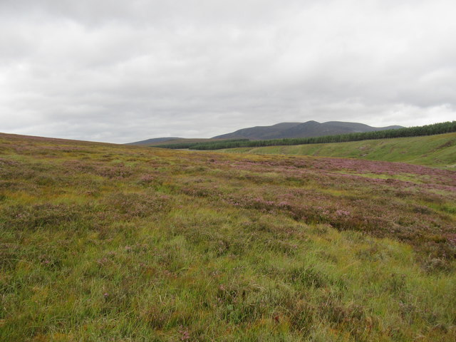
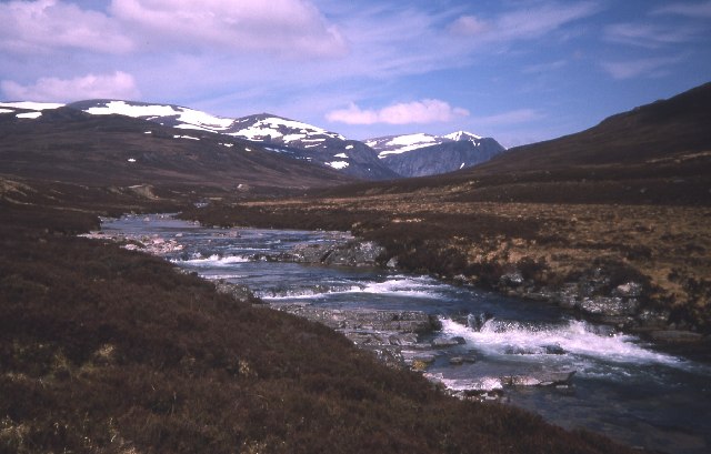
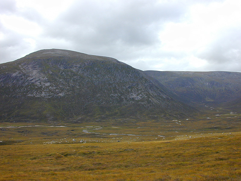
Situated in the eastern part of the Cairngorms, Cairn Geldie is a popular destination for hikers and mountaineers seeking to challenge themselves on its steep slopes. The ascent can be demanding, but the reward is well worth it. On a clear day, visitors are treated to stunning panoramas of the surrounding mountains, glens, and lochs.

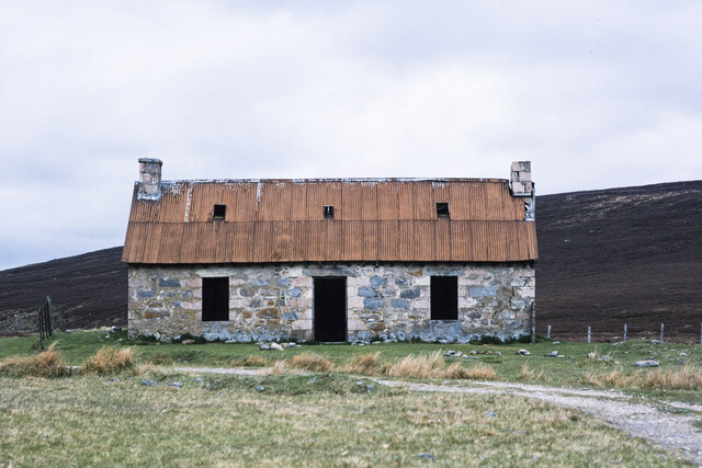
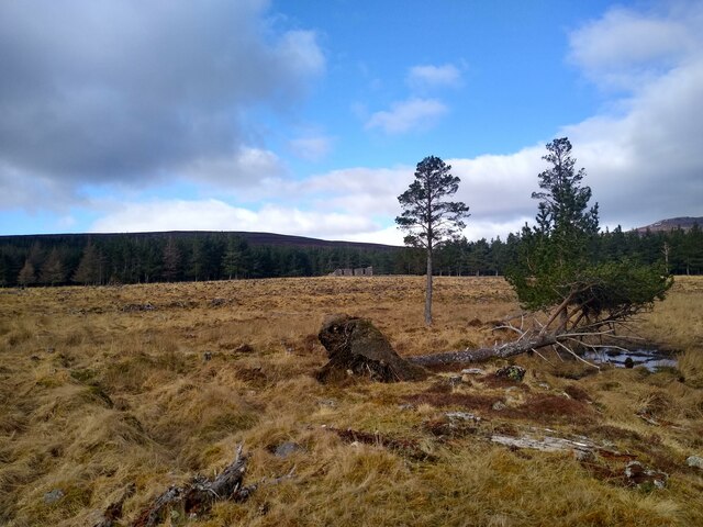
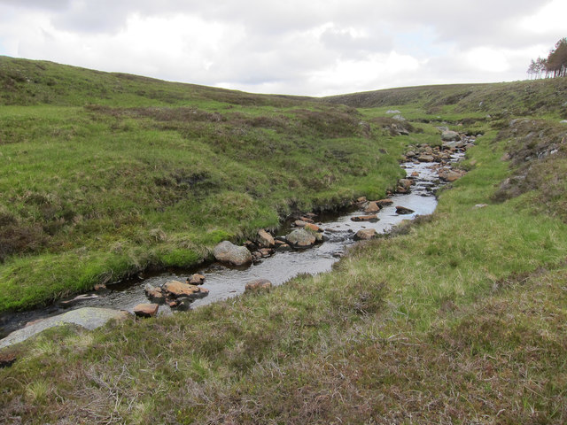
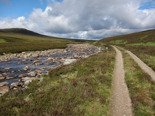
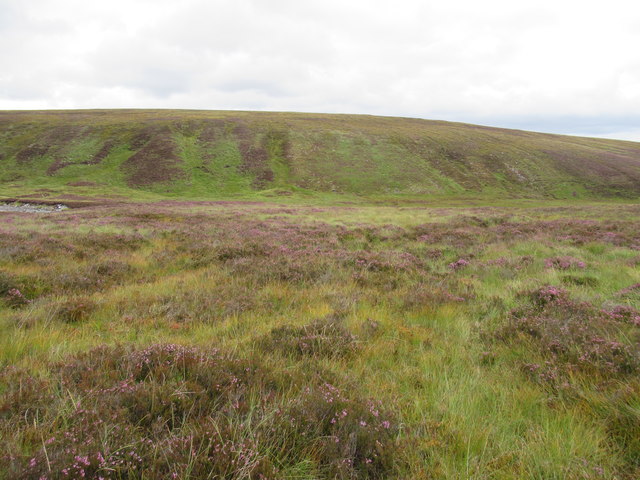
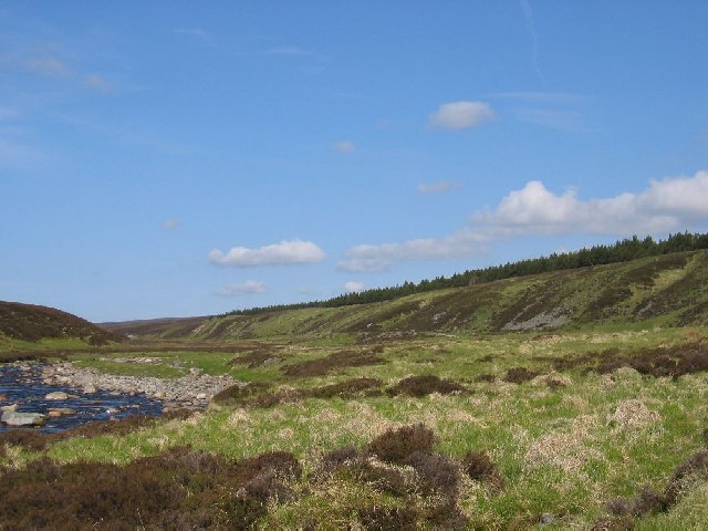
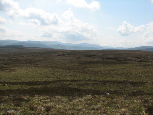
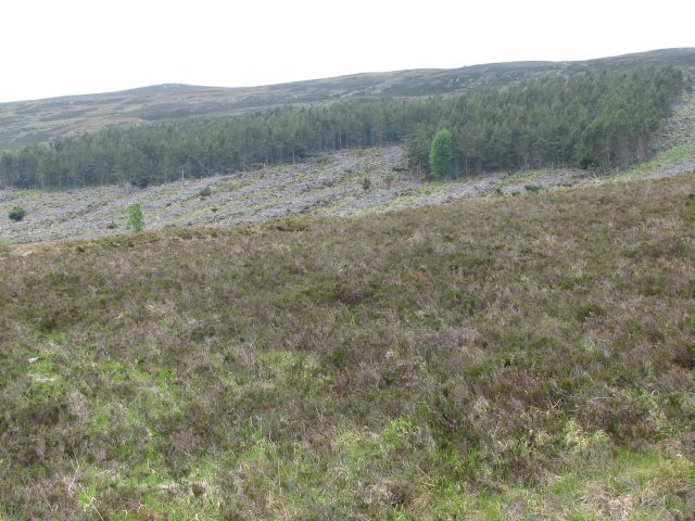
The hill is known for its rugged and wild terrain, characterized by rocky outcrops, scree slopes, and grassy plateaus. It is also home to a variety of plant and animal species, including heather, moss, ptarmigan, and mountain hare. The area is protected as a nature reserve, ensuring the preservation of its unique ecosystem.

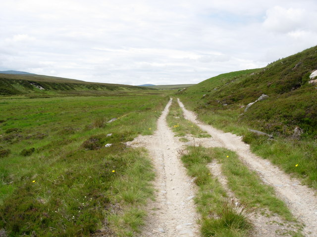
Cairn Geldie offers various routes for different levels of experience and fitness. The most popular trail starts from the Linn of Dee car park and follows the Geldie Burn. As hikers ascend, they pass through a mixture of woodland and open moorland before reaching the summit. The descent can be made by retracing the same route or by exploring alternative paths.

Whether you are an experienced mountaineer or simply enjoy a good hike, Cairn Geldie is a must-visit destination in Aberdeenshire. Its natural beauty and challenging terrain make it an ideal spot for outdoor enthusiasts seeking adventure and breathtaking views.

If you have any feedback on the listing, please let us know in the comments section below.

Cairn Geldie Images

Images are sourced within 2km of 56.976798/-3.6539023 or Grid Reference NN9988. Thanks to Geograph Open Source API. All images are credited.

Geldie Burn The burn looks like a veritable river here, wide, but shallow. This is the view towards the Geldie-Feshie watershed.
Geldie Burn
The burn looks like a veritable river here, wide, but shallow. This is the view towards the Geldie-Feshie watershed.
Geldie Bothy in 1994 The building as it was in 1994 with no windows and no door. The building has had work done in the past to make it secure and perhaps bring it into use - <a title="https://www.geograph.org.uk/photo/918116" href="https://www.geograph.org.uk/photo/918116">Link</a> - but more recent reports show that later, a sign was erected warning that it was unsafe.
Geldie Bothy in 1994
The building as it was in 1994 with no windows and no door. The building has had work done in the past to make it secure and perhaps bring it into use - Link - but more recent reports show that later, a sign was erected warning that it was unsafe.
Ruigh nan Clach Update: Still in ruins. The clear area between the house and the path seems to have been wasteland for a while now.
Ruigh nan Clach
Update: Still in ruins. The clear area between the house and the path seems to have been wasteland for a while now.
Approach to the Red House The former derelict Geldie Bothy, now called the Red House, has been beautifully restored, and reopened in 2022. This was my first visit to the new bothy - it features two rooms, and an elevated toilet with superb views in an extra outhouse. Plus, the strategic location at the confluence of three important hill paths.
Approach to the Red House
The former derelict Geldie Bothy, now called the Red House, has been beautifully restored, and reopened in 2022. This was my first visit to the new bothy - it features two rooms, and an elevated toilet with superb views in an extra outhouse. Plus, the strategic location at the confluence of three important hill paths.
View across the Geldie On the opposite bank, the Allt an t-Sionnaich runs down the hillside and merges with the Geldie. Several ruined buildings are on that side, too. The hill on the other side is Carn Liath.
View across the Geldie
On the opposite bank, the Allt an t-Sionnaich runs down the hillside and merges with the Geldie. Several ruined buildings are on that side, too. The hill on the other side is Carn Liath.
Allt Dhaidh Beag Tributary of the Geldie Burn.
Allt Dhaidh Beag
Tributary of the Geldie Burn.
Allt Dhaidh Beag Looking towards Beinn Bhrotain.
Allt Dhaidh Beag
Looking towards Beinn Bhrotain.
Geldie Burn and track Looking upstream.
Geldie Burn and track
Looking upstream.
Track by Geldie Burn
View north-east across Geldie Burn (hidden) near Braemar
View east from foot of Cnapan Garbh near Braemar
View north-west from foot of Cnapan Garbh near Braemar
Geldie Burn Heading west
Geldie Burn
Heading west
River Dee Taken S.E. of Sgor Mor (813m) between White Bridge and Corrour Bothy with views to Beinn Bhrotan (1157m), Devils Point (1004m) and the top of Cairn Toul (1213m).
River Dee
Taken S.E. of Sgor Mor (813m) between White Bridge and Corrour Bothy with views to Beinn Bhrotan (1157m), Devils Point (1004m) and the top of Cairn Toul (1213m).
Geldie Track The track along the Geldie valley towards Geldie Lodge and Glen Feshie. The river Geldie at this point runs in a shallow, flat bottomed valley, with moorland on each side sloping upwards towards the high mountains.
Geldie Track
The track along the Geldie valley towards Geldie Lodge and Glen Feshie. The river Geldie at this point runs in a shallow, flat bottomed valley, with moorland on each side sloping upwards towards the high mountains.
Approaching the hills along the Dee Going up the Dee, as the hills approach it swings to a more northerly direction. The Devil's Point is on the right, with Cairn Toul behind and the end of the Beinn Bhrotain massif on the left.
Approaching the hills along the Dee
Going up the Dee, as the hills approach it swings to a more northerly direction. The Devil's Point is on the right, with Cairn Toul behind and the end of the Beinn Bhrotain massif on the left.
Moorland A large plateau of grass, peat and heather lies between Carn Fiaclach and Cairn Geldie.
A hillwalker's path leading from the River Dee to the southern slopes of Carn Cloich-mhuilinn crosses the north edge of the square.
Moorland
A large plateau of grass, peat and heather lies between Carn Fiaclach and Cairn Geldie. A hillwalker's path leading from the River Dee to the southern slopes of Carn Cloich-mhuilinn crosses the north edge of the square.
Plantation Small, partially felled plantation of trees on the northern slopes of Cairn Geldie.
Plantation
Small, partially felled plantation of trees on the northern slopes of Cairn Geldie.
Show me another place!

Cairn Geldie is located at Grid Ref: NN9988 (Lat: 56.976798, Lng: -3.6539023)

Unitary Authority: Aberdeenshire

Police Authority: North East

What 3 Words

///starfish.yacht.farms. Near Inverey, Aberdeenshire

Nearby Locations

Cairn Geldie

Related Wikis

Chest of Dee

Chest of Dee is a waterfall of Scotland. == See also == Waterfalls of Scotland == References ==

Places, place names, and structures on Mar Lodge Estate

Mar Lodge Estate is the largest remnant of the ancient Earldom of Mar in Aberdeenshire, Scotland and is now owned by the National Trust for Scotland....

Beinn Bhrotain

Beinn Bhrotain (Scottish Gaelic: Hill of the mastiff) or Ben Vrottan is a Scottish mountain in the Cairngorms range, 18 kilometres west of Braemar in the...

Loch Tilt

Loch Tilt is a small mountain freshwater loch that sits at the end of Glen Tilt and is located in north-east Perth and Kinross, Scotland. Loch Tilt has...

Falls of Dee

Falls of Dee is a waterfall on Braeriach in the Cairngorms, Scotland. == See also == Waterfalls of Scotland == References ==

Càrn a' Mhàim

Càrn a' Mhàim is a Scottish mountain situated in the inner part of the Cairngorms range, some 15 kilometres west of Braemar in the county of Aberdeenshire...

The Devil's Point

The Devil's Point (Scottish Gaelic: Bod an Deamhain) is a mountain in the Cairngorms of Scotland, lying to the west of the Lairig Ghru pass. The Gaelic...

Glen Lui

Glen Lui from Gleann Laoigh – calves' glen – Gordon (1925) is one of the major glens on the Mar Lodge Estate, in Aberdeenshire, Scotland. Its main watercourse...

Have you been to Cairn Geldie?

Leave your review of Cairn Geldie below (or comments, questions and feedback).