Startup Hill

Hill, Mountain in Lanarkshire

Scotland

Startup Hill

Woodland beside the A73
Woodland beside the A73 Credit: JThomas

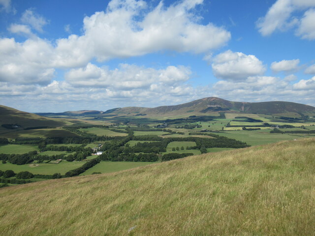
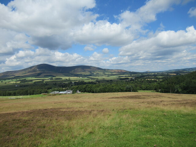
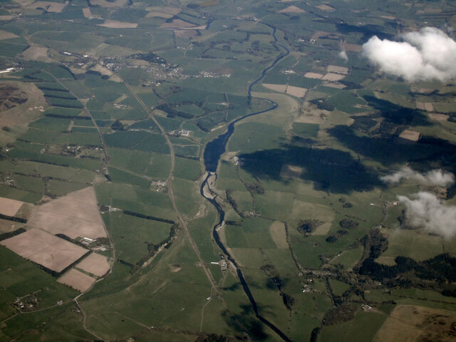
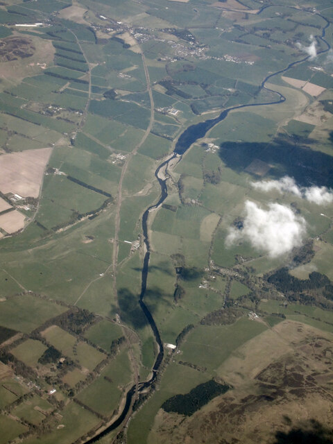
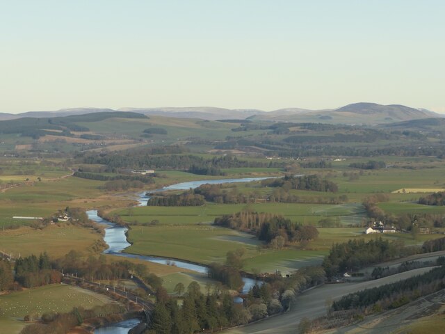
Startup Hill is a prominent landmark located in Lanarkshire, Scotland. Rising to an elevation of approximately 620 meters (2,034 feet), it stands as one of the highest peaks in the region. Situated within the picturesque Southern Uplands, Startup Hill offers breathtaking panoramic views of the surrounding countryside.

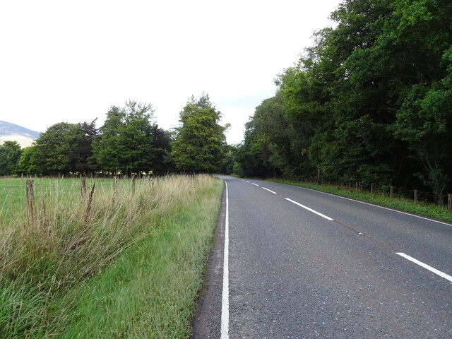
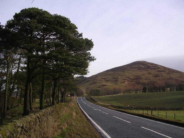
This hill is a popular destination for outdoor enthusiasts, hikers, and nature lovers. Its accessible location and well-maintained trails make it an ideal spot for both experienced climbers and casual walkers. The ascent to the summit is relatively moderate, allowing visitors of various fitness levels to enjoy the journey.

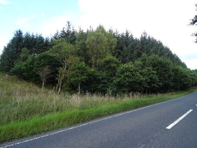
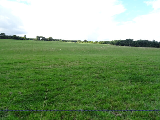
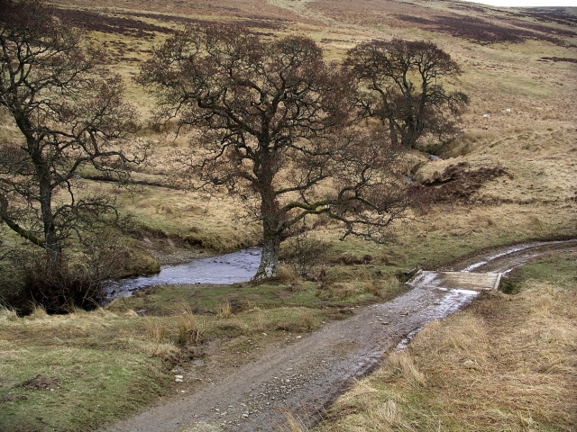
The hill is covered in lush vegetation, with sprawling meadows and dense forests adorning its slopes. It is home to a diverse range of flora and fauna, providing a haven for wildlife such as deer, foxes, and various bird species. In spring, the landscape is adorned with vibrant wildflowers, while autumn brings a stunning display of colors as the leaves change.

At the peak of Startup Hill, visitors are rewarded with breathtaking views of the Lanarkshire countryside. On a clear day, it is possible to see far into the distance, with the rolling hills and valleys stretching out in all directions. The summit also offers an ideal vantage point to enjoy the sunrise or sunset, creating a truly magical experience.

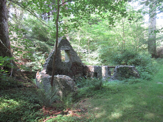
Startup Hill is not only a natural gem but also holds historical significance. It is believed to have been inhabited since ancient times, with remnants of stone circles and burial mounds scattered across its slopes. These archaeological sites provide a glimpse into the rich history and heritage of the area.

Overall, Startup Hill in Lanarkshire offers a perfect blend of natural beauty, outdoor recreation, and historical intrigue, making it a must-visit destination for those exploring the Scottish countryside.

If you have any feedback on the listing, please let us know in the comments section below.
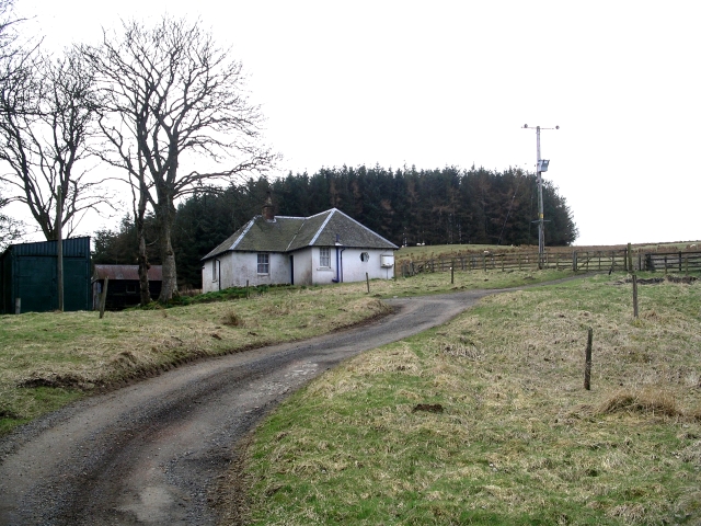
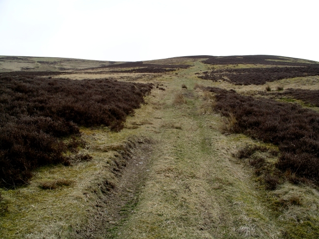
Startup Hill Images

Images are sourced within 2km of 55.548931/-3.6229118 or Grid Reference NS9729. Thanks to Geograph Open Source API. All images are credited.

Woodland beside the A73
Bend in the A73 towards Lanark
Hillside grazing off the A73
A73 beside woodland Towards Lanark.
A73 beside woodland
Towards Lanark.
Old toll house Since 2016 this cottage, once a tollhouse, has had new windows fitted and 'flood defences' added at the roadside. There was once a ford across the R Clyde on the other side of the road.  The right hand third was the toll office with a door, now a window in the porch.  The toll keeper lived in the left hand two thirds with an internal door between the two parts.   The toll gate was at the left hand gable.  The tollhouse has been named Hartside and Lamington with the Milestone Society ID now changed to SL.HARTSIDE.
Old toll house
Since 2016 this cottage, once a tollhouse, has had new windows fitted and 'flood defences' added at the roadside. There was once a ford across the R Clyde on the other side of the road. The right hand third was the toll office with a door, now a window in the porch. The toll keeper lived in the left hand two thirds with an internal door between the two parts. The toll gate was at the left hand gable. The tollhouse has been named Hartside and Lamington with the Milestone Society ID now changed to SL.HARTSIDE.
Ruined building on the Lamington Burn This might be a ruined corn mill, although old Ordnance Survey maps also show a bathing house in the vicinity (these grounds are part of the estate of Lamington House, demolished in the 1950s).
Ruined building on the Lamington Burn
This might be a ruined corn mill, although old Ordnance Survey maps also show a bathing house in the vicinity (these grounds are part of the estate of Lamington House, demolished in the 1950s).
Hardington House estate viewed from Startup Hill The white house visible in the valley below is Hardington House, built in 1720 with later Victorian extensions, which was once the home of Lord Braxfield (1722-1799), a local man who became Lord Justice Clerk (the second-most senior judge in Scotland), with a fearsome reputation (although this is disputed by some). 

The house is a Grade B listed building: <span class="nowrap"><a title="https://britishlistedbuildings.co.uk/200347487-hardington-house-wiston-and-roberton#.Yuad-y1Q13Q" rel="nofollow ugc noopener" href="https://britishlistedbuildings.co.uk/200347487-hardington-house-wiston-and-roberton#.Yuad-y1Q13Q">Link</a><img style="margin-left:2px;" alt="External link" title="External link - shift click to open in new window" src="https://s1.geograph.org.uk/img/external.png" width="10" height="10"/></span>
Hardington House estate viewed from Startup Hill
The white house visible in the valley below is Hardington House, built in 1720 with later Victorian extensions, which was once the home of Lord Braxfield (1722-1799), a local man who became Lord Justice Clerk (the second-most senior judge in Scotland), with a fearsome reputation (although this is disputed by some). The house is a Grade B listed building: LinkExternal link
A train approaching Lamington Viaduct on the West Coast Main Line A view from the slopes of Startup Hill, with Tinto in the distance, and the railway line crossing the Clyde via the Lamington Viaduct.
A train approaching Lamington Viaduct on the West Coast Main Line
A view from the slopes of Startup Hill, with Tinto in the distance, and the railway line crossing the Clyde via the Lamington Viaduct.
Rough grazing at Hillhouse, Lamington Looking towards the farm buildings at Hillhouse, with Tinto rising in the background, and the tiny steep hill of Quothquan Law also visible in the distance.
Rough grazing at Hillhouse, Lamington
Looking towards the farm buildings at Hillhouse, with Tinto rising in the background, and the tiny steep hill of Quothquan Law also visible in the distance.
Clydesdale from the air Looking downstream from Lamington.
Clydesdale from the air
Looking downstream from Lamington.
Clydesdale from the air Looking downstream from Lamington.
Clydesdale from the air
Looking downstream from Lamington.
Lamington to Cowgill track An old road through Key Cleuch and a very fine through route with a spectacular meltwater channel. This is the western side.
Lamington to Cowgill track
An old road through Key Cleuch and a very fine through route with a spectacular meltwater channel. This is the western side.
Lamington Bridge, West Coast Main Line The bridge required emergency repairs a few years earlier after flood damage.
Lamington Bridge, West Coast Main Line
The bridge required emergency repairs a few years earlier after flood damage.
River Clyde, Lamington The wide section is due to gravel extraction.
River Clyde, Lamington
The wide section is due to gravel extraction.
A702 near Hartside and Startup Hill Trunk road from Abington to Biggar
A702 near Hartside and Startup Hill
Trunk road from Abington to Biggar
Bridge and confluence, Lamington Burn At this point the burn is composed of the Little Smagill (coming in from the upper right of the picture) and the Houphead Burn (coming in from the right under the wooden bridge).  The track connects Bleakfield with Easkgill Rig.
Bridge and confluence, Lamington Burn
At this point the burn is composed of the Little Smagill (coming in from the upper right of the picture) and the Houphead Burn (coming in from the right under the wooden bridge). The track connects Bleakfield with Easkgill Rig.
Bleakfield The cottage of a local sheep farmer, busy with the onset of the lambing season.
Bleakfield
The cottage of a local sheep farmer, busy with the onset of the lambing season.
Track, Easkgill Rig Looking up towards Hardrig Head.  Not much greenery after the late spring, the recent snows have only just melted.  But the skylarks are singing...
Track, Easkgill Rig
Looking up towards Hardrig Head. Not much greenery after the late spring, the recent snows have only just melted. But the skylarks are singing...
Show me another place!

Startup Hill is located at Grid Ref: NS9729 (Lat: 55.548931, Lng: -3.6229118)

Unitary Authority: South Lanarkshire

Police Authority: Lanarkshire

What 3 Words

///before.achieving.obliging. Near Biggar, South Lanarkshire

Related Wikis

Lamington railway station

Lamington railway station served the village of Lamington, South Lanarkshire, Scotland from 1848 to 1965 on the Caledonian main line. == History == The...

Lamington, South Lanarkshire

Lamington is a conservation village in South Lanarkshire in Scotland, roughly between Biggar and Lanark and sits astride the A702 trunk road. It is reputed...

Roberton, South Lanarkshire

Roberton is a village in South Lanarkshire, Scotland. == Origins == The origins of the town of Roberton are intertwined with those of the Robertons of...

A702 road

The A702 is a major road in Scotland, that runs from Edinburgh to St. John's Town of Dalry in Dumfries and Galloway. It is the last section of the route...

Wiston, South Lanarkshire

Wiston is a small village in South Lanarkshire, Scotland. It is located 13 miles (21 km) south east of Lanark and 8 miles (13 km) south west of Biggar...

Unthank, South Lanarkshire

Unthank is a small village in South Lanarkshire, Scotland. == Note == The geographic coordinates are from the Ordnance Survey. == References ==

Duneaton Water

Duneaton Water is a river in South Lanarkshire, Scotland. It joins the River Clyde at Abington. == References ==

Tinto

Tinto is an isolated hill in the Southern Uplands of Scotland. It comprises little more than one top, which stands on the west bank of the River Clyde...

Nearby Amenities

Located within 500m of 55.548931,-3.6229118
Startup Hill
Corbett: no
Ele: 439
Graham: no
Munro: no
Natural: peak
Lat/Long: 55.5489317/-3.62305
The data included in this document is from www.openstreetmap.org. The data is made available under ODbL.

Have you been to Startup Hill?

Leave your review of Startup Hill below (or comments, questions and feedback).