Hopton

Settlement in Shropshire

England

Hopton

By Valeswood Lane Small field north of Valeswood Lane.
By Valeswood Lane Credit: Richard Webb

Hopton is a small village located in the county of Shropshire, England. Situated approximately 4 miles south of the town of Craven Arms, Hopton falls within the administrative district of South Shropshire. The village is nestled in a picturesque rural setting, surrounded by rolling hills and lush green countryside.

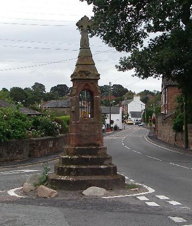
Hopton is home to a close-knit community, with a population of around 200 residents. The village is characterized by its traditional stone-built houses and quaint cottages, which add to its charm and appeal. The architecture reflects the village's long history, with some buildings dating back several centuries.

Although Hopton is a small village, it offers a range of amenities for its residents. These include a local pub, which serves as a social hub for the community, and a village hall that hosts various events and gatherings throughout the year. The village also boasts a primary school and a church, providing important facilities for the local population.

The surrounding area offers ample opportunities for outdoor activities, with numerous walking and cycling routes to explore. Hopton is also conveniently located near various attractions, such as Stokesay Castle, an impressive medieval fortified manor house, and the stunning Long Mynd, a prominent hill and popular destination for hikers and nature enthusiasts.

Overall, Hopton is a charming village that provides a peaceful and idyllic setting for its residents, while offering easy access to the natural beauty and historical sites of Shropshire.

If you have any feedback on the listing, please let us know in the comments section below.
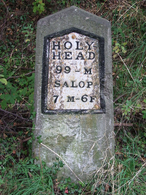
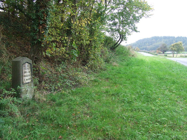
Hopton Images

Images are sourced within 2km of 52.775521/-2.908684 or Grid Reference SJ3820. Thanks to Geograph Open Source API. All images are credited.

By Valeswood Lane Small field north of Valeswood Lane.
By Valeswood Lane
Small field north of Valeswood Lane.
Old Milestone Old milestone on what would have been the A.5 near to Great Ness, Shropshire. For overall view see <a title="https://www.geograph.org.uk/photo/4776149" href="https://www.geograph.org.uk/photo/4776149">Link</a>
Old Milestone
Old milestone on what would have been the A.5 near to Great Ness, Shropshire. For overall view see Link
Holyhead 99 Old milestone on what would have been the A.5 near to Great Ness, Shropshire. For close up view see <a title="https://www.geograph.org.uk/photo/4776146" href="https://www.geograph.org.uk/photo/4776146">Link</a>
Holyhead 99
Old milestone on what would have been the A.5 near to Great Ness, Shropshire. For close up view see Link
Milestone Milestone on what would have been the A5 near to Nesscliffe, Shropshire; for overall view see <a title="https://www.geograph.org.uk/photo/4930458" href="https://www.geograph.org.uk/photo/4930458">Link</a>
Milestone
Milestone on what would have been the A5 near to Nesscliffe, Shropshire; for overall view see Link
Holyhead 98 Milestone on what would have been the A5 near to Nesscliffe, Shropshire; for close up view see <a title="https://www.geograph.org.uk/photo/4930452" href="https://www.geograph.org.uk/photo/4930452">Link</a>
Holyhead 98
Milestone on what would have been the A5 near to Nesscliffe, Shropshire; for close up view see Link
Kynaston's Cave, Nesscliffe Reputedly the hideaway of the highwayman Humphrey Kynaston.
Kynaston's Cave, Nesscliffe
Reputedly the hideaway of the highwayman Humphrey Kynaston.
Nesscliffe Footbridge Suspension footbridge with a lightweight FRP (fibre reinforced polymer) deck. Although FRP has been used for smaller elements for walkways and gratings its use in larger structures has been limited. This structure seems to be performing well after some early remedial work.
Nesscliffe Footbridge
Suspension footbridge with a lightweight FRP (fibre reinforced polymer) deck. Although FRP has been used for smaller elements for walkways and gratings its use in larger structures has been limited. This structure seems to be performing well after some early remedial work.
The Church of St Andrew at Great Ness Viewed from the south-east.
The Church of St Andrew at Great Ness
Viewed from the south-east.
Road in Great Ness with the option to visit St Andrew's Church Looking south-westward
Road in Great Ness with the option to visit St Andrew's Church
Looking south-westward
Ordnance Survey Flush Bracket 2765 This can be found on the wall of a house - a private dwelling - at The Prill. There is also a 'cancelled' Cut Mark at the same location which this bracket presumably supersedes.
For more detail see : <span class="nowrap"><a title="http://www.bench-marks.org.uk/bm2285" rel="nofollow ugc noopener" href="http://www.bench-marks.org.uk/bm2285">Link</a><img style="margin-left:2px;" alt="External link" title="External link - shift click to open in new window" src="https://s1.geograph.org.uk/img/external.png" width="10" height="10"/></span>
Ordnance Survey Flush Bracket 2765
This can be found on the wall of a house - a private dwelling - at The Prill. There is also a 'cancelled' Cut Mark at the same location which this bracket presumably supersedes. For more detail see : LinkExternal link
Road (the former A5) at The Prill Looking north-westward.
Road (the former A5) at The Prill
Looking north-westward.
Well Lane near Nesscliffe Looking south-westward.
Well Lane near Nesscliffe
Looking south-westward.
A5 overbridge crossing near Wilcott
A5 north of Kinton
A5 north of Kinton
Woodland in Spring Nesscliffe Hill Country Park.
Woodland in Spring
Nesscliffe Hill Country Park.
Nesscliffe Telephone Exchange Situated near Wilcott, this TE is of a design common in rural areas and has the code WNNCL. It provides telephone and broadband services to 407 residential and 42 non-residential premises in Nesscliffe plus Felton Butler, Great Ness, Hopton, Kinton, Pentre and Wilcott nearby. Ventilation louvres can be seen on the front of this TE whilst BT antennas can just be seen to the left of the photo. The numbering range of this TE is (01743) 741xxx, the (01743) referring to the Shrewsbury group of thirteen TEs, and its postcode is SY4 1BJ.
Nesscliffe Telephone Exchange
Situated near Wilcott, this TE is of a design common in rural areas and has the code WNNCL. It provides telephone and broadband services to 407 residential and 42 non-residential premises in Nesscliffe plus Felton Butler, Great Ness, Hopton, Kinton, Pentre and Wilcott nearby. Ventilation louvres can be seen on the front of this TE whilst BT antennas can just be seen to the left of the photo. The numbering range of this TE is (01743) 741xxx, the (01743) referring to the Shrewsbury group of thirteen TEs, and its postcode is SY4 1BJ.
Modern Milestone by St Andrew's church, Great Ness New metal plate attached to new stone post by the UC road, in parish of GREAT NESS (SHREWSBURY AND ATCHAM District), near St Andrew's church, on the verge to the old road, on West side of road. Telford-type iron plate, erected by the parish in the 21st century. 

Inscription reads:- : HOLY- / HEAD / 99 - M / SALOP / 7 M - 6F :

The original Thomas Telford milestone is on the old A5 to the South West at Grid reference: SJ 3918 1860 

Milestone Society National ID: SA_HH099aR.
Modern Milestone by St Andrew's church, Great Ness
New metal plate attached to new stone post by the UC road, in parish of GREAT NESS (SHREWSBURY AND ATCHAM District), near St Andrew's church, on the verge to the old road, on West side of road. Telford-type iron plate, erected by the parish in the 21st century. Inscription reads:- : HOLY- / HEAD / 99 - M / SALOP / 7 M - 6F : The original Thomas Telford milestone is on the old A5 to the South West at Grid reference: SJ 3918 1860 Milestone Society National ID: SA_HH099aR.
Old Milestone by the former A5, Nesscliffe Metal plate attached to stone post by the UC road (was A5), in parish of GREAT NESS (SHREWSBURY AND ATCHAM District), 30m South East of the junction between the A5 and Well Lane, Nesscliffe, by North end of bus stop layby, on verge, by large tree, on South West side of road. Telford gabled iron plate, erected by the Holyhead Road turnpike trust in the 19th century. 

Inscription reads:-
HOLY-
HEAD
98 - M
SALOP
8M-6F

Grade II Listed. List Entry Number: 1175339 
<span class="nowrap"><a title="https://historicengland.org.uk/listing/the-list/list-entry/1175339" rel="nofollow ugc noopener" href="https://historicengland.org.uk/listing/the-list/list-entry/1175339">Link</a><img style="margin-left:2px;" alt="External link" title="External link - shift click to open in new window" src="https://s1.geograph.org.uk/img/external.png" width="10" height="10"/></span>

Milestone Society National ID: SA_HH098.
Old Milestone by the former A5, Nesscliffe
Metal plate attached to stone post by the UC road (was A5), in parish of GREAT NESS (SHREWSBURY AND ATCHAM District), 30m South East of the junction between the A5 and Well Lane, Nesscliffe, by North end of bus stop layby, on verge, by large tree, on South West side of road. Telford gabled iron plate, erected by the Holyhead Road turnpike trust in the 19th century. Inscription reads:- HOLY- HEAD 98 - M SALOP 8M-6F Grade II Listed. List Entry Number: 1175339 LinkExternal link Milestone Society National ID: SA_HH098.
Show me another place!

Hopton is located at Grid Ref: SJ3820 (Lat: 52.775521, Lng: -2.908684)

Unitary Authority: Shropshire

Police Authority: West Mercia

What 3 Words

///likely.dockers.unstable. Near Great Ness, Shropshire

Nearby Locations

Hopton Hopton Hill

Related Wikis

Nesscliffe

Nesscliffe is a village in Shropshire, England, located north of the River Severn. The village comes under the Great Ness parish. The A5 road, which previously...

St Andrew's Church, Great Ness

St Andrew's Church is in the village of Great Ness, Shropshire, England. It is an active Anglican parish church in the deanery of Ellesmere, the archdeaconry...

Great Ness

Great Ness and Little Ness are civil parishes in Shropshire, England. == Common local governance == The two parishes share a parish council. The parishes...

Kinton, Shropshire

Kinton is a hamlet in Shropshire, England. It is part of the civil parish of Great Ness, and is situated to the west of the A5 road. Richard Mathews, the...

Ruyton-XI-Towns

Ruyton-XI-Towns ( "ry-tən eleven towns"), formally Ruyton of the Eleven Towns or simply Ruyton, is a village and civil parish next to the River Perry in...

Nesscliffe Training Area

The Nesscliffe Training Area is a military training facility located near Nesscliffe in Shropshire. == History == The training area is located on and around...

Packwood Haugh School

Packwood Haugh School is a co-educational private preparatory school for pupils from the ages of 4 to 13, offering places for both day and boarding pupils...

Nesscliffe and Pentre railway station

Nesscliffe and Pentre railway station was a station in Nesscliffe, Shropshire, England. The station was opened in 1866 and closed in 1933. == References... ==

Nearby Amenities

Located within 500m of 52.775521,-2.908684
Access: no
Barrier: kissing_gate
Foot: yes
Lat/Long: 52.772549/-2.9084916
Access: no
Barrier: kissing_gate
Foot: yes
Lat/Long: 52.7726564/-2.9072795
Parking
Access: permissive
Capacity: 10
Parking: surface
Lat/Long: 52.7728933/-2.9058579
Give Way
Direction: forward
Lat/Long: 52.774541/-2.9071187
Give Way
Direction: forward
Lat/Long: 52.7744231/-2.9072693
Give Way
Direction: backward
Lat/Long: 52.7743958/-2.9071149
Give Way
Direction: forward
Lat/Long: 52.7757957/-2.9089339
Give Way
Direction: forward
Lat/Long: 52.7775002/-2.9100512
Give Way
Direction: forward
Lat/Long: 52.7776467/-2.9101189
Give Way
Direction: backward
Lat/Long: 52.7775856/-2.9098974
Entrance: main
Lat/Long: 52.7720028/-2.907473
Parking
Access: yes
Fee: no
Operator: Shropshire Council
Operator Type: government
Parking: layby
Surface: unpaved
Lat/Long: 52.773372/-2.9130285
Oliver's Point
Natural: peak
Lat/Long: 52.7722124/-2.9114193
The data included in this document is from www.openstreetmap.org. The data is made available under ODbL.

Have you been to Hopton?

Leave your review of Hopton below (or comments, questions and feedback).