Airgiod Bheinn

Hill, Mountain in Perthshire

Scotland

Airgiod Bheinn

Summit of Braigh Coire Chruinn bhalgain Cairn on the summit of the Munro.
Summit of Braigh Coire Chruinn bhalgain Credit: Iain Russell

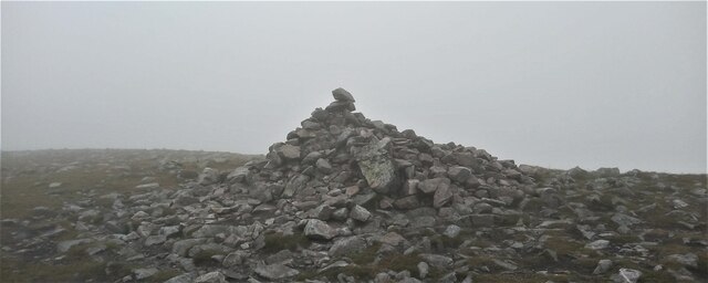
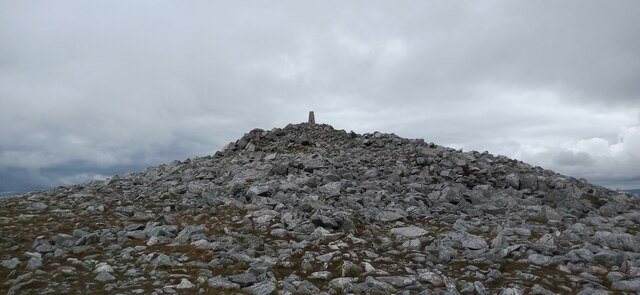
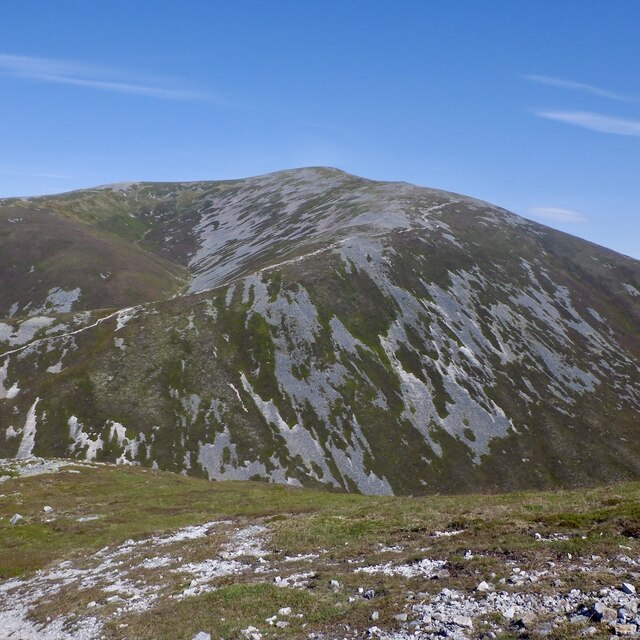
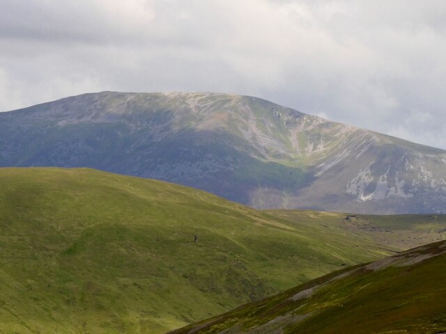
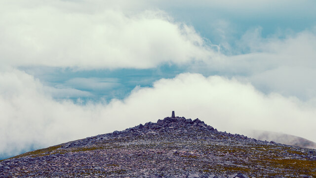
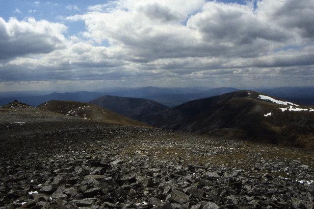
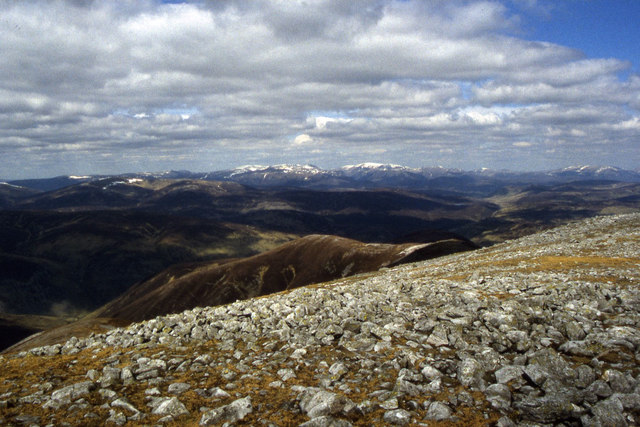
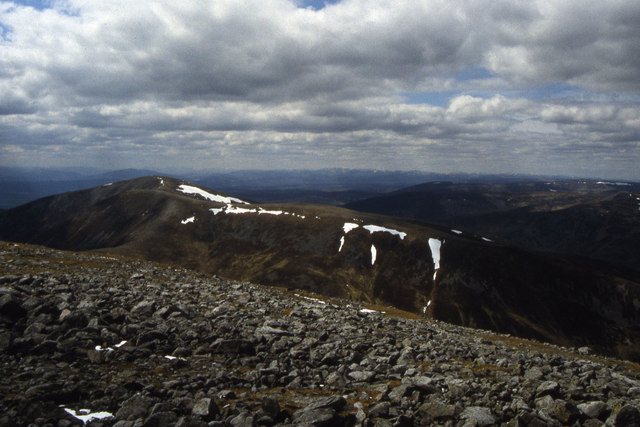
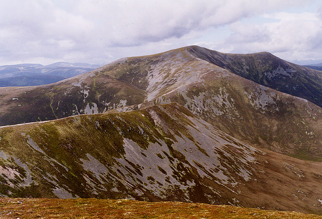
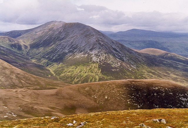
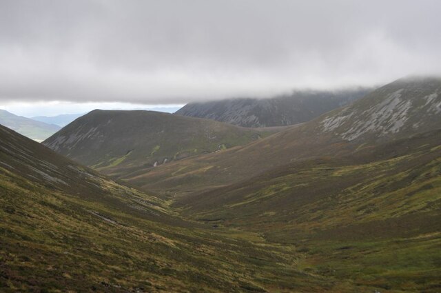
Airgiod Bheinn, also known as Ben Earb, is a prominent hill located in Perthshire, Scotland. Standing at an elevation of 892 meters (2,926 feet), it is part of the Grampian Mountains range. Airgiod Bheinn is situated about 13 kilometers (8 miles) southeast of the village of Blair Atholl and lies within the Cairngorms National Park.

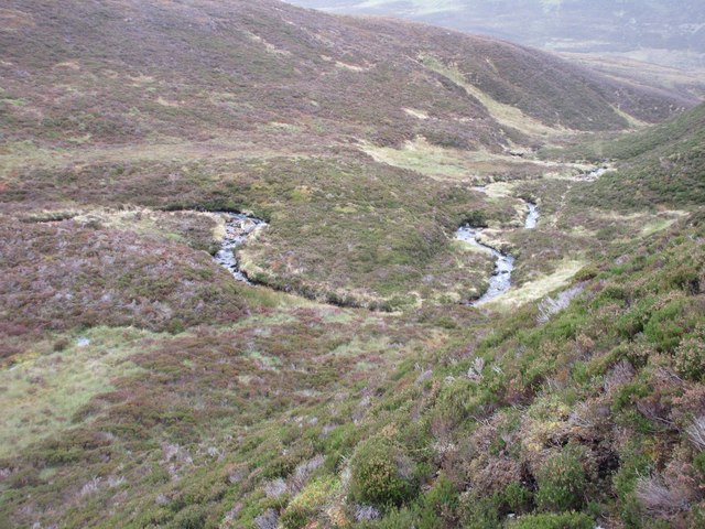
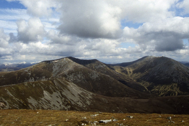
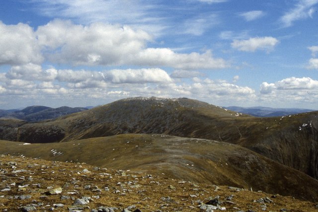
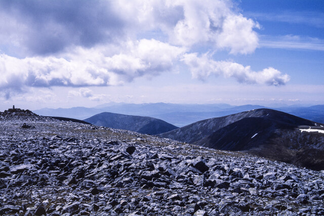
The hill features a distinctive pyramid-shaped peak, making it easily recognizable from a distance. It offers breathtaking panoramic views of the surrounding landscape, including the picturesque River Tilt and the nearby Munros such as Beinn a' Ghlo. The diverse terrain of Airgiod Bheinn includes rugged cliffs, steep slopes, and rocky outcrops, providing a challenging but rewarding hiking experience for outdoor enthusiasts.

The ascent to the summit of Airgiod Bheinn can be accessed through various routes, with the most popular starting from the nearby village of Old Blair. The trail takes hikers through heather-covered slopes, ancient woodlands, and open moorland, offering a chance to encounter wildlife such as red deer, golden eagles, and ptarmigans.

Due to its location within the Cairngorms National Park, Airgiod Bheinn is subject to the Scottish Outdoor Access Code, which encourages responsible outdoor activities and preservation of the natural environment. It is advisable for visitors to check weather conditions before undertaking the hike, as the Scottish climate can be unpredictable, especially at higher altitudes.

Overall, Airgiod Bheinn is a striking hill in Perthshire, offering a challenging yet rewarding outdoor experience for nature lovers and hikers alike.

If you have any feedback on the listing, please let us know in the comments section below.

Airgiod Bheinn Images

Images are sourced within 2km of 56.828217/-3.7025418 or Grid Reference NN9672. Thanks to Geograph Open Source API. All images are credited.

Summit of Braigh Coire Chruinn bhalgain Cairn on the summit of the Munro.
Summit of Braigh Coire Chruinn bhalgain
Cairn on the summit of the Munro.
Trig Pillar on Carn nan Gabhar The true summit of the Munro is marked by a large cairn further along the ridge behind this point.
Trig Pillar on Carn nan Gabhar
The true summit of the Munro is marked by a large cairn further along the ridge behind this point.
Bràigh Coire Chruinn-bhalgain View from Beinn Mhaol.
Bràigh Coire Chruinn-bhalgain
View from Beinn Mhaol.
Carn nan Gabhar Beinn a' Ghlo's highest summit seen from Creag Bhreac to its east.
Carn nan Gabhar
Beinn a' Ghlo's highest summit seen from Creag Bhreac to its east.
Not the real summit The trig point on Carn nan Gabhar viewed from the actual summit which is 1m higher.
Not the real summit
The trig point on Carn nan Gabhar viewed from the actual summit which is 1m higher.
Allt na Beinne Bige Looking down on the Allt na Beinne Bige snaking its way between Beinn Bheag and Airgiod Bheinn.
Allt na Beinne Bige
Looking down on the Allt na Beinne Bige snaking its way between Beinn Bheag and Airgiod Bheinn.
Braigh Coire Chruinn-bhalgain & Beinn a' Ghlo as seen from Carn Liath
Eastern ridge from Braigh Coire Chruinn-bhalgain with view to Beinn a' Ghlo
South western ridge from Beinn a' Ghlo with view to Braigh Coire Chruinn-bhalgain
Stony summit of Carn nan Gabhar with view towards the Cairngorm Mountains
View to Braigh Coire Chruinn-bhalgain from Beinn a' Ghlo
Bràigh Coire Chruinn-bhalgain, from Carn Liath Showing clearly the linking ridges between the two mountains.
Bràigh Coire Chruinn-bhalgain, from Carn Liath
Showing clearly the linking ridges between the two mountains.
Carn nan Gabhar, from Carn Liath
Bràigh Coire Chruinn-bhalgain Summit The second highest of the three summits of Beinn a' Ghlo.
Bràigh Coire Chruinn-bhalgain Summit
The second highest of the three summits of Beinn a' Ghlo.
Glas Leathad Glas Leathad, the 'green grassy slope', viewed from Bealach an Fhiodha.
Glas Leathad
Glas Leathad, the 'green grassy slope', viewed from Bealach an Fhiodha.
Carn nan Gabhar Trig Point The actual summit of Carn nan Gabhar is a short distance north of here, over very stony, rocky ground.
Carn nan Gabhar Trig Point
The actual summit of Carn nan Gabhar is a short distance north of here, over very stony, rocky ground.
Allt Bealach an Fhiodha
Rocky summit area of Carn nan Gabhar Shattered rock at the summit of Carn nan Gabhar which is one of the three Munros of the mountain group, Beinn a' Ghlo. The tor at the left side of the image has Carn nan Gabhar's trig point and might appear to be high than the camera location, but isn't.
The other Munros of Beinn a' Ghlo are Carn Liath and Bràigh Coire Chruinn-bhalgain; both are seen in the image.
Rocky summit area of Carn nan Gabhar
Shattered rock at the summit of Carn nan Gabhar which is one of the three Munros of the mountain group, Beinn a' Ghlo. The tor at the left side of the image has Carn nan Gabhar's trig point and might appear to be high than the camera location, but isn't. The other Munros of Beinn a' Ghlo are Carn Liath and Bràigh Coire Chruinn-bhalgain; both are seen in the image.
Show me another place!

Airgiod Bheinn is located at Grid Ref: NN9672 (Lat: 56.828217, Lng: -3.7025418)

Unitary Authority: Perth and Kinross

Police Authority: Tayside

What 3 Words

///factored.tribal.shudders. Near Blair Atholl, Perth & Kinross

Related Wikis

Beinn a' Ghlò

Beinn a’ Ghlò is a Scottish mountain situated roughly 10 km (6 mi) north east of Blair Atholl in the Forest of Atholl in between Glen Tilt and Glen Loch...

Càrn Liath (Munro)

Carn Liath (976 m) is a mountain in the Grampian Mountains of Scotland. It lies east of Blair Atholl in Perthshire, Scotland. Although belonging to the...

Loch Loch

Loch Loch is a remote freshwater loch, located in Glen Loch in Perth and Kinross, some 9.5 miles north of Pitlochry, Scotland and is within the Forest...

Ben Vuirich

Ben Vuirich (903 m) is a mountain in the Grampian Mountains of Scotland. It is located in Perthshire, north of the town of Pitlochry. A mountain of heather...

Glen Tilt

Glen Tilt (Scottish Gaelic: Gleann Teilt) is a glen in the extreme north of Perthshire, Scotland. Beginning at the confines of Aberdeenshire, it follows...

Carn a' Chlamain

Càrn a' Chlamain (Gaelic: Càrn a' Chlamhain) is a Scottish mountain situated roughly 12 kilometres north of Blair Atholl in the Forest of Atholl. It is...

Loch Moraig

Loch Moraig is a freshwater loch, located 2 miles northeast of Blair Atholl. Loch Moraig was an artificial loch, originally a Snipe marsh, that was dammed...
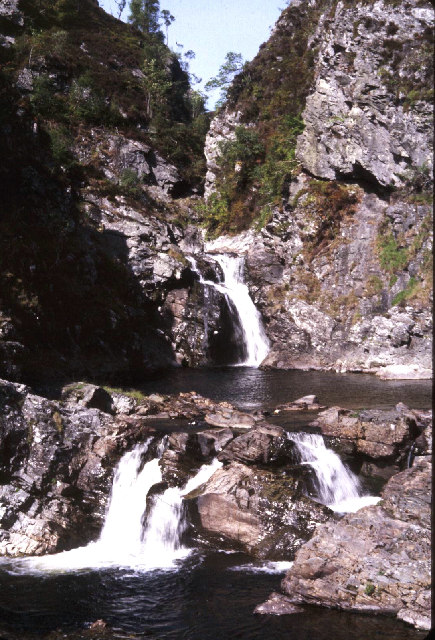
Falls of Tarf

The Falls of Tarf is a waterfall on the Tarf Water in the eastern Highlands of Scotland. Immediately downstream of the falls the Tarf is joined by a second...

Nearby Amenities

Located within 500m of 56.828217,-3.7025418
Airgiod Bheinn
Ele: 1061
Natural: peak
Lat/Long: 56.8277743/-3.7027359
The data included in this document is from www.openstreetmap.org. The data is made available under ODbL.

Have you been to Airgiod Bheinn?

Leave your review of Airgiod Bheinn below (or comments, questions and feedback).