Hangman Hill

Hill, Mountain in Kirkcudbrightshire

Scotland

Hangman Hill

Wayside houses, Mainsriddle
Wayside houses, Mainsriddle Credit: Eirian Evans

Hangman Hill is a prominent hill located in Kirkcudbrightshire, a historic county in the southwest of Scotland. Rising to a height of approximately 198 meters (650 feet), it offers commanding views of the surrounding landscape.

Situated near the town of Kirkcudbright, Hangman Hill derives its name from a dark and mysterious past. Legend has it that the hill was once used as a site for public hangings, hence the eerie name. However, there is no concrete historical evidence to support this claim.

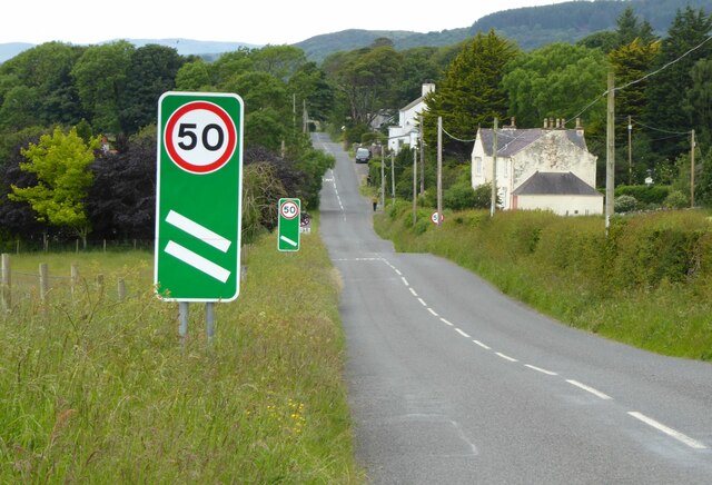
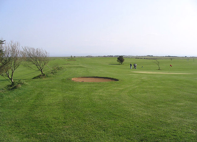
The hill is a popular destination for hikers and nature enthusiasts due to its accessibility and picturesque views. A well-maintained footpath leads up to the summit, making it an enjoyable and manageable climb for all skill levels. From the top, visitors are rewarded with breathtaking panoramas of the surrounding countryside, including the rolling hills, farmland, and the nearby coastline.

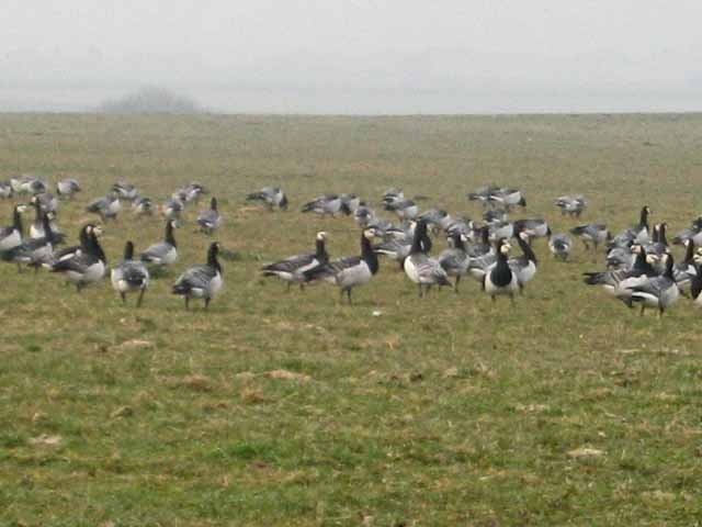
Hangman Hill also offers an excellent vantage point for birdwatching, as the area is known for its diverse avian population. Bird species such as buzzards, kestrels, and peregrine falcons can often be spotted soaring above the hill.

Additionally, Hangman Hill holds historical significance as it is believed to have been a site of ancient settlements. Archaeological findings suggest human activity in the area dating back to the Bronze Age, further adding to its appeal for history enthusiasts.

Overall, Hangman Hill is a captivating natural landmark, providing visitors with stunning views, intriguing legends, and a glimpse into Scotland's rich history.

If you have any feedback on the listing, please let us know in the comments section below.

Hangman Hill Images

Images are sourced within 2km of 54.897376/-3.6196143 or Grid Reference NX9657. Thanks to Geograph Open Source API. All images are credited.

Wayside houses, Mainsriddle
Grazing land and forest west of Mainsriddle
Cottage, Prestonmill
Cottage at Prestonmill This cottage is to the west of Prestonmill Burn
Cottage at Prestonmill
This cottage is to the west of Prestonmill Burn
Wind-blown tree A roadside tree shows the force and direction of the prevailing wind. Trees are not plentiful in this merse, but they are distinctive.
Wind-blown tree
A roadside tree shows the force and direction of the prevailing wind. Trees are not plentiful in this merse, but they are distinctive.
Grazing land near to Newmains Extensive grazing fields succeed the arable land as one moves inland. Cows are plentiful and the land tells of their importance.
Grazing land near to Newmains
Extensive grazing fields succeed the arable land as one moves inland. Cows are plentiful and the land tells of their importance.
Lane from East Preston More like a farm track with tarmac, but ideal for cycling! In the background, Criffel has emerged from mist and broods over the merse.
Lane from East Preston
More like a farm track with tarmac, but ideal for cycling! In the background, Criffel has emerged from mist and broods over the merse.
Hedge-gap with berries A rich crop of brambles and hawthorn in the hedge, with a view over the high-output monoculture devoted to cows.
Hedge-gap with berries
A rich crop of brambles and hawthorn in the hedge, with a view over the high-output monoculture devoted to cows.
Cows and pasture by Hawhill More cows in the landscape, but actually eating the grass for themselves this time, and looking rather contented.
Cows and pasture by Hawhill
More cows in the landscape, but actually eating the grass for themselves this time, and looking rather contented.
Bus shelter at Prestonmill A view of cottages and a slightly rusty bus shelter at Prestonmill, a location whose interesting parts are in a deep dingle and out of camera shot.
Bus shelter at Prestonmill
A view of cottages and a slightly rusty bus shelter at Prestonmill, a location whose interesting parts are in a deep dingle and out of camera shot.
Wreaths Cottage With the remains of Wreaths Tower.
Mersehead Sands and Solway Firth beyond.
Wreaths Cottage
With the remains of Wreaths Tower. Mersehead Sands and Solway Firth beyond.
Cowcorse farm Cattle in the foreground and Robin Rigg Offshore Wind Farm in the distance.
Cowcorse farm
Cattle in the foreground and Robin Rigg Offshore Wind Farm in the distance.
Approaching Mainsriddle On the A710.
Approaching Mainsriddle
On the A710.
Mainsriddle, Dumfries and Galloway. Entering Mainsriddle on the A710 from the east.
Mainsriddle, Dumfries and Galloway.
Entering Mainsriddle on the A710 from the east.
The remains of Wreaths Tower, Wreaths Cottages.
Barnacle Geese at West Preston near Southerness Every winter about 24,000 Barnacle Geese migrate from their breeding grounds in Svalbard to the Solway Coast. <span class="nowrap"><a title="http://en.wikipedia.org/wiki/Barnacle_Goose" rel="nofollow ugc noopener" href="http://en.wikipedia.org/wiki/Barnacle_Goose">Link</a><img style="margin-left:2px;" alt="External link" title="External link - shift click to open in new window" src="https://s1.geograph.org.uk/img/external.png" width="10" height="10"/></span>
Barnacle Geese at West Preston near Southerness
Every winter about 24,000 Barnacle Geese migrate from their breeding grounds in Svalbard to the Solway Coast. LinkExternal link
A country road A narrow road with passing places near Maxwellfield.
A country road
A narrow road with passing places near Maxwellfield.
Solway Links Golf Course A pay and play course with rates at £10 for 9 holes and £15 for 18 holes. A board at the entrance to the links claims that the course is 99% midge free!
Solway Links Golf Course
A pay and play course with rates at £10 for 9 holes and £15 for 18 holes. A board at the entrance to the links claims that the course is 99% midge free!
Show me another place!

Hangman Hill is located at Grid Ref: NX9657 (Lat: 54.897376, Lng: -3.6196143)

Unitary Authority: Dumfries and Galloway

Police Authority: Dumfries and Galloway

What 3 Words

///banter.unframed.priced. Near Dalbeattie, Dumfries & Galloway

Nearby Locations

Hangman Hill Prestonmill

Related Wikis

John Paul Jones Cottage Museum

The John Paul Jones Cottage Museum is located on the Arbigland Estate near Kirkbean in the historical county of Kirkcudbrightshire, Dumfries and Galloway...

Kirkbean

Kirkbean (Scottish Gaelic: Cille Bheathain) is a Scottish village and civil parish on the Solway Firth, in the historic county of Kirkcudbrightshire and...

Southerness

Southerness (/sʌðə'nɛs/; Scots: Satterness) is a small, compact coastal village in Dumfries and Galloway, Scotland. Southerness is located approximately...

Southerness Lighthouse

Southerness lighthouse is located at the village of Southerness in South West Scotland. It is at present the second oldest lighthouse in Scotland. The...

Criffel

Criffel is a hill in the historical county of Kirkcudbrightshire, Dumfries and Galloway, south-west Scotland. It is 570 m (1,870 ft) high but appears higher...

Abbey Vale F.C.

Abbey Vale Football Club are a football club based in the village of New Abbey in the historical county of Kirkcudbright shire in the Dumfries and Galloway...

New Abbey

New Abbey (Scottish Gaelic: An Abaid Ùr) is a village in the historical county of Kirkcudbrightshire in Dumfries and Galloway, Scotland. It is 6 miles...

Sweetheart Abbey

The Abbey of Dulce Cor, better known as Sweetheart Abbey (Gaelic: An Abaid Ur), was a Cistercian monastery founded in 1275 in what is now the village of...

Nearby Amenities

Located within 500m of 54.897376,-3.6196143
Bus Stop
Torrorie Farm
Naptan AtcoCode: 680000783111
Naptan Bearing: NE
Naptan BusStopType: CUS
Naptan CommonName: Torrorie Farm
Naptan Indicator: Road End
Naptan Landmark: Torrorie
Naptan NaptanCode: 34235769
Naptan Notes: none
Naptan Street: A710
Naptan Verified: no
Source: naptan_import
Lat/Long: 54.8983696/-3.6255014
Bus Stop
Torrorie Farm
Naptan AtcoCode: 680000783222
Naptan Bearing: SW
Naptan BusStopType: CUS
Naptan CommonName: Torrorie Farm
Naptan Indicator: opp Road End
Naptan Landmark: Torrorie
Naptan NaptanCode: 34235782
Naptan Notes: none
Naptan Street: A710
Naptan Verified: no
Source: naptan_import
Lat/Long: 54.8982514/-3.6256058
Power: pole
Lat/Long: 54.8997726/-3.6142613
Power: pole
Lat/Long: 54.8993068/-3.6153859
Power: pole
Lat/Long: 54.8988398/-3.6165174
Power: pole
Lat/Long: 54.8984699/-3.6174541
Power: pole
Lat/Long: 54.8979407/-3.6187336
Power: pole
Lat/Long: 54.8975843/-3.6200201
Power: pole
Lat/Long: 54.8972225/-3.62133
Power: pole
Lat/Long: 54.896881/-3.6225555
Power: pole
Lat/Long: 54.8965313/-3.6238161
Power: pole
Lat/Long: 54.8961782/-3.6250954
Power: pole
Lat/Long: 54.895832/-3.6263492
Power: pole
Lat/Long: 54.8965732/-3.6256379
Power: pole
Lat/Long: 54.8969728/-3.6261685
Power: pole
Lat/Long: 54.8975033/-3.6269056
The data included in this document is from www.openstreetmap.org. The data is made available under ODbL.

Have you been to Hangman Hill?

Leave your review of Hangman Hill below (or comments, questions and feedback).