Ben Shee

Hill, Mountain in Perthshire

Scotland

Ben Shee

Innerdownie skyscape A beautiful evening sky above Innerdownie in the eastern Ochil Hills, viewed from the Crook of Devon, almost 10km distant.
Innerdownie skyscape Credit: William Starkey

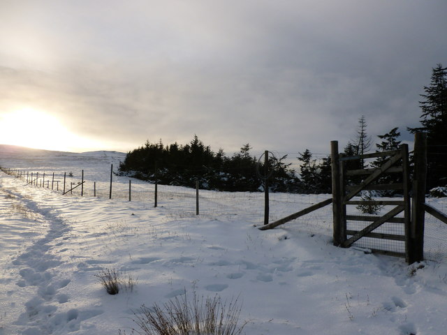
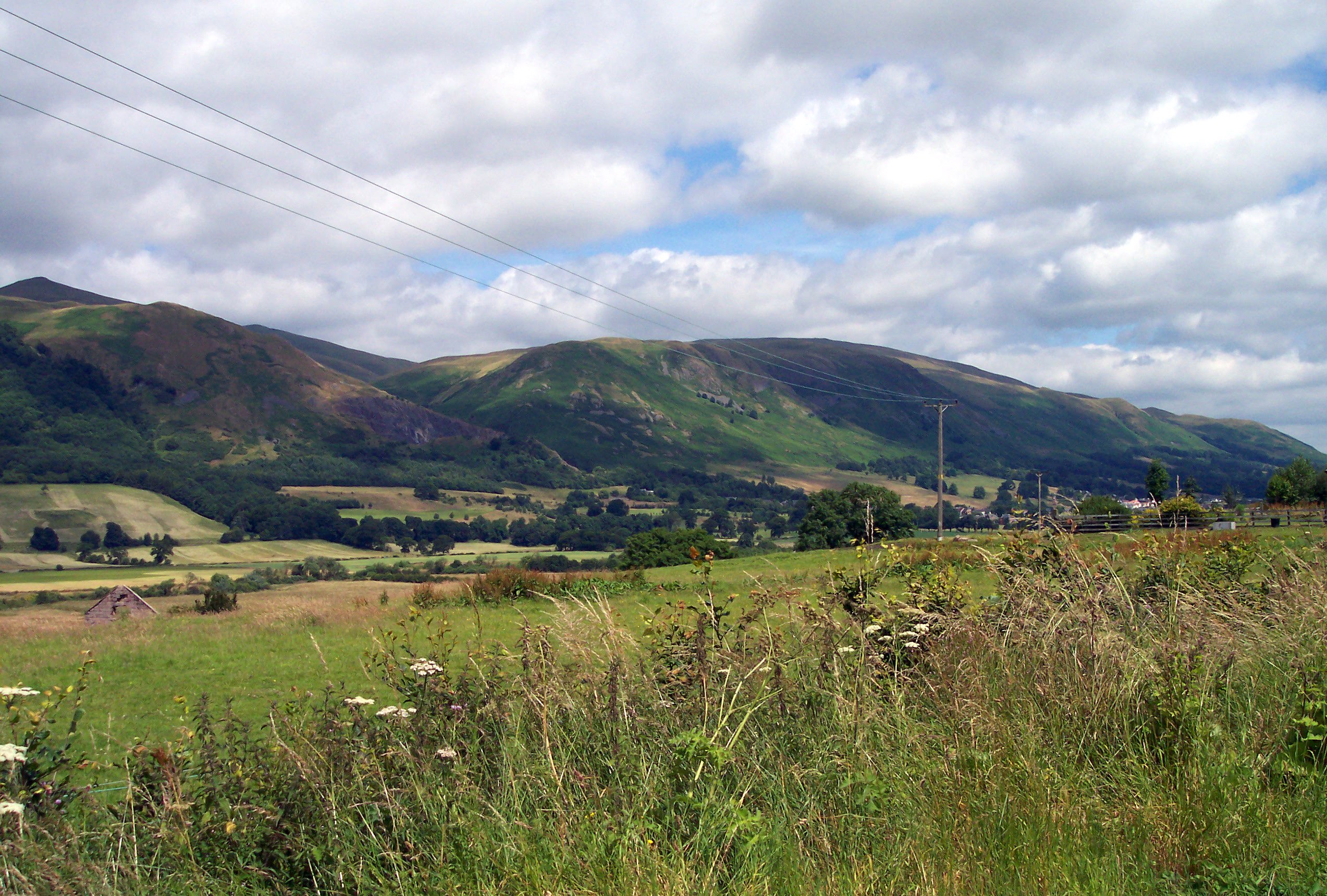
Ben Shee is a prominent hill located in Perthshire, Scotland. It is part of the Grampian Mountains range and is situated approximately 15 miles north of Blairgowrie. Standing at an elevation of 2,392 feet (729 meters), it offers breathtaking panoramic views of the surrounding area.

The hill is known for its distinctive pyramid-like shape and is a popular destination for hikers, mountaineers, and nature enthusiasts. Its ascent can be challenging, with steep and rugged terrain, but it rewards climbers with stunning vistas and a sense of accomplishment.

The vegetation on Ben Shee varies depending on the altitude. At lower levels, heather dominates the landscape, while higher up, grasses and mosses can be found. The hill is also home to a variety of wildlife, including red grouse, mountain hares, and occasionally golden eagles.

Ben Shee is often described as a hidden gem, as it is less frequented compared to some of the more famous peaks in the region. This makes it an ideal destination for those seeking a quieter and more secluded outdoor experience.

The hill is accessible from several starting points, including the nearby Glen Shee ski resort. There are various routes to reach the summit, each offering different levels of difficulty and scenery. It is advisable to check weather conditions and come prepared with appropriate clothing and equipment when planning a trip to Ben Shee.

If you have any feedback on the listing, please let us know in the comments section below.

Ben Shee Images

Images are sourced within 2km of 56.21608/-3.6916042 or Grid Reference NN9503. Thanks to Geograph Open Source API. All images are credited.

Innerdownie skyscape A beautiful evening sky above Innerdownie in the eastern Ochil Hills, viewed from the Crook of Devon, almost 10km distant.
Innerdownie skyscape
A beautiful evening sky above Innerdownie in the eastern Ochil Hills, viewed from the Crook of Devon, almost 10km distant.
Dusk on Innerdownie Light fading quickly on the summit of Innerdownie in the Ochil Hills - the moon is visible on this December evening, with snow lying on the ground.
Dusk on Innerdownie
Light fading quickly on the summit of Innerdownie in the Ochil Hills - the moon is visible on this December evening, with snow lying on the ground.
Forestry east of Black Hill Recently planted conifers near Black Hill. The turbines of the Green Knowes wind farm can be seen on the skyline.
Forestry east of Black Hill
Recently planted conifers near Black Hill. The turbines of the Green Knowes wind farm can be seen on the skyline.
Approaching the summit of Innerdownie At 611m, this is the joint lowest of Scotland's Donalds (2000 foot summits south of the Highland Boundary Fault).
Approaching the summit of Innerdownie
At 611m, this is the joint lowest of Scotland's Donalds (2000 foot summits south of the Highland Boundary Fault).
Innerdownie summit cairn Looking towards the distant Perthshire hills on a cold December day.
Innerdownie summit cairn
Looking towards the distant Perthshire hills on a cold December day.
Looking from Bentie Knowe to Innerdownie There is both a deer fence and an old drystane dyke here.
Looking from Bentie Knowe to Innerdownie
There is both a deer fence and an old drystane dyke here.
Gate below Whitewisp Hill The setting sun highlights footprints in the snow as it brings a slight glow to a wintry scene in the Ochil Hills.
Gate below Whitewisp Hill
The setting sun highlights footprints in the snow as it brings a slight glow to a wintry scene in the Ochil Hills.
View towards Innerdownie Looking back towards Bentie Knowe and Innerdownie from the snow-covered path to Whitewisp Hill, in the Ochils.
View towards Innerdownie
Looking back towards Bentie Knowe and Innerdownie from the snow-covered path to Whitewisp Hill, in the Ochils.
Shelter near summit of Innerdownie A very slight degree of protection from the wind is offered here, although this was a rare almost windless day during an otherwise very wet and windy spell of weather.
Shelter near summit of Innerdownie
A very slight degree of protection from the wind is offered here, although this was a rare almost windless day during an otherwise very wet and windy spell of weather.
Bentie Knowe A minor knowe (knoll) on the crest of the hill between Innerdownie and Whitewisp Hill.
Bentie Knowe
A minor knowe (knoll) on the crest of the hill between Innerdownie and Whitewisp Hill.
House at Glensherup Reservoir Taken from the dam of the reservoir, which was originally built for the Dunfermline Corporation.
House at Glensherup Reservoir
Taken from the dam of the reservoir, which was originally built for the Dunfermline Corporation.
Glensherup Reservoir Looking over the reservoir from the flank of Ben Shee, an area which has been planted with native trees.
Glensherup Reservoir
Looking over the reservoir from the flank of Ben Shee, an area which has been planted with native trees.
Lower Glendevon Reservoir
View across Glen Eagles towards The Law
Edge of Glen Sherup Wood in Glendevon Operated by The Woodland Trust.
Edge of Glen Sherup Wood in Glendevon
Operated by The Woodland Trust.
View along Glen Devon looking towards The Law The road is in extremely good condition having been reasonably recently resurfaced as it serves both the two dams and the windfarm at the top of the glen.
View along Glen Devon looking towards The Law
The road is in extremely good condition having been reasonably recently resurfaced as it serves both the two dams and the windfarm at the top of the glen.
Looking across the spillway and dam towards Common Hill
Water intake tower at Lower Glendevon Reservoir
Show me another place!

Ben Shee is located at Grid Ref: NN9503 (Lat: 56.21608, Lng: -3.6916042)

Unitary Authority: Perth and Kinross

Police Authority: Tayside

What 3 Words

///showdown.standards.coping. Near Dollar, Clackmannanshire

Related Wikis

Ochil Hills

The Ochil Hills ( ; Scottish Gaelic: Monadh Ochail is a range of hills in Scotland north of the Forth valley bordered by the towns of Stirling, Alloa,...

Strathdevon

Strathdevon is the strath of the River Devon in Clackmannanshire, Scotland. Strathdevon is associated with the parish of Muckhart and was up until 1971...

Glendevon Castle

Glendevon Castle is a collection of conjoined structures dating from the 15th century. The property is now (2022) semi-derelict. It lies on a private road...

A823 road

The A823 is a road in Scotland which goes from south of Crieff to Dunfermline. It joins onto the A823(M) and the A822 which runs to Crieff.

Castle Campbell

Castle Campbell is a medieval castle situated above the town of Dollar, Clackmannanshire, in central Scotland. It was the lowland seat of the earls and...

Roman Catholic Archdiocese of St Andrews and Edinburgh

The Archdiocese of Saint Andrews & Edinburgh (Latin: Archidioecesis Sancti Andreae et Edimburgensis) is an archdiocese of the Latin Church of the Catholic...

Dollar Glen

Dollar Glen is a small glen (valley) owned by the National Trust for Scotland. It is located in the Ochils that dramatically mark the Highland fault. It...

Muckhart

Muckhart (Scottish Gaelic: Muc-Ă€ird) commonly refers to two small villages in Clackmannanshire, Scotland, Pool of Muckhart (Scottish Gaelic: Poll Mhuc...

Nearby Amenities

Located within 500m of 56.21608,-3.6916042
Ben Shee
Ele: 516
Natural: peak
Lat/Long: 56.2161088/-3.6914488
The data included in this document is from www.openstreetmap.org. The data is made available under ODbL.

Have you been to Ben Shee?

Leave your review of Ben Shee below (or comments, questions and feedback).