An Garbh Choire

Hill, Mountain in Aberdeenshire

Scotland

An Garbh Choire

Headwall of Garbh Choire Mòr Garbh Choire Mòr is an 'upper bay' of An Garbh Choire, the massive bowl of rock and boulder between Braigh Riabhach and Càrn an t-Sabhail.
Headwall of Garbh Choire Mòr Credit: Trevor Littlewood

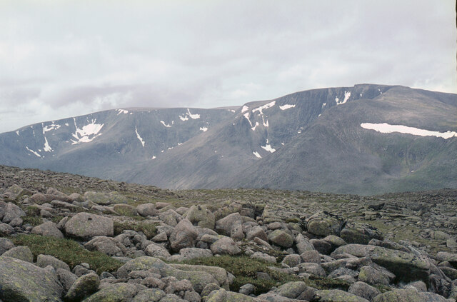
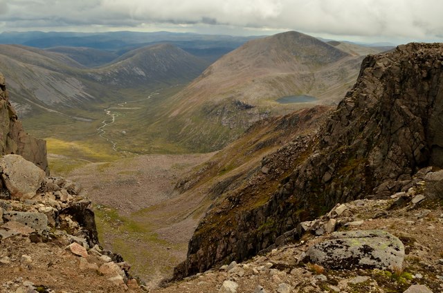
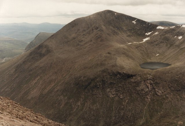
An Garbh Choire is a prominent hill located in Aberdeenshire, Scotland. It is part of the Cairngorms National Park and is situated in the eastern Highlands region. Standing at an elevation of 1,291 meters (4,236 feet), it is considered a munro, a term used to describe Scottish mountains over 3,000 feet.

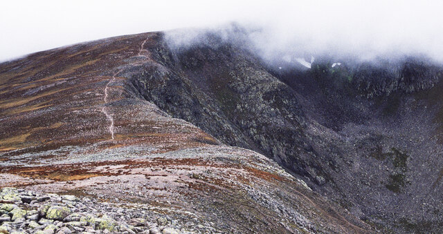
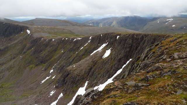
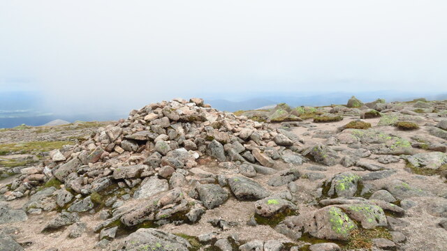
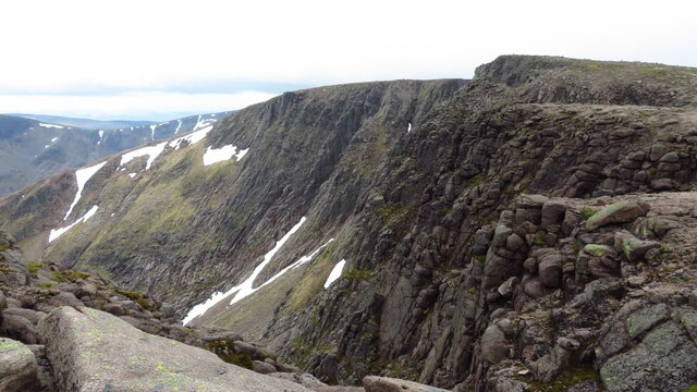
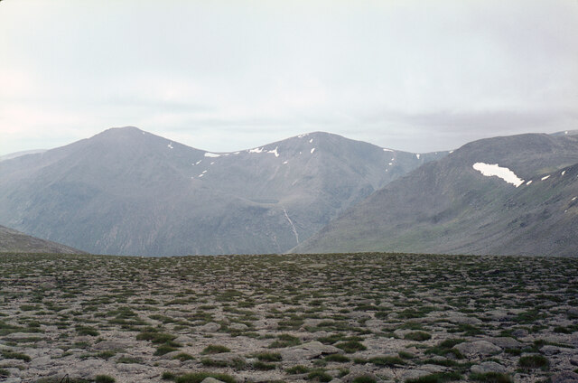
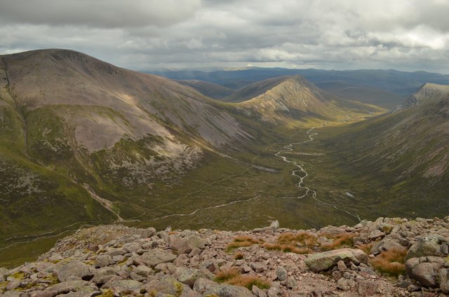
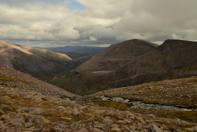
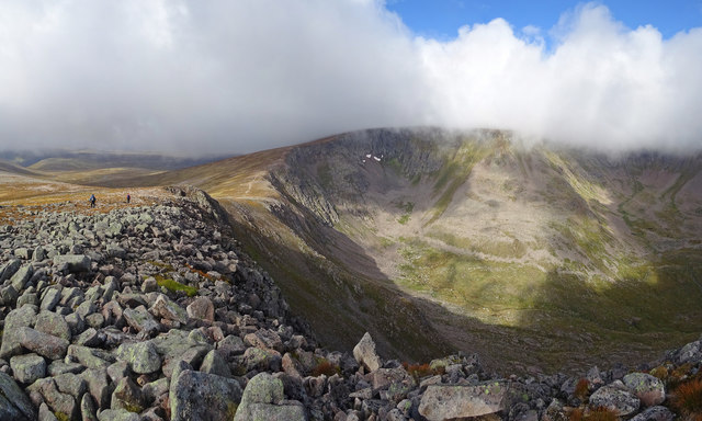
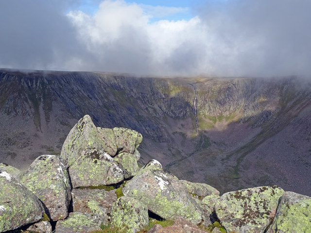
An Garbh Choire is known for its rugged and dramatic landscape, characterized by steep cliffs, crags, and rocky outcrops. The hill is composed mainly of granite, which gives it a distinctive appearance and offers a challenging terrain for climbers and hikers. The surrounding area is also home to a diverse range of flora and fauna, including heather, mosses, and various bird species.

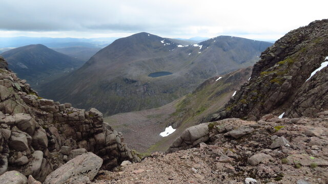
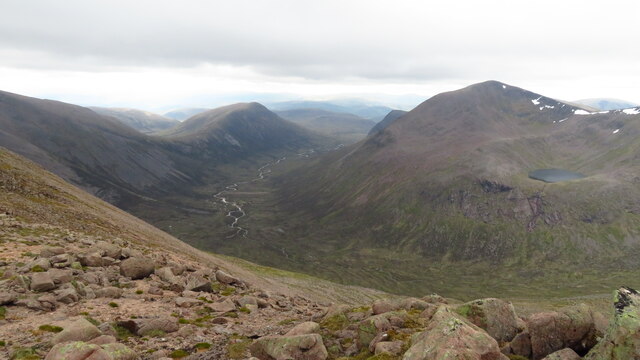
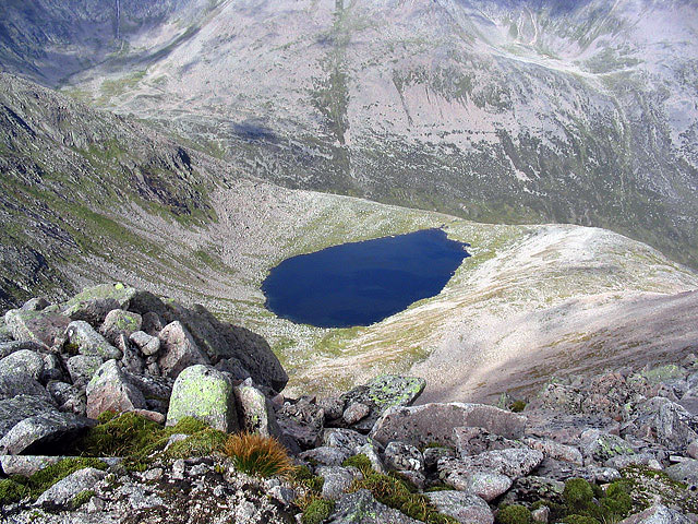
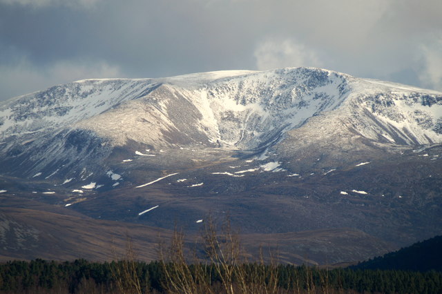
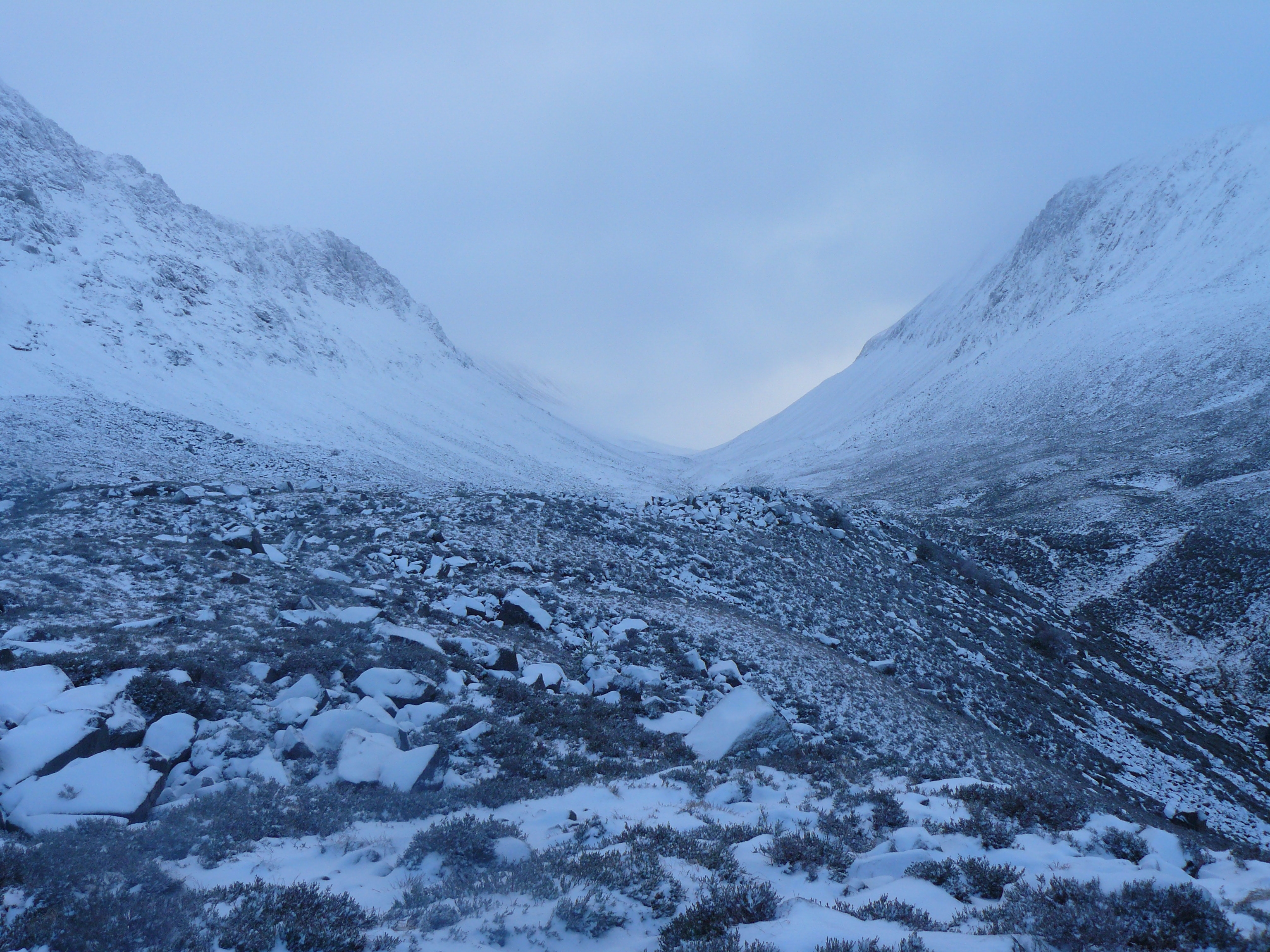
The ascent of An Garbh Choire is a popular activity for outdoor enthusiasts, offering breathtaking panoramic views of the surrounding Cairngorms mountain range and the nearby Loch Morlich. In winter, the hill attracts snow sports enthusiasts who enjoy skiing and snowboarding on its slopes.

Access to An Garbh Choire is typically gained from the Cairngorm Mountain ski resort, which provides a convenient starting point for hikers. The hill can be climbed via various routes, with the most common being the Coire an t-Sneachda route, which takes approximately 4-6 hours to complete.

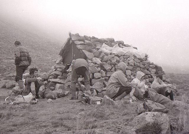
Due to its challenging nature and remote location, it is recommended for experienced hikers or those accompanied by a guide. An Garbh Choire offers a thrilling and rewarding adventure for those seeking to explore the beauty of the Scottish Highlands.

If you have any feedback on the listing, please let us know in the comments section below.

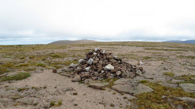
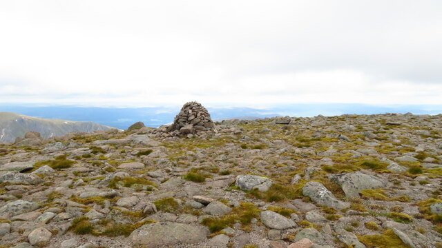
An Garbh Choire Images

Images are sourced within 2km of 57.06634/-3.7303723 or Grid Reference NN9598. Thanks to Geograph Open Source API. All images are credited.

Headwall of Garbh Choire Mòr Garbh Choire Mòr is an 'upper bay' of An Garbh Choire, the massive bowl of rock and boulder between Braigh Riabhach and Càrn an t-Sabhail.
Headwall of Garbh Choire Mòr
Garbh Choire Mòr is an 'upper bay' of An Garbh Choire, the massive bowl of rock and boulder between Braigh Riabhach and Càrn an t-Sabhail.
Western cairn on Carn na Criche With a lack of vegetation, the walking is easy across the Cairngorm plateau towards Braeriach.
Western cairn on Carn na Criche
With a lack of vegetation, the walking is easy across the Cairngorm plateau towards Braeriach.
Corrie rim on Carn na Criche - view SSE
Southern cairn at Einich Cairn
Cairn at summit of Braeriach
View towards Cairn Toul & Sgor an Lochain Uaine from Braeriach
Cliffs on the southern face of Braeriach
The Lairig Ghru, Carn a' Mhaim & Cairn Toul from Braeriach
The Braeriach massif from across the Lairig Ghru Coire Bhrochain below the summit is well seen here. The photo was taken from near Lochan Buidhe.
The Braeriach massif from across the Lairig Ghru
Coire Bhrochain below the summit is well seen here. The photo was taken from near Lochan Buidhe.
Cairn Toul and Angel's Peak Taken from near Lochan Buidhe on the east of the Lairig Ghru. Cairn Toul is the higher mountain, on the left:  Angel's Peak is central. Below them is Lochan Uaine.
Cairn Toul and Angel's Peak
Taken from near Lochan Buidhe on the east of the Lairig Ghru. Cairn Toul is the higher mountain, on the left: Angel's Peak is central. Below them is Lochan Uaine.
Lochan Uaine The lochan was viewed from the col between Cairn Toul (Carn an t-Sabhail) and The Angel’s Peak (Sgor an Lochain Uaine).
Lochan Uaine
The lochan was viewed from the col between Cairn Toul (Carn an t-Sabhail) and The Angel’s Peak (Sgor an Lochain Uaine).
Braeriach from Aviemore
Braeriach, Cairngorm National Park View down the west gully from the summit of Braeriach, Britain's 3rd highest mountain.
Braeriach, Cairngorm National Park
View down the west gully from the summit of Braeriach, Britain's 3rd highest mountain.
View of the Lairig Ghru Pass from Braeriach, Scotland View from the northern end of the Braeriach horseshoe over the mountain pass of Lairig Ghru below.  Braeriach is Britain's 3rd highest mountain.  The watercourse in the glen below is the head of the river Dee, which eventually flows to Aberdeen.
View of the Lairig Ghru Pass from Braeriach, Scotland
View from the northern end of the Braeriach horseshoe over the mountain pass of Lairig Ghru below. Braeriach is Britain's 3rd highest mountain. The watercourse in the glen below is the head of the river Dee, which eventually flows to Aberdeen.
Top of the Falls of Dee, Aberdeenshire The River Dee finds its source in the Cairngorm Mountains at over 4000 ft above sea level on the summit plateau of Braeriach, Britain's 3rd highest mountain.  The view here is of the top of the falls where the Dee, at this stage a small stream, leaves the Plateau.
Top of the Falls of Dee, Aberdeenshire
The River Dee finds its source in the Cairngorm Mountains at over 4000 ft above sea level on the summit plateau of Braeriach, Britain's 3rd highest mountain. The view here is of the top of the falls where the Dee, at this stage a small stream, leaves the Plateau.
Garbh Choire Refuge Members of Aberdeen Mountaineering Club have a rest beside the refuge.

The small structure was built by members of Aberdeen University Lairig Club in 1966 to provide a place to stay overnight for three or four people  to give access to nearby winter ice climbing in the Garbh Choire area. 

In more recent years it has fallen into disrepair, and is only used as an emergency refuge. There are plans to renovate it in 2018
Garbh Choire Refuge
Members of Aberdeen Mountaineering Club have a rest beside the refuge. The small structure was built by members of Aberdeen University Lairig Club in 1966 to provide a place to stay overnight for three or four people to give access to nearby winter ice climbing in the Garbh Choire area. In more recent years it has fallen into disrepair, and is only used as an emergency refuge. There are plans to renovate it in 2018
An Garbh Choire The view to the back of An Garbh Choire and the location of where this was taken 9 years ago:-
<a title="https://www.geograph.org.uk/photo/2490923" href="https://www.geograph.org.uk/photo/2490923">Link</a>
Perhaps the highest roughest and largest corrie in Scotland, the 2 figures at left give an idea of the scale.
An Garbh Choire
The view to the back of An Garbh Choire and the location of where this was taken 9 years ago:- Link Perhaps the highest roughest and largest corrie in Scotland, the 2 figures at left give an idea of the scale.
Opposite the Falls From the summit of Sgorr an Lochain Uaine (The Angels Peak) The Falls of Dee can clearly be seen plunging over 500 feet into the mighty An Garbh Choire.
This is the view from just above the falls taken over 9 years ago:-
<a title="https://www.geograph.org.uk/photo/2495174" href="https://www.geograph.org.uk/photo/2495174">Link</a>
Opposite the Falls
From the summit of Sgorr an Lochain Uaine (The Angels Peak) The Falls of Dee can clearly be seen plunging over 500 feet into the mighty An Garbh Choire. This is the view from just above the falls taken over 9 years ago:- Link
Show me another place!

An Garbh Choire is located at Grid Ref: NN9598 (Lat: 57.06634, Lng: -3.7303723)

Unitary Authority: Aberdeenshire

Police Authority: North East

What 3 Words

///rear.pupils.premises. Near Aviemore, Highland

Nearby Locations

An Garbh Choire

Related Wikis

Have you been to An Garbh Choire?

Leave your review of An Garbh Choire below (or comments, questions and feedback).