Banham

Settlement in Norfolk Breckland

England

Banham

Post Box at Banham NR16 1638. Royal Mail list this box as 'Grove Corner'.
Post Box at Banham Credit: David Bremner

Banham is a village located in the county of Norfolk, in the eastern part of England. Situated about 20 miles southwest of Norwich, it falls within the district of Breckland. With a population of around 1,000 residents, Banham is a small and close-knit community.

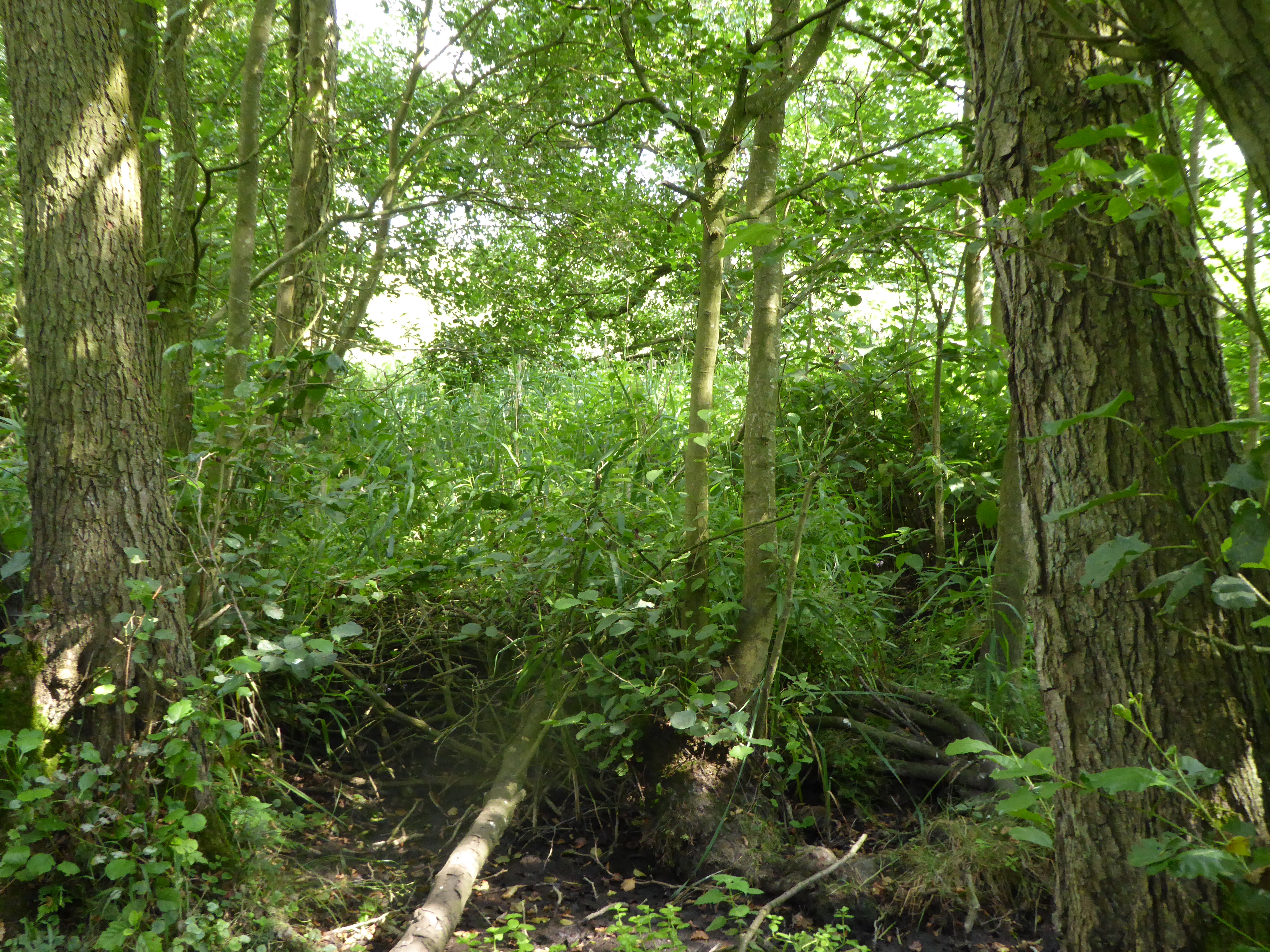
The village is characterized by its picturesque countryside setting, with rolling hills and meadows surrounding the area. It is renowned for its beautiful landscapes and tranquil atmosphere, making it an attractive destination for nature lovers and those seeking a peaceful retreat.

Banham is most famously known for being home to Banham Zoo, a popular tourist attraction in the region. The zoo, established in 1968, houses over 2,000 animals from around the world and offers a range of interactive experiences and educational programs for visitors of all ages.

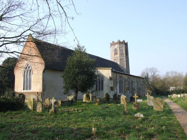
In addition to the zoo, Banham boasts a rich history, with several historic buildings and landmarks scattered throughout the village. These include the 14th-century St. Mary's Church, which exhibits stunning medieval architecture, and Banham Castle, a Grade II listed building that has been converted into residential apartments.

The village also offers a variety of amenities and services to its residents, including a primary school, a post office, local shops, and a village hall. Furthermore, Banham is well-connected to surrounding areas by road, with the A11 passing nearby, providing easy access to Norwich and other major towns in Norfolk.

Overall, Banham is a charming village known for its natural beauty, rich history, and the popular Banham Zoo, making it a delightful place to visit or reside in the heart of Norfolk.

If you have any feedback on the listing, please let us know in the comments section below.
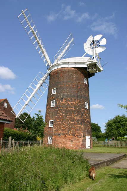
Banham Images

Images are sourced within 2km of 52.452518/1.037181 or Grid Reference TM0688. Thanks to Geograph Open Source API. All images are credited.

Post Box at Banham NR16 1638. Royal Mail list this box as 'Grove Corner'.
Post Box at Banham
NR16 1638. Royal Mail list this box as 'Grove Corner'.
'Long Thatch' on Doe Lane
Banham, Norfolk The village green, war memorial and church
Banham, Norfolk
The village green, war memorial and church
Banham Zoo In-flight shot of a vulture being flown at Banham Zoo's Bird's of Prey Display
Banham Zoo
In-flight shot of a vulture being flown at Banham Zoo's Bird's of Prey Display
The road between Banham and New Buckenham Kenninghall to the left, New Buckenham to the right
The road between Banham and New Buckenham
Kenninghall to the left, New Buckenham to the right
Road junction in Banham
A field near Mill Farm
Heath Farm
Heath Farm
Countryside near Quidenham Park
Junction to Winfarthing on road from Banham to New Buckenham Banham College buildings can be seen in the distance
Junction to Winfarthing on road from Banham to New Buckenham
Banham College buildings can be seen in the distance
Hunts Corner Road junction with phonebox and postbox Hunts Corner Norfolk.
Hunts Corner
Road junction with phonebox and postbox Hunts Corner Norfolk.
White House Farm
White House Farm
The Garden House
The Garden House
Long, Straight Footpath South of Banham
Long, Straight Footpath
South of Banham
Flags at the Entrance to Banham Zoo Showing the road to Kenninghall, taken from the Zoo Car Park
Flags at the Entrance to Banham Zoo
Showing the road to Kenninghall, taken from the Zoo Car Park
St Mary The Virgin, Banham
Timber-framed cottages on the north-western corner of the green Perhaps most widely known for its renowned zoo, the village of Banham is located along the B1113, 11 kilometres north of Diss, 19 kilometres east of Thetford and 32 kilometres south-west of Norwich.  The tree-lined village green > <a title="https://www.geograph.org.uk/photo/1408840" href="https://www.geograph.org.uk/photo/1408840">Link</a> is surrounded by old thatched houses > <a title="https://www.geograph.org.uk/photo/1408825" href="https://www.geograph.org.uk/photo/1408825">Link</a> some with overhanging storeys, and dominated by St Mary's church > <a title="https://www.geograph.org.uk/photo/1408886" href="https://www.geograph.org.uk/photo/1408886">Link</a> which adjoins the green in the west.  Industries in Banham include the Gaymer Cider factory and brick making from locally found clay.  The village has a number of small shops, a Spar supermarket and a village shop > <a title="https://www.geograph.org.uk/photo/1408855" href="https://www.geograph.org.uk/photo/1408855">Link</a> and post office, two pubs, and a primary school which caters for about 120 pupils.
Timber-framed cottages on the north-western corner of the green
Perhaps most widely known for its renowned zoo, the village of Banham is located along the B1113, 11 kilometres north of Diss, 19 kilometres east of Thetford and 32 kilometres south-west of Norwich. The tree-lined village green > Link is surrounded by old thatched houses > Link some with overhanging storeys, and dominated by St Mary's church > Link which adjoins the green in the west. Industries in Banham include the Gaymer Cider factory and brick making from locally found clay. The village has a number of small shops, a Spar supermarket and a village shop > Link and post office, two pubs, and a primary school which caters for about 120 pupils.
Cottages on Church Hill These timber-framed cottages are situated by the north-western corner of the village green.  Perhaps most widely known for its renowned zoo, the village of Banham is located along the B1113, 11 kilometres north of Diss, 19 kilometres east of Thetford and 32 kilometres south-west of Norwich.  The tree-lined village green > <a title="https://www.geograph.org.uk/photo/1408840" href="https://www.geograph.org.uk/photo/1408840">Link</a> is surrounded by old thatched houses > <a title="https://www.geograph.org.uk/photo/1408825" href="https://www.geograph.org.uk/photo/1408825">Link</a> some with overhanging storeys, and dominated by St Mary's church > <a title="https://www.geograph.org.uk/photo/1408886" href="https://www.geograph.org.uk/photo/1408886">Link</a> which adjoins the green in the west.  Industries in Banham include the Gaymer Cider factory and brick making from locally found clay.  The village has a number of small shops, a Spar supermarket and a village shop > <a title="https://www.geograph.org.uk/photo/1408855" href="https://www.geograph.org.uk/photo/1408855">Link</a> and post office, two pubs, and a primary school which caters for about 120 pupils.
Cottages on Church Hill
These timber-framed cottages are situated by the north-western corner of the village green. Perhaps most widely known for its renowned zoo, the village of Banham is located along the B1113, 11 kilometres north of Diss, 19 kilometres east of Thetford and 32 kilometres south-west of Norwich. The tree-lined village green > Link is surrounded by old thatched houses > Link some with overhanging storeys, and dominated by St Mary's church > Link which adjoins the green in the west. Industries in Banham include the Gaymer Cider factory and brick making from locally found clay. The village has a number of small shops, a Spar supermarket and a village shop > Link and post office, two pubs, and a primary school which caters for about 120 pupils.
Show me another place!

Banham is located at Grid Ref: TM0688 (Lat: 52.452518, Lng: 1.037181)

Administrative County: Norfolk

District: Breckland

Police Authority: Norfolk

What 3 Words

///honestly.husky.suppers. Near Banham, Norfolk

Nearby Locations

Banham Banham

Related Wikis

Related Videos

Tourism Business Survey results 2023

The Larking Gowen Tourism Business Survey seminar took place this year, and in April leaders from the sector gathered at ...

Nearby Amenities

Located within 500m of 52.452518,1.037181
Banham
Place: village
Lat/Long: 52.4496963/1.0402275
Grey's Manor, adj
Naptan AtcoCode: 2900B0410
Naptan Bearing: W
Naptan BusStopType: CUS
Naptan CommonName: Grey's Manor
Naptan Indicator: adj
Naptan Locality: Banham
Naptan NaptanCode: nfoadpag
Naptan Street: Winfarthing Road
Naptan Verified: no
Source: naptan_import
Lat/Long: 52.4483114/1.0358366
Grey's Manor, opp
Naptan AtcoCode: 2900B0411
Naptan Bearing: NE
Naptan BusStopType: CUS
Naptan CommonName: Grey's Manor
Naptan Indicator: opp
Naptan Locality: Banham
Naptan NaptanCode: nfoadpaj
Naptan Street: Winfarthing Road
Naptan Verified: no
Source: naptan_import
Lat/Long: 52.4487733/1.0360598
Phone Box, adj
Naptan AtcoCode: 2900B045
Naptan Bearing: E
Naptan BusStopType: CUS
Naptan CommonName: Phone Box
Naptan Indicator: adj
Naptan Landmark: BT Box
Naptan Locality: Banham
Naptan NaptanCode: nfoadpap
Naptan Street: Crown Street
Naptan Verified: no
Source: naptan_import
Lat/Long: 52.4526041/1.0381783
Bus Stop
Naptan AtcoCode: 2900B047
Naptan Bearing: N
Naptan CommonName: school
Naptan Indicator: adj
Naptan Landmark: school
Naptan Latitude: 52.4508406
Naptan Locality: Banham
Naptan Longitude: 1.0368056
Naptan NaptanCode: nfoadpaw
Naptan ShortCommonName: school
Naptan Street: Crown Street
Source: naptan_import;survey
Lat/Long: 52.4510976/1.036824
Phone Box, opp
Naptan AtcoCode: 2900B048
Naptan Bearing: W
Naptan BusStopType: CUS
Naptan CommonName: Phone Box
Naptan Indicator: opp
Naptan Landmark: opp BT Box
Naptan Locality: Banham
Naptan NaptanCode: nfoadpda
Naptan Street: Crown Street
Naptan Verified: no
Source: naptan_import
Lat/Long: 52.4525095/1.0380098
Naptan AtcoCode: 2900B049
Naptan Bearing: S
Naptan BusStopType: CUS
Naptan CommonName: school
Naptan Indicator: opp
Naptan Landmark: school
Naptan Locality: Banham
Naptan NaptanCode: nfoadpdg
Naptan ShortCommonName: school
Naptan Street: Crown Street
Naptan Verified: no
Source: naptan_import
Lat/Long: 52.4508376/1.0369231
Give Way
Lat/Long: 52.4525528/1.0394828
Give Way
Lat/Long: 52.4526284/1.0370816
Turning Circle
Lat/Long: 52.4539839/1.0396821
Fixme: Is this a pub -- the Red Lion?
Lat/Long: 52.4512662/1.0370918
Barrier: cycle_barrier
Bicycle: no
Lat/Long: 52.4487658/1.036014
Banham
Man Made: village_sign
Material: wood
Lat/Long: 52.4525631/1.0368318
Recycling
Lat/Long: 52.4484519/1.035032
Post Box
Collection Times: Mo-Fr 09:00; Sa 07:00
Post Box Mounting: telegraph_pole
Post Box Type: lamp
Ref: NR16 1628D
Royal Cypher: EIIR
Royal Cypher Wikidata: Q33102113
Lat/Long: 52.4495994/1.0367245
Historic: memorial
Memorial: war_memorial
Lat/Long: 52.4526121/1.036577
Post Box
Collection Times: Mo-Fr 16:30; Sa 10:30
Post Box Type: wall
Ref: NR16 1630
Royal Cypher: EIIR
Royal Cypher Wikidata: Q33102113
Lat/Long: 52.4522688/1.0368443
Post Office
Banham Post Office
Addr City: Norwich
Addr Housename: Norfolk House
Addr Postcode: NR16 2AA
Addr Street: The Green
Addr Village: Banham
Brand: Post Office
Brand Wikidata: Q1783168
Contact Website: https://www.postoffice.co.uk/branch-finder/0551368/banham
Fhrs Id: 832148
Opening Hours: Mo-Fr 09:00-17:30; Sa 09:00-12:30
Ref Pol Id: 176
Source Addr: FSA Food Hygiene Ratings Database
Source Opening Hours: pol_branch_list_2018-01
Wikidata: Q26344805
Lat/Long: 52.4523189/1.0367782
Waste Basket
Lat/Long: 52.4525779/1.0369602
Bench
Backrest: yes
Lat/Long: 52.4525791/1.0369127
Entrance: main
Lat/Long: 52.4528624/1.03525
Give Way
Lat/Long: 52.4484922/1.0362667
Give Way
Lat/Long: 52.4486155/1.0360682
Give Way
Lat/Long: 52.4484167/1.0357122
Give Way
Lat/Long: 52.4527751/1.0398836
Give Way
Lat/Long: 52.4527302/1.039946
Material: wood
Power: pole
Lat/Long: 52.4525875/1.0396966
Give Way
Lat/Long: 52.4524717/1.0402769
Barrier: gap
Lat/Long: 52.4560225/1.0395437
Fixme: incomplete
Lat/Long: 52.4559677/1.0395357
Give Way
Lat/Long: 52.4483003/1.0353305
Give Way
Lat/Long: 52.4516582/1.0369661
Give Way
Lat/Long: 52.45236/1.036908
Power: pole
Lat/Long: 52.4556858/1.042411
Crossing
Crossing: unmarked
Tactile Paving: no
Lat/Long: 52.4536282/1.0406279
Location Transition: yes
Power: pole
Transformer: distribution
Lat/Long: 52.4554263/1.0426176
Barrier: kissing_gate
Foot: yes
Lat/Long: 52.4545924/1.0307701
Defibrillator
Defibrillator Location: On outside wall of Banham Community Centre, just to the left of the main entrance.
Emergency: defibrillator
Ref GB The Circuit: 407C4FDA-AB75-40B6-8436-AE1B00CB5453
Lat/Long: 52.4486921/1.0353012
Entrance: main
Lat/Long: 52.4486773/1.0353783
The data included in this document is from www.openstreetmap.org. The data is made available under ODbL.

Have you been to Banham?

Leave your review of Banham below (or comments, questions and feedback).