Stantaway Hill

Hill, Mountain in Devon

England

Stantaway Hill

Damage to wall by Torquay coach station The steps in question are shown at <a title="https://www.geograph.org.uk/search.php?i=200874342" href="https://www.geograph.org.uk/search.php?i=200874342">Link</a> . Slabs of coping have tipped onto the bank and there's a substantial crack in the stonework.
Damage to wall by Torquay coach station Credit: Derek Harper

Stantaway Hill is a prominent hill located in Devon, England. It is situated in the county's southeastern region, near the village of Totnes. Rising to an elevation of approximately 231 meters (758 feet), it is considered more of a hill than a mountain.

The hill is part of the Dartmoor National Park, a vast area known for its rugged landscapes, granite tors, and rich wildlife. Stantaway Hill offers breathtaking panoramic views of the surrounding countryside, including the nearby River Dart and the rolling hills of Dartmoor.

Covered in a patchwork of moorland, grasses, and heather, Stantaway Hill is a haven for nature enthusiasts and hikers. Numerous footpaths and trails crisscross the area, providing opportunities for outdoor activities such as walking, hiking, and mountain biking. The hill is also home to a variety of plant and animal species, including wild ponies, deer, and birds of prey.

Stantaway Hill holds historical significance as well. The remains of ancient settlements and burial sites can be found on its slopes, highlighting its long-standing human occupation. These archaeological features contribute to the hill's cultural value and add an element of intrigue for those interested in history and archaeology.

Overall, Stantaway Hill offers visitors a chance to immerse themselves in the natural beauty of the Dartmoor National Park, with its picturesque landscapes, diverse flora and fauna, and rich historical heritage. Whether for leisurely walks or more adventurous hikes, this hill is a must-visit destination for anyone exploring the Devon countryside.

If you have any feedback on the listing, please let us know in the comments section below.

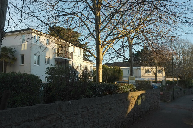
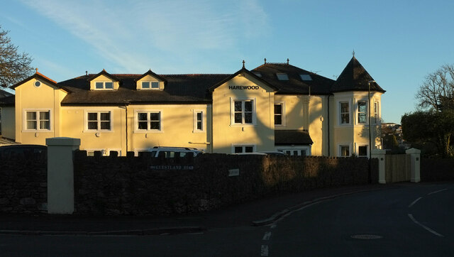
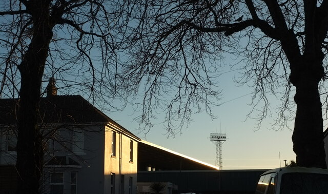
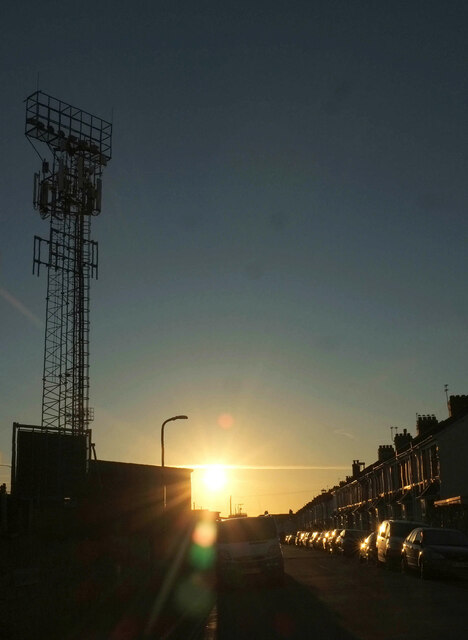
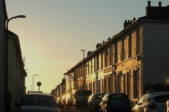
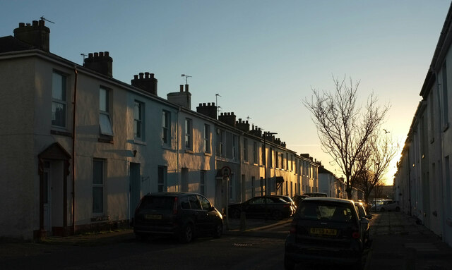
Stantaway Hill Images

Images are sourced within 2km of 50.476239/-3.5387217 or Grid Reference SX9065. Thanks to Geograph Open Source API. All images are credited.

Damage to wall by Torquay coach station The steps in question are shown at <a title="https://www.geograph.org.uk/search.php?i=200874342" href="https://www.geograph.org.uk/search.php?i=200874342">Link</a> . Slabs of coping have tipped onto the bank and there's a substantial crack in the stonework.
Damage to wall by Torquay coach station
The steps in question are shown at Link . Slabs of coping have tipped onto the bank and there's a substantial crack in the stonework.
Buildings on Stanley Road, Babbacombe Flats and Stanley Court on the left, and Hadleigh Court, a residential care home for the elderly.
Buildings on Stanley Road, Babbacombe
Flats and Stanley Court on the left, and Hadleigh Court, a residential care home for the elderly.
House, Babbacombe In late afternoon sunlight, at the corner of Guestland Road and Cary Park.
House, Babbacombe
In late afternoon sunlight, at the corner of Guestland Road and Cary Park.
Stand, Plainmoor The edge of the stand roof at Torquay United FC, seen from Devons Road, glints in the late afternoon sun. A symbol of better times ahead, perhaps - the club languishes in the National League South, tier 6 of the football league.
Stand, Plainmoor
The edge of the stand roof at Torquay United FC, seen from Devons Road, glints in the late afternoon sun. A symbol of better times ahead, perhaps - the club languishes in the National League South, tier 6 of the football league.
Marnham Road, Plainmoor On the left are floodlights at Torquay United FC.
Marnham Road, Plainmoor
On the left are floodlights at Torquay United FC.
Springfield Road, Plainmoor Terraced houses on the west side of the street, which is barred to through traffic by posts.
Springfield Road, Plainmoor
Terraced houses on the west side of the street, which is barred to through traffic by posts.
St Edmund's Road, Plainmoor Terraced houses on the east side of the street, seen from the junction with Fortune Way.
St Edmund's Road, Plainmoor
Terraced houses on the east side of the street, seen from the junction with Fortune Way.
Flats, Plainmoor On the right is the 11-flat Mulberry Court; on the left is Dunboyne Court, with 46 flats. In between are traffic lights at the crossroads of Warbro Road and Manor Road, and the junction of  Westhill Road and St Marychurch Road.
Flats, Plainmoor
On the right is the 11-flat Mulberry Court; on the left is Dunboyne Court, with 46 flats. In between are traffic lights at the crossroads of Warbro Road and Manor Road, and the junction of Westhill Road and St Marychurch Road.
Frosted leaves by Teignmouth Road, Torquay Fallen beech leaves predominate, plus a dandelion or two on a wide verge.
Frosted leaves by Teignmouth Road, Torquay
Fallen beech leaves predominate, plus a dandelion or two on a wide verge.
Blackthorn, Welsury Covert The hillside above Brown's Bridge Road shown in <a href="https://www.geograph.org.uk/photo/152267">SX8966 : Below Welsury Covert</a> at a different season.
Blackthorn, Welsury Covert
The hillside above Brown's Bridge Road shown in SX8966 : Below Welsury Covert at a different season.
Pussy willow, Brown's Bridge Looking along the railway line towards Torre from Brown's Bridge, with Salix caprea (Goat Willow) overhanging the line.
Pussy willow, Brown's Bridge
Looking along the railway line towards Torre from Brown's Bridge, with Salix caprea (Goat Willow) overhanging the line.
Pruned trees, The Willows An area of trees and bushes beside the steps and path connecting Wren Park to The Willows has been drastically cut back, allowing a clearer view of the car park should one wish for such a thing. On the right is the corner of Marks & Spencer.
Pruned trees, The Willows
An area of trees and bushes beside the steps and path connecting Wren Park to The Willows has been drastically cut back, allowing a clearer view of the car park should one wish for such a thing. On the right is the corner of Marks & Spencer.
Pillar box, Shiphay A George VI postbox (number TQ2 263) that's on Collaton Road (in the background) rather than Birch Walk as the street name suggests.
Pillar box, Shiphay
A George VI postbox (number TQ2 263) that's on Collaton Road (in the background) rather than Birch Walk as the street name suggests.
Sheep in orchard, Cockington Another view of the orchard shown in <a href="https://www.geograph.org.uk/photo/2401574">SX8964 : Sheep in orchard, Cockington</a>, with a conglomeration of the flock lurking in the shade by the gate, although it's not really sunny.
Sheep in orchard, Cockington
Another view of the orchard shown in SX8964 : Sheep in orchard, Cockington, with a conglomeration of the flock lurking in the shade by the gate, although it's not really sunny.
Comfrey and trolley, The Willows Comfrey growing by a remnant of natural(-ish) woodland beside Nicholson Road. The road is used instead of the car park for parking for Sainsbury's and there is no trolley point, with the result that many lazy shoppers leave trolleys alongside. Are they totally nuts?
Comfrey and trolley, The Willows
Comfrey growing by a remnant of natural(-ish) woodland beside Nicholson Road. The road is used instead of the car park for parking for Sainsbury's and there is no trolley point, with the result that many lazy shoppers leave trolleys alongside. Are they totally nuts?
Sainsbury's, The Willows <a href="https://www.geograph.org.uk/photo/2250825">SX8966 : Supermarket by night</a> by day. Note the way shoppers must cross a through exit road to enter the store.
Sainsbury's, The Willows
SX8966 : Supermarket by night by day. Note the way shoppers must cross a through exit road to enter the store.
Roses, Riviera Way Wild roses blooming and losing their petals by the A3022 dual carriageway.
Roses, Riviera Way
Wild roses blooming and losing their petals by the A3022 dual carriageway.
Drake Avenue, Cockington
Show me another place!

Stantaway Hill is located at Grid Ref: SX9065 (Lat: 50.476239, Lng: -3.5387217)

Unitary Authority: Torbay

Police Authority: Devon and Cornwall

What 3 Words

///mull.yours.weedy. Near Cockington, Devon

Related Wikis

The Breeze (South Devon)

The Breeze (South Devon) was an Independent Local Radio station serving South Devon, England. The station was folded into Greatest Hits Radio South West...

Ashfield, Torquay

Ashfield in Torquay, Devon was the childhood home of Agatha Christie. She lived there from her birth until the time of her marriage, and intermittently...

Torquay Academy

Torquay Academy is a coeducational secondary school and sixth form located in Torquay, Devon, England. Before 1 September 2012, it was known as Torquay...

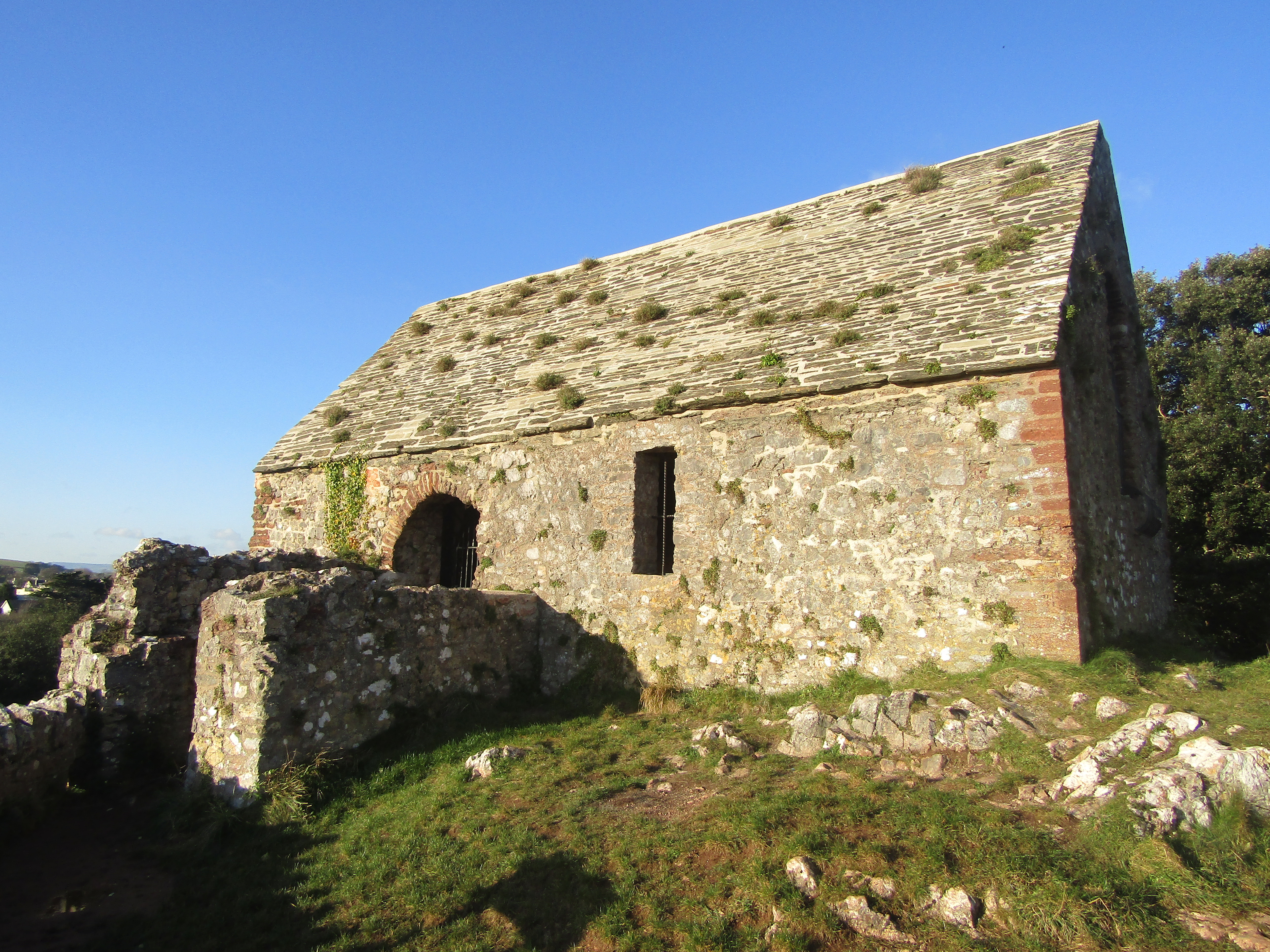
St Michael's Chapel, Torquay

St Michael's Chapel is a small, aisleless, medieval chapel situated on the summit of Chapel Hill, in Torquay, Devon. The structure is considered to date...

Nearby Amenities

Located within 500m of 50.476239,-3.5387217
Mini Roundabout
Direction: clockwise
Lat/Long: 50.4727084/-3.5368065
Mini Roundabout
Direction: clockwise
Lat/Long: 50.4738278/-3.535579
Crossing
Source: Bing
Lat/Long: 50.4755971/-3.5363173
Bus Stop
Bus: yes
Public Transport: platform
Lat/Long: 50.4725086/-3.5390345
Upton
Is In: Devon, England, UK
Place: suburb
Lat/Long: 50.4744088/-3.5364238
Bus Stop
Bus: yes
Public Transport: platform
Lat/Long: 50.4747084/-3.5414478
Turning Circle
Source: Bing
Lat/Long: 50.4743181/-3.5420838
Post Box
Brand: Royal Mail
Brand Wikidata: Q638098
Brand Wikipedia: en:Royal Mail
Collection Times: Mo-Fr 09:00; Sa 07:00; Su off
Operator: Royal Mail
Operator Wikidata: Q638098
Post Box Design: type_b
Post Box Mounting: stone_wall
Post Box Type: wall
Postal Code: TQ1
Ref: TQ1 36D
Royal Cypher: EVIIR
Royal Cypher Wikidata: Q33102324
Source: survey;streetlevel imagery;aerial imagery
Lat/Long: 50.4765852/-3.5329777
Post Box
Brand: Royal Mail
Brand Wikidata: Q638098
Brand Wikipedia: en:Royal Mail
Collection Times: Mo-Fr 09:00; Sa 07:00; Su off
Operator: Royal Mail
Operator Wikidata: Q638098
Post Box Design: type_c
Post Box Mounting: stone_wall
Post Box Type: wall
Ref: TQ1 16D
Royal Cypher: VR
Royal Cypher Wikidata: Q33102356
Source: survey;streetlevel imagery;aerial imagery
Lat/Long: 50.4725869/-3.5383219
Turning Circle
Lat/Long: 50.4734923/-3.5437653
Turning Circle
Lat/Long: 50.4794456/-3.5387632
Post Box
Brand: Royal Mail
Brand Wikidata: Q638098
Brand Wikipedia: en:Royal Mail
Collection Times: Mo-Fr 09:00; Sa 07:00; Su off
Operator: Royal Mail
Operator Wikidata: Q638098
Post Box Design: type_b
Post Box Type: pillar
Postal Code: TQ2
Ref: TQ2 234D
Royal Cypher: GVIR
Royal Cypher Wikidata: Q33102169
Source: survey;streetlevel imagery;aerial imagery
Lat/Long: 50.4804257/-3.5400572
Bus Stop
Barton Road
Naptan AtcoCode: 1190TOA01085
Naptan Bearing: S
Naptan CommonName: Barton Road
Naptan Landmark: Oak Lawn Court
Naptan NaptanCode: tbyjdjw
Naptan PlusbusZoneRef: NABT
Naptan Street: Barton Road
Naptan Verified: no
Source: naptan_import
Lat/Long: 50.4745522/-3.5433717
Bus Stop
Teignmouth Road
Naptan AtcoCode: 1190TOA01087
Naptan Bearing: N
Naptan CommonName: Teignmouth Road
Naptan NaptanCode: tbyjdmd
Naptan PlusbusZoneRef: NABT
Naptan Street: Teignmouth Road
Naptan Verified: no
Source: naptan_import
Lat/Long: 50.4723961/-3.5391159
Bus Stop
St Vincents Road
Bus: yes
Naptan AtcoCode: 1190TOA01088
Naptan Bearing: W
Naptan CommonName: St Vincents Road
Naptan NaptanCode: tbyjdmg
Naptan PlusbusZoneRef: NABT
Naptan Street: St Vincents Road
Naptan Verified: no
Public Transport: platform
Source: naptan_import
Lat/Long: 50.4747753/-3.5421528
Bus Stop
Dower Road
Bus: yes
Naptan AtcoCode: 1190TOA10656
Naptan Bearing: W
Naptan CommonName: Dower Road
Naptan Crossing: Dower Road
Naptan Indicator: Opp
Naptan NaptanCode: tbydtda
Naptan PlusbusZoneRef: NABT
Naptan ShortCommonName: Chatto Road
Naptan Street: Chatto Road
Naptan Verified: no
Public Transport: platform
Source: naptan_import
Lat/Long: 50.4781055/-3.5331138
Bus Stop
Chatto Road
Bus: yes
Naptan AtcoCode: 1190TOA10657
Naptan Bearing: E
Naptan CommonName: Chatto Road
Naptan Crossing: Shirburn Road
Naptan NaptanCode: tbydpwa
Naptan PlusbusZoneRef: NABT
Naptan ShortCommonName: Wrights Lane
Naptan Street: Chatto Road
Naptan Verified: no
Public Transport: platform
Source: naptan_import
Lat/Long: 50.4780037/-3.5340125
Bus Stop
Upton Road
Bus: yes
Naptan AtcoCode: 1190TOA10658
Naptan Bearing: N
Naptan CommonName: Upton Road
Naptan Crossing: Chatto Road
Naptan Indicator: Opp
Naptan NaptanCode: tbydpgt
Naptan PlusbusZoneRef: NABT
Naptan Street: Lymington Road
Naptan Verified: no
Public Transport: platform
Source: naptan_import
Lat/Long: 50.4756244/-3.5364301
Bus Stop
Upton Post Office
Bus: yes
Naptan AtcoCode: 1190TOA10660
Naptan Bearing: NW
Naptan CommonName: Upton Post Office
Naptan Crossing: Upton Road
Naptan NaptanCode: tbydpjt
Naptan PlusbusZoneRef: NABT
Naptan Street: St James Road
Naptan Verified: no
Public Transport: platform
Source: naptan_import
Lat/Long: 50.4753671/-3.5361681
Bus Stop
Coach Station
Bus: yes
Naptan AtcoCode: 1190TOA10662
Naptan Bearing: NE
Naptan CommonName: Coach Station
Naptan Crossing: Lower Thurlow Road
Naptan NaptanCode: tbydpjm
Naptan PlusbusZoneRef: NABT
Naptan Street: Lymington Road
Naptan Verified: no
Public Transport: platform
Source: naptan_import
Lat/Long: 50.4734147/-3.5362176
Bus Stop
Coach Station
Bus: yes
Naptan AtcoCode: 1190TOA10663
Naptan Bearing: SW
Naptan CommonName: Coach Station
Naptan Crossing: Lower Thurlow Road
Naptan Indicator: Opp
Naptan NaptanCode: tbydpja
Naptan PlusbusZoneRef: NABT
Naptan Street: Lymington Road
Naptan Verified: no
Public Transport: platform
Source: naptan_import
Lat/Long: 50.4730988/-3.536306
Bus Stop
Upton Park
Bus: yes
Naptan AtcoCode: 1190TOA10664
Naptan Bearing: S
Naptan CommonName: Upton Park
Naptan Indicator: Opp
Naptan NaptanCode: tbydpdw
Naptan PlusbusZoneRef: NABT
Naptan Street: Lymington Road
Naptan Verified: no
Public Transport: platform
Source: naptan_import
Lat/Long: 50.472427/-3.5367775
Bus Stop
Torquay Community College
Bus: yes
Naptan AtcoCode: 1190TOA10902
Naptan Bearing: S
Naptan CommonName: Torquay Community College
Naptan Crossing: Cricketfield Road
Naptan NaptanCode: tbydmda
Naptan PlusbusZoneRef: NABT
Naptan Street: Parkhurst Road
Naptan Verified: no
Public Transport: platform
Source: naptan_import
Lat/Long: 50.4778379/-3.5431545
Bus Stop
Parkhurst Road
Bus: yes
Naptan AtcoCode: 1190TOA10903
Naptan Bearing: SW
Naptan CommonName: Parkhurst Road
Naptan Crossing: Cricketfield Road
Naptan NaptanCode: tbydmdp
Naptan PlusbusZoneRef: NABT
Naptan Street: St Vincent's Road
Naptan Verified: no
Public Transport: platform
Source: naptan_import
Lat/Long: 50.4758389/-3.5426525
Bus Stop
St.vincents Road
Bus: yes
Naptan AtcoCode: 1190TOA10904
Naptan Bearing: NE
Naptan CommonName: St.vincents Road
Naptan Crossing: Teignmouth Road
Naptan NaptanCode: tbydmpt
Naptan PlusbusZoneRef: NABT
Naptan Street: St Vincent's Road
Naptan Verified: no
Public Transport: platform
Source: naptan_import
Lat/Long: 50.4750314/-3.5404699
Bus Stop
Upton Road
Bus: yes
Naptan AtcoCode: 1190TOA10905
Naptan Bearing: NE
Naptan CommonName: Upton Road
Naptan Crossing: Magdalene Road
Naptan NaptanCode: tbydpaj
Naptan PlusbusZoneRef: NABT
Naptan Street: Upton Road
Naptan Verified: no
Public Transport: platform
Source: naptan_import
Lat/Long: 50.4725493/-3.5384162
Bus Stop
Cricket Field Road
Bus: yes
Naptan AtcoCode: 1190TOA88877
Naptan Bearing: W
Naptan CommonName: Cricket Field Road
Naptan Crossing: Park Hurst Road
Naptan NaptanCode: tbyjajm
Naptan PlusbusZoneRef: NABT
Naptan Street: Torquay Community College
Naptan Verified: no
Public Transport: platform
Source: naptan_import
Lat/Long: 50.4779765/-3.5422006
Bus Stop
Torquay Community College
Bus: yes
Naptan AtcoCode: 1190TOA88879
Naptan Bearing: E
Naptan CommonName: Torquay Community College
Naptan Crossing: Parkhurst Road
Naptan NaptanCode: tbyjajt
Naptan PlusbusZoneRef: NABT
Naptan Street: Cricket Filed Road
Naptan Verified: no
Public Transport: platform
Source: naptan_import
Lat/Long: 50.4781475/-3.5435452
Bus Stop
Torquay Community College
Bus: yes
Naptan AtcoCode: 1190TOZ00850
Naptan Bearing: N
Naptan CommonName: Torquay Community College
Naptan Crossing: Cricketfield Road
Naptan NaptanCode: tbydmaw
Naptan PlusbusZoneRef: NABT
Naptan Street: Parkhurst Road
Naptan Verified: no
Public Transport: platform
Source: naptan_import
Lat/Long: 50.4774122/-3.5433803
Bus Stop
Parkhurst Road
Bus: yes
Naptan AtcoCode: 1190TOZ00851
Naptan Bearing: N
Naptan CommonName: Parkhurst Road
Naptan Crossing: Cricketfield Road
Naptan NaptanCode: tbydmdm
Naptan PlusbusZoneRef: NABT
Naptan Street: Arthington
Naptan Verified: no
Public Transport: platform
Source: naptan_import
Lat/Long: 50.4759455/-3.5427546
Post Box
Brand: Royal Mail
Brand Wikidata: Q638098
Brand Wikipedia: en:Royal Mail
Collection Times: Mo-Fr 09:00; Sa 07:00; Su off
Operator: Royal Mail
Operator Wikidata: Q638098
Post Box Design: type_b
Post Box Type: pillar
Ref: TQ1 347D
Royal Cypher: EIIR
Royal Cypher Wikidata: Q33102113
Source: survey;streetlevel imagery;aerial imagery
Lat/Long: 50.4731082/-3.5365699
Post Box
Brand: Royal Mail
Brand Wikidata: Q638098
Brand Wikipedia: en:Royal Mail
Collection Times: Mo-Fr 09:00; Sa 07:00; Su off
Operator: Royal Mail
Operator Wikidata: Q638098
Post Box Design: type_b
Post Box Mounting: brick_pillar
Post Box Type: wall
Ref: TQ1 77D
Royal Cypher: GR
Royal Cypher Wikidata: Q33102273
Source: survey;streetlevel imagery;aerial imagery
Lat/Long: 50.4750862/-3.5437065
Noexit: yes
Lat/Long: 50.4773474/-3.5327329
Barrier: bollard
Lat/Long: 50.4734562/-3.5408407
Desc Os: Daison Rock
Man Made: survey_point
Ref Os: SX76/T99
Source Posn: OS_OpenData_SurveyPoints
Lat/Long: 50.478932/-3.5357922
Post Box
Brand: Royal Mail
Brand Wikidata: Q638098
Brand Wikipedia: en:Royal Mail
Collection Times: Mo-Fr 09:00; Sa 07:00; Su off
Operator: Royal Mail
Operator Wikidata: Q638098
Post Box Mounting: stone_wall
Post Box Type: wall
Ref: TQ1 43D
Royal Cypher: VR
Royal Cypher Wikidata: Q33102356
Source: survey;streetlevel imagery;aerial imagery
Lat/Long: 50.472803/-3.5344806
Post Box
Brand: Royal Mail
Brand Wikidata: Q638098
Brand Wikipedia: en:Royal Mail
Collection Times: Mo-Fr 16:45; Sa 12:00; Su off
Drive Through: no
Operator: Royal Mail
Operator Wikidata: Q638098
Post Box Design: type_a
Post Box Type: pillar
Ref: TQ1 99
Royal Cypher: EIIR
Royal Cypher Wikidata: Q33102113
Source: survey;streetlevel imagery;aerial imagery;local knowledge
Lat/Long: 50.4752214/-3.5359948
Post Box
Brand: Royal Mail
Brand Wikidata: Q638098
Brand Wikipedia: en:Royal Mail
Collection Times: Mo-Fr 09:00; Sa 07:00; Su off
Operator: Royal Mail
Operator Wikidata: Q638098
Post Box Design: type_b
Post Box Mounting: stone_wall
Post Box Type: wall
Ref: TQ2 45D
Royal Cypher: EIIR
Royal Cypher Wikidata: Q33102113
Source: survey;streetlevel imagery;aerial imagery;local knowledge
Lat/Long: 50.47808/-3.5432816
Post Office
Lymington Road Post Office
Addr City: Torquay
Addr Housenumber: 189
Addr Postcode: TQ1 4AU
Addr Street: Lymington Road
Opening Hours: Mo-Sa 06:00-22:30; Su 07:00-21:30
Ref Pol Id: 149127
Source: pol_branch_list_2020‑11‑13
Lat/Long: 50.4751656/-3.5359076
Generator Method: photovoltaic
Generator Output Electricity: yes
Generator Source: solar
Generator Type: solar_photovoltaic_panel
Location: roof
Power: generator
Lat/Long: 50.4755971/-3.5347272
Generator Method: photovoltaic
Generator Output Electricity: yes
Generator Source: solar
Generator Type: solar_photovoltaic_panel
Location: roof
Power: generator
Lat/Long: 50.4761503/-3.5439072
Generator Method: photovoltaic
Generator Output Electricity: yes
Generator Source: solar
Generator Type: solar_photovoltaic_panel
Location: roof
Power: generator
Lat/Long: 50.4774436/-3.5444175
Generator Method: photovoltaic
Generator Output Electricity: yes
Generator Source: solar
Generator Type: solar_photovoltaic_panel
Location: roof
Power: generator
Lat/Long: 50.4773181/-3.5441882
Generator Method: photovoltaic
Generator Output Electricity: yes
Generator Source: solar
Generator Type: solar_photovoltaic_panel
Location: roof
Power: generator
Lat/Long: 50.4769805/-3.5431202
Generator Method: photovoltaic
Generator Output Electricity: yes
Generator Source: solar
Generator Type: solar_photovoltaic_panel
Location: roof
Power: generator
Lat/Long: 50.4778093/-3.5422816
Generator Method: photovoltaic
Generator Output Electricity: yes
Generator Source: solar
Generator Type: solar_photovoltaic_panel
Location: roof
Power: generator
Lat/Long: 50.4778648/-3.5435442
Generator Method: photovoltaic
Generator Output Electricity: yes
Generator Source: solar
Generator Type: solar_photovoltaic_panel
Location: roof
Power: generator
Lat/Long: 50.4738573/-3.5332357
Generator Method: photovoltaic
Generator Output Electricity: yes
Generator Source: solar
Generator Type: solar_photovoltaic_panel
Location: roof
Power: generator
Lat/Long: 50.4739051/-3.5332257
Generator Method: photovoltaic
Generator Output Electricity: yes
Generator Source: solar
Generator Type: solar_photovoltaic_panel
Location: roof
Power: generator
Lat/Long: 50.4766785/-3.5329655
Post Box
Brand: Royal Mail
Brand Wikidata: Q638098
Brand Wikipedia: en:Royal Mail
Collection Times: Mo-Fr 09:00; Sa 07:00; Su off
Note: Post box with brick surround in stone wall
Operator: Royal Mail
Operator Wikidata: Q638098
Post Box Design: type_b
Post Box Mounting: stone_wall
Post Box Type: wall
Ref: TQ1 13D
Royal Cypher: GR
Royal Cypher Wikidata: Q33102273
Source: survey;streetlevel imagery;aerial imagery
Lat/Long: 50.4753019/-3.5401037
Morrisons Daily
Addr Country: GB
Addr Housenumber: 189
Addr Postcode: TQ1 4AU
Addr Street: Lymington Road
Brand: Morrisons Daily
Brand Wikidata: Q99752411
Fhrs Id: 709540
Operator: McColl's
Operator Wikidata: Q16997477
Shop: convenience
Website: https://my.morrisons.com/storefinder/65919/morrisons-daily-torquay-lymington-road
Lat/Long: 50.4751934/-3.5359218
The data included in this document is from www.openstreetmap.org. The data is made available under ODbL.

Have you been to Stantaway Hill?

Leave your review of Stantaway Hill below (or comments, questions and feedback).