Hele

Settlement in Devon

England

Hele

Damage to wall by Torquay coach station The steps in question are shown at <a title="https://www.geograph.org.uk/search.php?i=200874342" href="https://www.geograph.org.uk/search.php?i=200874342">Link</a> . Slabs of coping have tipped onto the bank and there's a substantial crack in the stonework.
Damage to wall by Torquay coach station Credit: Derek Harper

Hele is a small village located in the South Hams district of Devon, England. Situated approximately 3 miles west of Dartmouth and 5 miles south of Totnes, Hele is nestled in a picturesque and rural setting. The village is surrounded by rolling hills, lush green fields, and woodlands, providing stunning views and a tranquil atmosphere.

Hele is known for its quaint and charming character, with many traditional thatched cottages and historic buildings. The village exudes a sense of history, with evidence of its past evident in the local architecture. The notable St. Helen's Church, dating back to the 13th century, stands as a prominent landmark.

Although small in size, Hele offers a range of amenities to its residents and visitors. There is a village shop, providing essential supplies and local produce, and a welcoming pub that serves hearty meals and refreshing beverages. The village also boasts a vibrant community spirit, with various events and activities organized throughout the year.

The surrounding area of Hele offers plenty of opportunities for outdoor enthusiasts. Nearby, there are numerous walking and cycling routes, allowing visitors to explore the stunning countryside. Additionally, the village is within close proximity to the stunning South Devon coastline, providing access to beautiful beaches and coastal walks.

Hele provides a peaceful and idyllic retreat for those seeking a rural escape in the heart of Devon. With its charming character, beautiful surroundings, and strong sense of community, Hele offers a quintessential village experience.

If you have any feedback on the listing, please let us know in the comments section below.
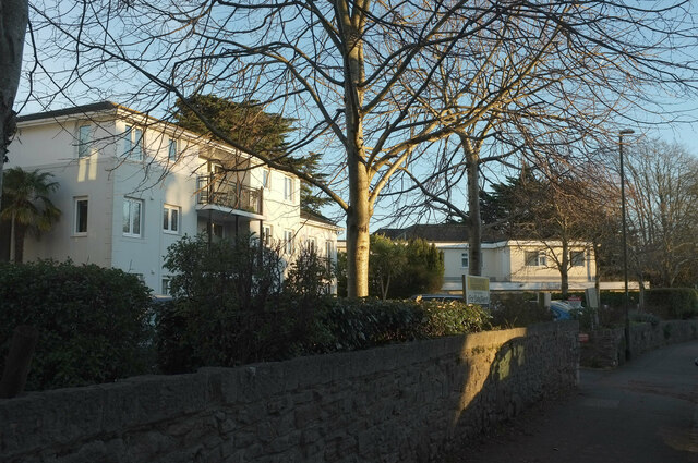
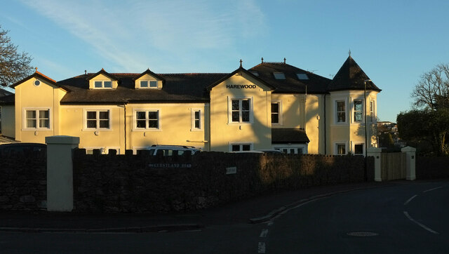
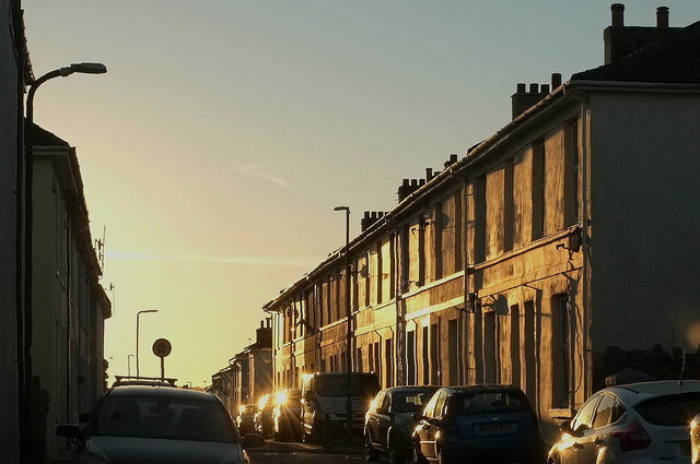
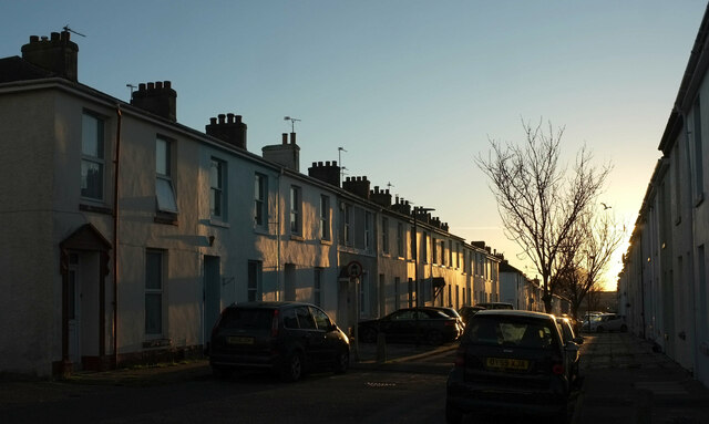
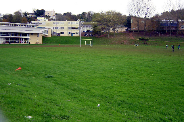
Hele Images

Images are sourced within 2km of 50.482669/-3.538463 or Grid Reference SX9065. Thanks to Geograph Open Source API. All images are credited.

Damage to wall by Torquay coach station The steps in question are shown at <a title="https://www.geograph.org.uk/search.php?i=200874342" href="https://www.geograph.org.uk/search.php?i=200874342">Link</a> . Slabs of coping have tipped onto the bank and there's a substantial crack in the stonework.
Damage to wall by Torquay coach station
The steps in question are shown at Link . Slabs of coping have tipped onto the bank and there's a substantial crack in the stonework.
Buildings on Stanley Road, Babbacombe Flats and Stanley Court on the left, and Hadleigh Court, a residential care home for the elderly.
Buildings on Stanley Road, Babbacombe
Flats and Stanley Court on the left, and Hadleigh Court, a residential care home for the elderly.
House, Babbacombe In late afternoon sunlight, at the corner of Guestland Road and Cary Park.
House, Babbacombe
In late afternoon sunlight, at the corner of Guestland Road and Cary Park.
Stand, Plainmoor The edge of the stand roof at Torquay United FC, seen from Devons Road, glints in the late afternoon sun. A symbol of better times ahead, perhaps - the club languishes in the National League South, tier 6 of the football league.
Stand, Plainmoor
The edge of the stand roof at Torquay United FC, seen from Devons Road, glints in the late afternoon sun. A symbol of better times ahead, perhaps - the club languishes in the National League South, tier 6 of the football league.
Marnham Road, Plainmoor On the left are floodlights at Torquay United FC.
Marnham Road, Plainmoor
On the left are floodlights at Torquay United FC.
Springfield Road, Plainmoor Terraced houses on the west side of the street, which is barred to through traffic by posts.
Springfield Road, Plainmoor
Terraced houses on the west side of the street, which is barred to through traffic by posts.
St Edmund's Road, Plainmoor Terraced houses on the east side of the street, seen from the junction with Fortune Way.
St Edmund's Road, Plainmoor
Terraced houses on the east side of the street, seen from the junction with Fortune Way.
Flats, Plainmoor On the right is the 11-flat Mulberry Court; on the left is Dunboyne Court, with 46 flats. In between are traffic lights at the crossroads of Warbro Road and Manor Road, and the junction of  Westhill Road and St Marychurch Road.
Flats, Plainmoor
On the right is the 11-flat Mulberry Court; on the left is Dunboyne Court, with 46 flats. In between are traffic lights at the crossroads of Warbro Road and Manor Road, and the junction of Westhill Road and St Marychurch Road.
Frosted leaves by Teignmouth Road, Torquay Fallen beech leaves predominate, plus a dandelion or two on a wide verge.
Frosted leaves by Teignmouth Road, Torquay
Fallen beech leaves predominate, plus a dandelion or two on a wide verge.
Blackthorn, Welsury Covert The hillside above Brown's Bridge Road shown in <a href="https://www.geograph.org.uk/photo/152267">SX8966 : Below Welsury Covert</a> at a different season.
Blackthorn, Welsury Covert
The hillside above Brown's Bridge Road shown in SX8966 : Below Welsury Covert at a different season.
Pussy willow, Brown's Bridge Looking along the railway line towards Torre from Brown's Bridge, with Salix caprea (Goat Willow) overhanging the line.
Pussy willow, Brown's Bridge
Looking along the railway line towards Torre from Brown's Bridge, with Salix caprea (Goat Willow) overhanging the line.
Pruned trees, The Willows An area of trees and bushes beside the steps and path connecting Wren Park to The Willows has been drastically cut back, allowing a clearer view of the car park should one wish for such a thing. On the right is the corner of Marks & Spencer.
Pruned trees, The Willows
An area of trees and bushes beside the steps and path connecting Wren Park to The Willows has been drastically cut back, allowing a clearer view of the car park should one wish for such a thing. On the right is the corner of Marks & Spencer.
Pillar box, Shiphay A George VI postbox (number TQ2 263) that's on Collaton Road (in the background) rather than Birch Walk as the street name suggests.
Pillar box, Shiphay
A George VI postbox (number TQ2 263) that's on Collaton Road (in the background) rather than Birch Walk as the street name suggests.
Comfrey and trolley, The Willows Comfrey growing by a remnant of natural(-ish) woodland beside Nicholson Road. The road is used instead of the car park for parking for Sainsbury's and there is no trolley point, with the result that many lazy shoppers leave trolleys alongside. Are they totally nuts?
Comfrey and trolley, The Willows
Comfrey growing by a remnant of natural(-ish) woodland beside Nicholson Road. The road is used instead of the car park for parking for Sainsbury's and there is no trolley point, with the result that many lazy shoppers leave trolleys alongside. Are they totally nuts?
Sainsbury's, The Willows <a href="https://www.geograph.org.uk/photo/2250825">SX8966 : Supermarket by night</a> by day. Note the way shoppers must cross a through exit road to enter the store.
Sainsbury's, The Willows
SX8966 : Supermarket by night by day. Note the way shoppers must cross a through exit road to enter the store.
Roses, Riviera Way Wild roses blooming and losing their petals by the A3022 dual carriageway.
Roses, Riviera Way
Wild roses blooming and losing their petals by the A3022 dual carriageway.
Formerly flooded area at the Willows, Torquay Another view of <a href="https://www.geograph.org.uk/photo/1562179">SX8966 : Formerly flooded area at the Willows, Torquay</a>, which is now knee-deep in mint and smelling unexpectedly pleasant; I was expecting stagnant water and traffic fumes.
Formerly flooded area at the Willows, Torquay
Another view of SX8966 : Formerly flooded area at the Willows, Torquay, which is now knee-deep in mint and smelling unexpectedly pleasant; I was expecting stagnant water and traffic fumes.
Walkway, The Willows Taken from approximately the same spot as <a href="https://www.geograph.org.uk/photo/2092042">SX8966 : Walkway, The Willows</a> and a reverse view of <a href="https://www.geograph.org.uk/photo/1777969">SX8966 : Path at The Willows</a>.
Walkway, The Willows
Taken from approximately the same spot as SX8966 : Walkway, The Willows and a reverse view of SX8966 : Path at The Willows.
Show me another place!

Hele is located at Grid Ref: SX9065 (Lat: 50.482669, Lng: -3.538463)

Unitary Authority: Torbay

Police Authority: Devon and Cornwall

What 3 Words

///supper.healthier.unit. Near Cockington, Devon

Related Wikis

Torquay Academy

Torquay Academy is a coeducational secondary school and sixth form located in Torquay, Devon, England. Before 1 September 2012, it was known as Torquay...
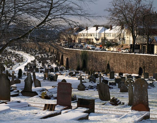
Torquay Cemetery

Torquay Cemetery, also known as Barton Road Cemetery is a burial ground located in the town of Torquay, Devon, England. The first interment, which took...

St Cuthbert Mayne School

St Cuthbert Mayne School is a coeducational secondary school and sixth form located in Torquay in the English county of Devon. The school is named after...

The Breeze (South Devon)

The Breeze (South Devon) was an Independent Local Radio station serving South Devon, England. The station was folded into Greatest Hits Radio South West...

Nearby Amenities

Located within 500m of 50.482669,-3.538463
Mini Roundabout
Direction: clockwise
Lat/Long: 50.4830545/-3.5347369
Mini Roundabout
Direction: clockwise
Lat/Long: 50.4832025/-3.5344452
Hele
Is In: Devon, England, UK
Place: suburb
Lat/Long: 50.482664/-3.5373208
Turning Circle
Lat/Long: 50.4794456/-3.5387632
Post Box
Brand: Royal Mail
Brand Wikidata: Q638098
Brand Wikipedia: en:Royal Mail
Collection Times: Mo-Fr 09:00; Sa 07:00; Su off
Operator: Royal Mail
Operator Wikidata: Q638098
Post Box Design: type_b
Post Box Type: pillar
Postal Code: TQ2
Ref: TQ2 234D
Royal Cypher: GVIR
Royal Cypher Wikidata: Q33102169
Source: survey;streetlevel imagery;aerial imagery
Lat/Long: 50.4804257/-3.5400572
Post Box
Brand: Royal Mail
Brand Wikidata: Q638098
Brand Wikipedia: en:Royal Mail
Collection Times: Mo-Fr 09:00, Sa 07:00; Su off
Operator: Royal Mail
Operator Wikidata: Q638098
Post Box Design: type_b
Post Box Type: pillar
Postal Code: TQ2
Ref: TQ2 84D
Royal Cypher: EIIR
Royal Cypher Wikidata: Q33102113
Source: survey;streetlevel imagery;aerial imagery
Lat/Long: 50.4817608/-3.5435598
Barrier: bollard
Bicycle: yes
Foot: yes
Motorcar: no
Lat/Long: 50.4869017/-3.5391353
Bus Stop
Lat/Long: 50.4858721/-3.5374526
Post Box
Brand: Royal Mail
Brand Wikidata: Q638098
Brand Wikipedia: en:Royal Mail
Collection Times: Mo-Fr 09:00; Sa 07:00; Su off
Operator: Royal Mail
Operator Wikidata: Q638098
Post Box Design: type_b
Post Box Mounting: brick_pillar
Post Box Type: wall
Postal Code: TQ2
Ref: TQ2 336D
Royal Cypher: EIIR
Royal Cypher Wikidata: Q33102113
Source: survey;streetlevel imagery;aerial imagery
Lat/Long: 50.4854155/-3.5365711
Barrier: bollard
Lat/Long: 50.4853303/-3.5389342
Barrier: bollard
Lat/Long: 50.4851989/-3.5390866
Post Box
Brand: Royal Mail
Brand Wikidata: Q638098
Brand Wikipedia: en:Royal Mail
Collection Times: Mo-Fr 09:00; Sa 07:00; Su off
Drive Through: no
Operator: Royal Mail
Operator Wikidata: Q638098
Post Box Design: type_a
Post Box Type: pillar
Postal Code: TQ2
Ref: TQ2 40D
Royal Cypher: EIIR
Royal Cypher Wikidata: Q33102113
Source: survey;streetlevel imagery;aerial imagery
Lat/Long: 50.484901/-3.5332456
Turning Circle
Lat/Long: 50.4862302/-3.5404225
Bus Stop
Cuthbert Mayne School
Naptan AtcoCode: 1190TOA01103
Naptan Bearing: N
Naptan CommonName: Cuthbert Mayne School
Naptan Crossing: Combe Road
Naptan Landmark: School
Naptan NaptanCode: tbyjdpa
Naptan ShortCommonName: Cuthbert Mayne
Naptan Street: Teignmouth Road
Naptan Verified: no
Source: naptan_import
Lat/Long: 50.4845593/-3.5334072
Bus Stop
Harmsworth House
Bus: yes
Naptan AtcoCode: 1190TOA10643
Naptan Bearing: S
Naptan CommonName: Harmsworth House
Naptan Crossing: Dorchester Grove
Naptan Landmark: Gas Works
Naptan NaptanCode: tbydmja
Naptan PlusbusZoneRef: NABT
Naptan Street: Barton Hill Road
Naptan Verified: no
Public Transport: platform
Source: naptan_import
Lat/Long: 50.4861431/-3.5421845
Bus Stop
Hele Cross
Naptan AtcoCode: 1190TOA10644
Naptan Bearing: E
Naptan CommonName: Hele Cross
Naptan NaptanCode: tbydmpg
Naptan PlusbusZoneRef: NABT
Naptan ShortCommonName: Hele Plymco
Naptan Street: Hele Road
Naptan Verified: no
Shelter: yes
Source: naptan_import
Lat/Long: 50.4850416/-3.5411478
Bus Stop
Hele Cross
Naptan AtcoCode: 1190TOA10645
Naptan Bearing: W
Naptan CommonName: Hele Cross
Naptan Indicator: Opp Plymco
Naptan NaptanCode: tbydmta
Naptan PlusbusZoneRef: NABT
Naptan Street: Hele Road
Naptan Verified: no
Shelter: yes
Source: naptan_import
Lat/Long: 50.4849888/-3.5403849
Bus Stop
Hele Village
Bench: no
Bin: no
Lit: yes
Naptan AtcoCode: 1190TOA10646
Naptan Bearing: SE
Naptan CommonName: Hele Village
Naptan Crossing: Hele Road
Naptan NaptanCode: tbydpad
Naptan PlusbusZoneRef: NABT
Naptan Street: Orchard Road
Naptan Verified: no
Shelter: no
Source: naptan_import
Tactile Paving: no
Lat/Long: 50.4847289/-3.5389526
Bus Stop
Hele Village
Naptan AtcoCode: 1190TOA10647
Naptan Bearing: NW
Naptan CommonName: Hele Village
Naptan Crossing: Orchard Road
Naptan NaptanCode: tbydpat
Naptan PlusbusZoneRef: NABT
Naptan Street: Hele Road
Naptan Verified: no
Source: naptan_import
Lat/Long: 50.4843472/-3.5385737
Bus Stop
Hele Road
Bench: no
Bin: no
Lit: yes
Naptan AtcoCode: 1190TOA10649
Naptan Bearing: SE
Naptan CommonName: Hele Road
Naptan Crossing: Westhill Road
Naptan NaptanCode: tbydpmt
Naptan PlusbusZoneRef: NABT
Naptan Street: Teignmouth Road
Naptan Verified: no
Shelter: no
Source: naptan_import
Tactile Paving: no
Lat/Long: 50.4833458/-3.5353978
Bus Stop
West Hill Road
Bench: no
Bin: no
Lit: yes
Naptan AtcoCode: 1190TOA10650
Naptan Bearing: NW
Naptan CommonName: West Hill Road
Naptan Crossing: Teignmouth Road
Naptan NaptanCode: tbydpwp
Naptan PlusbusZoneRef: NABT
Naptan ShortCommonName: Cuthbert Mayne School
Naptan Street: Westhill Road
Naptan Verified: no
Shelter: no
Source: naptan_import
Tactile Paving: no
Lat/Long: 50.4828904/-3.5337902
Bus Stop
Cuthbert Mayne School
Naptan AtcoCode: 1190TOA10899
Naptan Bearing: SW
Naptan CommonName: Cuthbert Mayne School
Naptan Crossing: Trumlands Road
Naptan NaptanCode: tbydtat
Naptan PlusbusZoneRef: NABT
Naptan Street: Teignmouth Road
Naptan Verified: no
Source: naptan_import
Lat/Long: 50.484389/-3.5333594
Bus Stop
Truro Avenue
Naptan AtcoCode: 1190TOA10912
Naptan Bearing: S
Naptan CommonName: Truro Avenue
Naptan Crossing: Lichfield Avenue
Naptan NaptanCode: tbydpjw
Naptan PlusbusZoneRef: NABT
Naptan Street: Truro Avenue
Naptan Verified: no
Source: naptan_import
Lat/Long: 50.4852039/-3.5363602
Bus Stop
Truro Avenue
Naptan AtcoCode: 1190TOA10915
Naptan Bearing: E
Naptan CommonName: Truro Avenue
Naptan Crossing: Truro Avenue
Naptan NaptanCode: tbydpmw
Naptan PlusbusZoneRef: NABT
Naptan Street: Lincoln Green
Naptan Verified: no
Source: naptan_import
Lat/Long: 50.4840929/-3.5353515
Bus Stop
Barton Hill Road
Bus: yes
Naptan AtcoCode: 1190TOA88860
Naptan Bearing: N
Naptan CommonName: Barton Hill Road
Naptan NaptanCode: tbyjada
Naptan PlusbusZoneRef: NABT
Naptan Street: Barton Hill Road
Naptan Verified: no
Public Transport: platform
Source: naptan_import
Lat/Long: 50.4863976/-3.5422653
Bus Stop
Barton Road
Naptan AtcoCode: 1190TOA88878
Naptan Bearing: N
Naptan CommonName: Barton Road
Naptan Crossing: Cemetry
Naptan NaptanCode: tbyjajp
Naptan PlusbusZoneRef: NABT
Naptan Street: Barton Road
Naptan Verified: no
Source: naptan_import
Lat/Long: 50.4832458/-3.5429642
Bus Stop
Hele Cross
Naptan AtcoCode: 1190TOA88880
Naptan Bearing: S
Naptan CommonName: Hele Cross
Naptan Crossing: Hele Cross
Naptan NaptanCode: tbyjama
Naptan PlusbusZoneRef: NABT
Naptan Street: Barton Road
Naptan Verified: no
Source: naptan_import
Lat/Long: 50.4846128/-3.5422898
Bus Stop
Barton Road
Naptan AtcoCode: 1190TOA88881
Naptan Bearing: S
Naptan CommonName: Barton Road
Naptan Crossing: Opposite Cemetry
Naptan NaptanCode: tbyjamd
Naptan PlusbusZoneRef: NABT
Naptan Street: Barton Road
Naptan Verified: no
Source: naptan_import
Lat/Long: 50.4829403/-3.5429401
Bus Stop
Hele Road Cemetery
Naptan AtcoCode: 1190TOX28460
Naptan Bearing: E
Naptan CommonName: Hele Road Cemetery
Naptan NaptanCode: tbydmad
Naptan PlusbusZoneRef: NABT
Naptan Street: Hele Road
Naptan Verified: no
Source: naptan_import
Lat/Long: 50.4846672/-3.5442932
Bus Stop
Hele Road Cemetery
Naptan AtcoCode: 1190TOX28461
Naptan Bearing: W
Naptan CommonName: Hele Road Cemetery
Naptan Indicator: Opp
Naptan NaptanCode: tbydmat
Naptan PlusbusZoneRef: NABT
Naptan Street: Hele Road
Naptan Verified: no
Source: naptan_import
Lat/Long: 50.4846544/-3.5438981
Bus Stop
Cuthbert Mayne School
Bench: no
Bin: no
Lit: yes
Naptan AtcoCode: 1190TOX28462
Naptan Bearing: SE
Naptan CommonName: Cuthbert Mayne School
Naptan Crossing: Shelley Avenue
Naptan NaptanCode: tbydtaw
Naptan PlusbusZoneRef: NABT
Naptan Street: Westhill Road
Naptan Verified: no
Shelter: no
Source: naptan_import
Tactile Paving: no
Lat/Long: 50.4828431/-3.5332812
Bus Stop
Torquay Community College
Naptan AtcoCode: 1190TOZ00824
Naptan Bearing: NE
Naptan CommonName: Torquay Community College
Naptan Crossing: Woodland Road
Naptan NaptanCode: tbydjwa
Naptan PlusbusZoneRef: NABT
Naptan Street: Barton Road
Naptan Verified: no
Source: naptan_import
Lat/Long: 50.4809035/-3.5446075
Desc Os: Daison Rock
Man Made: survey_point
Ref Os: SX76/T99
Source Posn: OS_OpenData_SurveyPoints
Lat/Long: 50.478932/-3.5357922
Post Box
Brand: Royal Mail
Brand Wikidata: Q638098
Brand Wikipedia: en:Royal Mail
Collection Times: Mo-Fr 09:00; Sa 07:00; Su off
Operator: Royal Mail
Operator Wikidata: Q638098
Post Box Design: type_a
Post Box Type: pillar
Ref: TQ2 106D
Royal Cypher: EIIR
Royal Cypher Wikidata: Q33102113
Source: survey;streetlevel imagery;aerial imagery;local knowledge
Lat/Long: 50.4851101/-3.5405482
Crossing
Button Operated: yes
Crossing: traffic_signals
Crossing Island: no
Tactile Paving: yes
Lat/Long: 50.4849994/-3.5410578
Armadillo Torquay
Addr City: Torquay
Addr Postcode: TQ2 8JH
Addr Street: Barton Hill Road
Shop: storage_rental
Lat/Long: 50.4853439/-3.5418018
Parking
Parking: surface
Lat/Long: 50.4850792/-3.541885
Generator Method: photovoltaic
Generator Output Electricity: yes
Generator Source: solar
Generator Type: solar_photovoltaic_panel
Location: roof
Power: generator
Lat/Long: 50.4832209/-3.5420532
Generator Method: photovoltaic
Generator Output Electricity: yes
Generator Source: solar
Generator Type: solar_photovoltaic_panel
Location: roof
Power: generator
Lat/Long: 50.4832056/-3.5419888
Generator Method: photovoltaic
Generator Output Electricity: yes
Generator Source: solar
Generator Type: solar_photovoltaic_panel
Location: roof
Power: generator
Lat/Long: 50.4831407/-3.5418413
Generator Method: photovoltaic
Generator Output Electricity: yes
Generator Source: solar
Generator Type: solar_photovoltaic_panel
Location: roof
Power: generator
Lat/Long: 50.4832056/-3.5413665
Generator Method: photovoltaic
Generator Output Electricity: yes
Generator Source: solar
Generator Type: solar_photovoltaic_panel
Location: roof
Power: generator
Lat/Long: 50.4830212/-3.5424689
Generator Method: photovoltaic
Generator Output Electricity: yes
Generator Source: solar
Generator Type: solar_photovoltaic_panel
Location: roof
Power: generator
Lat/Long: 50.4824683/-3.5429088
Generator Method: photovoltaic
Generator Output Electricity: yes
Generator Source: solar
Generator Type: solar_photovoltaic_panel
Location: roof
Power: generator
Lat/Long: 50.4822754/-3.5418815
Generator Method: photovoltaic
Generator Output Electricity: yes
Generator Source: solar
Generator Type: solar_photovoltaic_panel
Location: roof
Power: generator
Lat/Long: 50.4817429/-3.5439683
Generator Method: photovoltaic
Generator Output Electricity: yes
Generator Source: solar
Generator Type: solar_photovoltaic_panel
Location: roof
Power: generator
Lat/Long: 50.4812445/-3.543983
Generator Method: photovoltaic
Generator Output Electricity: yes
Generator Source: solar
Generator Type: solar_photovoltaic_panel
Location: roof
Power: generator
Lat/Long: 50.4800573/-3.5436129
Generator Method: photovoltaic
Generator Output Electricity: yes
Generator Source: solar
Generator Type: solar_photovoltaic_panel
Location: roof
Power: generator
Lat/Long: 50.4801119/-3.5434975
Generator Method: photovoltaic
Generator Output Electricity: yes
Generator Source: solar
Generator Type: solar_photovoltaic_panel
Location: roof
Power: generator
Lat/Long: 50.4801879/-3.5433929
Generator Method: photovoltaic
Generator Output Electricity: yes
Generator Source: solar
Generator Type: solar_photovoltaic_panel
Location: roof
Power: generator
Lat/Long: 50.481027/-3.5416338
Generator Method: photovoltaic
Generator Output Electricity: yes
Generator Source: solar
Generator Type: solar_photovoltaic_panel
Location: roof
Power: generator
Lat/Long: 50.4805712/-3.5410813
Generator Method: photovoltaic
Generator Output Electricity: yes
Generator Source: solar
Generator Type: solar_photovoltaic_panel
Location: roof
Power: generator
Lat/Long: 50.4805183/-3.5409391
Generator Method: photovoltaic
Generator Output Electricity: yes
Generator Source: solar
Generator Type: solar_photovoltaic_panel
Location: roof
Power: generator
Lat/Long: 50.4846208/-3.5358403
Generator Method: photovoltaic
Generator Output Electricity: yes
Generator Source: solar
Generator Type: solar_photovoltaic_panel
Location: roof
Power: generator
Lat/Long: 50.4868384/-3.5371787
Generator Method: photovoltaic
Generator Output Electricity: yes
Generator Source: solar
Generator Type: solar_photovoltaic_panel
Location: roof
Power: generator
Lat/Long: 50.4868401/-3.5371331
Generator Method: photovoltaic
Generator Output Electricity: yes
Generator Source: solar
Generator Type: solar_photovoltaic_panel
Location: roof
Power: generator
Lat/Long: 50.4864634/-3.5389937
Generator Method: photovoltaic
Generator Output Electricity: yes
Generator Source: solar
Generator Type: solar_photovoltaic_panel
Location: roof
Power: generator
Lat/Long: 50.486268/-3.539042
Generator Method: photovoltaic
Generator Output Electricity: yes
Generator Source: solar
Generator Type: solar_photovoltaic_panel
Location: roof
Power: generator
Lat/Long: 50.4860188/-3.5349557
Tesco Express
Addr City: Torquay
Addr Postcode: TQ1 4RY
Addr Street: Teignmouth Road
Brand: Tesco Express
Brand Wikidata: Q98456772
Contact Website: https://www.tesco.com/store-locator/torquay/teignmouth-rd
Shop: convenience
Lat/Long: 50.4825844/-3.5355207
Fuel
Lat/Long: 50.4824775/-3.5356316
The data included in this document is from www.openstreetmap.org. The data is made available under ODbL.

Have you been to Hele?

Leave your review of Hele below (or comments, questions and feedback).