Bandonhill

Settlement in Surrey

England

Bandonhill

Saint Mary's Church Detail of the knapped flint on the exterior wall of the church.
Saint Mary's Church Credit: Peter Trimming

Bandonhill is a small village located in the borough of Sutton in Surrey, England. It is situated approximately 12 miles south of central London and is surrounded by the towns of Wallington, Carshalton, and Hackbridge. Bandonhill is known for its peaceful and picturesque setting, with a mix of residential areas and open green spaces.

The village is primarily residential, consisting of a range of properties including Victorian and Edwardian houses, as well as more modern developments. It offers a quiet and family-friendly environment, making it a popular choice for those looking to escape the hustle and bustle of the city while still being within easy reach of London.

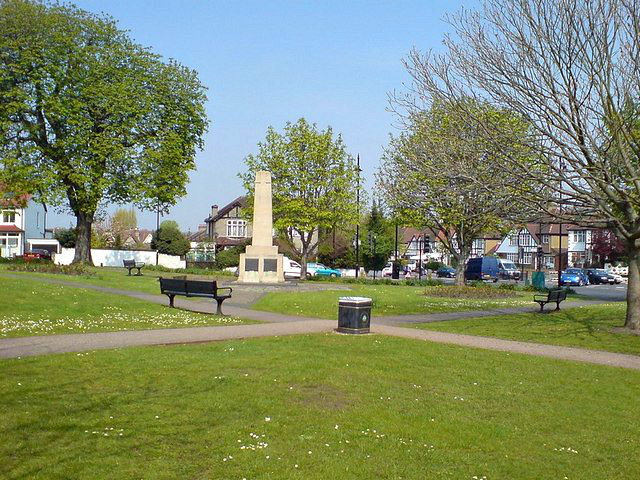
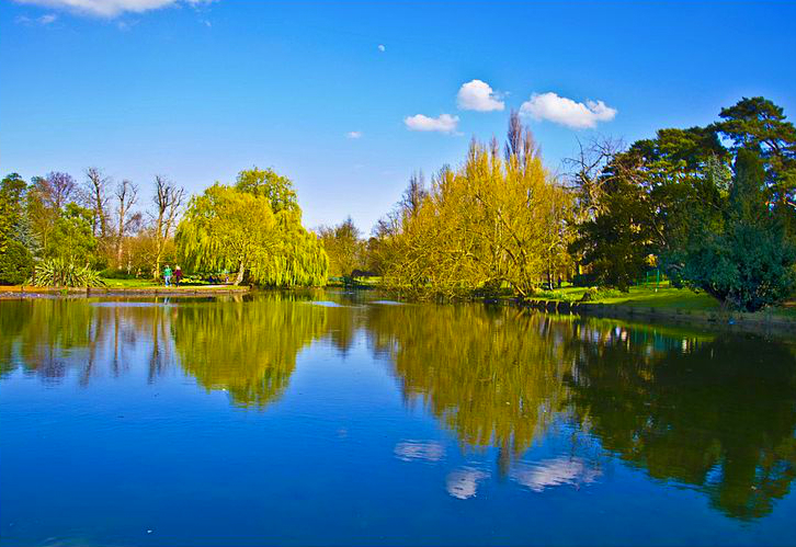
Bandonhill is home to several amenities and facilities, including a primary school, local shops, and a number of parks and recreational areas. Beddington Park, located nearby, offers beautiful green spaces, a lake, and historical features such as the 18th-century Carew Manor. The park provides opportunities for walking, jogging, picnicking, and enjoying nature.

Transport links in Bandonhill are convenient, with several bus routes connecting the village to neighboring towns and train stations. Hackbridge station, located just a short distance away, provides regular train services to London and other destinations.

Overall, Bandonhill offers a peaceful and idyllic village lifestyle, with easy access to nearby towns and London. Its charming character, green spaces, and community atmosphere make it an attractive place to live for those seeking a tranquil suburban setting.

If you have any feedback on the listing, please let us know in the comments section below.
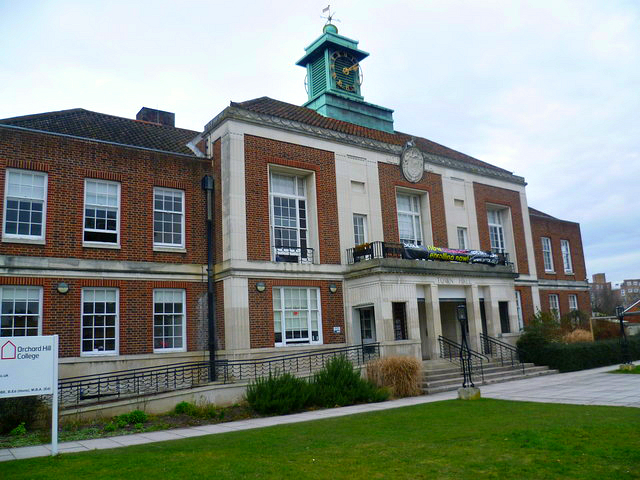
Bandonhill Images

Images are sourced within 2km of 51.363325/-0.136228 or Grid Reference TQ2964. Thanks to Geograph Open Source API. All images are credited.

Saint Mary's Church Detail of the knapped flint on the exterior wall of the church.
Saint Mary's Church
Detail of the knapped flint on the exterior wall of the church.
Beddington Resident I went in search of an albino grey squirrel, reported on the previous day, but I only saw five of the usual colouration. Photographed in the churchyard of Saint Mary's church.
Beddington Resident
I went in search of an albino grey squirrel, reported on the previous day, but I only saw five of the usual colouration. Photographed in the churchyard of Saint Mary's church.
Beddington Park Resident Grey squirrel, seen during a break in foraging.
Beddington Park Resident
Grey squirrel, seen during a break in foraging.
Little Egret Seen in Beddington Park. It had been fishing in the River Wandle, but noticed my approach.
Little Egret
Seen in Beddington Park. It had been fishing in the River Wandle, but noticed my approach.
Female Kestrel Its talons gripping the tip of a branch, close to Beddington Park.
Female Kestrel
Its talons gripping the tip of a branch, close to Beddington Park.
Female Kestrel Its talons gripping the tip of a branch, close to Beddington Park.
Female Kestrel
Its talons gripping the tip of a branch, close to Beddington Park.
Heron Seen in Beddington Park, with the heron watching a potential meal in the nearby brambles.
Heron
Seen in Beddington Park, with the heron watching a potential meal in the nearby brambles.
Carew Manor Late afternoon at Carew Manor, originally called Beddington Place, home to the Carew family from 1351-1859. It is now a school.
Carew Manor
Late afternoon at Carew Manor, originally called Beddington Place, home to the Carew family from 1351-1859. It is now a school.
Sandy Lane South Looking along Sandy Lane South towards its junction with Stafford Road.  The postbox here, sited outside Bandon Hill Primary School, is a regular recipient of knitted postbox toppers.  The one seen here, by Jan Gibson of the knitting group Yarn Bombers of Ewell, is commemorating Queen Elizabeth II's Platinum Jubilee.  For a closer view of the postbox, see <a href="https://www.geograph.org.uk/photo/7167107">TQ2963 : Postbox, Sandy Lane South</a>.
Sandy Lane South
Looking along Sandy Lane South towards its junction with Stafford Road. The postbox here, sited outside Bandon Hill Primary School, is a regular recipient of knitted postbox toppers. The one seen here, by Jan Gibson of the knitting group Yarn Bombers of Ewell, is commemorating Queen Elizabeth II's Platinum Jubilee. For a closer view of the postbox, see TQ2963 : Postbox, Sandy Lane South.
Postbox, Sandy Lane South Postbox in Sandy Lane South sited outside Bandon Hill Primary School,  a regular recipient of knitted postbox toppers.  This one, by Jan Gibson of the knitting group Yarn Bombers of Ewell, is commemorating Queen Elizabeth II's Platinum Jubilee.  For a close up of the topper, see <a href="https://www.geograph.org.uk/photo/7167111">TQ2963 : Postbox topper, Sandy Lane South</a> and for a wider view see <a href="https://www.geograph.org.uk/photo/7167103">TQ2963 : Sandy Lane South</a>.
Postbox, Sandy Lane South
Postbox in Sandy Lane South sited outside Bandon Hill Primary School, a regular recipient of knitted postbox toppers. This one, by Jan Gibson of the knitting group Yarn Bombers of Ewell, is commemorating Queen Elizabeth II's Platinum Jubilee. For a close up of the topper, see TQ2963 : Postbox topper, Sandy Lane South and for a wider view see TQ2963 : Sandy Lane South.
Postbox topper, Sandy Lane South A knitted postbox topper on a postbox in Sandy Lane South sited outside Bandon Hill Primary School, a regular recipient of such decorations.  This one, by Jan Gibson of the knitting group Yarn Bombers of Ewell, is commemorating Queen Elizabeth II's Platinum Jubilee.  For a photo of the whole postbox see <a href="https://www.geograph.org.uk/photo/7167107">TQ2963 : Postbox, Sandy Lane South</a>.
Postbox topper, Sandy Lane South
A knitted postbox topper on a postbox in Sandy Lane South sited outside Bandon Hill Primary School, a regular recipient of such decorations. This one, by Jan Gibson of the knitting group Yarn Bombers of Ewell, is commemorating Queen Elizabeth II's Platinum Jubilee. For a photo of the whole postbox see TQ2963 : Postbox, Sandy Lane South.
Elms Pond A pair of Egyptian geese relaxing on a day which was generally sunny.
Elms Pond
A pair of Egyptian geese relaxing on a day which was generally sunny.
Manor Garden Heron perched in a tree in this small garden, which is situated at the southwestern edge of Beddington Park.
Manor Garden
Heron perched in a tree in this small garden, which is situated at the southwestern edge of Beddington Park.
Carshalton Floral display at The Grove.
Carshalton
Floral display at The Grove.
Carshalton Grove Lodge, at the edge of The Grove, sporting bunting remaining from the Platinum Jubilee celebrations.
Carshalton
Grove Lodge, at the edge of The Grove, sporting bunting remaining from the Platinum Jubilee celebrations.
Carshalton The former 'Fox & Hounds' public house.
Carshalton
The former 'Fox & Hounds' public house.
Carshalton The former 'Fox & Hounds' public house.
Carshalton
The former 'Fox & Hounds' public house.
Carshalton Day of Dance Pennyroyal Clog, outside the Sassis Café.
Carshalton Day of Dance
Pennyroyal Clog, outside the Sassis Café.
Show me another place!

Bandonhill is located at Grid Ref: TQ2964 (Lat: 51.363325, Lng: -0.136228)

Unitary Authority: Sutton

Police Authority: Metropolitan

What 3 Words

///mute.swan.rams. Near Carshalton, London

Nearby Locations

Bandonhill Brandon Hill

Related Wikis

Bandonhill

Bandonhill (sometimes spelt as Bandon Hill) is a small locality in the London Borough of Sutton, located between Wallington and Beddington. It is best...

Bandon Hill Cemetery

Bandon Hill Cemetery is a cemetery in Wallington, south-west London. While it was founded in 1900 by the Croydon Rural District Council, it is actually...

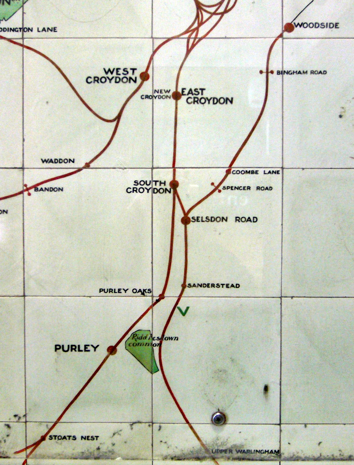
Bandon Halt railway station

Bandon Halt was a station on the 1847 London, Brighton and South Coast Railway extension from West Croydon to Epsom. It was situated between Waddon and...

Municipal Borough of Beddington and Wallington

Beddington and Wallington was, from 1915 to 1965, a local government district in north east Surrey, England. It formed part of the London suburbs, lying...

Wallington, London

Wallington is a town in the London Borough of Sutton, South London, England, 9.7 miles (15.6 km) south-west of Charing Cross. Before the Municipal Borough...

Wilson's School

Wilson's School is a state boys' grammar school with academy status in the London Borough of Sutton, England. It was founded as Wilson's Grammar School...

Beddington

Beddington is a suburban settlement in the London Borough of Sutton on the boundary with the London Borough of Croydon. Beddington is formed from a village...

Carshalton and Wallington (UK Parliament constituency)

Carshalton and Wallington is a constituency (also known as a seat) represented in the House of Commons of the Parliament of the United Kingdom since 2019...

Nearby Amenities

Located within 500m of 51.363325,-0.136228
Traffic Signals
Lat/Long: 51.3595926/-0.1377991
Created By: YahooApplet 1.0
Lat/Long: 51.3635499/-0.1406462
Mini Roundabout
Direction: clockwise
Lat/Long: 51.3654867/-0.1403973
Created By: YahooApplet 1.0
Lat/Long: 51.3646864/-0.1405354
Created By: YahooApplet 1.0
Ref GB Tflcid: RWG216486
Traffic Calming: hump
Lat/Long: 51.3644614/-0.1405858
Created By: YahooApplet 1.0
Lat/Long: 51.3656713/-0.1375933
Ref GB Tflcid: RWG216556
Traffic Calming: hump
Lat/Long: 51.3657758/-0.1367348
Created By: YahooApplet 1.0
Lat/Long: 51.3661273/-0.1352784
Created By: YahooApplet 1.0
Lat/Long: 51.367709/-0.1354789
Created By: YahooApplet 1.0
Lat/Long: 51.3667582/-0.1328085
Created By: YahooApplet 1.0
Lat/Long: 51.3664693/-0.1339168
Post Box
Collection Times: Mo-Fr 09:00; Sa 07:00
Drive Through: no
Operator: Royal Mail
Operator Wikidata: Q638098
Post Box Type: pillar
Ref: SM6 178D
Royal Cypher: GR
Royal Cypher Wikidata: Q33102273
Source: survey
Lat/Long: 51.3676072/-0.1352815
Post Box
Collection Times: Mo-Fr 17:15; Sa 12:00; Su off
Drive Through: no
Operator: Royal Mail
Operator Wikidata: Q638098
Post Box Type: pillar
Ref: CR0 428
Royal Cypher: GR
Royal Cypher Wikidata: Q33102273
Source: survey
Lat/Long: 51.36694/-0.1320599
Ref GB Tflcid: RWG216248
Traffic Calming: hump
Lat/Long: 51.3623898/-0.140497
Post Box
Collection Times: Mo-Fr 16:00; Sa 11:15; Su off
Drive Through: no
Operator: Royal Mail
Operator Wikidata: Q638098
Post Box Type: pillar
Ref: SM6 132
Royal Cypher: GR
Royal Cypher Wikidata: Q33102273
Source: survey
Lat/Long: 51.3654387/-0.1415979
Ref GB Tflcid: RWG216259
Traffic Calming: hump
Lat/Long: 51.3626036/-0.1411048
Barrier: bollard
Bicycle: yes
Foot: yes
Lat/Long: 51.3652881/-0.1416209
Ref GB Tflcid: RWG216153
Traffic Calming: hump
Lat/Long: 51.3629561/-0.1313227
Ref GB Tflcid: RWG216213
Traffic Calming: hump
Lat/Long: 51.3631657/-0.130971
Crossing
Bicycle: yes
Crossing: traffic_signals
Crossing Ref: toucan
Lat/Long: 51.3626907/-0.1317317
Melrose Tudor
Building: apartments
Lat/Long: 51.3610568/-0.130492
Post Box
Operator: Royal Mail
Operator Wikidata: Q638098
Ref: SM6 129
Lat/Long: 51.3609577/-0.1305893
Ref GB Tflcid: RWG216150
Traffic Calming: hump
Lat/Long: 51.3628572/-0.1320195
Ref GB Tflcid: RWG216569
Traffic Calming: hump
Lat/Long: 51.3611361/-0.1368584
Ref GB Tflcid: RWG216219
Traffic Calming: hump
Lat/Long: 51.3624758/-0.1351706
Post Box
Drive Through: no
Operator: Royal Mail
Operator Wikidata: Q638098
Post Box Type: pillar
Ref: SM6 69
Royal Cypher: EVIIR
Royal Cypher Wikidata: Q33102324
Source: survey
Lat/Long: 51.3617319/-0.1401611
Pharmacy
Stafford Pharmacy
Addr City: Wallington
Addr Housenumber: 150
Addr Postcode: SM6 9BS
Addr Street: Stafford Road
Healthcare: pharmacy
Opening Hours: Mo-Fr 09:00-18:30; Sa 09:00-13:00; Su off
Operator: Medipharmacy Group
Source: survey
Website: https://www.nhs.uk/Services/pharmacies/Overview/DefaultView.aspx?id=6698
Lat/Long: 51.3596275/-0.1391261
Telephone
Booth: ST6
Covered: booth
Lat/Long: 51.3595282/-0.1392102
Bicycle Parking
Bicycle Parking: stands
Capacity: 4
Covered: no
Lat/Long: 51.3595233/-0.139491
Cafe
Mellows Pavilion Cafe
Addr City: Wallington
Addr Housename: Mellows Park
Addr Postcode: SM6 9BU
Addr Street: Stafford Road
Fhrs Authority: Sutton
Fhrs Id: 1109475
Outdoor Seating: yes
Source: survey;https://ratings.food.gov.uk/OpenDataFiles/FHRS529en-GB.xml
Lat/Long: 51.3602342/-0.1332936
Crossing
Crossing: uncontrolled
Crossing Island: yes
Crossing Ref: zebra
Tactile Paving: yes
Lat/Long: 51.3599614/-0.1336893
Post Box
Collection Times: Mo-Fr 18:45; Sa 11:15; Su off
Drive Through: no
Operator: Royal Mail
Operator Wikidata: Q638098
Post Box Type: pillar
Ref: SM6 116
Royal Cypher: GR
Royal Cypher Wikidata: Q33102273
Source: survey
Lat/Long: 51.3591016/-0.1380431
Bus Stop
Bandon Hill Cemetery
Local Ref: A
Naptan AtcoCode: 490003576N
Naptan Bearing: N
Naptan CommonName: Bandon Hill Cemetery
Naptan Indicator: Stop A
Naptan Street: PLOUGH LANE
Naptan Verified: no
Public Transport: platform
Lat/Long: 51.3659683/-0.1321355
Bus Stop
Bandon Hill Cemetery
Local Ref: J
Naptan AtcoCode: 490003769S
Naptan Bearing: S
Naptan CommonName: Croydon Road Plough Lane
Naptan Indicator: Stop J
Naptan Street: PLOUGH LANE
Naptan Verified: no
Public Transport: platform
Lat/Long: 51.3665779/-0.1319423
Bus Stop
Garden Close
Local Ref: L
Naptan AtcoCode: 490007112N
Naptan Bearing: N
Naptan CommonName: Garden Close
Naptan Indicator: Stop L
Naptan Street: PLOUGH LANE
Naptan Verified: no
Public Transport: platform
Lat/Long: 51.3616424/-0.1313524
Bus Stop
Garden Close
Bus: yes
Local Ref: M
Naptan AtcoCode: 490007112S
Naptan Bearing: S
Naptan CommonName: Garden Close
Naptan Indicator: Stop M
Naptan Street: PLOUGH LANE
Naptan Verified: no
Network: TFL
Operator: TFL
Public Transport: platform
Shelter: no
Lat/Long: 51.3616415/-0.1311338
Bus Stop
Mellows Park
Local Ref: B
Naptan AtcoCode: 490009796E
Naptan Bearing: E
Naptan CommonName: Mellows Park
Naptan Indicator: Stop B
Naptan Street: STAFFORD ROAD
Naptan Verified: no
Public Transport: platform
Lat/Long: 51.3600701/-0.1331318
Bus Stop
Mellows Park
Local Ref: W
Naptan AtcoCode: 490009796W
Naptan Bearing: W
Naptan CommonName: Mellows Park
Naptan Indicator: Stop W
Naptan Street: STAFFORD ROAD
Naptan Verified: no
Public Transport: platform
Lat/Long: 51.3598526/-0.1342544
Bus Stop
Stafford Road / Sandy Lane South
Local Ref: A
Naptan AtcoCode: 490011925E
Naptan Bearing: E
Naptan CommonName: Stafford RoadSandy Lane South
Naptan Indicator: Stop A
Naptan Street: STAFFORD ROAD
Naptan Verified: no
Public Transport: platform
Lat/Long: 51.3597541/-0.1371113
Bus Stop
Stafford Road / Sandy Lane South
Local Ref: U
Naptan AtcoCode: 490011925W
Naptan Bearing: W
Naptan CommonName: Stafford RoadSandy Lane South
Naptan Indicator: Stop U
Naptan Street: STAFFORD ROAD
Naptan Verified: no
Public Transport: platform
Lat/Long: 51.3594802/-0.13852
Bus Stop
Sandy Lane South
Local Ref: D
Naptan AtcoCode: 490011928S
Naptan Bearing: S
Naptan CommonName: Sandy Lane South
Naptan Indicator: Stop D
Naptan Street: SANDY LANE SOUTH
Naptan Verified: no
Public Transport: platform
Lat/Long: 51.3589526/-0.1378595
Fast Food
Family Fishbar
Addr City: Wallington
Addr Housenumber: 171
Addr Postcode: SM6 9BT
Addr Street: Stafford Road
Cuisine: fish_and_chips
Fhrs Authority: Sutton
Fhrs Id: 848003
Internet Access: wlan
Old Name: Blue Water Fish Bar
Lat/Long: 51.3593348/-0.1389129
Fast Food
Tandoori Night
Addr City: Wallington
Addr Housenumber: 187
Addr Postcode: SM6 9BT
Addr Street: Stafford Road
Cuisine: indian
Fhrs Authority: Sutton
Fhrs Id: 1083552
Lat/Long: 51.3593843/-0.1382483
Fast Food
Perfect Kebab
Addr City: Wallington
Addr Housenumber: 142
Addr Postcode: SM6 9BS
Addr Street: Stafford Road
Cuisine: kebab
Fhrs Authority: Sutton
Fhrs Id: 430847
Lat/Long: 51.3595957/-0.1394091
Ref GB Tflcid: RWG216281
Traffic Calming: hump
Lat/Long: 51.361364/-0.142094
Atm
Atm: yes
Booth: KXCash
Colour: grey
Description: phone box converted to atm with phone on outside
Fee: no
Operator Atm: Cashzone
Lat/Long: 51.3595357/-0.1393835
A1deSIGNS
Addr City: Wallington
Addr Housenumber: 4
Addr Postcode: SM6 8JX
Addr Street: Sandy Lane North
Description: Business Signs
Is In County: Surrey
Office: company
Opening Hours: Mo-Fr 08:00-17:00
Payment Cash: yes
Phone: +44 20 8646 9886
Website: https://www.a1designs.co.uk
Lat/Long: 51.3625856/-0.133311
Ladbrokes
Addr City: Wallington
Addr Housenumber: 138
Addr Postcode: SM6 9BS
Addr Street: Stafford Road
Brand: Ladbrokes
Brand Wikidata: Q1799875
Brand Wikipedia: en:Ladbrokes Coral
Shop: bookmaker
Lat/Long: 51.3595849/-0.13955
The Connoisseur
Addr City: Wallington
Addr Housenumber: 146
Addr Postcode: SM6 9BS
Addr Street: Stafford Road
Fhrs Authority: Sutton
Fhrs Id: 898433
Shop: convenience
Lat/Long: 51.3596092/-0.1393153
Degenis's Haircare
Addr City: Wallington
Addr Housenumber: 148
Addr Postcode: SM6 9BS
Addr Street: Stafford Road
Shop: hairdresser
Lat/Long: 51.3596159/-0.139204
Eye Contact Vision Clinic
Addr City: Wallington
Addr Housenumber: 152
Addr Postcode: SM6 9BS
Addr Street: Stafford Road
Shop: optician
Source: survey
Lat/Long: 51.3596276/-0.1390672
Cosy Homes Fireplaces Ltd
Addr City: Wallington
Addr Housenumber: 154-156
Addr Postcode: SM6 9BS
Addr Street: Stafford Road
Not Website: www.cosyhomes.org.uk
Phone: +44 20 8669 2878
Shop: fireplace
Source: survey
Source Not Website: Shop front
Website: https://www.cosyhomesfireplaces.co.uk/
Lat/Long: 51.3596326/-0.1389706
AS Partnership
Addr City: Wallington
Addr Housenumber: 158
Addr Postcode: SM6 9BS
Addr Street: Stafford Road
Email: info@aspartnership.co.uk
Office: accountant
Phone: +44 20 8669 1100
Source: survey
Website: https://www.aspartnership.co.uk/
Lat/Long: 51.3596494/-0.1388539
Manor Glass and Glazing
Addr City: Wallington
Addr Housenumber: 160-162
Addr Postcode: SM6 9BS
Addr Street: Stafford Road
Craft: glaziery
Email: manor.glass@tiscali.co.uk
Opening Hours: Mo-Fr 09:00-17:00; Sa 08:00-12:00; Su off
Phone: +44 20 8647 6620
Source: survey
Website: https://www.manorglassltd.co.uk/
Lat/Long: 51.3596494/-0.138752
Levander Care Agency
Addr City: Wallington
Addr Housenumber: 164
Addr Postcode: SM6 9BS
Addr Street: Stafford Road
Source: survey
Lat/Long: 51.3596527/-0.1386487
CSQ Marketing
Addr City: Wallington
Addr Housenumber: 191
Addr Postcode: SM6 9BT
Addr Street: Stafford Road
Office: advertising_agency
Phone: +44 20 8241 4443
Website: https://www.csqmarketing.co.uk/
Lat/Long: 51.359396/-0.1380506
Lucky Food & Wine
Addr City: Wallington
Addr Housenumber: 189
Addr Postcode: SM6 9BT
Addr Street: Stafford Road
Shop: convenience
Lat/Long: 51.3593914/-0.1381512
Fast Food
Tennesee Express
Addr City: Wallington
Addr Housenumber: 185
Addr Postcode: SM6 9BT
Addr Street: Stafford Road
Cuisine: chicken
Fhrs Authority: Sutton
Lat/Long: 51.3593751/-0.1383282
Wallington Nails
Addr City: Wallington
Addr Housenumber: 183
Addr Postcode: SM6 9BT
Addr Street: Stafford Road
Beauty: nails
Shop: beauty
Lat/Long: 51.3593671/-0.1384328
Futurewise
Addr City: Wallington
Addr Housenumber: 181
Addr Postcode: SM6 9BT
Addr Street: Stafford Road
Office: accountant
Lat/Long: 51.3593638/-0.1385059
Jordan Restoration Ministry
Addr City: Wallington
Addr Housenumber: 179
Addr Postcode: SM6 9BT
Addr Street: Stafford Road
Office: charity
Lat/Long: 51.3593575/-0.1385877
J&T Motor Services
Addr City: Wallington
Addr Housenumber: 173-177
Addr Postcode: SM6 9BT
Addr Street: Stafford Road
Shop: car_repair
Website: https://www.jtmotorservices-wallington.co.uk/
Lat/Long: 51.3593445/-0.1387708
Cafe
Cafe De Niro
Addr City: Wallington
Addr Housenumber: 169
Addr Postcode: SM6 9BT
Addr Street: Stafford Road
Fhrs Authority: Sutton
Fhrs Id: 754287
Lat/Long: 51.3593257/-0.1390041
Stafford Barber Shop
Addr City: Wallington
Addr Housenumber: 167
Addr Postcode: SM6 9BT
Addr Street: Stafford Road
Shop: hairdresser
Lat/Long: 51.3593215/-0.13909
Wallington Dry Cleaners
Addr City: Wallington
Addr Housenumber: 165
Addr Postcode: SM6 9BT
Addr Street: Stafford Road
Shop: dry_cleaning
Lat/Long: 51.3593144/-0.1391798
Cmyk Printers
Addr City: Wallington
Addr Housenumber: 163
Addr Postcode: SM6 9BT
Addr Street: Stafford Road
Shop: copyshop
Lat/Long: 51.3593077/-0.139263
Mobility Centre
Addr City: Wallington
Addr Housenumber: 161
Addr Postcode: SM6 9BT
Addr Street: Stafford Road
Shop: medical_supply
Lat/Long: 51.3593014/-0.1393481
Access: private
Entrance: main
Lat/Long: 51.359089/-0.1381226
Access: private
Entrance: main
Lat/Long: 51.3590891/-0.1380757
Post Box
Collection Times: Mo-Fr 09:00; Sa 07:00
Drive Through: no
Operator: Royal Mail
Operator Wikidata: Q638098
Post Box Type: pillar
Ref: SM6 117D
Royal Cypher: EIIR
Royal Cypher Wikidata: Q33102113
Source: survey
Lat/Long: 51.3625854/-0.1343382
Tactile Paving: yes
Lat/Long: 51.3599221/-0.1336773
Barrier: bollard
Lat/Long: 51.3607853/-0.1368341
Crossing
Fixme: The pedestrian crossing of the side road here may be either via a speed table or a "Copenhagen Crossing" (not checked when imported) #tflcid #surveyme
Traffic Calming: table
Lat/Long: 51.3594839/-0.1396874
Crossing
Fixme: The pedestrian crossing of the side road here may be either via a speed table or a "Copenhagen Crossing" (not checked when imported) #tflcid #surveyme
Lat/Long: 51.3595965/-0.1384832
Ref GB Tflcid: RWG216445
Traffic Calming: hump
Lat/Long: 51.3653328/-0.1420783
Ref GB Tflcid: RWG216443
Traffic Calming: hump
Lat/Long: 51.3656994/-0.1417284
Ref GB Tflcid: RWG216487
Traffic Calming: hump
Lat/Long: 51.3643596/-0.1418246
Ref GB Tflcid: RWG216298
Traffic Calming: hump
Lat/Long: 51.360294/-0.1414328
Ref GB Tflcid: RWG216459
Traffic Calming: hump
Lat/Long: 51.3643592/-0.1418301
Ref GB Tflcid: RWG216477
Traffic Calming: hump
Lat/Long: 51.3633582/-0.1430394
Ref GB Tflcid: RWG216479
Traffic Calming: hump
Lat/Long: 51.3634784/-0.1416945
Ref GB Tflcid: RWG216452
Traffic Calming: hump
Lat/Long: 51.3653891/-0.1413942
Ref GB Tflcid: RWG216463
Traffic Calming: hump
Lat/Long: 51.3642491/-0.1431705
Ref GB Tflcid: RWG216268
Traffic Calming: hump
Lat/Long: 51.362308/-0.1426205
Ref GB Tflcid: RWG216267
Traffic Calming: hump
Lat/Long: 51.3624847/-0.1417143
Ref GB Tflcid: RWG216231
Traffic Calming: hump
Lat/Long: 51.3620029/-0.1386892
Ref GB Tflcid: RWG216542
Traffic Calming: hump
Lat/Long: 51.3654574/-0.1375784
Ref GB Tflcid: RWG216502
Traffic Calming: hump
Lat/Long: 51.3658877/-0.1403419
Ref GB Tflcid: RWG216567
Traffic Calming: hump
Lat/Long: 51.3603763/-0.1373354
Ref GB Tflcid: RWG216553
Traffic Calming: hump
Lat/Long: 51.3647152/-0.1401661
Ref GB Tflcid: RWG216550
Traffic Calming: hump
Lat/Long: 51.3648851/-0.1379837
Ref GB Tflcid: RWG216495
Traffic Calming: hump
Lat/Long: 51.3647847/-0.1405197
Ref GB Tflcid: RWG216215
Traffic Calming: hump
Lat/Long: 51.3626603/-0.1334875
Ref GB Tflcid: RWG216561
Traffic Calming: hump
Lat/Long: 51.3664074/-0.1341634
Ref GB Tflcid: RWG216499
Traffic Calming: hump
Lat/Long: 51.3653249/-0.1404333
Ref GB Tflcid: RWG216491
Traffic Calming: hump
Lat/Long: 51.3644262/-0.1410145
Ref GB Tflcid: RWG216571
Traffic Calming: hump
Lat/Long: 51.362079/-0.1365007
Ref GB Tflcid: RWG216551
Traffic Calming: hump
Lat/Long: 51.3648101/-0.1389467
Ref GB Tflcid: RWG216328
Traffic Calming: hump
Lat/Long: 51.3597118/-0.1397365
Ref GB Tflcid: RWG216533
Traffic Calming: hump
Lat/Long: 51.3655928/-0.1385303
Ref GB Tflcid: RWG216559
Traffic Calming: hump
Lat/Long: 51.366205/-0.1349691
Ref GB Tflcid: RWG216580
Traffic Calming: hump
Lat/Long: 51.3611616/-0.1364487
Ref GB Tflcid: RWG216214
Traffic Calming: hump
Lat/Long: 51.3627454/-0.1328589
Ref GB Tflcid: RWG216555
Traffic Calming: hump
Lat/Long: 51.3657074/-0.1372454
Ref GB Tflcid: RWG216277
Traffic Calming: hump
Lat/Long: 51.3616182/-0.1407197
Ref GB Tflcid: RWG216546
Traffic Calming: hump
Lat/Long: 51.3650787/-0.1375519
Ref GB Tflcid: RWG216557
Traffic Calming: hump
Lat/Long: 51.3659672/-0.1359269
Ref GB Tflcid: RWG216263
Traffic Calming: hump
Lat/Long: 51.3634197/-0.1406385
Ref GB Tflcid: RWG216575
Traffic Calming: hump
Lat/Long: 51.36205/-0.1353026
Ref GB Tflcid: RWG216329
Traffic Calming: hump
Lat/Long: 51.3601978/-0.139841
Ref GB Tflcid: RWG216535
Traffic Calming: hump
Lat/Long: 51.3656498/-0.1378497
Ref GB Tflcid: RWG216218
Traffic Calming: hump
Lat/Long: 51.3623478/-0.134856
Ref GB Tflcid: RWG216227
Traffic Calming: hump
Lat/Long: 51.3621987/-0.1377521
Ref GB Tflcid: RWG216299
Traffic Calming: hump
Lat/Long: 51.3605178/-0.1402159
Ref GB Tflcid: RWG216302
Traffic Calming: hump
Lat/Long: 51.3613895/-0.1401269
Ref GB Tflcid: RWG216505
Traffic Calming: hump
Lat/Long: 51.3670228/-0.1402422
Ref GB Tflcid: RWG216564
Traffic Calming: hump
Lat/Long: 51.3666298/-0.1333009
Ref GB Tflcid: RWG216570
Traffic Calming: hump
Lat/Long: 51.3616338/-0.1367321
Ref GB Tflcid: RWG216300
Traffic Calming: hump
Lat/Long: 51.360852/-0.139988
Ref GB Tflcid: RWG216256
Traffic Calming: hump
Lat/Long: 51.3630026/-0.1406137
Ref GB Tflcid: RWG216579
Traffic Calming: hump
Lat/Long: 51.3617162/-0.1357741
Ref GB Tflcid: RWG216216
Traffic Calming: hump
Lat/Long: 51.3625829/-0.1341061
Ref GB Tflcid: RWG216530
Traffic Calming: hump
Lat/Long: 51.3655717/-0.1392113
Ref GB Tflcid: RWG216246
Traffic Calming: hump
Lat/Long: 51.361993/-0.1403316
Ref GB Tflcid: RWG216210
Traffic Calming: hump
Lat/Long: 51.3636352/-0.129388
Ref GB Tflcid: RWG216497
Traffic Calming: hump
Lat/Long: 51.3654565/-0.1407722
Ref GB Tflcid: RWG216496
Traffic Calming: hump
Lat/Long: 51.365518/-0.1399648
Ref GB Tflcid: RWG216262
Traffic Calming: hump
Lat/Long: 51.3635337/-0.1409729
Ref GB Tflcid: RWG216548
Traffic Calming: hump
Lat/Long: 51.3647652/-0.1375149
Ref GB Tflcid: RWG216482
Traffic Calming: hump
Lat/Long: 51.3638665/-0.1406252
Bicycle Parking
Bicycle Parking: stands
Capacity: 4
Ref GB Tflcid: RWG207586
Lat/Long: 51.3669797/-0.1320537
Bicycle Parking
Bicycle Parking: stands
Capacity: 4
Ref GB Tflcid: RWG207607
Lat/Long: 51.360165/-0.1334519
Bicycle Parking
Bicycle Parking: stands
Capacity: 2
Ref GB Tflcid: RWG207510
Lat/Long: 51.3616283/-0.140145
Bicycle Parking
Bicycle Parking: stands
Capacity: 4
Ref GB Tflcid: RWG207531
Lat/Long: 51.3595936/-0.1387604
Inscription: 126/136 Stafford Road
Operator: UK Power Networks
Operator Wikidata: Q7864927
Power: substation
Ref: 212344
Substation: minor_distribution
Lat/Long: 51.3597709/-0.14051
Operator: UK Power Networks
Operator Wikidata: Q7864927
Power: substation
Ref: 211603
Substation: minor_distribution
Lat/Long: 51.3664565/-0.1324012
Operator: UK Power Networks
Operator Wikidata: Q7864927
Power: substation
Ref: 211590
Substation: minor_distribution
Lat/Long: 51.3623107/-0.14063
Operator: UK Power Networks
Operator Wikidata: Q7864927
Power: substation
Ref: 211593
Substation: minor_distribution
Lat/Long: 51.3656665/-0.1366522
Operator: UK Power Networks
Operator Wikidata: Q7864927
Power: substation
Ref: 211591
Substation: minor_distribution
Lat/Long: 51.3641407/-0.1413193
Crossing
Crossing: uncontrolled
Crossing Island: no
Crossing Ref: zebra
Lat/Long: 51.3668096/-0.1320937
Give Way
Direction: forward
Lat/Long: 51.3668837/-0.1321643
Give Way
Direction: forward
Lat/Long: 51.366732/-0.1320155
Tactile Paving: yes
Lat/Long: 51.3600082/-0.1337026
Crossing
Crossing: traffic_signals
Lat/Long: 51.359481/-0.1379413
Bench
Lat/Long: 51.3595308/-0.13954
Crossing
Crossing: island
Crossing Markings: yes
Lat/Long: 51.3594492/-0.1394156
Bicycle Parking
Bicycle Parking: stands
Capacity: 4
Covered: no
Lat/Long: 51.359542/-0.1392647
Crossing
Crossing: traffic_signals
Lat/Long: 51.3596068/-0.1379514
Crossing
Crossing: traffic_signals
Lat/Long: 51.3595498/-0.1379293
Crossing
Crossing: traffic_signals
Lat/Long: 51.3594921/-0.1378228
The data included in this document is from www.openstreetmap.org. The data is made available under ODbL.

Have you been to Bandonhill?

Leave your review of Bandonhill below (or comments, questions and feedback).