Holytown

Settlement in Lanarkshire

Scotland

Holytown

Diana Quadrant, Holytown
Diana Quadrant, Holytown Credit: Elliott Simpson

Holytown is a small village located in the county of Lanarkshire, Scotland. Situated approximately 12 miles southeast of Glasgow, it falls within the North Lanarkshire council area. With a population of around 4,500 residents, Holytown is a close-knit community with a rich history.

The village is known for its peaceful and picturesque setting. Surrounded by rolling hills and green landscapes, Holytown offers a tranquil environment for its residents. The nearby Strathclyde Country Park provides opportunities for outdoor activities, including walking, cycling, and fishing.

Holytown has a range of amenities to cater to the needs of its residents. The village boasts several shops, including convenience stores, a post office, and a pharmacy. There are also a few pubs and restaurants, providing options for leisure and dining. For education, Holytown is home to two primary schools, ensuring local children have access to quality education within the village.

Transportation links in Holytown are convenient, with a train station connecting the village to Glasgow and other nearby towns. The M8 motorway is easily accessible, providing quick access to Glasgow and Edinburgh.

Historically, Holytown was primarily a mining village, with coal mining being a significant industry in the area. However, like many mining communities, Holytown has experienced a decline in this industry over the years. Today, the village has diversified its economy, with residents employed in various sectors, including healthcare, education, and retail.

Overall, Holytown is a charming village, offering a peaceful and close community atmosphere while providing easy access to larger nearby cities.

If you have any feedback on the listing, please let us know in the comments section below.
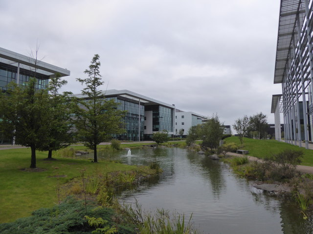
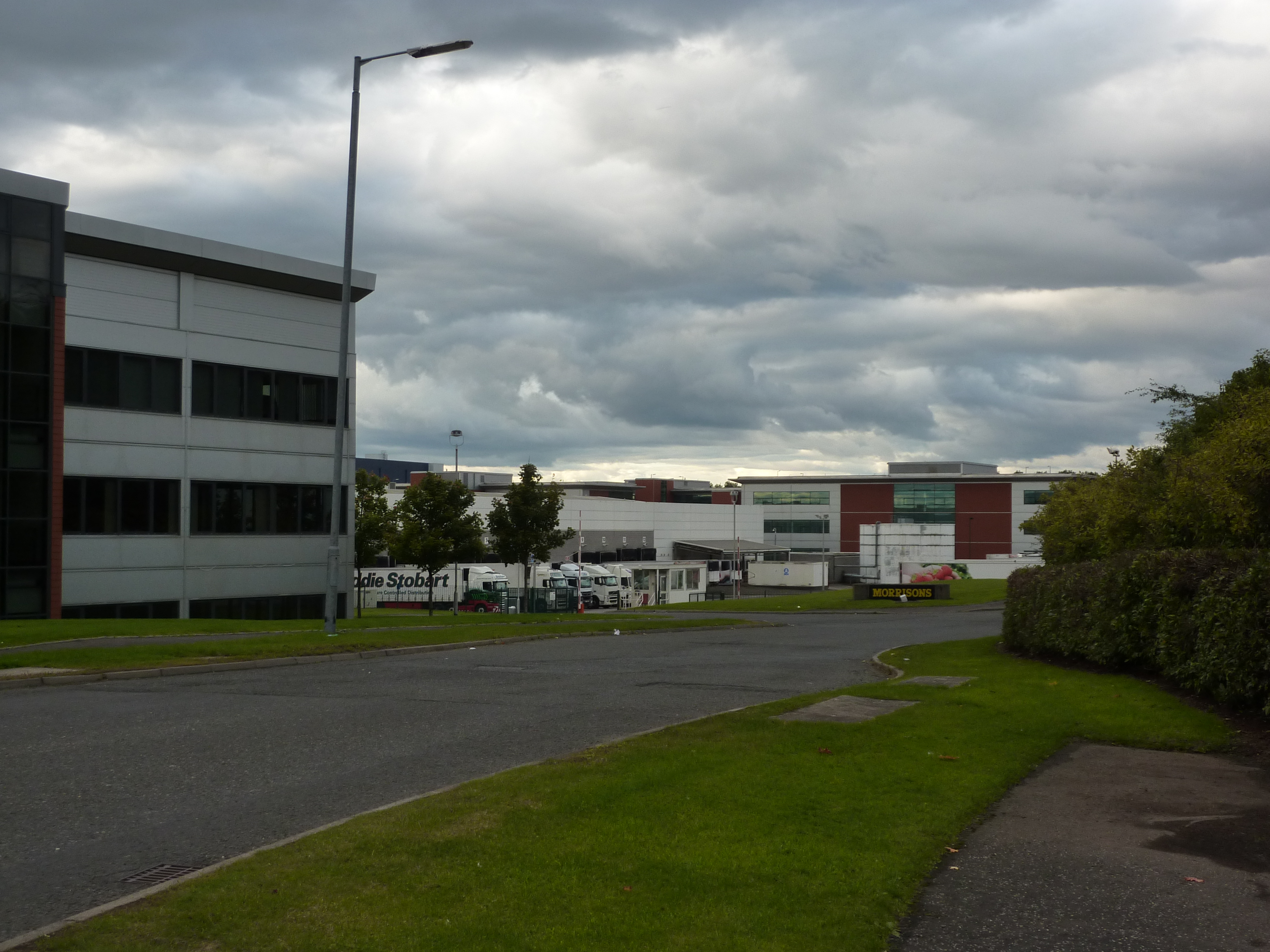
Holytown Images

Images are sourced within 2km of 55.822526/-3.971415 or Grid Reference NS7660. Thanks to Geograph Open Source API. All images are credited.

Diana Quadrant, Holytown
Eurocentral and Newhouse Industrial Estate from the air Eurocentral is on the left. The A8 dual carriageway (soon to become the M8 motorway) runs between the roundabouts at the top left.
Eurocentral and Newhouse Industrial Estate from the air
Eurocentral is on the left. The A8 dual carriageway (soon to become the M8 motorway) runs between the roundabouts at the top left.
Newhouse roundabouts from the air Construction of the M8 motorway 'missing link' resulted in the creation of a lot of roundabouts at Newhouse. At least six roundabouts are visible in this photo.
Newhouse roundabouts from the air
Construction of the M8 motorway 'missing link' resulted in the creation of a lot of roundabouts at Newhouse. At least six roundabouts are visible in this photo.
Newhouse from the air Newhouse industrial estate by the new stretch of the M8 motorway.
Newhouse from the air
Newhouse industrial estate by the new stretch of the M8 motorway.
Eurocentral from the air A large business park beside Junction 7 of the M8 motorway.
Eurocentral from the air
A large business park beside Junction 7 of the M8 motorway.
Newhouse Industrial Estate from the air With the M8 motorway and Chapelhall in the background.
Newhouse Industrial Estate from the air
With the M8 motorway and Chapelhall in the background.
Newhouse Industrial Estate from the air With the M8 motorway and Chapelhall in the background.
Newhouse Industrial Estate from the air
With the M8 motorway and Chapelhall in the background.
Eurocentral from the air Beside the M8 motorway, between Glasgow and Edinburgh.
Eurocentral from the air
Beside the M8 motorway, between Glasgow and Edinburgh.
Eurocentral from the air With the M8 motorway and Calderbank beyond.
Eurocentral from the air
With the M8 motorway and Calderbank beyond.
Eurocentral from the air With the M8 motorway and Calderbank beyond and Chapelhall to the right.
Eurocentral from the air
With the M8 motorway and Calderbank beyond and Chapelhall to the right.
Eurocentral from the air Beside the M8 motorway.
Eurocentral from the air
Beside the M8 motorway.
The M8 motorway at Eurocentral View looking was along the motorway, with Maxim business park in the background.
The M8 motorway at Eurocentral
View looking was along the motorway, with Maxim business park in the background.
Pond in landscaping at Eurocentral
Car park at Eurocentral
Dakota Hotel, Eurocentral
Landscaping at Eurocentral
The M8 motorway at Eurocentral Viewed from the over-bridge at the Eurocentral junction.
The M8 motorway at Eurocentral
Viewed from the over-bridge at the Eurocentral junction.
The M8 motorway at Eurocentral Looking east from the over-bridge at the Eurocentral junction.
The M8 motorway at Eurocentral
Looking east from the over-bridge at the Eurocentral junction.
Show me another place!

Holytown is located at Grid Ref: NS7660 (Lat: 55.822526, Lng: -3.971415)

Unitary Authority: North Lanarkshire

Police Authority: Lanarkshire

What 3 Words

///grafted.sound.planet. Near Holytown, North Lanarkshire

Nearby Locations

Holytown

Related Wikis

Holytown

Holytown (Scots: 'Holy-Town' - Holytown, Scottish Gaelic: Baile a' Chuilinn) is a village situated to the east of Bellshill and north of Motherwell in...

New Stevenston

New Stevenston is a village situated between Motherwell and Bellshill in North Lanarkshire, Scotland. Most local amenities are shared with the adjacent...

Eurocentral

Eurocentral is one of the largest industrial estates in Scotland, just off the M8 motorway, about 12 miles (19 kilometres) east of Glasgow city centre...

Holytown railway station

Holytown railway station is a railway station serving both Holytown and New Stevenston in North Lanarkshire, Scotland. It is located on the Shotts Line...

Nearby Amenities

Located within 500m of 55.822526,-3.971415
Holytown
Is In: North Lanarkshire
Name En: Holytown
Name Gd: Baile a' Chuilinn
Place: town
Wikidata: Q5887146
Wikipedia: en:Holytown
Lat/Long: 55.8212588/-3.9767761
Traffic Signals
Source: survey
Lat/Long: 55.8212521/-3.9772502
Wright Spray Painting
Addr City: Holytown
Addr Housenumber: Unit 1
Addr Postcode: ML1 4UA
Addr Street: Plantation Avenue
Source: survey
Lat/Long: 55.8229734/-3.9718283
Addr City: Holytown
Addr Housenumber: 5
Addr Postcode: ML1 4UA
Addr Street: Plantation Avenue
Source: survey
Lat/Long: 55.8228227/-3.9715493
Addr City: Holytown
Addr Housenumber: 3
Addr Postcode: ML1 4UA
Addr Street: Plantation Avenue
Source: survey
Lat/Long: 55.8227564/-3.9714957
Premier
Addr City: Holytown
Addr Country: GB
Addr Housenumber: 141
Addr Postcode: ML1 4TW
Addr Street: Main Street
Brand: Premier
Brand Wikidata: Q7240340
Brand Wikipedia: en:Premier Stores
Fhrs Id: 877125
Opening Hours: PH,Mo-Su 06:00-22:00
Shop: convenience
Wheelchair: yes
Lat/Long: 55.8229252/-3.96994
Post Box
Lat/Long: 55.8227203/-3.9696718
Pub
The Crown Bar
Addr City: Holytown
Addr Postcode: ML1 4TP
Addr Street: Main Street
Source: survey
Lat/Long: 55.8230186/-3.9680786
Scotmid
Brand: Scotmid
Brand Wikidata: Q7435719
Brand Wikipedia: en:Scotmid
Shop: supermarket
Source: survey
Website: https://scotmid.coop/store/holytown/
Lat/Long: 55.8211806/-3.9770087
Keir Hardie Sports Centre
Check Date: 2023-11-17
Leisure: sports_centre
Source: survey
Lat/Long: 55.8220345/-3.9782209
Recycling
Source: survey
Lat/Long: 55.8209085/-3.9777393
Holytown War Memorial
Historic: memorial
Memorial: war_memorial
Lat/Long: 55.8238046/-3.9658537
Parking
Lat/Long: 55.8248402/-3.9707686
Crossing
Crossing: unmarked
Crossing Island: no
Tactile Paving: no
Lat/Long: 55.8197701/-3.9685571
Crossing: informal
Lat/Long: 55.8186248/-3.9696146
Doctors
Holytown Surgery
Source: survey
Lat/Long: 55.8217064/-3.9757994
Bus Stop
Holytown, Main Street opp Holytwon Medical Centre
Bench: yes
Bus: yes
Check Date Shelter: 2021-12-19
Naptan AtcoCode: 6160409
Naptan NaptanCode: 65237273
Public Transport: platform
Shelter: yes
Source: survey
Lat/Long: 55.8213945/-3.9761454
Pub
The White House
Lat/Long: 55.8212797/-3.9777672
Psychic Cafe
Shop: gift
Lat/Long: 55.8213438/-3.9773614
Barrier: bollard
Bicycle: yes
Lat/Long: 55.8220603/-3.9765851
Studio 42
Addr City: Holytown
Addr Housenumber: 42
Addr Street: Main Street
Opening Hours: We-Sa 09:00-17:00
Phone: +44 1698 832603
Shop: hairdresser
Lat/Long: 55.8210787/-3.9774387
Waste Basket
Lat/Long: 55.8264509/-3.9687451
Generator Method: photovoltaic
Generator Output Electricity: yes
Generator Source: solar
Generator Type: solar_photovoltaic_panel
Power: generator
Lat/Long: 55.821843/-3.9748195
Peter's Barbers
Addr City: Holytown
Shop: hairdresser
Lat/Long: 55.8219335/-3.9744167
Crossing
Crossing: traffic_signals
Tactile Paving: yes
Lat/Long: 55.8224464/-3.9714856
Bus Stop
Holytown, Main Street before Plantation Avenue
Bus: yes
Naptan AtcoCode: 6160411
Naptan NaptanCode: 65232794
Public Transport: platform
Lat/Long: 55.8223305/-3.9722551
Atm
Lat/Long: 55.8228494/-3.9700763
Best Buds Florist
Addr City: Holytown
Phone: +44 1698 734719
Shop: florist
Lat/Long: 55.8225712/-3.9713581
Fast Food
Jumbo Chinese Takeaway
Addr City: Holytown
Addr Housenumber: 113
Addr Street: Main Street
Cuisine: chinese
Phone: +44 1698 832281
Lat/Long: 55.8224589/-3.9718798
Wash & Go Laundry Service
Phone: +44 1698735296
Shop: laundry
Lat/Long: 55.8224393/-3.9719844
Fast Food
Spicy Cottage
Lat/Long: 55.8222902/-3.9726898
Anne's Chiropody/Podiatry Services
Healthcare: podiatrist
Phone: +44 1698296632
Lat/Long: 55.8213569/-3.9772944
Chris Muldoon Barbers
Shop: hairdresser
Lat/Long: 55.8213802/-3.9771922
Fast Food
Anton's Fast Food
Cuisine: fish_and_chips
Lat/Long: 55.822354/-3.9714558
Fast Food
New Jade House Chinese Takeaway
Cuisine: chinese
Lat/Long: 55.8223732/-3.9713663
Greetings on the Hill
Shop: gift
Lat/Long: 55.8232419/-3.9674266
Atm
Lat/Long: 55.8224104/-3.9712604
Continental Super Store
Shop: convenience
Lat/Long: 55.8224263/-3.9711153
Coral
Brand: Coral
Brand Wikidata: Q54621344
Brand Wikipedia: en:Coral (bookmaker)
Shop: bookmaker
Lat/Long: 55.8215811/-3.9761374
Elegance Hair and Beauty
Shop: hairdresser
Lat/Long: 55.8224063/-3.9712215
MTK Professional Boxing Gym & Performance Centre
Leisure: fitness_centre
Lat/Long: 55.8219334/-3.9734181
Fins Aquatics & Pet Supplies
Shop: pet
Lat/Long: 55.8218636/-3.974707
Fast Food
Tasty Bite
Cuisine: indian;turkish
Lat/Long: 55.8223344/-3.9715363
Pharmacy
Boots
Brand: Boots
Brand Wikidata: Q6123139
Brand Wikipedia: en:Boots (company)
Dispensing: yes
Healthcare: pharmacy
Website: https://www.boots.com/stores/5253-motherwell-holytn-ml1-4tj
Lat/Long: 55.8222978/-3.9716687
Waste Basket
Lat/Long: 55.8211297/-3.9773459
Krasunya
Phone: +44 1698833908
Shop: hairdresser
Lat/Long: 55.8219426/-3.9743136
Dog Grooming: Dog Beauty by Sylvia
Shop: pet_grooming
Lat/Long: 55.8218992/-3.9745086
The Coach House (derelict)
Disused Amenity: pub
Lat/Long: 55.8215325/-3.9763188
Post Box
Lat/Long: 55.8211511/-3.9774926
Restaurant
Coalfields Steakhouse, Bistro and Bar
Cuisine: steak_house
Lat/Long: 55.8213907/-3.9769941
Waste Basket
Lat/Long: 55.8195071/-3.9743394
Waste Basket
Lat/Long: 55.8224129/-3.9781505
Waste Basket
Lat/Long: 55.8222719/-3.9778202
Waste Basket
Lat/Long: 55.8242852/-3.9655148
Generator Method: photovoltaic
Generator Output Electricity: yes
Generator Source: solar
Generator Type: solar_photovoltaic_panel
Power: generator
Lat/Long: 55.8204557/-3.9779642
Bus Stop
Holytown, Main Street opp Stevenston Street
Bus: yes
Naptan AtcoCode: 6160408
Naptan NaptanCode: 65235262
Public Transport: platform
Lat/Long: 55.8211739/-3.9778401
Bus Stop
Holytown, Main Street before Stevenston Street
Bus: yes
Naptan AtcoCode: 6160407
Naptan NaptanCode: 65237238
Public Transport: platform
Lat/Long: 55.8209979/-3.9780643
Bus Stop
Holytown, Main Street atHolytwon Medical Centre
Bus: yes
Naptan AtcoCode: 6160410
Naptan NaptanCode: 65236462
Public Transport: platform
Lat/Long: 55.821634/-3.9755564
Bus Stop
Holytown, Main Street at Senior Citizens Centre
Bus: yes
Naptan AtcoCode: 6160412
Naptan NaptanCode: 65237278
Public Transport: platform
Lat/Long: 55.8226304/-3.9704043
Bus Stop
Holytown, Main Street at Crown Bar
Bus: yes
Naptan AtcoCode: 6160413
Naptan NaptanCode: 65232823
Public Transport: platform
Lat/Long: 55.8230853/-3.9683653
Bus Stop
Holytown, Main Street at War Memorial
Bus: yes
Naptan AtcoCode: 6160414
Naptan NaptanCode: 65236595
Public Transport: platform
Lat/Long: 55.8237434/-3.9659149
Bus Stop
Holytown, Stevenston Street before Windsor Road
Bus: yes
Naptan AtcoCode: 6160417
Naptan NaptanCode: 65234267
Public Transport: platform
Lat/Long: 55.8199315/-3.9769667
Bus Stop
Holytown, Stevenston Street opp Windsor Road
Bus: yes
Naptan AtcoCode: 6160418
Naptan NaptanCode: 65235623
Public Transport: platform
Lat/Long: 55.819335/-3.9770337
Bus Stop
Holytown, Dornoch Road at Apollo Path
Bus: yes
Naptan AtcoCode: 6160421
Naptan NaptanCode: 65234783
Public Transport: platform
Lat/Long: 55.8204794/-3.9660511
Bus Stop
Holytown, Dornoch Road after Mytle Drive
Bus: yes
Naptan AtcoCode: 61601751
Naptan NaptanCode: 65237965
Public Transport: platform
Lat/Long: 55.8182599/-3.9697809
The data included in this document is from www.openstreetmap.org. The data is made available under ODbL.

Have you been to Holytown?

Leave your review of Holytown below (or comments, questions and feedback).