Holywell

Settlement in Northumberland

England

Holywell

Seaton Delaval Hall Seaton Delaval Hall is a Grade I listed country house in Northumberland, England. It is near the coast just north of Newcastle upon Tyne. Located between Seaton Sluice and Seaton Delaval, it was designed by Sir John Vanbrugh in 1718 for Admiral George Delaval; it is now owned by the National Trust.

Since completion of the house in 1728, it has had an unfortunate history. Neither architect nor patron lived to see its completion; it then passed through a succession of heirs, being lived in only intermittently. Most damaging of all, in 1822 the central block was gutted by fire, and has remained an empty shell ever since.
Seaton Delaval Hall Credit: Brian Deegan

Holywell is a small village located in Northumberland, England. Situated on the eastern coast of the country, it lies approximately 11 miles north of Newcastle upon Tyne. With a population of around 1,500 residents, it is known for its picturesque setting and historical significance.

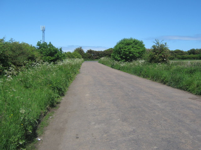
The village is surrounded by stunning countryside and offers breathtaking views of the North Sea. Holywell Dene, a local nature reserve, is a prominent feature of the area, attracting visitors with its beautiful woodland walks and abundance of wildlife.

Holywell has a rich history dating back to the medieval era. One of its notable landmarks is the Holywell Dene Railway Viaduct, a Grade II listed structure that was originally part of the North Eastern Railway. The viaduct is a testament to the village's industrial past and provides a unique sight for both locals and tourists.

In terms of amenities, Holywell offers a range of facilities including a primary school, a pub, and a village hall. The village has a close-knit community, with various activities and events organized throughout the year, fostering a sense of unity among its residents.

Being located near the coast, Holywell also provides easy access to nearby beaches, such as Seaton Sluice and Whitley Bay, which are popular tourist destinations known for their sandy shores and charming seaside attractions.

Overall, Holywell, Northumberland, offers a tranquil and idyllic place to reside, with its natural beauty, historical landmarks, and welcoming community making it an appealing location for residents and visitors alike.

If you have any feedback on the listing, please let us know in the comments section below.
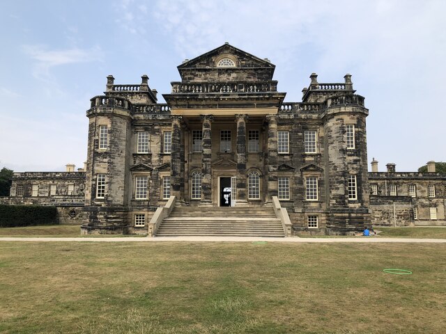
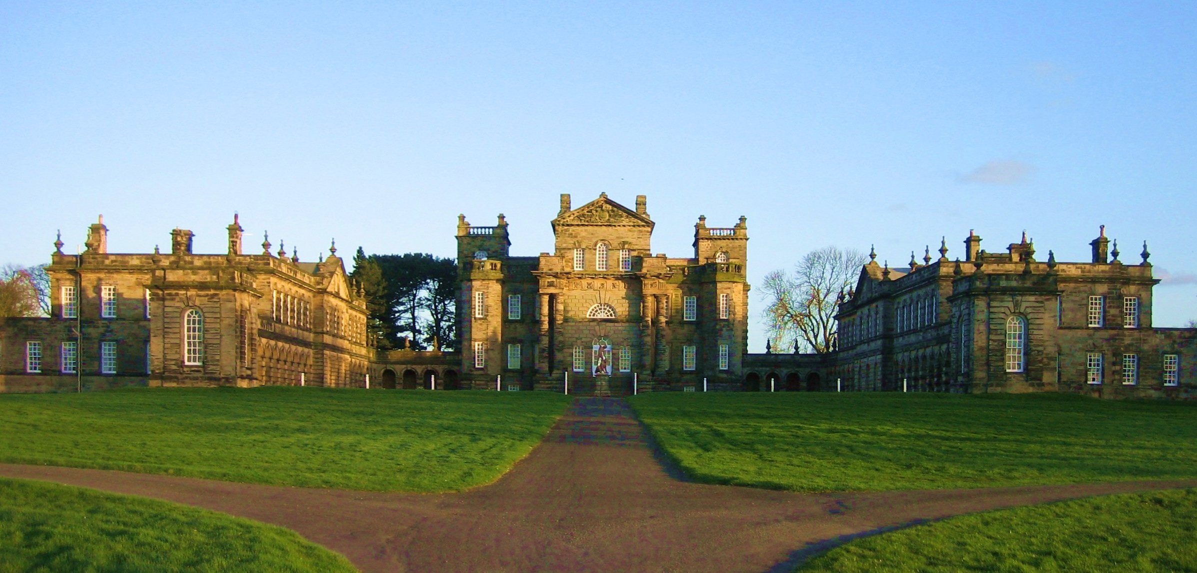
Holywell Images

Images are sourced within 2km of 55.065523/-1.505951 or Grid Reference NZ3174. Thanks to Geograph Open Source API. All images are credited.

Seaton Delaval Hall Seaton Delaval Hall is a Grade I listed country house in Northumberland, England. It is near the coast just north of Newcastle upon Tyne. Located between Seaton Sluice and Seaton Delaval, it was designed by Sir John Vanbrugh in 1718 for Admiral George Delaval; it is now owned by the National Trust.

Since completion of the house in 1728, it has had an unfortunate history. Neither architect nor patron lived to see its completion; it then passed through a succession of heirs, being lived in only intermittently. Most damaging of all, in 1822 the central block was gutted by fire, and has remained an empty shell ever since.
Seaton Delaval Hall
Seaton Delaval Hall is a Grade I listed country house in Northumberland, England. It is near the coast just north of Newcastle upon Tyne. Located between Seaton Sluice and Seaton Delaval, it was designed by Sir John Vanbrugh in 1718 for Admiral George Delaval; it is now owned by the National Trust. Since completion of the house in 1728, it has had an unfortunate history. Neither architect nor patron lived to see its completion; it then passed through a succession of heirs, being lived in only intermittently. Most damaging of all, in 1822 the central block was gutted by fire, and has remained an empty shell ever since.
Church of Our Lady, Seaton Delaval Grade 1 listed <span class="nowrap"><a title="https://historicengland.org.uk/listing/the-list/list-entry/1041317" rel="nofollow ugc noopener" href="https://historicengland.org.uk/listing/the-list/list-entry/1041317">Link</a><img style="margin-left:2px;" alt="External link" title="External link - shift click to open in new window" src="https://s1.geograph.org.uk/img/external.png" width="10" height="10"/></span>
Church of Our Lady, Seaton Delaval
Grade 1 listed LinkExternal link
Seaton Delaval Hall
Seaton Delaval Hall
Gardens west of the house Looking across some of the gardens at Seaton Delaval Hall.
Gardens west of the house
Looking across some of the gardens at Seaton Delaval Hall.
Gardens and west side of the hall Some of the gardens at Seaton Delaval Hall.
Gardens and west side of the hall
Some of the gardens at Seaton Delaval Hall.
Towards the Western Wing Looking towards the western wing (left) and the main house (right).
Towards the Western Wing
Looking towards the western wing (left) and the main house (right).
The Parterre Looking across the parterre to the west of the hall.
The Parterre
Looking across the parterre to the west of the hall.
Parterre and Hall Looking towards the west wing of Seaton Delaval Hall.
Parterre and Hall
Looking towards the west wing of Seaton Delaval Hall.
Parterre at Seaton Delaval Looking across the Parterre towards the west wing.
Parterre at Seaton Delaval
Looking across the Parterre towards the west wing.
Church of Our Lady The little Church near the hall at Seaton Delaval.
Church of Our Lady
The little Church near the hall at Seaton Delaval.
In front of the hall A statue in the middle of the square formed by the hall and wings.
In front of the hall
A statue in the middle of the square formed by the hall and wings.
Seaton Delaval Hall, central block The Hall is a Grade I listed C18th country house designed by Sir John Vanbrugh. The central block was gutted by fire in 1822 and has remained a shell since. Detailed description of the hall in wiki here: <span class="nowrap"><a title="https://en.wikipedia.org/wiki/Seaton_Delaval_Hall" rel="nofollow ugc noopener" href="https://en.wikipedia.org/wiki/Seaton_Delaval_Hall">Link</a><img style="margin-left:2px;" alt="External link" title="External link - shift click to open in new window" src="https://s1.geograph.org.uk/img/external.png" width="10" height="10"/></span>
Seaton Delaval Hall, central block
The Hall is a Grade I listed C18th country house designed by Sir John Vanbrugh. The central block was gutted by fire in 1822 and has remained a shell since. Detailed description of the hall in wiki here: LinkExternal link
Seaton Delaval Hall - Spiral staircase A view down several levels of Seaton Delaval Hall. The central part of the hall is a shell due to a disastrous fire in 1822 which gutted it and totally destroyed a range to the east. The eastern and western wings were however largely unaffected.
Seaton Delaval Hall - Spiral staircase
A view down several levels of Seaton Delaval Hall. The central part of the hall is a shell due to a disastrous fire in 1822 which gutted it and totally destroyed a range to the east. The eastern and western wings were however largely unaffected.
Public Bridleway, Holywell Dene The bridleway at this point crosses over the route of the old Avenue Branch of the Blyth & Tyne Railway via a fine stone bridge <a title="https://www.geograph.org.uk/photo/6437344" href="https://www.geograph.org.uk/photo/6437344">Link</a>.  The bridleway is part of the 'Reivers Off-Road Cycle Route', which links the North and Irish Seas.
Public Bridleway, Holywell Dene
The bridleway at this point crosses over the route of the old Avenue Branch of the Blyth & Tyne Railway via a fine stone bridge Link. The bridleway is part of the 'Reivers Off-Road Cycle Route', which links the North and Irish Seas.
Public Footpath, Holywell Dene At this point the footpath climbs away from the banks of the Seaton Burn to join the route of the old Avenue Branch of the Blyth & Tyne Railway close to a fine stone bridge <a title="https://www.geograph.org.uk/photo/6437344" href="https://www.geograph.org.uk/photo/6437344">Link</a>. This photograph was taken close to the spot where the photograph shown at <a title="https://www.geograph.org.uk/photo/6452281" href="https://www.geograph.org.uk/photo/6452281">Link</a> was also taken although at different times of the year.
Public Footpath, Holywell Dene
At this point the footpath climbs away from the banks of the Seaton Burn to join the route of the old Avenue Branch of the Blyth & Tyne Railway close to a fine stone bridge Link. This photograph was taken close to the spot where the photograph shown at Link was also taken although at different times of the year.
Step Stile & Gate near Crow Hall Farm and Holywell Dene This is the same step stile & gate as is shown at <a title="https://www.geograph.org.uk/photo/6452241" href="https://www.geograph.org.uk/photo/6452241">Link</a> although taken from the opposite side of the fence.
Step Stile & Gate near Crow Hall Farm and Holywell Dene
This is the same step stile & gate as is shown at Link although taken from the opposite side of the fence.
Squeeze Stile on Public Footpath, Holywell Dene This is the same squeeze stile as is shown at <a title="https://www.geograph.org.uk/photo/6454610" href="https://www.geograph.org.uk/photo/6454610">Link</a> although at a different time of year. This squeeze stile is designed to make it difficult (although not impossible) for cyclists to utilise this public footpath which drops steeply downhill to the Seaton Burn.
Squeeze Stile on Public Footpath, Holywell Dene
This is the same squeeze stile as is shown at Link although at a different time of year. This squeeze stile is designed to make it difficult (although not impossible) for cyclists to utilise this public footpath which drops steeply downhill to the Seaton Burn.
Old road between Seghill and Seaton Delaval Now a quiet lane after the construction of a more direct and wider road
Old road between Seghill and Seaton Delaval
Now a quiet lane after the construction of a more direct and wider road
Show me another place!

Holywell is located at Grid Ref: NZ3174 (Lat: 55.065523, Lng: -1.505951)

Unitary Authority: Northumberland

Police Authority: Northumbria

What 3 Words

///nights.deployed.deriving. Near Seaton Delaval, Northumberland

Nearby Locations

Bates Cottages Holywell

Related Wikis

Nearby Amenities

Located within 500m of 55.065523,-1.505951
Post Box
Brand: Royal Mail
Brand Wikidata: Q638098
Drive Through: no
Operator: Royal Mail
Operator Wikidata: Q638098
Post Box Type: lamp
Postal Code: NE25 0NP
Ref: NE25 245
Lat/Long: 55.0651155/-1.5105483
Holywell
Place: village
Lat/Long: 55.0645201/-1.5073118
Turning Circle
Lat/Long: 55.0654118/-1.5123334
Recycling
Recycling Glass: yes
Lat/Long: 55.0671681/-1.5117987
Post Box
Postal Code: NE25 0LJ
Ref: NE25 323
Lat/Long: 55.0639612/-1.5041113
Bus Stop
Bench: no
Bus: yes
Naptan AtcoCode: 3100Z316744
Naptan NaptanCode: nldajgdw
Public Transport: platform
Shelter: no
Lat/Long: 55.0633872/-1.5054466
Waste Basket
Lat/Long: 55.0643129/-1.5077621
Londis Shop and Post Office
Addr City: Holywell
Addr Postcode: NE25 0ND
Addr Street: Laurel Terrace
Brand: Londis
Brand Wikidata: Q21008564
Operator: Londis
Shop: supermarket
Lat/Long: 55.0650345/-1.5088464
Description: bird screen
Leisure: bird_hide
Shelter: no
Lat/Long: 55.0678854/-1.5027211
Description: Bird hide for wildlife trust members, bird screen publicly accessible
Leisure: bird_hide
Lat/Long: 55.0691665/-1.5037004
Generator Method: photovoltaic
Generator Output Electricity: yes
Generator Source: solar
Generator Type: solar_photovoltaic_panel
Location: roof
Power: generator
Lat/Long: 55.065189/-1.5034934
Generator Method: photovoltaic
Generator Output Electricity: yes
Generator Source: solar
Generator Type: solar_photovoltaic_panel
Location: roof
Power: generator
Lat/Long: 55.0652121/-1.5034531
Generator Method: photovoltaic
Generator Output Electricity: yes
Generator Source: solar
Generator Type: solar_photovoltaic_panel
Location: roof
Power: generator
Lat/Long: 55.065146/-1.5036623
Generator Method: photovoltaic
Generator Output Electricity: yes
Generator Source: solar
Generator Type: solar_photovoltaic_panel
Location: roof
Power: generator
Lat/Long: 55.065133/-1.5037643
Generator Method: photovoltaic
Generator Output Electricity: yes
Generator Source: solar
Generator Type: solar_photovoltaic_panel
Location: roof
Power: generator
Lat/Long: 55.0652796/-1.5045434
Generator Method: photovoltaic
Generator Output Electricity: yes
Generator Source: solar
Generator Type: solar_photovoltaic_panel
Location: roof
Power: generator
Lat/Long: 55.0654839/-1.5053924
Generator Method: photovoltaic
Generator Output Electricity: yes
Generator Source: solar
Generator Type: solar_photovoltaic_panel
Location: roof
Power: generator
Lat/Long: 55.0654186/-1.5053427
Generator Method: photovoltaic
Generator Output Electricity: yes
Generator Source: solar
Generator Type: solar_photovoltaic_panel
Location: roof
Power: generator
Lat/Long: 55.0653649/-1.5052931
Generator Method: photovoltaic
Generator Output Electricity: yes
Generator Source: solar
Generator Type: solar_photovoltaic_panel
Location: roof
Power: generator
Lat/Long: 55.0664631/-1.5034786
Generator Method: photovoltaic
Generator Output Electricity: yes
Generator Source: solar
Generator Type: solar_photovoltaic_panel
Location: roof
Power: generator
Lat/Long: 55.0665168/-1.5032694
Generator Method: photovoltaic
Generator Output Electricity: yes
Generator Source: solar
Generator Type: solar_photovoltaic_panel
Location: roof
Power: generator
Lat/Long: 55.0662242/-1.5029274
Generator Method: photovoltaic
Generator Output Electricity: yes
Generator Source: solar
Generator Type: solar_photovoltaic_panel
Location: roof
Power: generator
Lat/Long: 55.0652197/-1.5058537
Generator Method: photovoltaic
Generator Output Electricity: yes
Generator Source: solar
Generator Type: solar_photovoltaic_panel
Location: roof
Power: generator
Lat/Long: 55.0646514/-1.5109325
Generator Method: photovoltaic
Generator Output Electricity: yes
Generator Source: solar
Generator Type: solar_photovoltaic_panel
Location: roof
Power: generator
Lat/Long: 55.0646146/-1.5110746
Generator Method: photovoltaic
Generator Output Electricity: yes
Generator Source: solar
Generator Type: solar_photovoltaic_panel
Location: roof
Power: generator
Lat/Long: 55.0647697/-1.511662
Generator Method: photovoltaic
Generator Output Electricity: yes
Generator Source: solar
Generator Type: solar_photovoltaic_panel
Location: roof
Power: generator
Lat/Long: 55.0638343/-1.5108788
Generator Method: photovoltaic
Generator Output Electricity: yes
Generator Source: solar
Generator Type: solar_photovoltaic_panel
Location: roof
Power: generator
Lat/Long: 55.0637897/-1.5110451
Generator Method: photovoltaic
Generator Output Electricity: yes
Generator Source: solar
Generator Type: solar_photovoltaic_panel
Location: roof
Power: generator
Lat/Long: 55.0636561/-1.511831
Generator Method: photovoltaic
Generator Output Electricity: yes
Generator Source: solar
Generator Type: solar_photovoltaic_panel
Location: roof
Power: generator
Lat/Long: 55.0635793/-1.5123299
Generator Method: photovoltaic
Generator Output Electricity: yes
Generator Source: solar
Generator Type: solar_photovoltaic_panel
Location: roof
Power: generator
Lat/Long: 55.0636208/-1.5120831
Generator Method: photovoltaic
Generator Output Electricity: yes
Generator Source: solar
Generator Type: solar_photovoltaic_panel
Location: roof
Power: generator
Lat/Long: 55.0637283/-1.5130916
Generator Method: photovoltaic
Generator Output Electricity: yes
Generator Source: solar
Generator Type: solar_photovoltaic_panel
Location: roof
Power: generator
Lat/Long: 55.0650377/-1.5117143
Generator Method: photovoltaic
Generator Output Electricity: yes
Generator Source: solar
Generator Type: solar_photovoltaic_panel
Location: roof
Power: generator
Lat/Long: 55.065325/-1.5107648
Generator Method: photovoltaic
Generator Output Electricity: yes
Generator Source: solar
Generator Type: solar_photovoltaic_panel
Location: roof
Power: generator
Lat/Long: 55.0653418/-1.5107219
Generator Method: photovoltaic
Generator Output Electricity: yes
Generator Source: solar
Generator Type: solar_photovoltaic_panel
Location: roof
Power: generator
Lat/Long: 55.065179/-1.513549
Generator Method: photovoltaic
Generator Output Electricity: yes
Generator Source: solar
Generator Type: solar_photovoltaic_panel
Location: roof
Power: generator
Lat/Long: 55.0655108/-1.5134551
Bus Stop
Bench: no
Bus: yes
Departures Board: timetable
Naptan AtcoCode: 3100Z314746
Naptan NaptanCode: nldawmgm
Public Transport: platform
Shelter: yes
Lat/Long: 55.0649499/-1.5083495
Barrier: cycle_barrier
Lat/Long: 55.0623665/-1.5036598
Bus Stop
Bench: yes
Bus: yes
Public Transport: platform
Shelter: yes
Lat/Long: 55.0649322/-1.5135557
Addr Housenumber: 80
Lat/Long: 55.0652535/-1.5095414
The data included in this document is from www.openstreetmap.org. The data is made available under ODbL.

Have you been to Holywell?

Leave your review of Holywell below (or comments, questions and feedback).