Gartheryr

Hill, Mountain in Caernarfonshire

Wales

Gartheryr

A5 near Betws-y-Coed The A5 heading north, almost at Betws-y-Coed, just past Bron-haul.
A5 near Betws-y-Coed Credit: Bob Walters

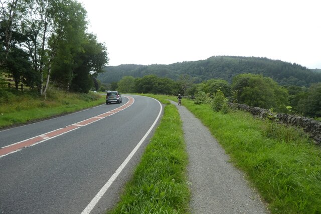
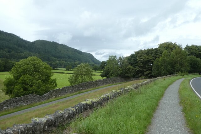
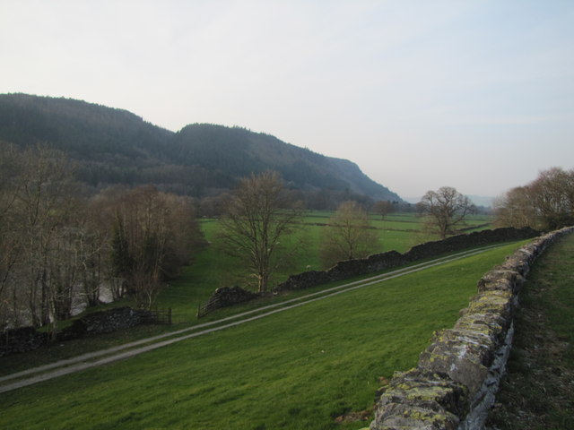
Gartheryr is a hill located in the historical county of Caernarfonshire, Wales. Situated in the Snowdonia National Park, it offers breathtaking panoramic views of the surrounding landscape. With an elevation of approximately 500 meters (1,640 feet), Gartheryr is a prominent feature in the area.

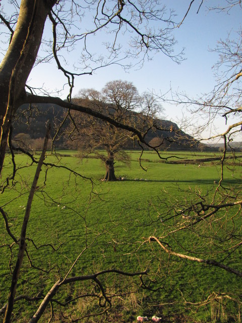
The hill is notable for its lush greenery and diverse flora and fauna. Its slopes are covered in heather, grasses, and wildflowers, creating a picturesque scene in the spring and summer months. The hillside is also home to a variety of animals, including mountain sheep, birds of prey, and smaller mammals such as rabbits and foxes.

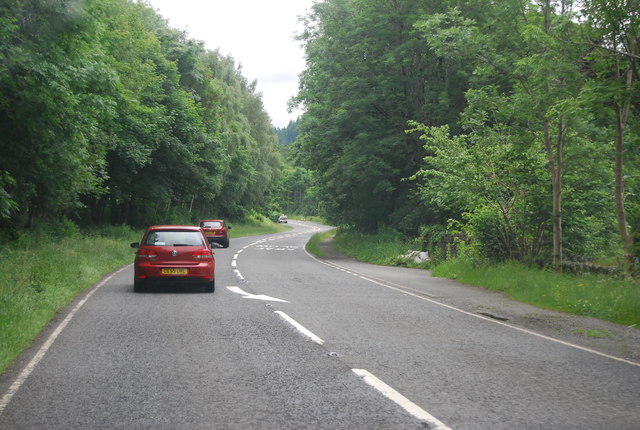
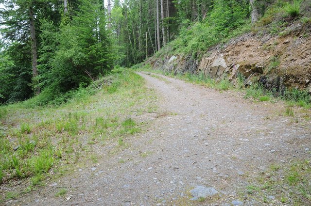
Gartheryr is a popular destination for outdoor enthusiasts and nature lovers. Numerous walking trails crisscross the hill, allowing visitors to explore its natural beauty and enjoy the peaceful atmosphere. One of the most favored routes is the Gartheryr Circular Walk, a moderate hike that takes approximately two hours to complete.

At the summit of Gartheryr, hikers are rewarded with stunning views of the surrounding countryside, including nearby lakes, valleys, and the towering peaks of Snowdonia. On a clear day, it is possible to see as far as the Irish Sea and the Isle of Anglesey.

Overall, Gartheryr is a beautiful and accessible hill that offers a wonderful opportunity to immerse oneself in the natural splendor of Caernarfonshire and discover the tranquility of the Welsh countryside.

If you have any feedback on the listing, please let us know in the comments section below.

Gartheryr Images

Images are sourced within 2km of 53.087524/-3.8091982 or Grid Reference SH7856. Thanks to Geograph Open Source API. All images are credited.

A5 near Betws-y-Coed The A5 heading north, almost at Betws-y-Coed, just past Bron-haul.
A5 near Betws-y-Coed
The A5 heading north, almost at Betws-y-Coed, just past Bron-haul.
Field near Rhyd y creua Farm Looking across a field beside the A470.
Field near Rhyd y creua Farm
Looking across a field beside the A470.
Rhyd y creua Farm Looking towards the farm from the A470.
Rhyd y creua Farm
Looking towards the farm from the A470.
Path beside the A470 Looking along the A470 towards Betws-y-Coed.
Path beside the A470
Looking along the A470 towards Betws-y-Coed.
Footpath beside the A470 Running alongside the A470 near Betws-y-Coed.
Footpath beside the A470
Running alongside the A470 near Betws-y-Coed.
Conwy Valley
Conwy Valley
Bend ahead on the A470
Park Hill Guest House / Gwesty Bryn Parc, Betws-y-Coed
A5 at Bron-haul The A5 is a major trunk road that runs 260 miles from London to Holyhead. It follows the course of an old Roman Road (Watling Street).
Wikipedia: <span class="nowrap"><a title="http://en.wikipedia.org/wiki/A5_road_(Great_Britain)" rel="nofollow ugc noopener" href="http://en.wikipedia.org/wiki/A5_road_(Great_Britain)">Link</a><img style="margin-left:2px;" alt="External link" title="External link - shift click to open in new window" src="https://s1.geograph.org.uk/img/external.png" width="10" height="10"/></span>
A5 at Bron-haul
The A5 is a major trunk road that runs 260 miles from London to Holyhead. It follows the course of an old Roman Road (Watling Street). Wikipedia: LinkExternal link
Rhyd y creua Farm
Rhyd y creua Farm
A470, southbound The A470(T) is a major long-distance road in Wales, from Cardiff on the south coast to Llandudno on the north coast. It is 186 miles long, with a tortuous route through the country's mountainous central region, including the Brecon Beacons and Snowdonia National Park.
Wikipedia: <span class="nowrap"><a title="http://en.wikipedia.org/wiki/A470_road" rel="nofollow ugc noopener" href="http://en.wikipedia.org/wiki/A470_road">Link</a><img style="margin-left:2px;" alt="External link" title="External link - shift click to open in new window" src="https://s1.geograph.org.uk/img/external.png" width="10" height="10"/></span>
A470, southbound
The A470(T) is a major long-distance road in Wales, from Cardiff on the south coast to Llandudno on the north coast. It is 186 miles long, with a tortuous route through the country's mountainous central region, including the Brecon Beacons and Snowdonia National Park. Wikipedia: LinkExternal link
Betws-y-coed: postbox № LL24 67, Rhyd-y-creuau This small postbox is in a lay-by on the A470, one of those lay-bys which was probably the original course of the road which has subsequently been straightened. The scene behind is of a large pile of logs which await removal; I drove along here the following day and much of the pile had been removed.
Betws-y-coed: postbox № LL24 67, Rhyd-y-creuau
This small postbox is in a lay-by on the A470, one of those lay-bys which was probably the original course of the road which has subsequently been straightened. The scene behind is of a large pile of logs which await removal; I drove along here the following day and much of the pile had been removed.
Afon Conwy floodplain
Forest track Forest track below Mynydd Garthmyn near Betws-y-Coed.
Forest track
Forest track below Mynydd Garthmyn near Betws-y-Coed.
Road at Garthmyn Country road passing Garthmyn.
Road at Garthmyn
Country road passing Garthmyn.
Rough pasture, Garthmyn Rough pasture and grazing at Garthmyn
Rough pasture, Garthmyn
Rough pasture and grazing at Garthmyn
Milestone Milestone on the A5 near to Capel Garmon, Conwy; for overall view see <a title="https://www.geograph.org.uk/photo/4951115" href="https://www.geograph.org.uk/photo/4951115">Link</a>
Milestone
Milestone on the A5 near to Capel Garmon, Conwy; for overall view see Link
Holyhead 46 Milestone hidden in the ivy lower right of photo on the A5 near to Capel Garmon, Conwy; for close up view see <a title="https://www.geograph.org.uk/photo/4951110" href="https://www.geograph.org.uk/photo/4951110">Link</a>
Holyhead 46
Milestone hidden in the ivy lower right of photo on the A5 near to Capel Garmon, Conwy; for close up view see Link
Show me another place!

Gartheryr is located at Grid Ref: SH7856 (Lat: 53.087524, Lng: -3.8091982)

Unitary Authority: Conwy

Police Authority: North Wales

What 3 Words

///zone.shortcuts.painted. Near Betws-y-Coed, Conwy

Nearby Locations

Betws-y-Coed Gartheryr

Related Wikis

St Mary's Church, Betws-y-Coed

St Mary's Church, Betws-y-Coed, is in the village of Betws-y-Coed, Conwy, Wales. It is an active Anglican parish church of the Church in Wales, in the...

Betws-y-Coed

Betws-y-coed (Welsh: [ˈbɛtʊs ə ˈkoːɨ̯d] ; meaning 'prayer-house in the wood') is a village and community in the Conwy valley in Conwy County Borough, Wales...

Betws-y-Coed railway station

Betws-y-coed railway station is on the Conwy Valley Line, which runs between Llandudno and Blaenau Ffestiniog. It is situated 15+1⁄2 miles (24.9 km) south...

River Llugwy

River Llugwy (Welsh: Afon Llugwy) is a tributary of the River Conwy, and has its source at Ffynnon Llugwy, a lake in the Carneddau range of mountains in...

Nearby Amenities

Located within 500m of 53.087524,-3.8091982
Hiking: yes
Information: guidepost
Source: GPS survey
Tourism: information
Lat/Long: 53.0867134/-3.8043983
Bench
Backrest: yes
Lat/Long: 53.0868729/-3.8044681
38W
Hiking: yes
Information: guidepost
Source: GPS survey
Tourism: information
Lat/Long: 53.0877867/-3.8035799
Hiking: yes
Information: guidepost
Source: GPS survey
Tourism: information
Lat/Long: 53.0878016/-3.8038035
Hiking: yes
Information: guidepost
Source: GPS survey
Tourism: information
Lat/Long: 53.0878471/-3.8039484
39Q
Hiking: yes
Information: guidepost
Source: GPS survey
Tourism: information
Lat/Long: 53.0862309/-3.8084874
35O
Hiking: yes
Information: guidepost
Source: GPS survey
Tourism: information
Lat/Long: 53.0846851/-3.8035387
The data included in this document is from www.openstreetmap.org. The data is made available under ODbL.

Have you been to Gartheryr?

Leave your review of Gartheryr below (or comments, questions and feedback).