Badgworthy Hill

Hill, Mountain in Devon North Devon

England

Badgworthy Hill

Long Combe
Long Combe Credit: Roger Cornfoot

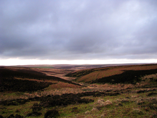
Badgworthy Hill is a prominent geographical feature located in Devon, a county in southwestern England. Standing at an elevation of 1,207 feet (368 meters), it is classified as a hill rather than a mountain. The hill is part of the Exmoor National Park, renowned for its stunning landscapes and rich wildlife.

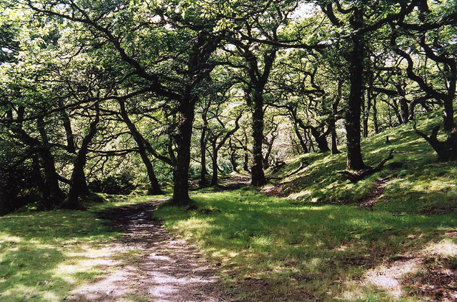
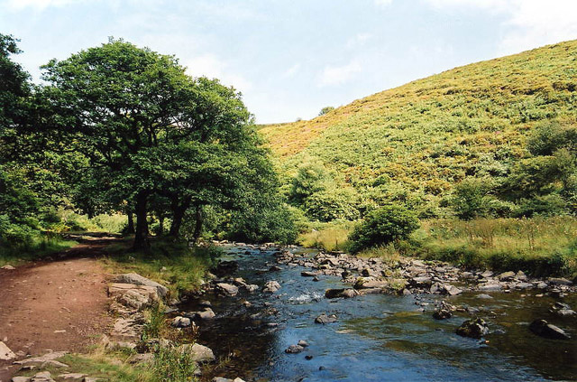
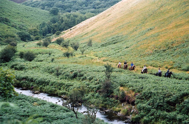
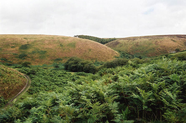
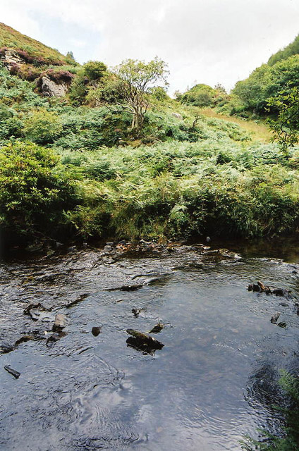
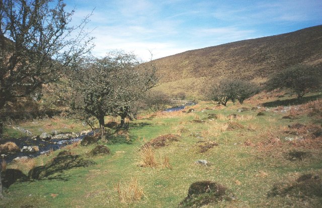
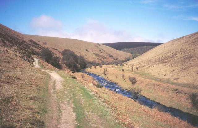
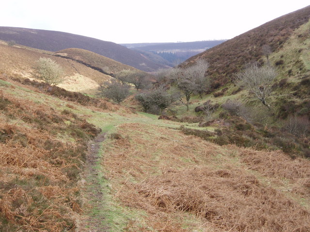
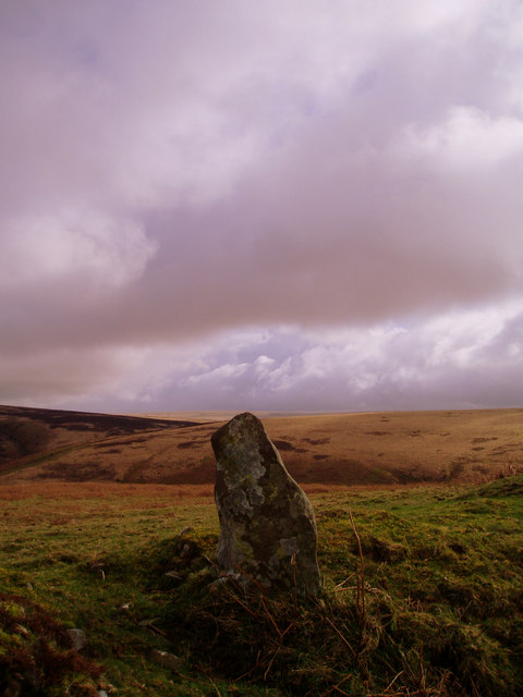
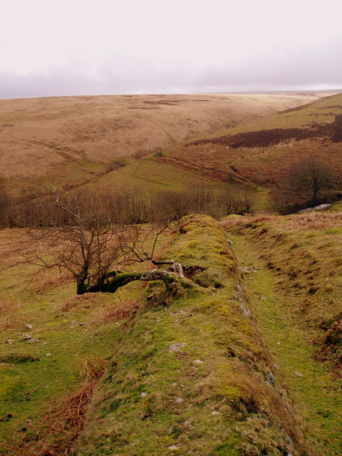
Badgworthy Hill is situated in the heart of the park, near the village of Oare. It offers breathtaking panoramic views of the surrounding countryside, including the rolling hills and lush valleys that characterize the region. The hill itself is covered in heather and gorse, creating a vibrant and colorful scenery.

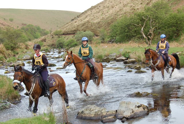
The area surrounding Badgworthy Hill is steeped in folklore and history. It is believed to be the setting for R.D. Blackmore's famous novel "Lorna Doone," which portrays the adventures of a notorious band of outlaws in 17th-century Devon. Visitors can explore the landscapes that inspired the novel and imagine themselves in the midst of the gripping storyline.

The hill is a popular destination for hikers and nature enthusiasts, offering various walking trails that cater to different levels of difficulty. It provides an excellent opportunity to observe the diverse wildlife that calls Exmoor National Park home, including red deer, Exmoor ponies, and a variety of bird species.

Overall, Badgworthy Hill in Devon is a picturesque and historically significant landmark that attracts visitors with its natural beauty, cultural heritage, and recreational opportunities.

If you have any feedback on the listing, please let us know in the comments section below.

Badgworthy Hill Images

Images are sourced within 2km of 51.180232/-3.7335394 or Grid Reference SS7843. Thanks to Geograph Open Source API. All images are credited.

Long Combe
Long Combe
Tom's Hill prehistoric stone row A wide double prehistoric stone row (or avenue) measuring 17.5m long, including 6 medium-sized stones. The row is orientated north to south. <span class="nowrap"><a title="https://stonerows.wordpress.com/gazetteer/region/exmoor/toms-hill/" rel="nofollow ugc noopener" href="https://stonerows.wordpress.com/gazetteer/region/exmoor/toms-hill/">Link</a><img style="margin-left:2px;" alt="External link" title="External link - shift click to open in new window" src="https://s1.geograph.org.uk/img/external.png" width="10" height="10"/></span>
Tom's Hill prehistoric stone row
A wide double prehistoric stone row (or avenue) measuring 17.5m long, including 6 medium-sized stones. The row is orientated north to south. LinkExternal link
Brendon: Badgworthy Wood Woodland on the walk south from Malmsmead to the 'Doone Country', beside Badgworthy Water
Brendon: Badgworthy Wood
Woodland on the walk south from Malmsmead to the 'Doone Country', beside Badgworthy Water
Brendon: Badgworthy Water With the Oare Water, Badgworthy Water combines to form the East Lyn, which meets the West Lyn at Lynmouth. By the path south from Malmsmead
Brendon: Badgworthy Water
With the Oare Water, Badgworthy Water combines to form the East Lyn, which meets the West Lyn at Lynmouth. By the path south from Malmsmead
Brendon: Badgworthy Water Badgworthy Water provides the border between west Somerset and north Devon. Riders on the Somerset bank in Oare parish
Brendon: Badgworthy Water
Badgworthy Water provides the border between west Somerset and north Devon. Riders on the Somerset bank in Oare parish
Brendon: site of medieval village Overlooking the site of a medieval village at the foot of Hoccombe Combe, in 'Doone Country', lost in the bracken
Brendon: site of medieval village
Overlooking the site of a medieval village at the foot of Hoccombe Combe, in 'Doone Country', lost in the bracken
Brendon: Badgworthy Water Looking east to the Somerset bank
Brendon: Badgworthy Water
Looking east to the Somerset bank
Badgworthy Water River, deep in the moor.  Heads north to join the East Lyn.
Badgworthy Water
River, deep in the moor. Heads north to join the East Lyn.
Badgworthy Water The river downstream and north of the medieval village.
Badgworthy Water
The river downstream and north of the medieval village.
Crossing Badgworthy Water Riders crossing in a south west direction heading towards the remains of the medieval village.
Crossing Badgworthy Water
Riders crossing in a south west direction heading towards the remains of the medieval village.
Looking down Lankcombe The path leads down to the valley of Badgworthy Water, Little Black Hill on the left.
Looking down Lankcombe
The path leads down to the valley of Badgworthy Water, Little Black Hill on the left.
Standing stone above Badgworthy Water Standing stone on Badgworthy Lees above Badgworthy Water which flows through the Doone Valley (made famous in RD Blackmore's "Lorna Doone"). There is also a deserted medieval village in the valley below this stone.
Standing stone above Badgworthy Water
Standing stone on Badgworthy Lees above Badgworthy Water which flows through the Doone Valley (made famous in RD Blackmore's "Lorna Doone"). There is also a deserted medieval village in the valley below this stone.
Field boundary looking South from Badgworthy Lees Field boundary looking South from Badgworthy Lees into Hoccombe Combe.
Field boundary looking South from Badgworthy Lees
Field boundary looking South from Badgworthy Lees into Hoccombe Combe.
Hoccombe Water, Exmoor Looking south west, at the confluence of the main water and (Lanacombe?) stream
Hoccombe Water, Exmoor
Looking south west, at the confluence of the main water and (Lanacombe?) stream
Open Spaces 2 Pan left from previous picture with 25% overlap.
Open Spaces 2
Pan left from previous picture with 25% overlap.
Open Spaces 3 Pan left again with 50% overlap.
Open Spaces 3
Pan left again with 50% overlap.
Hoccombe combe This early morning view of Hoccombe combe is from the head of the combe, following it down will take you to Badgeworthy water and the Doone valley.
Hoccombe combe
This early morning view of Hoccombe combe is from the head of the combe, following it down will take you to Badgeworthy water and the Doone valley.
Trout Hill Exmoor Trout Hill is bleak open moorland, nothing but this boundary fence as a feature which runs all the way down into the Doone valley.
Trout Hill Exmoor
Trout Hill is bleak open moorland, nothing but this boundary fence as a feature which runs all the way down into the Doone valley.
Show me another place!

Badgworthy Hill is located at Grid Ref: SS7843 (Lat: 51.180232, Lng: -3.7335394)

Administrative County: Devon

District: North Devon

Police Authority: Devon and Cornwall

What 3 Words

///reds.backswing.immunity. Near Lynton, Devon

Nearby Locations

Badgworthy Hill

Related Wikis

Lanacombe

Lanacombe is an area of Exmoor in Somerset, South West England. It is the site of several standing stones and cairns which have been scheduled as ancient...

North Exmoor SSSI

North Exmoor (grid reference SS800430) is a 12,005.3-hectare (29,666-acre) biological Site of Special Scientific Interest (SSSI) in Devon and Somerset...

Oare, Somerset

Oare is a village and civil parish on Oare Water on Exmoor in the Somerset West and Taunton district of Somerset, England. It is located 6 miles (10 km...

Church of St Mary, Oare

The Anglican Church of St Mary in Oare, Somerset, England, was built in the 15th century. It is a Grade II* listed building. == History == The nave and...

Malmsmead Bridge

Malmsmead Bridge is a 17th-century stone bridge which crosses Badgworthy Water in the hamlet of Malmsmead, on the road between Oare and Brendon. The Badgworthy...

Malmsmead

Malmsmead is a hamlet on the border between the English counties of Devon and Somerset. The nearest town is Lynton, which lies approximately 4.7 miles...

Robber's Bridge

Robber's Bridge, or Robbers Bridge, is an old masonry arch bridge in the royal forest of Exmoor near Doone Valley, carrying the minor road from Porlock...
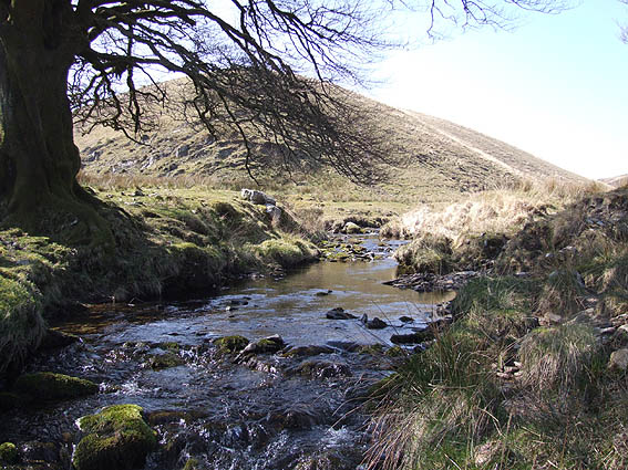
Oare Water

Oare Water passes through the village of Oare, on Exmoor in Somerset, England. It joins Badgworthy Water before flowing to Watersmeet and the Bristol Channel...

Nearby Amenities

Located within 500m of 51.180232,-3.7335394
Badgworthy Hill
Ele: 364
Natural: peak
Lat/Long: 51.1802777/-3.7333512
The data included in this document is from www.openstreetmap.org. The data is made available under ODbL.

Have you been to Badgworthy Hill?

Leave your review of Badgworthy Hill below (or comments, questions and feedback).