Barlocco Hill
Hill, Mountain in Kirkcudbrightshire
Scotland
Barlocco Hill

Barlocco Hill is a prominent geographical feature located in Kirkcudbrightshire, Scotland. It is classified as a hill, reaching an elevation of approximately 300 meters (984 feet) above sea level. The hill is situated in the southern region of Kirkcudbrightshire, near the village of Kirkcudbright.
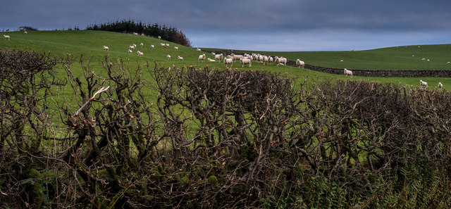
Barlocco Hill offers stunning panoramic views of the surrounding landscape, including the picturesque Solway Firth and the rolling hills of Galloway. The hill is covered in lush vegetation, with a mix of grasses, heather, and scattered trees dotting its slopes. The diverse flora provides habitat for various wildlife species, including birds, small mammals, and insects.
The hill is accessible via a well-maintained footpath, which winds its way up the slope to the summit. The hike to the top is relatively moderate, making it suitable for both experienced hikers and casual walkers. Along the way, visitors can admire the beautiful scenery and may even encounter some local wildlife.
At the summit of Barlocco Hill, visitors are rewarded with breathtaking views that stretch for miles. On a clear day, it is possible to see as far as the Lake District in England. The hilltop also offers a peaceful and serene atmosphere, providing an ideal spot for picnics or simply enjoying the tranquility of nature.
Barlocco Hill is a popular destination for outdoor enthusiasts, nature lovers, and those seeking a peaceful retreat away from the hustle and bustle of everyday life. Whether it's for a leisurely walk, a challenging hike, or a moment of tranquility, Barlocco Hill offers something for everyone.
If you have any feedback on the listing, please let us know in the comments section below.
Barlocco Hill Images
Images are sourced within 2km of 54.807629/-3.8955005 or Grid Reference NX7847. Thanks to Geograph Open Source API. All images are credited.


Barlocco Hill is located at Grid Ref: NX7847 (Lat: 54.807629, Lng: -3.8955005)
Unitary Authority: Dumfries and Galloway
Police Authority: Dumfries and Galloway
What 3 Words
///bonnet.drummers.roaming. Near Kirkcudbright, Dumfries & Galloway
Nearby Locations
Related Wikis

Wickerman Festival
The Wickerman Festival was an annual music festival held near Auchencairn in Dumfries and Galloway, Scotland. Dubbed "Scotland's Alternative Music festival...

Dundrennan Abbey
Dundrennan Abbey, in Dundrennan, Scotland, near to Kirkcudbright, was a Cistercian monastery in the Romanesque architectural style, established in 1142...

Dundrennan
Dundrennan (Gaelic: Dun Droighnein) is a village Dumfries and Galloway, Scotland, about 5 miles (8 km) east of Kirkcudbright. Its population is around...

Auchencairn
Auchencairn ([ɔxən'kʰɛ:(r)n]) is a village in the historical county of Kirkcudbrightshire in the Dumfries and Galloway region of Scotland. It is located...

Urr Water
Urr Water or River Urr (arc. River Orr) is a river in which flows through the counties of Dumfriesshire and Kirkcudbrightshire in southwest Scotland....

Abbey Head
Abbey Head is a headland on the Solway Firth coast of Dumfries and Galloway. == References ==

Hestan Island
Hestan Island is a small coastal island at the southern foot of the River Urr estuary in the Solway Firth, in the historical county of Kirkcudbrightshire...

Orchardton Castle
Orchardton Castle overlooks the Solway Coast. Built in the 1880s, this is a Grade B listed property formerly known as Orchardton House. Built around a...
Nearby Amenities
Located within 500m of 54.807629,-3.8955005Have you been to Barlocco Hill?
Leave your review of Barlocco Hill below (or comments, questions and feedback).