Cnoc Meala

Hill, Mountain in Sutherland

Scotland

Cnoc Meala

Cnoc Meala A hot day in the Flow Country.  This is a distant view from the Lochstrathy road.
Cnoc Meala Credit: Richard Webb

Cnoc Meala, also known as Meall Horn, is a prominent hill located in the county of Sutherland, in the northernmost part of the Scottish Highlands. Standing at an elevation of 755 meters (2,477 feet), it is considered a Corbett, which is a Scottish hill between 2,500 and 3,000 feet high.

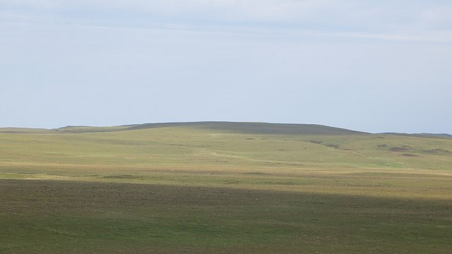
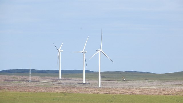
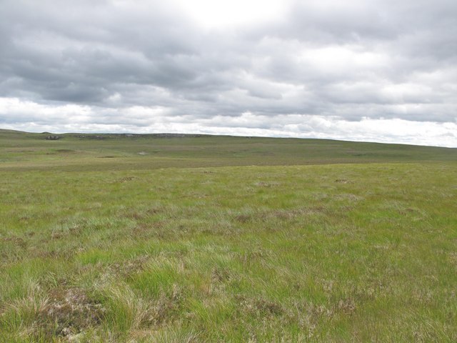
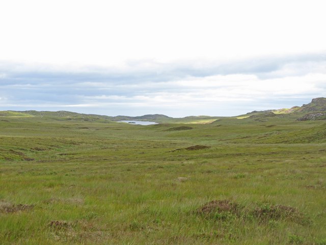
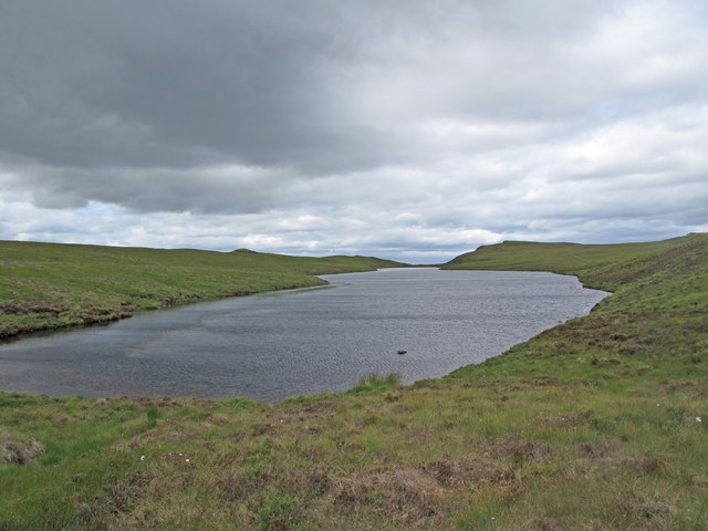
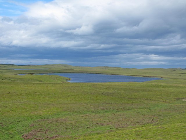
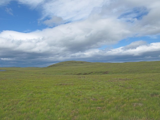
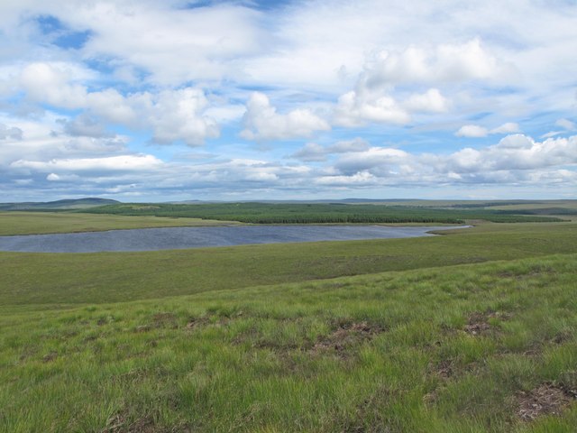
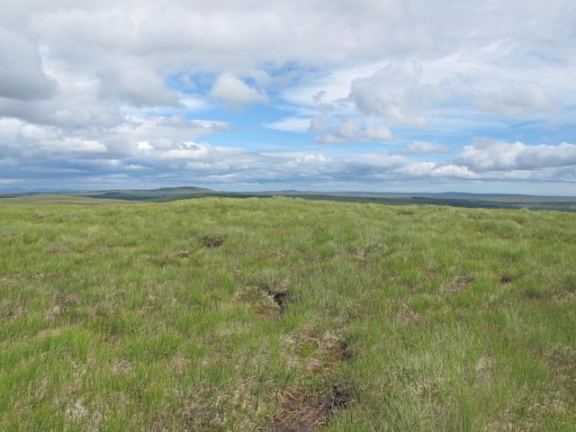
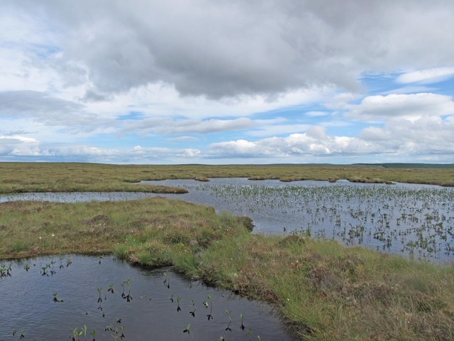
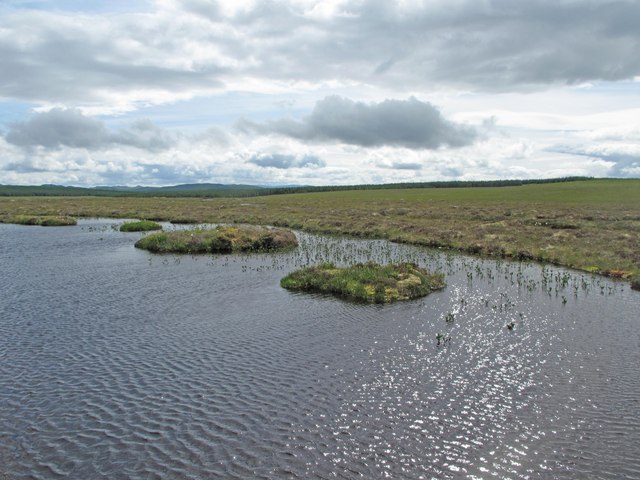
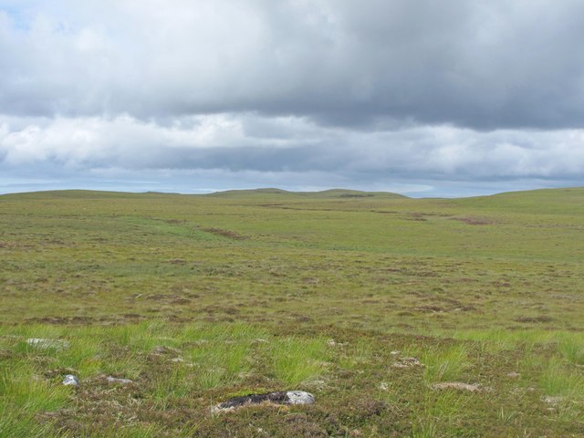
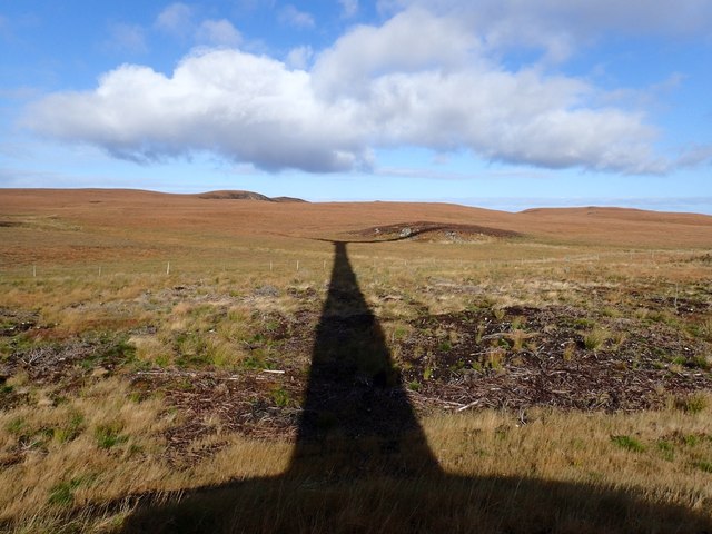
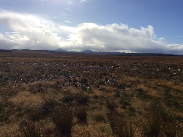
Situated in a remote and sparsely populated area, Cnoc Meala offers breathtaking views of the surrounding wilderness. Its position on the eastern edge of the vast Flow Country makes it an excellent vantage point for observing the expansive peatlands and rolling hills that characterize the area. On a clear day, the views can extend as far as the North Sea to the east and the mountains of Assynt to the west.

The ascent of Cnoc Meala can be accomplished by following a well-defined path that starts from the small village of Altnaharra. The route, although challenging, is not overly technical, making it accessible to experienced hikers and hillwalkers. However, it is important to note that the weather conditions in this part of Scotland can change rapidly, and proper equipment and navigation skills are essential.

Cnoc Meala is part of an area rich in archaeological and historical significance. The nearby Loch Naver contains a crannog, a type of ancient artificial island, which provides insights into the lives of early inhabitants. The hill itself is a haven for wildlife, including red deer, golden eagles, and various species of birds, making it a popular destination for nature lovers and wildlife enthusiasts.

Overall, Cnoc Meala offers a rewarding outdoor experience, combining stunning natural landscapes, historical intrigue, and a chance to spot Scotland's diverse wildlife.

If you have any feedback on the listing, please let us know in the comments section below.

Cnoc Meala Images

Images are sourced within 2km of 58.48042/-4.0921593 or Grid Reference NC7856. Thanks to Geograph Open Source API. All images are credited.

Cnoc Meala A hot day in the Flow Country.  This is a distant view from the Lochstrathy road.
Cnoc Meala
A hot day in the Flow Country. This is a distant view from the Lochstrathy road.
Strathy North power station The edge of a wind farm nearing completion. It looks terrible from the coast road.
Strathy North power station
The edge of a wind farm nearing completion. It looks terrible from the coast road.
Strathy North power station A digger is working beside a row of turbines in a former forestry plantation. This was taken towards the completion of the wind farm.
Strathy North power station
A digger is working beside a row of turbines in a former forestry plantation. This was taken towards the completion of the wind farm.
Loch Meala Loch Meala has a relatively small catchment area for its size and is located in a featureless area of blanket bog to the west of Strathy Forest. It outflows to the River Strathy
Loch Meala
Loch Meala has a relatively small catchment area for its size and is located in a featureless area of blanket bog to the west of Strathy Forest. It outflows to the River Strathy
Sutherland Peatland Blanket bog in the peatlands east of Caol-Loch Creag nan Laogh.
Sutherland Peatland
Blanket bog in the peatlands east of Caol-Loch Creag nan Laogh.
Sutherland Peatland The catchment of the Uidh Rabhain, a burn which flows into Loch Meadie in the far distance.
Sutherland Peatland
The catchment of the Uidh Rabhain, a burn which flows into Loch Meadie in the far distance.
Caol-Loch Creag an Laogh The narrow (caol) loch near Creag an Laogh (crag of the calf).
Caol-Loch Creag an Laogh
The narrow (caol) loch near Creag an Laogh (crag of the calf).
Peatland and Loch Buidhe Mor Blanket bog descending to the southern end of Loch Buidhe Mor.
Peatland and Loch Buidhe Mor
Blanket bog descending to the southern end of Loch Buidhe Mor.
Sutherland Peatland Blanket bog at the head of Loch Buidhe Mor, with Beinn nam Bo in the distance.
Sutherland Peatland
Blanket bog at the head of Loch Buidhe Mor, with Beinn nam Bo in the distance.
Loch Meala Loch Meala, with Strathy Forest behind.
Loch Meala
Loch Meala, with Strathy Forest behind.
Cnoc Meala The remote summit of Cnoc Meala, unmarked by a cairn since the blanket bog covers any building material.
Cnoc Meala
The remote summit of Cnoc Meala, unmarked by a cairn since the blanket bog covers any building material.
Blanket Bog West of Strathy Forest Blanket bog stretches to the horizon. This area is protected by deer fence and the vegetation is undisturbed, with Bog Myrtle a prominent species.
Blanket Bog West of Strathy Forest
Blanket bog stretches to the horizon. This area is protected by deer fence and the vegetation is undisturbed, with Bog Myrtle a prominent species.
Dubh Lochans Dubh Lochans with Bog Bean, west of Strathy Forest.
Dubh Lochans
Dubh Lochans with Bog Bean, west of Strathy Forest.
Dubh Lochan A dubh lochan in the peatlands west of Strathy Forest.
Dubh Lochan
A dubh lochan in the peatlands west of Strathy Forest.
Catchment of the Allt an Reidhe This peatland is drained by the Allt an Reidhe, which is a tributary of the River Strathy.
Catchment of the Allt an Reidhe
This peatland is drained by the Allt an Reidhe, which is a tributary of the River Strathy.
Edge of Strathy North Forest in Shadow of Wind Turbine All trees within the windfarm area have been felled, and the brash has been flattened. The boundary fence, which was previously electrified, was still in good condition. The hill in the background is Beinn nam Bo.
Edge of Strathy North Forest in Shadow of Wind Turbine
All trees within the windfarm area have been felled, and the brash has been flattened. The boundary fence, which was previously electrified, was still in good condition. The hill in the background is Beinn nam Bo.
Southern Edge of Strathy North Windfarm Area The forest had been cleared up to the southern boundary, and in the distance can be seen other forests where windfarms are planned. The hills behind are the Griams.
Southern Edge of Strathy North Windfarm Area
The forest had been cleared up to the southern boundary, and in the distance can be seen other forests where windfarms are planned. The hills behind are the Griams.
Wind Turbines in Strathy North Windfarm The forest has been cleared and the brash has been spread/ compacted.
Wind Turbines in Strathy North Windfarm
The forest has been cleared and the brash has been spread/ compacted.
Show me another place!

Cnoc Meala is located at Grid Ref: NC7856 (Lat: 58.48042, Lng: -4.0921593)

Unitary Authority: Highland

Police Authority: Highlands and Islands

What 3 Words

///tweed.commenced.trapdoor. Near Forsinard, Highland

Nearby Locations

Loch Meala Cnoc Meala

Related Wikis

Skelpick

Skelpick (Scottish Gaelic: Sgeilpeach) is a small remote crofting hamlet, 2 miles south of Bettyhill, in the far north of Sutherland, Scottish Highlands...

Leckfurin

Leckfurin is a small remote village, which lies on the left bank of the River Naver, in northern Sutherland in Scottish Highlands and is in the Scottish...

Armadale, Sutherland

Armadale (Scottish Gaelic: Armadal, Scots: Airmadale) is a small village on the north coast of Scotland, in the council area of Highland. The village is...

Swordly

Swordly (Scottish Gaelic: Suardailigh) is an extremely remote hamlet, located on the Bay of Swordly, on the north coastline of Scotland in Sutherland...

Have you been to Cnoc Meala?

Leave your review of Cnoc Meala below (or comments, questions and feedback).