Bryn Mawr

Hill, Mountain in Cardiganshire

Wales

Bryn Mawr

Byway at Ty'n Cornel in Cwm Doethie Fawr, Ceredigion Ty'n Cornel is a former YHA hostel, now very efficiently operated by the Elenydd Wilderness Hostels. <span class="nowrap"><a title="https://www.elenydd-hostels.co.uk/en" rel="nofollow ugc noopener" href="https://www.elenydd-hostels.co.uk/en">Link</a><img style="margin-left:2px;" alt="External link" title="External link - shift click to open in new window" src="https://s1.geograph.org.uk/img/external.png" width="10" height="10"/></span>
The track is a former drove road between Abergwesyn and Llanddewi-Brefi. The hostel is at an altitude of about 320 metres (1050 feet) so being enveloped by cloud is a regular and frequent occurrence.
It is five and a half miles (8·84 km) as the red kite flies between the hostel and the church tower in Llanddewi-Brefi. It is nearer seven miles by road!
Byway at Ty'n Cornel in Cwm Doethie Fawr, Ceredigion Credit: Roger D Kidd

The requested URL returned error: 429 Too Many Requests

If you have any feedback on the listing, please let us know in the comments section below.
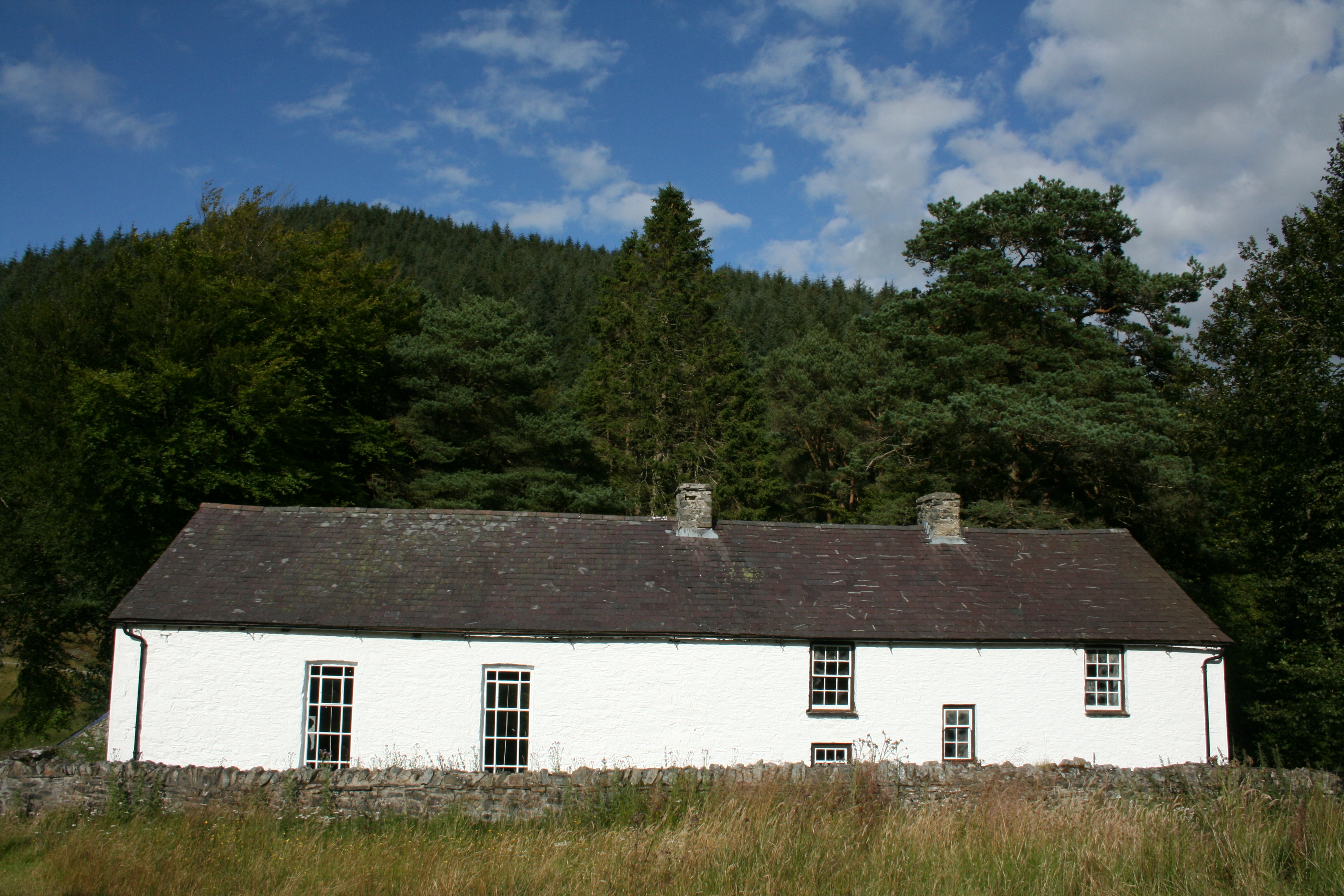
Bryn Mawr Images

Images are sourced within 2km of 52.155489/-3.8331384 or Grid Reference SN7452. Thanks to Geograph Open Source API. All images are credited.

Byway at Ty'n Cornel in Cwm Doethie Fawr, Ceredigion Ty'n Cornel is a former YHA hostel, now very efficiently operated by the Elenydd Wilderness Hostels. <span class="nowrap"><a title="https://www.elenydd-hostels.co.uk/en" rel="nofollow ugc noopener" href="https://www.elenydd-hostels.co.uk/en">Link</a><img style="margin-left:2px;" alt="External link" title="External link - shift click to open in new window" src="https://s1.geograph.org.uk/img/external.png" width="10" height="10"/></span>
The track is a former drove road between Abergwesyn and Llanddewi-Brefi. The hostel is at an altitude of about 320 metres (1050 feet) so being enveloped by cloud is a regular and frequent occurrence.
It is five and a half miles (8·84 km) as the red kite flies between the hostel and the church tower in Llanddewi-Brefi. It is nearer seven miles by road!
Byway at Ty'n Cornel in Cwm Doethie Fawr, Ceredigion
Ty'n Cornel is a former YHA hostel, now very efficiently operated by the Elenydd Wilderness Hostels. LinkExternal link The track is a former drove road between Abergwesyn and Llanddewi-Brefi. The hostel is at an altitude of about 320 metres (1050 feet) so being enveloped by cloud is a regular and frequent occurrence. It is five and a half miles (8·84 km) as the red kite flies between the hostel and the church tower in Llanddewi-Brefi. It is nearer seven miles by road!
Cwm Doethie Fawr in cloud, Ceredigion The view is looking south-east from the byway near Ty'n Cornel. The road is at an altitude of about 320 metres (1050 feet) so being in cloud is a regular and frequent occurrence.
Cwm Doethie Fawr in cloud, Ceredigion
The view is looking south-east from the byway near Ty'n Cornel. The road is at an altitude of about 320 metres (1050 feet) so being in cloud is a regular and frequent occurrence.
Hill pasture by Cwm Doethie Fawr in Ceredigion The view is looking south across Cwm Doethie Fawr from the byway near Ty'n Cornel. The road is at an altitude of about 320 metres (1050 feet) so being in cloud is a regular and frequent occurrence.
Hill pasture by Cwm Doethie Fawr in Ceredigion
The view is looking south across Cwm Doethie Fawr from the byway near Ty'n Cornel. The road is at an altitude of about 320 metres (1050 feet) so being in cloud is a regular and frequent occurrence.
Ty'n Cornel Hostel south-east of Llanddewi Brefi in Ceredigion Ty'n Cornel is a former YHA hostel, now very efficiently operated by the Elenydd Wilderness Hostels. <span class="nowrap"><a title="https://www.elenydd-hostels.co.uk/en" rel="nofollow ugc noopener" href="https://www.elenydd-hostels.co.uk/en">Link</a><img style="margin-left:2px;" alt="External link" title="External link - shift click to open in new window" src="https://s1.geograph.org.uk/img/external.png" width="10" height="10"/></span>
The track is a former drove road between Abergwesyn and Llanddewi-Brefi. The hostel is at an altitude of about 320 metres (1050 feet) so being enveloped by cloud is a regular and frequent occurrence.

It is five and a half miles (8·84 km) as the red kite flies between the hostel and the church tower in Llanddewi-Brefi. It is more like seven miles by road!
Ty'n Cornel Hostel south-east of Llanddewi Brefi in Ceredigion
Ty'n Cornel is a former YHA hostel, now very efficiently operated by the Elenydd Wilderness Hostels. LinkExternal link The track is a former drove road between Abergwesyn and Llanddewi-Brefi. The hostel is at an altitude of about 320 metres (1050 feet) so being enveloped by cloud is a regular and frequent occurrence. It is five and a half miles (8·84 km) as the red kite flies between the hostel and the church tower in Llanddewi-Brefi. It is more like seven miles by road!
Hill pasture in Cwm Doethie Fawr, Ceredigion Looking north-west from near Ty'n Cornel hostel.
Hill pasture in Cwm Doethie Fawr, Ceredigion
Looking north-west from near Ty'n Cornel hostel.
Former drove road to Llanddewi Brefi Looking north-west from near Ty'n Cornel hostel. It is about seven miles to Llanddewi Brefi, or five and a half miles (8·84 km) as the red kite flies. Those birds are often seen in this beautiful remote valley.
The old route linked Abergwesyn with Llanddewi Brefi.
Former drove road to Llanddewi Brefi
Looking north-west from near Ty'n Cornel hostel. It is about seven miles to Llanddewi Brefi, or five and a half miles (8·84 km) as the red kite flies. Those birds are often seen in this beautiful remote valley. The old route linked Abergwesyn with Llanddewi Brefi.
Rock outcrop in Cwm Doethie Fawr in Ceredigion About five hundred metres north-west of Ty'n Cornel hostel by the old drove road.
Rock outcrop in Cwm Doethie Fawr in Ceredigion
About five hundred metres north-west of Ty'n Cornel hostel by the old drove road.
Rock outcrop in Cwm Doethie Fawr in Ceredigion About five hundred metres north-west of Ty'n Cornel hostel by the old drove road.
Rock outcrop in Cwm Doethie Fawr in Ceredigion
About five hundred metres north-west of Ty'n Cornel hostel by the old drove road.
Former drover's road in Upper Cwm Doethie, Ceredigion Looking south-west about 350 metres from Ty'n Cornel hostel.
The drove road ran from Llanddewi Brefi to Abergwesyn via Cwm Doethie Fawr, Cwm Camddwr and Cwm Tywi.
Former drover's road in Upper Cwm Doethie, Ceredigion
Looking south-west about 350 metres from Ty'n Cornel hostel. The drove road ran from Llanddewi Brefi to Abergwesyn via Cwm Doethie Fawr, Cwm Camddwr and Cwm Tywi.
Byway to Llanddewi Brefi in Ceredigion Looking north-west from near Ty'n Cornel hostel. It is about seven miles to Llanddewi Brefi, or five and a half miles (8·84 km) as the red kite flies. Those birds are often seen in this beautiful remote valley.
This old drovers' route linked Abergwesyn with Llanddewi Brefi. It is now an unsurfaced byway open to all traffic, but often eroded by convoys of "off-roaders".
Byway to Llanddewi Brefi in Ceredigion
Looking north-west from near Ty'n Cornel hostel. It is about seven miles to Llanddewi Brefi, or five and a half miles (8·84 km) as the red kite flies. Those birds are often seen in this beautiful remote valley. This old drovers' route linked Abergwesyn with Llanddewi Brefi. It is now an unsurfaced byway open to all traffic, but often eroded by convoys of "off-roaders".
Former drover's road in Upper Cwm Doethie, Ceredigion Looking east towards Soar-y-Mynydd. Cwm Nant-y-Rhiw is off to the left.
The drove road ran from Llanddewi Brefi to Abergwesyn via Cwm Doethie Fawr, Cwm Camddwr and Cwm Tywi. Nowadays it is a byway "open to all traffic", but in practice it is only passable by some farm vehicles, and four wheel drive "off-roaders" whose convoys contribute a lot towards erosion which can become catastrophic. The descent to Soar-y-Mynydd is rocky, loose and steep.
Former drover's road in Upper Cwm Doethie, Ceredigion
Looking east towards Soar-y-Mynydd. Cwm Nant-y-Rhiw is off to the left. The drove road ran from Llanddewi Brefi to Abergwesyn via Cwm Doethie Fawr, Cwm Camddwr and Cwm Tywi. Nowadays it is a byway "open to all traffic", but in practice it is only passable by some farm vehicles, and four wheel drive "off-roaders" whose convoys contribute a lot towards erosion which can become catastrophic. The descent to Soar-y-Mynydd is rocky, loose and steep.
Byway to Soar-y-Mynydd in Ceredigion Looking north-east towards Soar-y-Mynydd, climbing from the ford across Afon Doethie Fach. Cwm Nant-y-Rhiw is off to the left. 
This former drove road ran from Llanddewi Brefi to Abergwesyn via Cwm Doethie Fawr, Cwm Camddwr and Cwm Tywi. Nowadays it is a byway "open to all traffic", but in practice it is only passable by some farm vehicles, and four wheel drive "off-roaders" whose convoys contribute a lot towards erosion which can become catastrophic. The descent to Soar-y-Mynydd is rocky, loose and steep.

<a href="https://www.geograph.org.uk/photo/4627271">SN7553 : Cwm Doethie byway erosion, Ceredigion</a>
Byway to Soar-y-Mynydd in Ceredigion
Looking north-east towards Soar-y-Mynydd, climbing from the ford across Afon Doethie Fach. Cwm Nant-y-Rhiw is off to the left. This former drove road ran from Llanddewi Brefi to Abergwesyn via Cwm Doethie Fawr, Cwm Camddwr and Cwm Tywi. Nowadays it is a byway "open to all traffic", but in practice it is only passable by some farm vehicles, and four wheel drive "off-roaders" whose convoys contribute a lot towards erosion which can become catastrophic. The descent to Soar-y-Mynydd is rocky, loose and steep. SN7553 : Cwm Doethie byway erosion, Ceredigion
Byway to Soar-y-Mynydd in Ceredigion Looking north-east towards Soar-y-Mynydd, climbing from the ford across Afon Doethie Fach. Cwm Nant-y-Rhiw is off to the left. 
This former drove road ran from Llanddewi Brefi to Abergwesyn via Cwm Doethie Fawr, Cwm Camddwr and Cwm Tywi. Nowadays it is a byway "open to all traffic", but in practice it is only passable by some farm vehicles, and four wheel drive "off-roaders" whose convoys contribute a lot towards erosion which can become catastrophic. The descent to Soar-y-Mynydd is rocky, loose and steep.

<a href="https://www.geograph.org.uk/photo/6703724">SN7553 : Eroded byway in Cwm Doethie, Ceredigion</a>
Byway to Soar-y-Mynydd in Ceredigion
Looking north-east towards Soar-y-Mynydd, climbing from the ford across Afon Doethie Fach. Cwm Nant-y-Rhiw is off to the left. This former drove road ran from Llanddewi Brefi to Abergwesyn via Cwm Doethie Fawr, Cwm Camddwr and Cwm Tywi. Nowadays it is a byway "open to all traffic", but in practice it is only passable by some farm vehicles, and four wheel drive "off-roaders" whose convoys contribute a lot towards erosion which can become catastrophic. The descent to Soar-y-Mynydd is rocky, loose and steep. SN7553 : Eroded byway in Cwm Doethie, Ceredigion
Rowan and hill pasture near Afon Doethie Fach, Ceredigion By the old drover's road to Abergwesyn, looking north-east across the Nant-y-Rhiw valley.
Rowan and hill pasture near Afon Doethie Fach, Ceredigion
By the old drover's road to Abergwesyn, looking north-east across the Nant-y-Rhiw valley.
Ceredigion hill pasture by Nant-y-Rhiw Looking north-east across the Nant-y-Rhiw valley, by the old drover's road. The ford and footbridge crossing Afon Doethie Fach are behind the camera.
Ceredigion hill pasture by Nant-y-Rhiw
Looking north-east across the Nant-y-Rhiw valley, by the old drover's road. The ford and footbridge crossing Afon Doethie Fach are behind the camera.
Byway and hill pasture near Cwm Doethie Fach in Ceredigion Looking north-east towards Soar-y-Mynydd, climbing from the ford across Afon Doethie Fach. Cwm Nant-y-Rhiw is off to the left. 
This former drove road ran from Llanddewi Brefi to Abergwesyn via Cwm Doethie Fawr, Cwm Camddwr and Cwm Tywi. Nowadays it is a byway "open to all traffic", but in practice it is only passable by some farm vehicles, and four wheel drive "off-roaders" whose convoys contribute a lot towards erosion which can become catastrophic. The descent to Soar-y-Mynydd a mile and a half ahead is rocky, loose and steep.

<a href="https://www.geograph.org.uk/photo/6703724">SN7553 : Eroded byway in Cwm Doethie, Ceredigion</a>
Byway and hill pasture near Cwm Doethie Fach in Ceredigion
Looking north-east towards Soar-y-Mynydd, climbing from the ford across Afon Doethie Fach. Cwm Nant-y-Rhiw is off to the left. This former drove road ran from Llanddewi Brefi to Abergwesyn via Cwm Doethie Fawr, Cwm Camddwr and Cwm Tywi. Nowadays it is a byway "open to all traffic", but in practice it is only passable by some farm vehicles, and four wheel drive "off-roaders" whose convoys contribute a lot towards erosion which can become catastrophic. The descent to Soar-y-Mynydd a mile and a half ahead is rocky, loose and steep. SN7553 : Eroded byway in Cwm Doethie, Ceredigion
Afon Doethie Fach near Bryn Mawr in Ceredigion Looking north towards Glog Fach from the footbridge above the ford. The confluence with the Afon Doethie Fawr is behind the camera about three hundred metres away.
Afon Doethie Fach near Bryn Mawr in Ceredigion
Looking north towards Glog Fach from the footbridge above the ford. The confluence with the Afon Doethie Fawr is behind the camera about three hundred metres away.
Afon Doethie Fach ford near Bryn Mawr in Ceredigion Looking south-south-east towards the confluence with the Afon Doethie Fawr, about three hundred metres away. The view is from the footbridge. The former drove road between Llanddewi Brefi and Abergwesyn (via Soar-y-Mynydd) fords the river here, Llanddewi Brefi being more than seven miles away, through the gate on the right.
Afon Doethie Fach ford near Bryn Mawr in Ceredigion
Looking south-south-east towards the confluence with the Afon Doethie Fawr, about three hundred metres away. The view is from the footbridge. The former drove road between Llanddewi Brefi and Abergwesyn (via Soar-y-Mynydd) fords the river here, Llanddewi Brefi being more than seven miles away, through the gate on the right.
Show me another place!

Bryn Mawr is located at Grid Ref: SN7452 (Lat: 52.155489, Lng: -3.8331384)

Unitary Authority: Ceredigion

Police Authority: Dyfed Powys

What 3 Words

///partner.disprove.hems. Near Tregaron, Ceredigion

Nearby Locations

Bryn Mawr

Related Wikis

Soar y mynydd

Soar-y-mynydd or Soar y mynydd is a Calvinist Methodist chapel near the eastern extremity of the large parish of Llanddewi Brefi, Ceredigion. It is claimed...

Camddwr

For the tributary of the River Wye, see Camddwr, Wye and for the tributary of the River Teifi, see Camddwr, Teifi.The Camddwr is a significant right-bank...

Llyn Brianne

Llyn Brianne is a man-made lake or reservoir in the headwaters of the River Towy in Wales. == Construction == The reservoir was constructed by Wimpey Construction...

Pentre-rhew

Pentre-rhew is a hamlet in the community of Llanddewibrefi, Ceredigion, Wales, which is 58.3 miles (93.9 km) from Cardiff and 169.6 miles (272.9 km) from...

Have you been to Bryn Mawr?

Leave your review of Bryn Mawr below (or comments, questions and feedback).