Carmeiloch Hill

Hill, Mountain in Stirlingshire

Scotland

Carmeiloch Hill

Shielbrae House
Shielbrae House Credit: Alan Reid

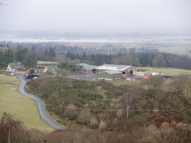
Carmeiloch Hill is a prominent hill located in Stirlingshire, Scotland. With an elevation of approximately 311 meters (1,020 feet), it offers breathtaking views of the surrounding landscape. Situated near the village of Thornhill, the hill is easily accessible to both locals and tourists.

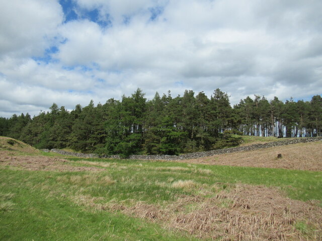
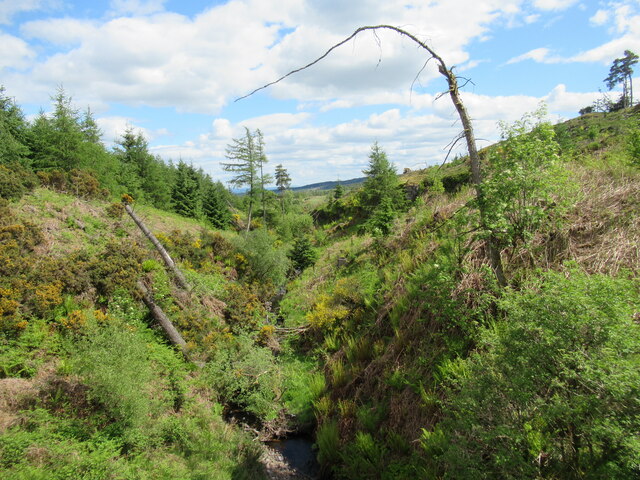
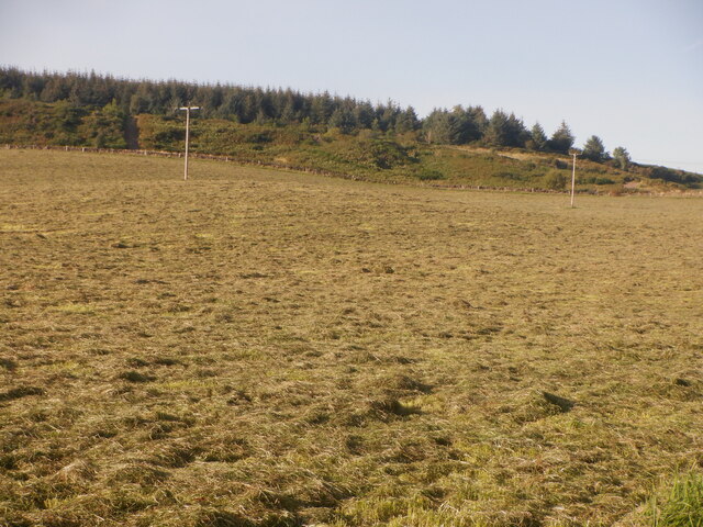
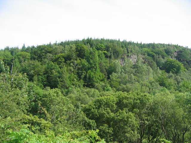
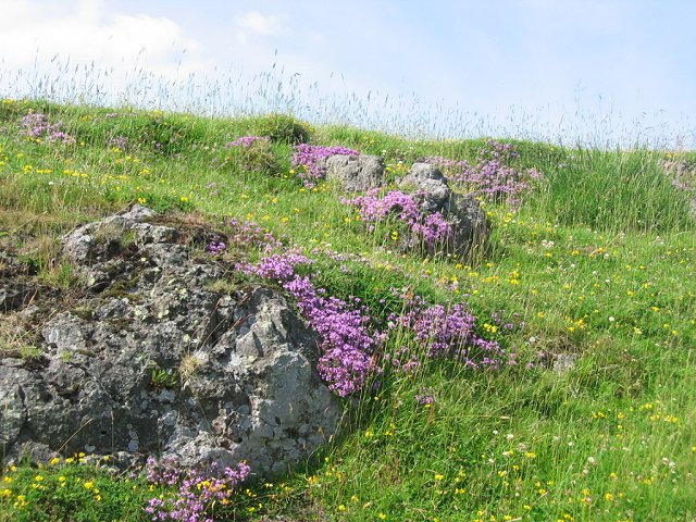
The terrain of Carmeiloch Hill is predominantly covered by heather and grass, making it a popular spot for hikers and nature enthusiasts. The hill is known for its diverse flora and fauna, which includes a variety of bird species, such as buzzards and kestrels. It is also home to several species of wildflowers, adding to its natural beauty.

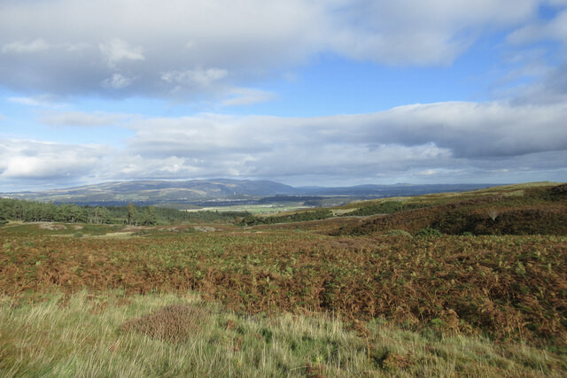
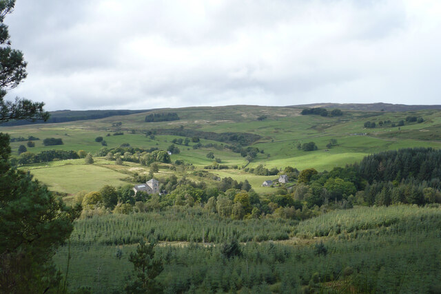
At the summit of Carmeiloch Hill, visitors are rewarded with panoramic views of the surrounding countryside, including the nearby Campsie Fells and the Trossachs National Park. On a clear day, it is even possible to catch a glimpse of the majestic Loch Lomond in the distance.

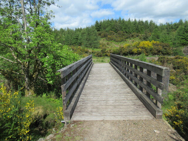
The hill is crisscrossed with a network of well-maintained walking trails, providing options for both leisurely strolls and more challenging hikes. The paths are clearly marked, ensuring that visitors can navigate their way easily. Along the way, there are benches and picnic spots, allowing hikers to take a break and enjoy the stunning vistas.

Whether it is for a leisurely walk, a challenging hike, or simply to marvel at the natural beauty of the Scottish countryside, Carmeiloch Hill in Stirlingshire offers a delightful experience for all who visit.

If you have any feedback on the listing, please let us know in the comments section below.

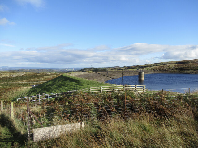
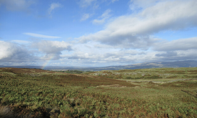
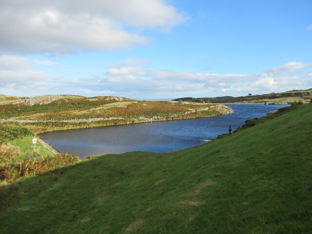
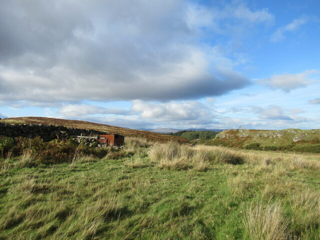
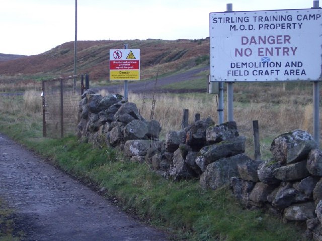
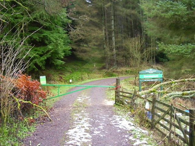
Carmeiloch Hill Images

Images are sourced within 2km of 56.10086/-4.0166061 or Grid Reference NS7491. Thanks to Geograph Open Source API. All images are credited.

Shielbrae House
Shielbrae House
Boundary wall and forestry at Mickle Indernade A couple of cuckoos were calling from the plantation. It's possible to go between the forest and the open moorland here via the hole in the wall near the left of the photo.
Boundary wall and forestry at Mickle Indernade
A couple of cuckoos were calling from the plantation. It's possible to go between the forest and the open moorland here via the hole in the wall near the left of the photo.
Footbridge over the West Burn in Garshellach Forest Various paths and tracks exist within Garshellach Forest which offer a variety of walks.
Footbridge over the West Burn in Garshellach Forest
Various paths and tracks exist within Garshellach Forest which offer a variety of walks.
West Burn in Garshellach Forest A view from the footbridge over this small burn in the Garshellach Forest, which drains into the River Forth via the Touch Burn (pronounced 'tooch', with the ch sound as in 'loch').
West Burn in Garshellach Forest
A view from the footbridge over this small burn in the Garshellach Forest, which drains into the River Forth via the Touch Burn (pronounced 'tooch', with the ch sound as in 'loch').
Heather and Scots pines at Slack of Ballangair The large-scale map attaches the name Slack of Ballangair to this area, where the West Burn flows through quite a deep ravine. The first part of the name probably derives from the Gaelic word slochd, meaning 'pit' or 'hollow'.
Heather and Scots pines at Slack of Ballangair
The large-scale map attaches the name Slack of Ballangair to this area, where the West Burn flows through quite a deep ravine. The first part of the name probably derives from the Gaelic word slochd, meaning 'pit' or 'hollow'.
Bracken and moorland on the Touch Hills The Touch Hills (pronounced 'tooch', with the 'ch' as in 'loch') are an expanse of moorland containing lots of lumpy, bumpy ground that doesn't give the easiest of walking, but there are good view over Stirling towards the Ochil Hills.
Bracken and moorland on the Touch Hills
The Touch Hills (pronounced 'tooch', with the 'ch' as in 'loch') are an expanse of moorland containing lots of lumpy, bumpy ground that doesn't give the easiest of walking, but there are good view over Stirling towards the Ochil Hills.
One of the Touch Reservoirs The smallest and easternmost of the Touch Reservoirs is just visible on the left-hand side of the photograph, lying below its slightly larger neighbour.

Touch is pronounced 'tooch', with the 'ch' as in 'loch'.
One of the Touch Reservoirs
The smallest and easternmost of the Touch Reservoirs is just visible on the left-hand side of the photograph, lying below its slightly larger neighbour. Touch is pronounced 'tooch', with the 'ch' as in 'loch'.
Outcrops on the Touch Hills Touch is pronounced 'tooch', with the 'ch' as in 'loch, although the hills are really just an expanse of lumpy moorland with small rock outcrops.

A partial rainbow is visible in the distance.
Outcrops on the Touch Hills
Touch is pronounced 'tooch', with the 'ch' as in 'loch, although the hills are really just an expanse of lumpy moorland with small rock outcrops. A partial rainbow is visible in the distance.
Eastern reservoir, Touch Hills This is the smallest and further east of the three Touch Reservoirs. Touch is pronounced 'tooch', with the 'ch' as in 'loch'.
Eastern reservoir, Touch Hills
This is the smallest and further east of the three Touch Reservoirs. Touch is pronounced 'tooch', with the 'ch' as in 'loch'.
Rough ground on the Touch Hills Touch is pronounced 'tooch', with the 'ch' as in 'loch'.
Rough ground on the Touch Hills
Touch is pronounced 'tooch', with the 'ch' as in 'loch'.
Murrayshall Farm The carse beyond is fogbound.
Murrayshall Farm
The carse beyond is fogbound.
Freshly cut grass, Castlehill
Houses north of North Third Reservoir The house on the left, with the pyramidally roofed tower, is the former reservoir pump house (built 1931), a B-listed building: <span class="nowrap"><a title="https://portal.historicenvironment.scot/designation/LB50839" rel="nofollow ugc noopener" href="https://portal.historicenvironment.scot/designation/LB50839">Link</a><img style="margin-left:2px;" alt="External link" title="External link - shift click to open in new window" src="https://s1.geograph.org.uk/img/external.png" width="10" height="10"/></span>
Houses north of North Third Reservoir
The house on the left, with the pyramidally roofed tower, is the former reservoir pump house (built 1931), a B-listed building: LinkExternal link
Sauchie Craig This square is mostly forest. Within the forest is a line of crags, probably dolerite. Mostly hidden at this end they can just be seen through the trees.
Sauchie Craig
This square is mostly forest. Within the forest is a line of crags, probably dolerite. Mostly hidden at this end they can just be seen through the trees.
Wild mountain thyme Wild flowers growing on a basalt outcrop just off the water board track. This area is made of lava flows giving a stepped or "trap" appearance to the landscape. Basalt weathers into a mineral rich soil, and basalt hills are often well vegetated.
Wild mountain thyme
Wild flowers growing on a basalt outcrop just off the water board track. This area is made of lava flows giving a stepped or "trap" appearance to the landscape. Basalt weathers into a mineral rich soil, and basalt hills are often well vegetated.
Stirling Training Camp M.O.D land near Stirling.  Also used as a 4x4 off roading centre as can be seen by the vehicle tracks in the distance.
Stirling Training Camp
M.O.D land near Stirling. Also used as a 4x4 off roading centre as can be seen by the vehicle tracks in the distance.
Track into woods near Craigniven Looking W from position
Track into woods near Craigniven
Looking W from position
Touch Hills The rocky moorland above Touch Reservoirs descends to boggy ground next to the forest.
Touch Hills
The rocky moorland above Touch Reservoirs descends to boggy ground next to the forest.
Show me another place!

Carmeiloch Hill is located at Grid Ref: NS7491 (Lat: 56.10086, Lng: -4.0166061)

Unitary Authority: Stirling

Police Authority: Forth Valley

What 3 Words

///marathons.cycles.crouches. Near Stirling

Related Wikis

Touch House

Touch House is a country house located 4 kilometres (2.5 mi) west of Stirling in central Scotland. It stands at the foot of the Touch Hills, on the south...

Gillies Hill

Gillies Hill is located west of Stirling and the M9, south of Cambusbarron, and north of the Bannock Burn in Central Scotland. Gillies Hill covers a 140...

Cambusbarron

Cambusbarron is a village in Stirling, Scotland. In the 2001 census, it had a population of 3,224. There is evidence of settlement at the site since the...

Birkhill House, Stirling

Birkhill House is a historic house situated between the city of Stirling and the village of Cambusbarron in central Scotland. == History == There is evidence...

Nearby Amenities

Located within 500m of 56.10086,-4.0166061
Barrier: cattle_grid
Bicycle: yes
Foot: yes
Motorcar: yes
Motorcycle: yes
Lat/Long: 56.1007974/-4.0095161
Access: private
Barrier: cattle_grid
Source: survey
Lat/Long: 56.1009467/-4.0166892
Power: pole
Lat/Long: 56.1010147/-4.0166084
Power: pole
Lat/Long: 56.1009879/-4.0159809
Power: pole
Lat/Long: 56.1009704/-4.0152885
Power: pole
Lat/Long: 56.1009167/-4.0137114
Power: pole
Lat/Long: 56.1008805/-4.0123894
Power: pole
Lat/Long: 56.1008409/-4.0110799
Power: pole
Lat/Long: 56.1008001/-4.0099399
The data included in this document is from www.openstreetmap.org. The data is made available under ODbL.

Have you been to Carmeiloch Hill?

Leave your review of Carmeiloch Hill below (or comments, questions and feedback).