Alltwen

Hill, Mountain in Caernarfonshire

Wales

Alltwen

Ysguborwen Road in Dwygyfylchi On the right is the Gladstone Bar & Grill.
Ysguborwen Road in Dwygyfylchi Credit: Mat Fascione

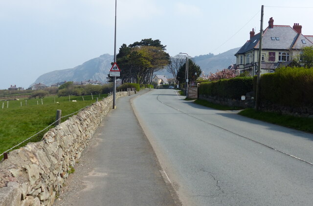
Alltwen is a small hill located in the county of Caernarfonshire, Wales. Rising to an elevation of approximately 122 meters (400 feet), it is part of the Snowdonia National Park. Alltwen is situated near the village of Penisarwaun, about 5 miles south of the town of Caernarfon.

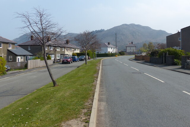
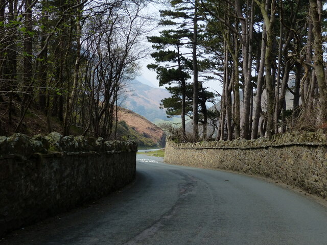
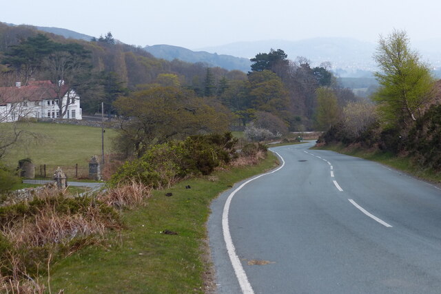
The hill offers breathtaking panoramic views of the surrounding landscape, including the Snowdonia mountain range to the south and the Menai Strait to the north. Its location within the national park makes it a popular destination for hikers and nature enthusiasts.

Alltwen is predominantly covered in grass and heather, with scattered patches of rocky outcrops. The terrain is relatively gentle, making it accessible to visitors of various fitness levels. There are several footpaths and trails that lead to the summit, providing opportunities for leisurely walks or more challenging hikes.

The hill is home to a variety of wildlife, including birds such as buzzards, kestrels, and pheasants. It is also known for its diverse flora, with an abundance of wildflowers and rare plant species.

At the summit of Alltwen, there is a trig point, which serves as a marker for surveying purposes. It is a great spot to take in the stunning vistas and enjoy a picnic surrounded by the natural beauty of the area.

Overall, Alltwen is a picturesque hill in Caernarfonshire that offers visitors the chance to immerse themselves in the stunning Welsh countryside and enjoy a peaceful and scenic outdoor experience.

If you have any feedback on the listing, please let us know in the comments section below.

Alltwen Images

Images are sourced within 2km of 53.277432/-3.8828914 or Grid Reference SH7477. Thanks to Geograph Open Source API. All images are credited.

Ysguborwen Road in Dwygyfylchi On the right is the Gladstone Bar & Grill.
Ysguborwen Road in Dwygyfylchi
On the right is the Gladstone Bar & Grill.
Houses along Ysguborwen Road in Dwygyfylchi
The parish church of St Gwynin and war memorial at Dwygyfylchi
Old Mill Road at Dwygyfylchi
Houses at the western end of the Sychnant Pass
Sheep and pasture near Dwygyfylchi
Road ascending the Sychnant Pass
Road descending the Sychnant Pass
Sychnant Pass near Capelulo
North Wales Path at the Sychnant Pass The North Wales Path is 60 miles long and connects Bangor to Prestatyn.
The western section is the more challenging, climbing onto moorlands below Moel Wnion, passing Aber Falls, and continuing below Foel Fras and Tal y Fan and then over Conwy Mountain with fine views along the coast and inland towards Snowdonia's peaks. The Great Orme and Llandudno are encircled to reach Colwyn Bay. The eastern section runs along or closer to the coast with much less ascent, passing Abergele and Rhyll to reach Prestatyn. It links with the Offa's Dyke Path National Trail, and the Clwydian Way, at Prestatyn.
North Wales Path at the Sychnant Pass
The North Wales Path is 60 miles long and connects Bangor to Prestatyn. The western section is the more challenging, climbing onto moorlands below Moel Wnion, passing Aber Falls, and continuing below Foel Fras and Tal y Fan and then over Conwy Mountain with fine views along the coast and inland towards Snowdonia's peaks. The Great Orme and Llandudno are encircled to reach Colwyn Bay. The eastern section runs along or closer to the coast with much less ascent, passing Abergele and Rhyll to reach Prestatyn. It links with the Offa's Dyke Path National Trail, and the Clwydian Way, at Prestatyn.
Road through the Sychnant Pass
Sychnant Pass Road towards Conwy On the left is the Sychnant Pass Country House Hotel.
Sychnant Pass Road towards Conwy
On the left is the Sychnant Pass Country House Hotel.
Sychnant Pass Road towards Conwy
Horses at Tyrau-Duon
Wales Coast Path towards Penmaen-bach Point The Wales Coast Path (Welsh: Llwybr Arfordir Cymru) is a long distance footpath which follows the whole of the coastline of Wales. It opened on 5 May 2012, and offers a 870 mile long route from Chepstow in the south to Queensferry in the north.
Wales is the first country in the world to provide a dedicated footpath along its entire coastline. The Path runs through eleven National Nature Reserves and other nature reserves, including those managed by The Wildlife Trusts or Royal Society for the Protection of Birds (RSPB).
Logo can be seen at<a href="https://www.geograph.org.uk/photo/3738617">SS0897 : Logo, Wales Coast Path</a>.
Website: <span class="nowrap"><a title="http://www.walescoastpath.gov.uk/default.aspx" rel="nofollow ugc noopener" href="http://www.walescoastpath.gov.uk/default.aspx">Link</a><img style="margin-left:2px;" alt="External link" title="External link - shift click to open in new window" src="https://s1.geograph.org.uk/img/external.png" width="10" height="10"/></span>
Wales Coast Path towards Penmaen-bach Point
The Wales Coast Path (Welsh: Llwybr Arfordir Cymru) is a long distance footpath which follows the whole of the coastline of Wales. It opened on 5 May 2012, and offers a 870 mile long route from Chepstow in the south to Queensferry in the north. Wales is the first country in the world to provide a dedicated footpath along its entire coastline. The Path runs through eleven National Nature Reserves and other nature reserves, including those managed by The Wildlife Trusts or Royal Society for the Protection of Birds (RSPB). Logo can be seen atSS0897 : Logo, Wales Coast Path. Website: LinkExternal link
Sand dunes along Conwy Sands Looking north across 3 miles of Conwy Bay towards Great Orme's Head.
Sand dunes along Conwy Sands
Looking north across 3 miles of Conwy Bay towards Great Orme's Head.
Show me another place!

Alltwen is located at Grid Ref: SH7477 (Lat: 53.277432, Lng: -3.8828914)

Unitary Authority: Conwy

Police Authority: North Wales

What 3 Words

///fail.startles.cycled. Near Conwy

Nearby Locations

Coed Pendyffryn Alltwen

Related Wikis

Sychnant Pass

Sychnant Pass (Welsh: Bwlch Sychnant, "Dry-stream Pass") in Conwy County Borough, Wales, links Conwy to Penmaenmawr via Dwygyfylchi. Much of the pass is...

Dwygyfylchi

Dwygyfylchi (Welsh: [dʊɨɡəˈvəlχi]) is a village in Conwy County Borough, Wales. It is part of the community of Penmaenmawr which has a population of 4...

Castell Caer Seion

Castell Caer Seion is an Iron Age hillfort situated at the top of Conwy Mountain, in Conwy County, North Wales. It is unusual for the fact that the main...

Mynydd y Dref

Mynydd y Dref (Welsh : "Mountain of the Town") or Conwy Mountain is a hilly area to the west of the town of Conwy, in North Wales. To the north it overlooks...

Conway Marsh railway station

Conway Marsh railway station (later known as Conway Morfa) was located about a mile north west of Conwy, Wales (Conway being the English name for the town...

Conwy Hospital

Conwy Hospital (Welsh: Ysbyty Conwy) was a community hospital in Conwy, Wales. It was managed by the Conwy & Denbighshire NHS Trust. == History == The...

Morfa Conwy

Morfa Conwy is a spit formed originally of marshy sand, north of the western end of the modern A55 entrance to Conwy in Conwy county borough, north-west...

Penmaenmawr railway station

Penmaenmawr railway station serves the town of Penmaenmawr, Wales, and is located on the North Wales Coast Line travelling from Crewe to Holyhead, 49+1...

Nearby Amenities

Located within 500m of 53.277432,-3.8828914
Alltwen
Ele: 255
Natural: peak
Lat/Long: 53.2775155/-3.8829369
Power: pole
Lat/Long: 53.2755896/-3.8762346
Power: pole
Lat/Long: 53.2740659/-3.8779807
Hiking: yes
Information: guidepost
Source: GPS survey
Tourism: information
Lat/Long: 53.2783105/-3.8759851
Hiking: yes
Information: guidepost
Source: GPS survey
Tourism: information
Lat/Long: 53.2779457/-3.8765404
Hiking: yes
Information: guidepost
Source: GPS survey
Tourism: information
Lat/Long: 53.2773523/-3.8776025
Hiking: yes
Information: guidepost
Source: GPS survey
Tourism: information
Lat/Long: 53.2762568/-3.8778493
Hiking: yes
Information: guidepost
Source: GPS survey
Tourism: information
Lat/Long: 53.2755479/-3.8777125
Hiking: yes
Information: guidepost
Source: GPS survey
Tourism: information
Lat/Long: 53.2745295/-3.882468
The data included in this document is from www.openstreetmap.org. The data is made available under ODbL.

Have you been to Alltwen?

Leave your review of Alltwen below (or comments, questions and feedback).