Auchenvey Hill

Hill, Mountain in Kirkcudbrightshire

Scotland

Auchenvey Hill

At Auchenvey Plantation A winter view showing hardwood planting near the Crogo Burn.
At Auchenvey Plantation Credit: Mary and Angus Hogg

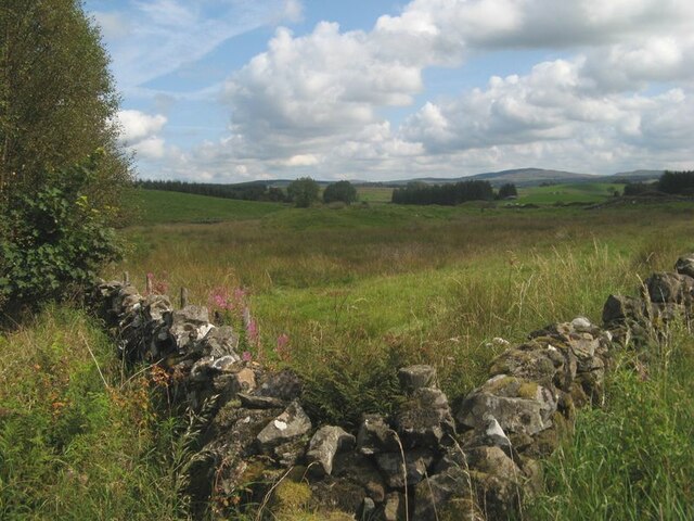
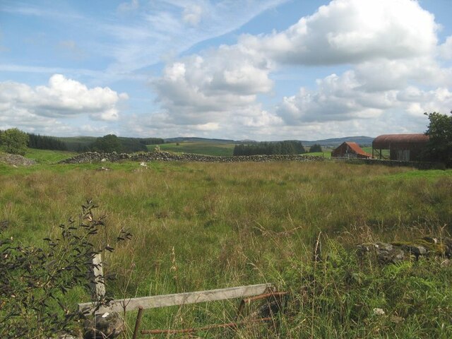
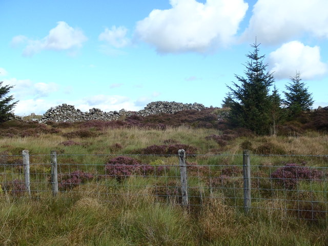
Auchenvey Hill is a prominent hill located in the region of Kirkcudbrightshire in Scotland. It is situated near the town of Castle Douglas and offers stunning views of the surrounding countryside. The hill is part of the Galloway Hills range and stands at a height of approximately 470 meters (1,542 feet) above sea level.

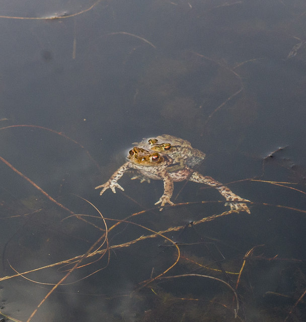
Auchenvey Hill is a popular destination for hikers and outdoor enthusiasts, with several walking trails leading to the summit. The terrain is mostly rugged and steep, providing a challenging yet rewarding hike for those who venture to the top. The hill is also home to a variety of wildlife, including red deer, birds of prey, and other indigenous species.

The summit of Auchenvey Hill offers panoramic views of the surrounding landscape, including rolling green hills, forests, and distant mountains. On a clear day, visitors can see all the way to the coast and even catch a glimpse of the Isle of Man in the distance.

Overall, Auchenvey Hill is a picturesque and tranquil spot for outdoor recreation and a must-visit destination for nature lovers in Kirkcudbrightshire.

If you have any feedback on the listing, please let us know in the comments section below.

Auchenvey Hill Images

Images are sourced within 2km of 55.067847/-3.9884591 or Grid Reference NX7376. Thanks to Geograph Open Source API. All images are credited.

At Auchenvey Plantation A winter view showing hardwood planting near the Crogo Burn.
At Auchenvey Plantation
A winter view showing hardwood planting near the Crogo Burn.
Corner of walls Pasture land by forestry at Auchenvey.
Corner of walls
Pasture land by forestry at Auchenvey.
Field and farm Damp pasture and outbuildings at Auchenvey.
Field and farm
Damp pasture and outbuildings at Auchenvey.
Small Shepherds' Cairn on Caldow Moor Small Shepherds' cairn on Caldow Moor now covered by woodland.
Small Shepherds' Cairn on Caldow Moor
Small Shepherds' cairn on Caldow Moor now covered by woodland.
A forestry road in Garcrogo Plantation Sitka trees on Caldow Moor.
A forestry road in Garcrogo Plantation
Sitka trees on Caldow Moor.
Forest road, Garcrogo
Dyke corner on Larglear Hill
Low Arvie, Corsock
Low Arvie, Corsock
Distant Mochrum
Distant Mochrum
Mochrum Fell Parked at entrance to forest to south at NX726726, then easy ascent via forest tracts which get to look less used as you progress until the last 20 metres of ascent which is off-piste through old stumps and recently planted conifers.
Name: Mochrum Fell
Hill number: 1793
Height: 317m / 1040ft
Area: 27C: The Glenkens to Annandale
Class: Ma
Grid ref: NX 72393 75029
Summit feature: ground 1m from trig point
Drop: 153m
Col: 164m  NX715784
Mochrum Fell
Parked at entrance to forest to south at NX726726, then easy ascent via forest tracts which get to look less used as you progress until the last 20 metres of ascent which is off-piste through old stumps and recently planted conifers. Name: Mochrum Fell Hill number: 1793 Height: 317m / 1040ft Area: 27C: The Glenkens to Annandale Class: Ma Grid ref: NX 72393 75029 Summit feature: ground 1m from trig point Drop: 153m Col: 164m NX715784
Above Mochrum
Above Mochrum
Little Mochrum
Little Mochrum
Blue Hills
Blue Hills
A love embrace This is only one among many acts of love taking place in a small remote pond
A love embrace
This is only one among many acts of love taking place in a small remote pond
Auchenvey
Auchenvey
Dreich morning, Auchenvey, 1 Ponies in pasture by the A712 with Woodhead beyond.
Dreich morning, Auchenvey, 1
Ponies in pasture by the A712 with Woodhead beyond.
Dreich morning, Auchenvey, 2 Mid Moss in the misty distance.
Dreich morning, Auchenvey, 2
Mid Moss in the misty distance.
Woodhead There are large numbers of horses on Farms and Smallholdings all along this road
Woodhead
There are large numbers of horses on Farms and Smallholdings all along this road
Show me another place!

Auchenvey Hill is located at Grid Ref: NX7376 (Lat: 55.067847, Lng: -3.9884591)

Unitary Authority: Dumfries and Galloway

Police Authority: Dumfries and Galloway

What 3 Words

///homes.quantity.ignore. Near Castle Douglas, Dumfries & Galloway

Nearby Locations

Auchenvey Hill Arvie Hill

Related Wikis

Corsock

Corsock (Scottish Gaelic: Corsag) is a village in the historical county of Kirkcudbrightshire, Dumfries and Galloway, south-west Scotland. It is located...

Glenlair House

Glenlair, near the village of Corsock in the historical county of Kirkcudbrightshire, in Dumfries and Galloway, was the home of the physicist James Clerk...

Ironmacannie Mill

Ironmacannie Mill is a historic watermill near Balmaclellan in Dumfries and Galloway, Scotland. Built in the 18th and 19th centuries, on the site of an...

Dumfries and Galloway

Dumfries and Galloway (Scots: Dumfries an Gallowa; Scottish Gaelic: Dùn Phrìs is Gall-Ghaidhealaibh) is one of the 32 unitary council areas of Scotland...

Have you been to Auchenvey Hill?

Leave your review of Auchenvey Hill below (or comments, questions and feedback).