Bampton

Settlement in Westmorland Eden

England

Bampton

Telephone Box from Withnail and I, Bampton A place of pilgrimage for fans of the film.
Telephone Box from Withnail and I, Bampton Credit: Rich Tea

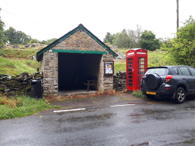
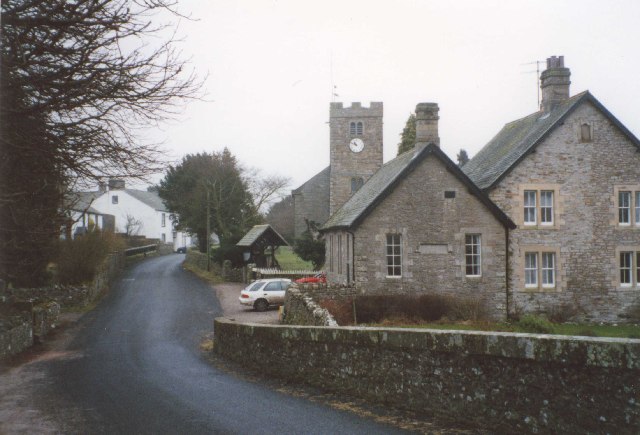
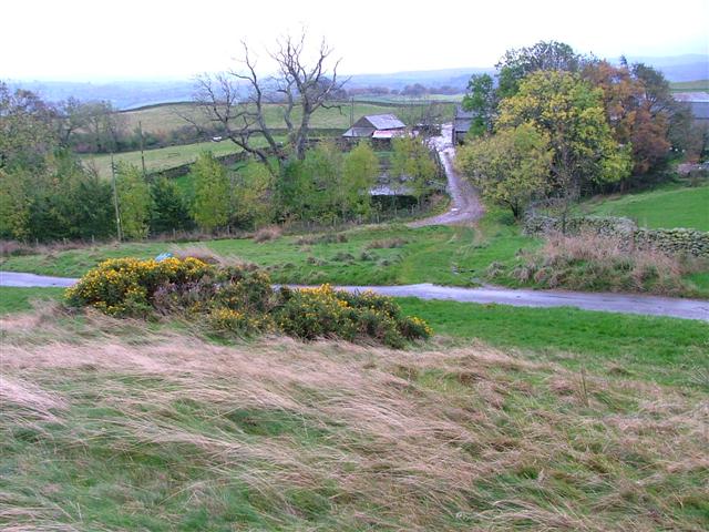
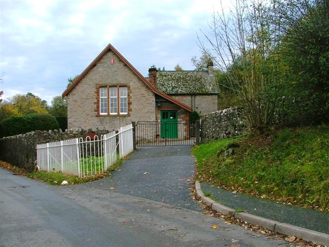
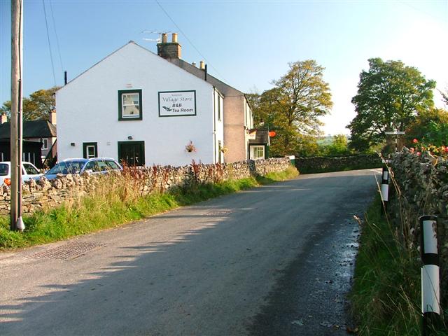
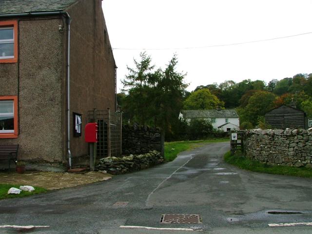
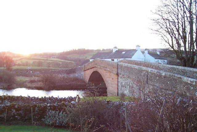
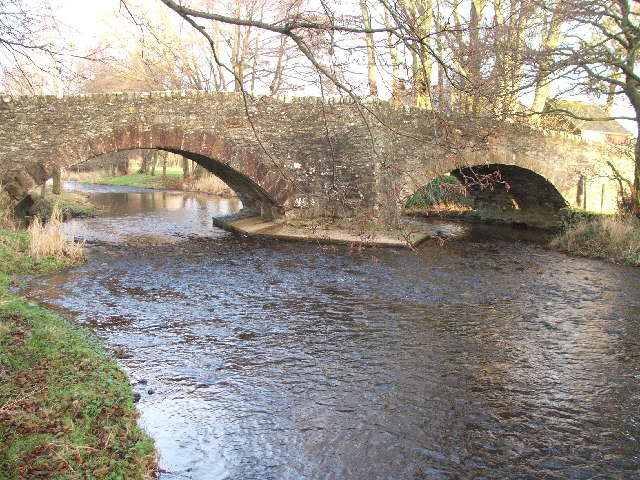
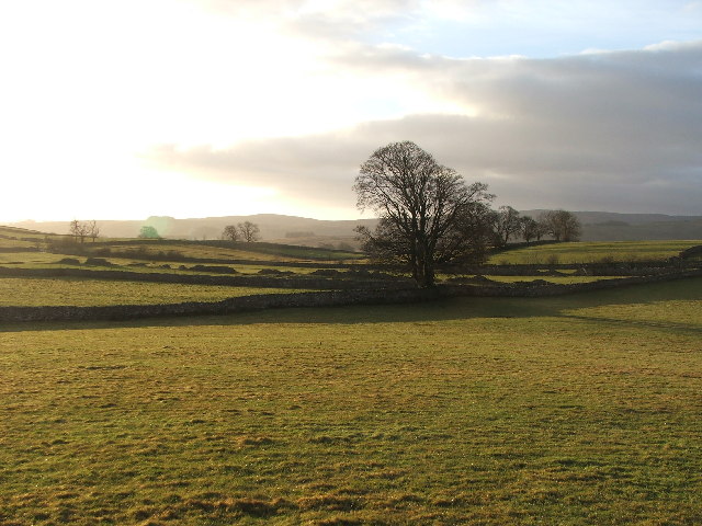
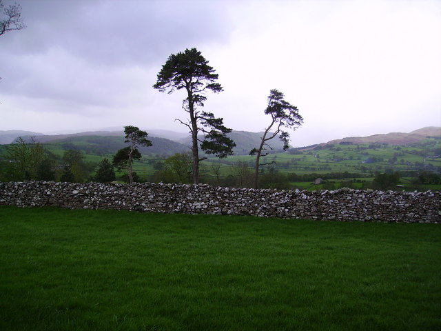
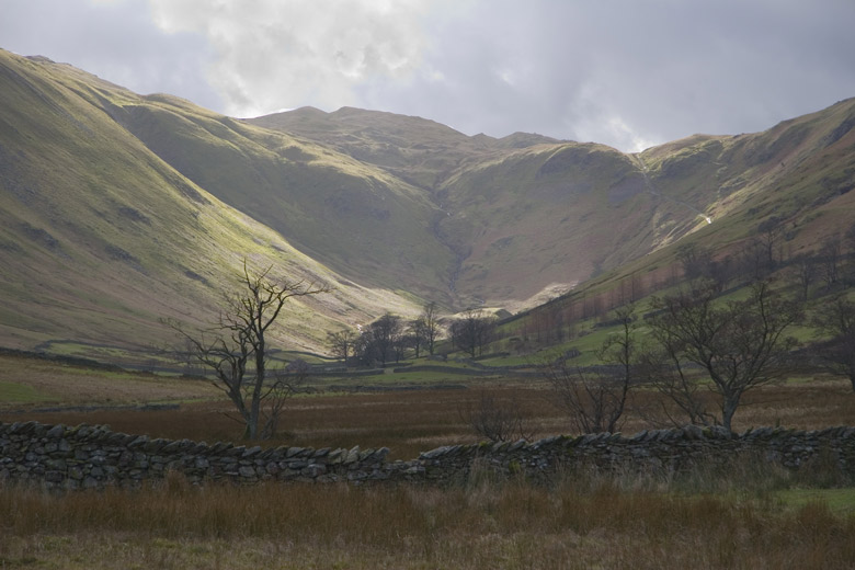
Bampton, Westmorland is a small rural village located in the county of Cumbria, England. Situated in the picturesque Lake District National Park, Bampton is surrounded by rolling green hills, stunning landscapes, and is known for its tranquility and natural beauty.

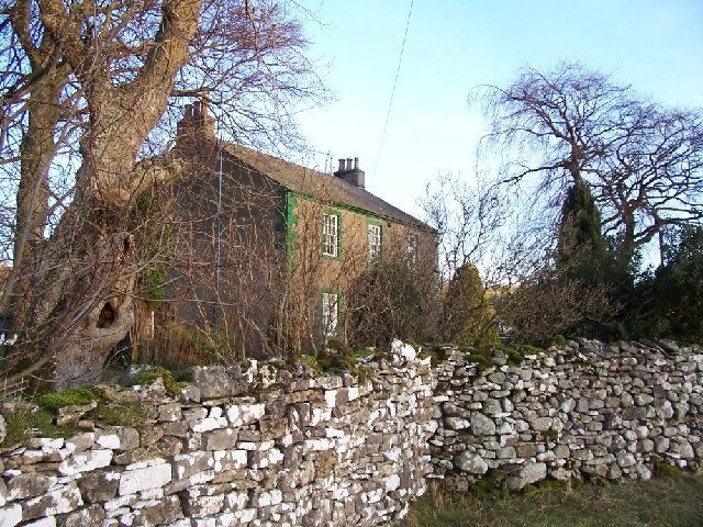
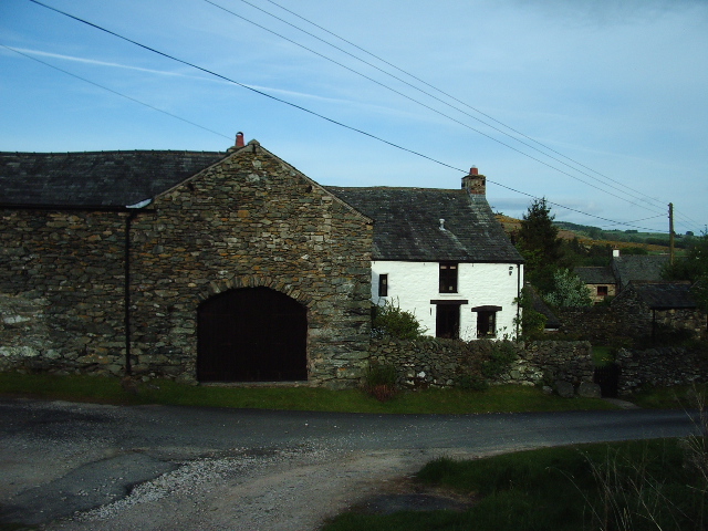
The village has a population of around 800 residents and is located approximately 10 miles northeast of the town of Penrith. Bampton is steeped in history, with its origins dating back to the Norman era. It is home to several historical buildings, including St Patrick's Church, which dates back to the 12th century and features a unique Norman doorway.

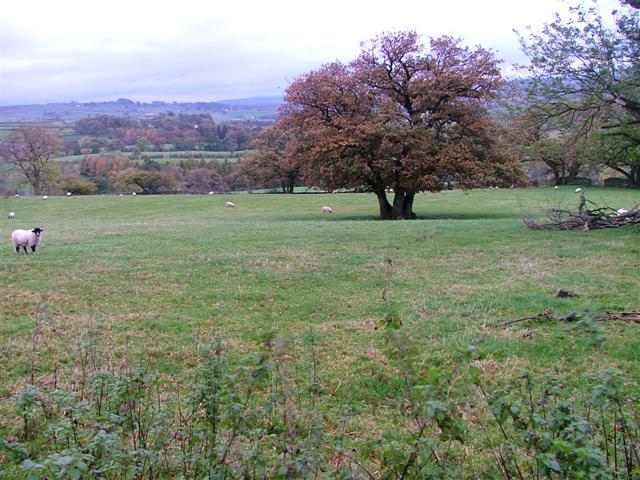
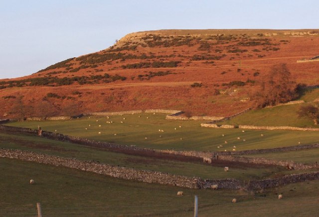
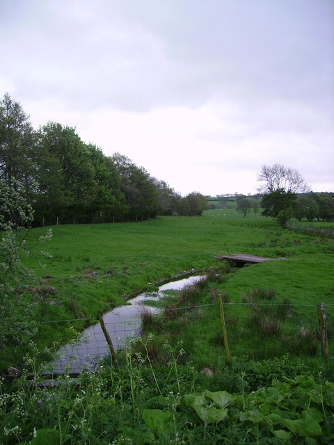
Agriculture has been a significant part of Bampton's economy for centuries, and the village is known for its farming heritage. The surrounding fields and farmland are predominantly used for sheep farming, and visitors can often see flocks grazing peacefully in the countryside.

Bampton is also a popular destination for outdoor enthusiasts, with numerous walking and hiking trails in the area. The village is located near Haweswater Reservoir, a stunning man-made lake that offers opportunities for fishing, birdwatching, and enjoying the scenic surroundings.

Despite its small size, Bampton has a strong sense of community and features a village school, a local pub, and a village hall that hosts various social events throughout the year. It offers a peaceful and idyllic retreat for those seeking a break from the hustle and bustle of city life.

If you have any feedback on the listing, please let us know in the comments section below.

Bampton Images

Images are sourced within 2km of 54.557322/-2.752546 or Grid Reference NY5118. Thanks to Geograph Open Source API. All images are credited.

Telephone Box from Withnail and I, Bampton A place of pilgrimage for fans of the film.
Telephone Box from Withnail and I, Bampton
A place of pilgrimage for fans of the film.
Bampton Grange This is a view up the village street from the bridge over the River Lowther.
Bampton Grange
This is a view up the village street from the bridge over the River Lowther.
Farm Road to Hullockhowe
Bampton Endowed School In 1999 the school had 21 pupils.
Bampton Endowed School
In 1999 the school had 21 pupils.
Bampton Village Store and Post Office
Postbox, Butterwick
Postbox, Butterwick
Fields Below Low Hullockhowe Looking north east from below Low Hullockhowe across the Lowther valley.
Fields Below Low Hullockhowe
Looking north east from below Low Hullockhowe across the Lowther valley.
Field gate Farm. Picture taken over a field gate instead of direct.
Field gate Farm.
Picture taken over a field gate instead of direct.
Knipe Moor A very distinct skyline and autumn colours.
Knipe Moor
A very distinct skyline and autumn colours.
The bridge at Bampton Grange. A beautiful sandstone bridge.
The bridge at Bampton Grange.
A beautiful sandstone bridge.
Bridge over Haweswater Beck at Greengate. Looking NW.
Bridge over Haweswater Beck at Greengate.
Looking NW.
Farmland near Walmgate. Slightly SE of Walmgate.
Farmland near Walmgate.
Slightly SE of Walmgate.
Beck Bampton Grange South bank of the River Lowther indicated by the trees on the left.
Beck Bampton Grange
South bank of the River Lowther indicated by the trees on the left.
Pines and Wall Near Bampton Grange looking towards Mardale
Pines and Wall
Near Bampton Grange looking towards Mardale
Fell End Farm, Butterwick, Penrith
The telephone kiosk from 'Withnail & I' A close up of the "Withnail and I" phone box. Filmed in 1986 the movie has a cult following around the world.
The telephone kiosk from 'Withnail & I'
A close up of the "Withnail and I" phone box. Filmed in 1986 the movie has a cult following around the world.
Limestone Pavement on Knipe Moor
Knipe Scar
Knipe Scar
Show me another place!

Bampton is located at Grid Ref: NY5118 (Lat: 54.557322, Lng: -2.752546)

Administrative County: Cumbria

District: Eden

Police Authority: Cumbria

What 3 Words

///submerged.friend.organs. Near Shap, Cumbria

Nearby Locations

Bampton

Related Wikis

Bampton, Cumbria

Bampton is a village and civil parish in the Westmorland and Furness unitary authority area of Cumbria, England, on the edge of the Lake District National...

Butterwick, Cumbria

Butterwick is a hamlet in Cumbria, England, near the village of Helton. == Location grid ==

Haweswater Beck

Haweswater Beck flows through Cumbria in England. It arises as a stream discharge from Haweswater Reservoir, at Gill Dubs, just east of the dam, and flows...

Bampton Grange

Bampton Grange is a village in Cumbria, England. Haweswater Beck arises as a stream discharge from Haweswater Reservoir and flows eastward, just north...

Knipescar Common

Knipescar Common, or Knipe Scar, is an upland area in the east of the English Lake District, above the River Lowther, near Bampton, Cumbria. It is the...

West Ward Rural District

West Ward was a rural district of the administrative county of Westmorland. The area was directly based on the former West Ward rural sanitary district...

Bomby

Bomby is a village in Cumbria, England. Bomby village consists only of one farm house. The farm is mostly known for its specific potatoes, the Kind Edward...

Boredale Hause

Boredale Hause is a mountain pass between Place Fell and Angletarn Pikes in the east of the English Lake District. It links the Patterdale and Boredale...

Nearby Amenities

Located within 500m of 54.557322,-2.752546
Bampton
Place: village
Source: npe
Wikidata: Q77637
Wikipedia: en:Bampton, Cumbria
Lat/Long: 54.5565978/-2.7513984
Bus Stop
Bus Shelter (Phone Box)
Naptan AtcoCode: 090074061419
Naptan Bearing: W
Naptan CommonName: Bus Shelter (Phone Box)
Naptan Indicator: near
Naptan Landmark: telephone box
Naptan NaptanCode: cumdadam
Naptan Street: No name
Naptan Verified: no
Source: naptan_import
Lat/Long: 54.5572077/-2.7524912
Barrier: cattle_grid
Source: survey
Lat/Long: 54.5573516/-2.7528496
Telephone
Booth: K6
Covered: booth
Note: this phone box appeared in the film Withnail and I
Source: survey
Lat/Long: 54.5572116/-2.752551
Post Office
Bampton Post Office
Addr Country: GB
Addr Postcode: CA10 2RQ
Branch: Bampton
Brand: Post Office
Brand Wikidata: Q1783168
Check Date: 2022-05-27
Check Date Opening Hours: 2022-05-27
Contact Website: https://www.postoffice.co.uk/branch-finder/2334100/bampton
Opening Hours: Mo-We,Fr 08:30-14:00; Sa 09:00-14:00; Su 10:00-12:00
Ref Pol Id: 8990
Lat/Long: 54.5567058/-2.7512935
Post Box
Ref: CA10 90
Lat/Long: 54.5562722/-2.7518606
Give Way
Direction: backward
Lat/Long: 54.5566161/-2.7514686
Give Way
Direction: backward
Lat/Long: 54.5570063/-2.7517512
Waterway: waterfall
Lat/Long: 54.5565306/-2.752417
Bench
Backrest: yes
Material: wood
Lat/Long: 54.5557341/-2.7461003
Recycling
Recycling Type: container
Lat/Long: 54.556537/-2.7486492
Grit Bin
Lat/Long: 54.556513/-2.7486658
Fuel
Kirkland Garage
Lat/Long: 54.5562538/-2.7516977
Information: guidepost
Tourism: information
Lat/Long: 54.5531925/-2.7500611
Information: guidepost
Tourism: information
Lat/Long: 54.5555222/-2.75176
Lime Kiln
Historic: lime_kiln
Lat/Long: 54.5560153/-2.7522613
Waterway: waterfall
Lat/Long: 54.5563836/-2.753483
Mill Crags
Place: locality
Lat/Long: 54.5568999/-2.7532056
Charging Station
Authentication App: yes
Capacity: 1
Fee: yes
Motorcar: yes
Network: Charge My Street
Operator: Bampton Memorial Hall
Payment App: yes
Payment Contactless: yes
Ref: EG2-02781
Socket Type2: 1
Socket Type2 Output: 7 kW
Lat/Long: 54.5566616/-2.7489097
Charging Station
Authentication App: yes
Capacity: 1
Fee: yes
Motorcar: yes
Network: Charge My Street
Operator: Bampton Memorial Hall
Payment App: yes
Payment Contactless: yes
Ref: EG2-02785
Socket Type2: 1
Socket Type2 Output: 7 kW
Lat/Long: 54.5566586/-2.7489131
Direction: 120
Generator Method: photovoltaic
Generator Output Electricity: yes
Generator Solar Modules: 28
Generator Source: solar
Generator Type: solar_photovoltaic_panel
Location: roof
Power: generator
Lat/Long: 54.5568009/-2.748668
Power: pole
Lat/Long: 54.5568468/-2.7493674
Man Made: utility_pole
Lat/Long: 54.5569638/-2.7485227
Man Made: utility_pole
Lat/Long: 54.5573839/-2.7488762
Man Made: utility_pole
Lat/Long: 54.5575763/-2.749612
Power: pole
Lat/Long: 54.5573865/-2.7488669
Power: pole
Lat/Long: 54.5559894/-2.7502446
Power: pole
Lat/Long: 54.5617081/-2.7525611
Power: pole
Lat/Long: 54.5607239/-2.751993
Power: pole
Lat/Long: 54.5595633/-2.7512908
Power: pole
Lat/Long: 54.5584947/-2.750678
Power: pole
Lat/Long: 54.5577568/-2.7502464
Power: pole
Lat/Long: 54.5585245/-2.7524604
Power: pole
Lat/Long: 54.5586049/-2.7553029
Power: pole
Lat/Long: 54.5580019/-2.7532409
Power: pole
Lat/Long: 54.556984/-2.753117
Power: pole
Lat/Long: 54.5570673/-2.7544796
Power: pole
Lat/Long: 54.5571709/-2.7554662
Power: pole
Lat/Long: 54.5571537/-2.7562502
Power: pole
Lat/Long: 54.5571125/-2.757057
Power: pole
Lat/Long: 54.5573631/-2.7569966
Power: pole
Lat/Long: 54.5576551/-2.7566368
Power: pole
Lat/Long: 54.5579532/-2.7562328
Power: pole
Lat/Long: 54.558277/-2.7558153
Power: pole
Lat/Long: 54.5555275/-2.7518377
Power: pole
Lat/Long: 54.5551476/-2.7516632
Power: pole
Lat/Long: 54.5547599/-2.7514739
Power: pole
Lat/Long: 54.554359/-2.7512981
Power: pole
Lat/Long: 54.5575811/-2.7496039
Power: pole
Lat/Long: 54.557381/-2.7488589
Power: pole
Lat/Long: 54.5569607/-2.7485179
Power: pole
Lat/Long: 54.5576566/-2.749369
Power: pole
Lat/Long: 54.5574581/-2.7474749
Power: pole
Lat/Long: 54.5572775/-2.7456478
The data included in this document is from www.openstreetmap.org. The data is made available under ODbL.

Have you been to Bampton?

Leave your review of Bampton below (or comments, questions and feedback).