Bamford

Settlement in Derbyshire High Peak

England

Bamford

Bridge over the River Derwent Looking along Lydgate Lane.
Bridge over the River Derwent Credit: DS Pugh

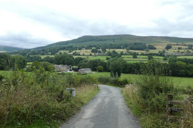
Bamford is a picturesque village located in Derbyshire, England. Situated in the Hope Valley, it is nestled in the heart of the Peak District National Park. With its stunning natural surroundings and charming rural atmosphere, Bamford is a popular destination for nature lovers and outdoor enthusiasts.

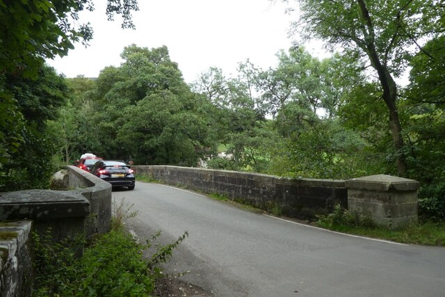
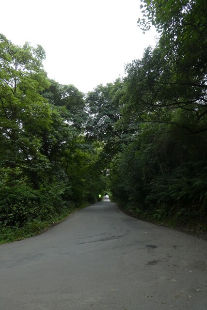
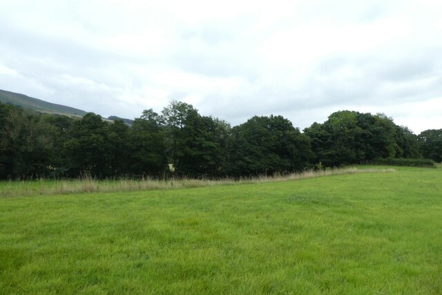
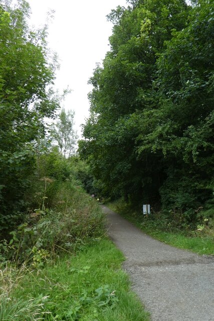
The village is surrounded by rolling hills, lush green meadows, and meandering rivers, offering breathtaking views and a tranquil environment. The nearby iconic gritstone edges, such as Stanage Edge and Burbage Rocks, attract climbers from all over the world.

Bamford is known for its strong sense of community and friendly atmosphere. The village features a range of amenities, including a village hall, a primary school, a post office, and a few local shops. There are also several traditional pubs and cafes, where visitors can enjoy a warm meal or a refreshing drink after a day of exploring the surrounding countryside.

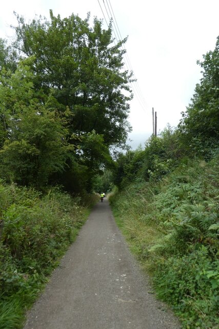
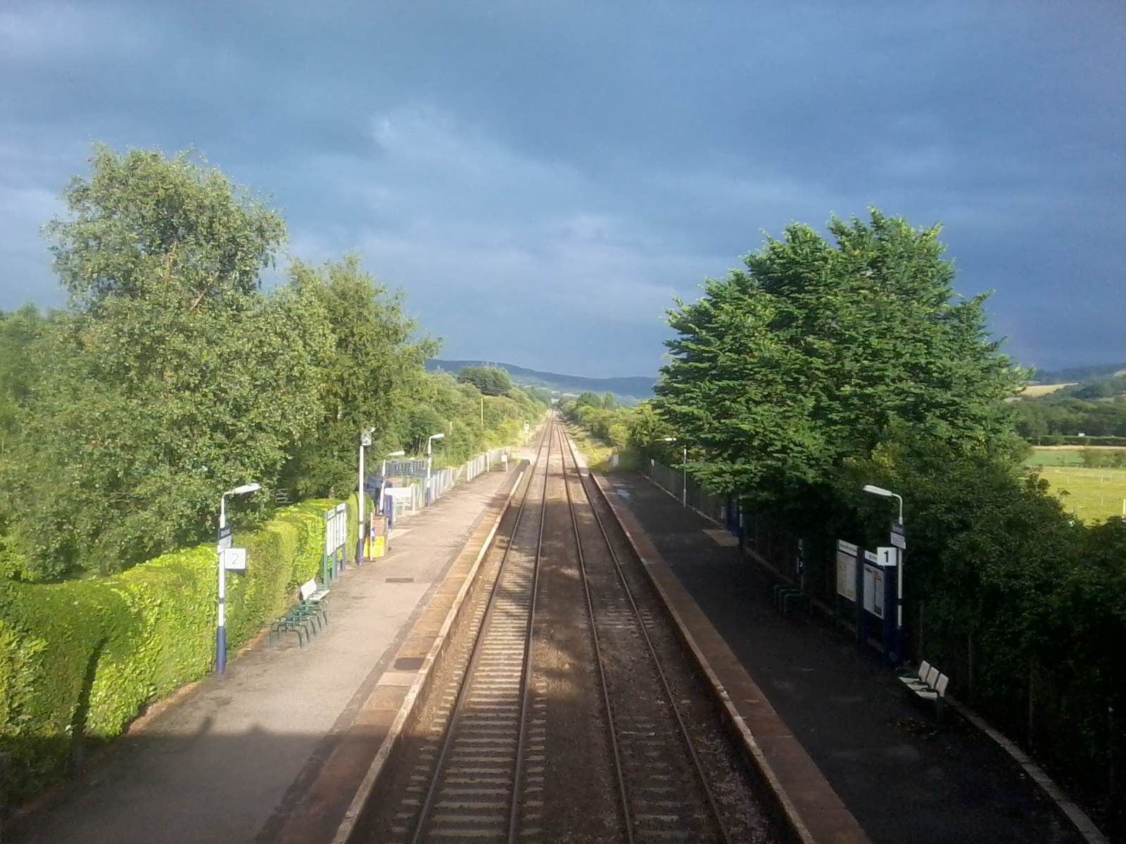
The area offers a multitude of outdoor activities, including hiking, cycling, fishing, and birdwatching. The nearby Ladybower Reservoir is a popular spot for water sports and scenic walks. The village is also well-connected to the wider region, with excellent transport links to nearby towns and cities.

Overall, Bamford provides a perfect blend of natural beauty, community spirit, and outdoor adventures. Whether seeking a peaceful retreat or an active getaway, this charming Derbyshire village offers something for everyone.

If you have any feedback on the listing, please let us know in the comments section below.

Bamford Images

Images are sourced within 2km of 53.347001/-1.6901201 or Grid Reference SK2083. Thanks to Geograph Open Source API. All images are credited.

Bridge over the River Derwent Looking along Lydgate Lane.
Bridge over the River Derwent
Looking along Lydgate Lane.
Junction of Carr Lane and Lydgate Lane Looking down Carr Lane below Ladybower reservoir.
Junction of Carr Lane and Lydgate Lane
Looking down Carr Lane below Ladybower reservoir.
Field beside Carr Lane The River Derwent runs amongst the trees.
Field beside Carr Lane
The River Derwent runs amongst the trees.
Thornhill Trail Looking along a cycle path along the former railway line.
Thornhill Trail
Looking along a cycle path along the former railway line.
Track to Carr Bottom Farm Looking along a track from the Thornhill Trail.
Track to Carr Bottom Farm
Looking along a track from the Thornhill Trail.
Along the Thornhill Trail Looking along the cycle path along the former railway line.
Along the Thornhill Trail
Looking along the cycle path along the former railway line.
Old milestone The Castleton 3 milepost on the A6187 has been kept well painted. It is on a narrow verge between the road and the River Noe about ½ mile east of the B6049 junction into Bradwell.   The A6187 was the A625.   It was renumbered after the collapse of the Mam Tor section, west of Castleton in 1981.  The mileposts along this route are very similar to ones known to have been made at Darwin & Co. Sheffield.   It is Grade II listed 1087854.
Old milestone
The Castleton 3 milepost on the A6187 has been kept well painted. It is on a narrow verge between the road and the River Noe about ½ mile east of the B6049 junction into Bradwell. The A6187 was the A625. It was renumbered after the collapse of the Mam Tor section, west of Castleton in 1981. The mileposts along this route are very similar to ones known to have been made at Darwin & Co. Sheffield. It is Grade II listed 1087854.
Old milepost A view across the A6187 Hope Road showing how close to the edge of the road the milestone is.  The River Noe is just over the hedge.
Old milepost
A view across the A6187 Hope Road showing how close to the edge of the road the milestone is. The River Noe is just over the hedge.
At a gateway by Carr Lane
View to Bamford Edge from Carr Lane
Bank House Farm, Thornhill
Signpost and repurposed phone box in Thornhill Like many phone kiosks in rural settlements, this one now contains a defibrillator.
Signpost and repurposed phone box in Thornhill
Like many phone kiosks in rural settlements, this one now contains a defibrillator.
A Hope Valley View Looking northwards from a train on the Hope Valley Line between Manchester and Sheffield, shortly after leaving Hope Station.
A Hope Valley View
Looking northwards from a train on the Hope Valley Line between Manchester and Sheffield, shortly after leaving Hope Station.
Longshaw Farm
Longshaw Farm
Hollow way beside a footpath It's possible that this hollow way was part of an ancient rouute between Win Hill and the river valley to the south. It is overgrown now and the public footpath runs alongside the ditch.
Hollow way beside a footpath
It's possible that this hollow way was part of an ancient rouute between Win Hill and the river valley to the south. It is overgrown now and the public footpath runs alongside the ditch.
Footpath steps climbing out of Hurst Clough This is the start of an old field path into Bamford. When Bamford Filters waterworks was constructed, the path had to be diverted around the perimeter. The area is also much more wooded than it once was.
Footpath steps climbing out of Hurst Clough
This is the start of an old field path into Bamford. When Bamford Filters waterworks was constructed, the path had to be diverted around the perimeter. The area is also much more wooded than it once was.
Derwent Aqueduct access gates and discharge well The Derwent Aqueduct was laid to bring water from the Derwent to Derby, Nottingham and Leicester. Its line is marked by distinctive access gates, like this one, which gives access to a discharge well. There is second gate, half buried in the undergrowth, in the background.
Derwent Aqueduct access gates and discharge well
The Derwent Aqueduct was laid to bring water from the Derwent to Derby, Nottingham and Leicester. Its line is marked by distinctive access gates, like this one, which gives access to a discharge well. There is second gate, half buried in the undergrowth, in the background.
Show me another place!

Bamford is located at Grid Ref: SK2083 (Lat: 53.347001, Lng: -1.6901201)

Administrative County: Derbyshire

District: High Peak

Police Authority: Derbyshire

What 3 Words

///ushering.calendars.busters. Near Hathersage, Derbyshire

Nearby Locations

Bamford Mill Stream

Related Wikis

Nearby Amenities

Located within 500m of 53.347001,-1.6901201
Bamford (Derwent Hotel)
Bus: yes
Public Transport: stop_position
Lat/Long: 53.3478546/-1.6895318
Bamford
Place: village
Source Name: local knowledge
Wikidata: Q1797598
Wikipedia: en:Bamford
Lat/Long: 53.3475694/-1.6885072
Pub
The Anglers
Addr City: Hope Valley
Addr Postcode: S33 0DY
Addr Street: Main Road
Addr Suburb: Bamford
Fhrs Id: 1258649
Food: yes
Real Ale: Mcmullen Country Bitter, Batemans Thirsty Work, Deauchars IPA
Website: https://www.anglers.rest/
Lat/Long: 53.3497937/-1.6891087
Noexit: yes
Lat/Long: 53.3473423/-1.6870919
Noexit: yes
Lat/Long: 53.3463429/-1.6865211
Post Box
Operator: Royal Mail
Ref: S33 363
Lat/Long: 53.3508788/-1.6902608
Bamford Bakery
Addr City: Hope Valley
Addr Postcode: S33 0AY
Addr Street: Main Road
Addr Suburb: Bamford
Fhrs Id: 1259071
Shop: bakery
Source Addr: FHRS Open Data
Lat/Long: 53.3474674/-1.6899607
Toilets
Fee: no
Opening Hours: Mo-Su 10:00-16:00
Wheelchair: yes
Lat/Long: 53.3478088/-1.6896705
Bus Stop
Bamford (Derwent Hotel)
Bus: yes
Public Transport: platform
Shelter: yes
Lat/Long: 53.3478559/-1.6896064
Post Office
Bamford Post Office
Addr City: Hope Valley
Addr Country: GB
Addr Housename: Anglers Rest
Addr Postcode: S33 0DY
Addr Street: Main Road
Addr Suburb: Bamford
Brand: Post Office
Brand Wikidata: Q1783168
Contact Website: https://www.postoffice.co.uk/branch-finder/5314585/bamford
Opening Hours: Mo-Sa 09:00-17:00
Ref Pol Id: 125491
Lat/Long: 53.3497321/-1.6890932
Bus Stop
Bamford Station Road
Bus: yes
Ele: 151.53
Naptan AtcoCode: 1000DBSR3753
Naptan NaptanCode: dbsagpgd
Public Transport: platform
Shelter: no
Lat/Long: 53.342818/-1.6917356
Bus Stop
Bamford Station Road
Bus: yes
Naptan AtcoCode: 1000DBSR3752
Naptan NaptanCode: dbsagpga
Public Transport: platform
Shelter: no
Lat/Long: 53.3427315/-1.6918375
Ele: 146
Lat/Long: 53.3465764/-1.6940528
Ele: 146
Lat/Long: 53.346574/-1.6940454
Ele: 145
Lat/Long: 53.3465764/-1.6940266
Ele: 145
Lat/Long: 53.3465784/-1.6940145
Ele: 145
Lat/Long: 53.3466583/-1.6937677
Ford: yes
Lat/Long: 53.3467349/-1.6936383
Ele: 146
Lat/Long: 53.3466085/-1.694213
Ele: 146
Lat/Long: 53.3466017/-1.6941816
Ele: 146
Lat/Long: 53.3466416/-1.6943558
Ele: 147
Lat/Long: 53.346646/-1.6944095
Ele: 147
Lat/Long: 53.3466903/-1.694518
Bus Stop
Bamford (Victoria Road)
Bus: yes
Ele: 160.66
Naptan AtcoCode: 1000DBMR3754
Naptan NaptanCode: dbsgjwmt
Public Transport: platform
Lat/Long: 53.345554/-1.691235
Ele: 150.09
Lat/Long: 53.3463234/-1.6924515
Ele: 149.37
Lat/Long: 53.3463178/-1.6924769
Ele: 146
Lat/Long: 53.3467864/-1.6936071
Ele: 146
Lat/Long: 53.3467992/-1.6935771
Bench
Backrest: yes
Ele: 179.89
Lat/Long: 53.3493825/-1.6895205
Bench
Backrest: yes
Ele: 173.88
Lat/Long: 53.3485957/-1.6893474
Bench
Ele: 169.8
Lat/Long: 53.3476222/-1.689739
Barrier: kissing_gate
Lat/Long: 53.3466431/-1.6854916
Place Of Worship
Our Lady of Sorrow Church
Denomination: roman_catholic
Node Id: 2095726675
Religion: christian
Source Name: OS Open Local Important Buildings Layer
Lat/Long: 53.3503419/-1.6904286
Historic Operator: Derwent Valley Water Board
Operator: Severn Trent Water
Pipeline: valve
Lat/Long: 53.3488736/-1.6852579
Country Store
Check Date: 2023-07-18
Disused Shop: convenience
Source: survey
Lat/Long: 53.3487476/-1.6896972
Tourism: artwork
Lat/Long: 53.3466157/-1.694196
Cafe
The Rest Cafe
Addr City: Hope Valley
Addr Postcode: S33 0DY
Addr Street: Main Road
Addr Suburb: Bamford
Fhrs Id: 1258649
Food: yes
Website: https://www.anglers.rest/
Lat/Long: 53.3496817/-1.6890426
Give Way
Lat/Long: 53.3490496/-1.6880114
Bicycle Parking
Bicycle Parking: stands
Capacity: 12
Covered: no
Source: survey
Surface: asphalt
Lat/Long: 53.3496711/-1.6887948
Generator Method: photovoltaic
Generator Output Electricity: yes
Generator Source: solar
Generator Type: solar_photovoltaic_panel
Location: roof
Power: generator
Lat/Long: 53.3502996/-1.6887878
Defibrillator
Access: yes
Check Date: 2023-03-07
Defibrillator Location En: On outside wall
Emergency: defibrillator
Lat/Long: 53.3495621/-1.6890123
Post Box
Collection Times: Mo-Fr 16:00; Sa 09:00; Su off
Post Box Type: pillar
Ref: S33 727
Royal Cypher: EIIR
Royal Cypher Wikidata: Q33102113
Lat/Long: 53.3477833/-1.6896575
Bus Stop
Bamford (Greenhead Park)
Bus: yes
Naptan AtcoCode: 1000DBAR3759
Naptan NaptanCode: dbsgwgpa
Public Transport: platform
Lat/Long: 53.3506551/-1.6903727
Bus Stop
Bamford (Institute)
Bench: no
Bin: no
Bus: yes
Lit: yes
Naptan AtcoCode: 1000DBAR5853
Naptan NaptanCode: dbsgwjag
Public Transport: platform
Shelter: no
Tactile Paving: no
Lat/Long: 53.349421/-1.6895092
Bus Stop
Bamford (Derwent Hotel)
Bus: yes
Naptan AtcoCode: 1000DBMR5918
Naptan NaptanCode: dbsagmwm
Public Transport: platform
Lat/Long: 53.3477788/-1.6894232
Bus Stop
Bamford (Victoria Road)
Bus: yes
Public Transport: platform
Lat/Long: 53.3460334/-1.690771
Bamford Station Road
Bus: yes
Public Transport: stop_position
Lat/Long: 53.3427293/-1.6917837
Bamford Station Road
Bus: yes
Public Transport: stop_position
Lat/Long: 53.3428176/-1.6918023
Bamford (Victoria Road)
Bus: yes
Public Transport: stop_position
Lat/Long: 53.3455383/-1.6911658
Bamford (Victoria Road)
Bus: yes
Public Transport: stop_position
Lat/Long: 53.3460511/-1.6908014
Bamford (Derwent Hotel)
Bus: yes
Public Transport: stop_position
Lat/Long: 53.3478026/-1.6895542
Post Box
Collection Times: Mo-Fr 16:15; Sa 12:15
Ref: S33 533
Royal Cypher: EIIR
Lat/Long: 53.3494857/-1.689111
Watering Place
Lat/Long: 53.3499098/-1.6892052
Barrier: block
Lat/Long: 53.3501738/-1.6859419
Generator Method: photovoltaic
Generator Output Electricity: yes
Generator Source: solar
Generator Type: solar_photovoltaic_panel
Location: roof
Power: generator
Lat/Long: 53.3464558/-1.6864106
Generator Method: photovoltaic
Generator Output Electricity: yes
Generator Source: solar
Generator Type: solar_photovoltaic_panel
Location: roof
Power: generator
Lat/Long: 53.346475/-1.6864481
Generator Method: photovoltaic
Generator Output Electricity: yes
Generator Source: solar
Generator Type: solar_photovoltaic_panel
Location: roof
Power: generator
Lat/Long: 53.3465198/-1.6865192
Generator Method: photovoltaic
Generator Output Electricity: yes
Generator Source: solar
Generator Type: solar_photovoltaic_panel
Location: roof
Power: generator
Lat/Long: 53.346543/-1.6865514
Generator Method: photovoltaic
Generator Output Electricity: yes
Generator Source: solar
Generator Type: solar_photovoltaic_panel
Location: roof
Power: generator
Lat/Long: 53.3464229/-1.6869014
Generator Method: photovoltaic
Generator Output Electricity: yes
Generator Source: solar
Generator Type: solar_photovoltaic_panel
Location: roof
Power: generator
Lat/Long: 53.3464077/-1.6868665
Generator Method: photovoltaic
Generator Output Electricity: yes
Generator Source: solar
Generator Type: solar_photovoltaic_panel
Location: roof
Power: generator
Lat/Long: 53.3463293/-1.6867378
Generator Method: photovoltaic
Generator Output Electricity: yes
Generator Source: solar
Generator Type: solar_photovoltaic_panel
Location: roof
Power: generator
Lat/Long: 53.346302/-1.6867002
Generator Method: photovoltaic
Generator Output Electricity: yes
Generator Source: solar
Generator Type: solar_photovoltaic_panel
Location: roof
Power: generator
Lat/Long: 53.346479/-1.6881044
Generator Method: photovoltaic
Generator Output Electricity: yes
Generator Source: solar
Generator Type: solar_photovoltaic_panel
Location: roof
Power: generator
Lat/Long: 53.3482027/-1.6870771
Generator Method: photovoltaic
Generator Output Electricity: yes
Generator Source: solar
Generator Type: solar_photovoltaic_panel
Location: roof
Power: generator
Lat/Long: 53.3476506/-1.6914786
Generator Method: photovoltaic
Generator Output Electricity: yes
Generator Source: solar
Generator Type: solar_photovoltaic_panel
Location: roof
Power: generator
Lat/Long: 53.34689/-1.6916556
Bicycle Parking
Bicycle Parking: stands
Capacity: 12
Covered: no
Lat/Long: 53.3496257/-1.6888958
Bicycle Repair Station
Service Bicycle Pump: yes
Lat/Long: 53.3496003/-1.6889099
Noexit: yes
Lat/Long: 53.3472118/-1.6874972
Bench
Backrest: yes
Lat/Long: 53.3468508/-1.6899499
Bench
Backrest: no
Lat/Long: 53.3467042/-1.6855395
Bench
Backrest: yes
Lat/Long: 53.3468699/-1.6900356
Defibrillator
Access: yes
Check Date: 2023-03-07
Defibrillator Location: On gatepost.
Emergency: defibrillator
Indoor: no
Opening Hours: 24/7
Ref GB The Circuit: 6F9E1A3E-570F-46FD-B46D-ABAC01521BCE
Lat/Long: 53.3477011/-1.6894806
Shelter
Lat/Long: 53.3478551/-1.6896572
Public Bookcase
Bamford Book Box
Access: yes
Opening Hours: 24/7
Public Bookcase Type: wooden_cabinet
Lat/Long: 53.3479188/-1.6893799
West Lees Road
Power: substation
Ref: 3074
Lat/Long: 53.3503902/-1.6890609
Pipeline: valve
Lat/Long: 53.3513296/-1.6889782
Pipeline: valve
Lat/Long: 53.3513147/-1.6890099
Pipeline: valve
Lat/Long: 53.3512987/-1.6890381
Historic Operator: Derwent Valley Water Board
Operator: Severn Trent Water
Pipeline: valve
Lat/Long: 53.3503651/-1.6875214
Historic Operator: Derwent Valley Water Board
Operator: Severn Trent Water
Pipeline: valve
Lat/Long: 53.3503491/-1.6875517
Historic Operator: Derwent Valley Water Board
Operator: Severn Trent Water
Pipeline: valve
Lat/Long: 53.3503329/-1.687578
Historic Operator: Derwent Valley Water Board
Operator: Severn Trent Water
Pipeline: valve
Lat/Long: 53.3488564/-1.685288
Historic Operator: Derwent Valley Water Board
Operator: Severn Trent Water
Pipeline: valve
Lat/Long: 53.3488413/-1.6853225
Bus: yes
Public Transport: stop_position
Lat/Long: 53.3514348/-1.6912535
Give Way
Lat/Long: 53.3507974/-1.6903784
Give Way
Direction: backward
Lat/Long: 53.3475006/-1.689705
Give Way
Lat/Long: 53.3483728/-1.6893603
Give Way
Lat/Long: 53.3484782/-1.6893777
Give Way
Lat/Long: 53.3490782/-1.6881191
Bench
Backrest: yes
Lat/Long: 53.3495703/-1.6892282
Bench
Lat/Long: 53.3509296/-1.6903304
Grit Bin
Lat/Long: 53.350817/-1.690154
Generator Method: photovoltaic
Generator Orientation: south_west
Generator Output Electricity: yes
Generator Solar Modules: 16
Generator Source: solar
Generator Type: solar_photovoltaic_panel
Power: generator
Lat/Long: 53.350073/-1.6888609
Charging Station
Authentication App: yes
Capacity: 1
Fee: yes
Motorcar: yes
Network: Charge My Street
Operator: Anglers Rest
Payment App: yes
Ref: EG-08265
Socket Type2: 1
Socket Type2 Current: 32
Socket Type2 Output: 22kW
Socket Type2 Voltage: 415
Lat/Long: 53.3500629/-1.688973
Charging Station
Authentication App: yes
Capacity: 1
Fee: yes
Motorcar: yes
Network: Charge My Street
Operator: Anglers Rest
Payment App: yes
Ref: EG-08311
Socket Type2: 1
Socket Type2 Current: 32
Socket Type2 Output: 22kW
Socket Type2 Voltage: 415
Lat/Long: 53.3500668/-1.6889652
Man Made: street_cabinet
Lat/Long: 53.3500832/-1.6889691
Parking
Access: customers
Parking: surface
Surface: unpaved
Lat/Long: 53.3431126/-1.6933607
The data included in this document is from www.openstreetmap.org. The data is made available under ODbL.

Have you been to Bamford?

Leave your review of Bamford below (or comments, questions and feedback).