Bryn Mawr

Hill, Mountain in Glamorgan

Wales

Bryn Mawr

Ordnance Survey Pivot This OS pivot can be found on a rock west side of the track. It marks a point 924.6ft above mean sea level.
Ordnance Survey Pivot Credit: Adrian Dust

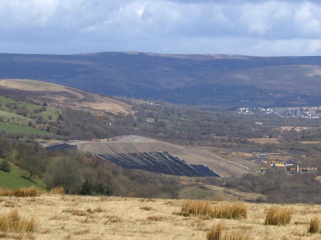
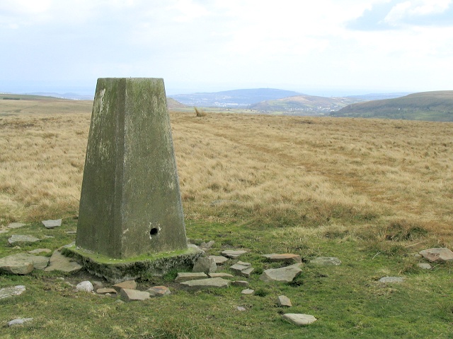
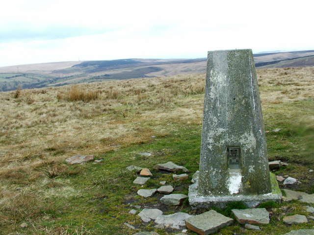
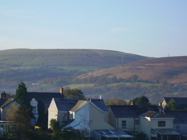
Bryn Mawr is a hill located in the county of Glamorgan, South Wales, United Kingdom. It is situated in the northern part of the county, near the town of Tredegar and the village of Ebbw Vale. With an elevation of approximately 457 meters (1499 ft), Bryn Mawr is considered a prominent landmark in the region.

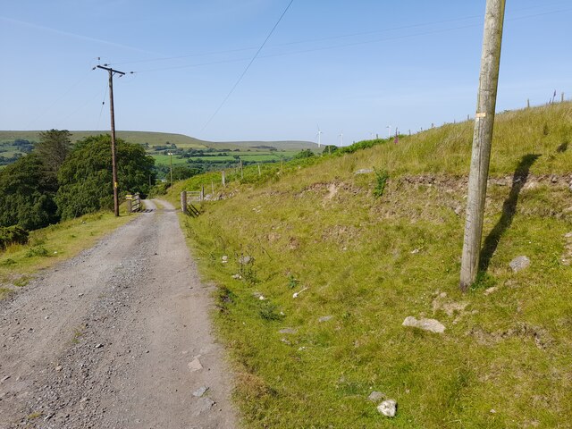
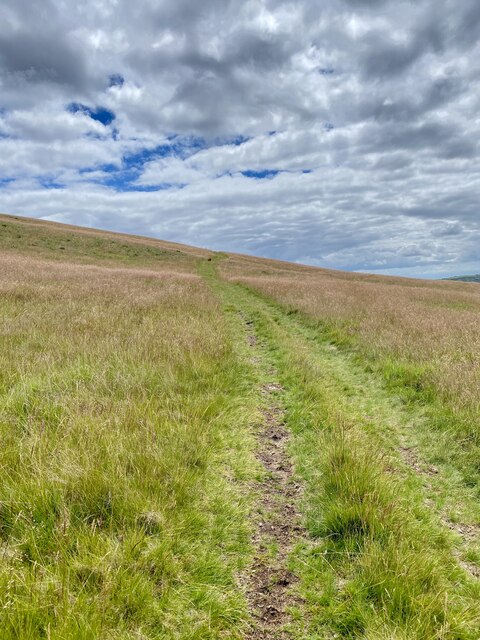
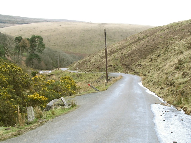
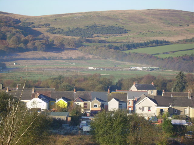
The hill offers breathtaking panoramic views of the surrounding countryside, including the nearby valleys and the lush greenery of the Brecon Beacons National Park. Its location in a rural area makes it a popular destination for outdoor enthusiasts, hikers, and nature lovers.

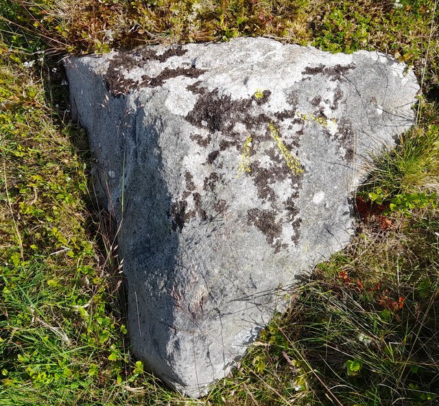
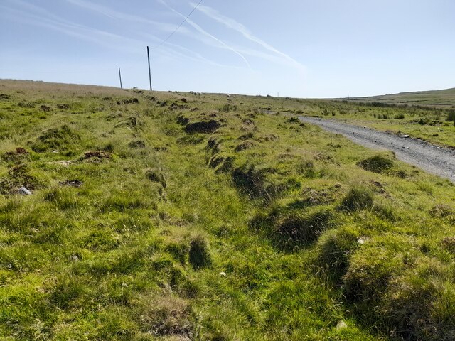
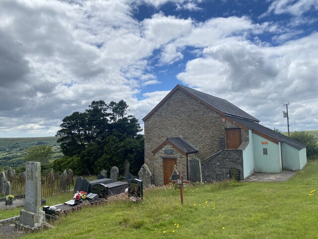
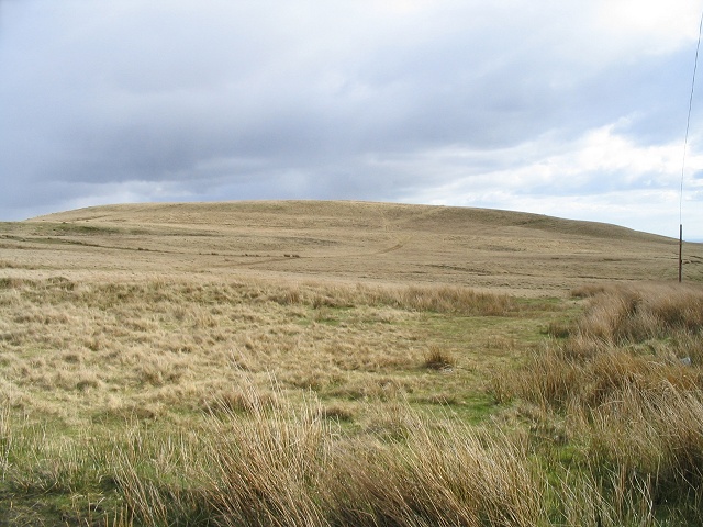
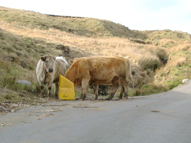
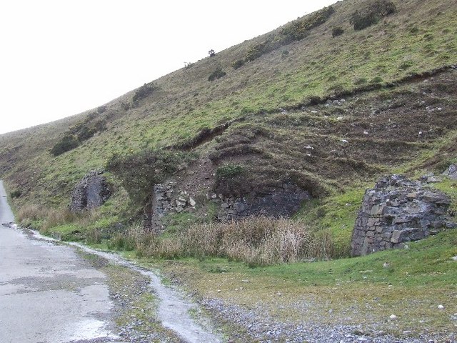
Bryn Mawr is characterized by its rugged terrain, with steep slopes and rocky outcrops. It is covered in a mix of heather, grasses, and scattered trees, providing habitats for various wildlife species. The hill is also known for its rich historical significance. Ruins of ancient settlements, burial mounds, and standing stones can be found in the vicinity, offering a glimpse into the area's past.

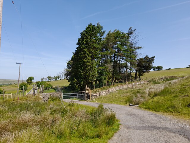
Access to Bryn Mawr is provided by a network of footpaths and trails, making it easily accessible for visitors. The hill attracts a diverse range of visitors, from locals seeking outdoor recreation to tourists looking to explore the natural beauty of the Glamorgan region.

In summary, Bryn Mawr is a stunning hill in Glamorgan, offering picturesque views, diverse wildlife, and a glimpse into the region's history. It is a popular destination for outdoor activities and a must-visit location for those seeking to immerse themselves in nature.

If you have any feedback on the listing, please let us know in the comments section below.

Bryn Mawr Images

Images are sourced within 2km of 51.762214/-3.8986448 or Grid Reference SN6908. Thanks to Geograph Open Source API. All images are credited.

Ordnance Survey Pivot This OS pivot can be found on a rock west side of the track. It marks a point 924.6ft above mean sea level.
Ordnance Survey Pivot
This OS pivot can be found on a rock west side of the track. It marks a point 924.6ft above mean sea level.
Tresgyrch-fach Trees mark the location of now destroyed farm.
Tresgyrch-fach
Trees mark the location of now destroyed farm.
Track to Nant-moel-uchaf Farm
Track & Ditch
Track & Ditch
Footpath around Mynydd Llechart
Baran Independent Chapel Capel y Baran is a Welsh Independent chapel situated in a remote location on Baran Mountain near Pontardawe. Despite that, services are still (2022) held on the first Sunday of each month.

See <span class="nowrap"><a title="https://coflein.gov.uk/en/site/10109?term=Pontardawe%20&pg=3" rel="nofollow ugc noopener" href="https://coflein.gov.uk/en/site/10109?term=Pontardawe%20&pg=3">Link</a><img style="margin-left:2px;" alt="External link" title="External link - shift click to open in new window" src="https://s1.geograph.org.uk/img/external.png" width="10" height="10"/></span>
Baran Independent Chapel
Capel y Baran is a Welsh Independent chapel situated in a remote location on Baran Mountain near Pontardawe. Despite that, services are still (2022) held on the first Sunday of each month. See LinkExternal link
Bridge over Clydach river This bridge is quite narrow, as evidenced by the battered barriers. Traffic should only cross one direction at a time. This river travels a long way through the mountain and eventually becomes the river Clydach.
Bridge over Clydach river
This bridge is quite narrow, as evidenced by the battered barriers. Traffic should only cross one direction at a time. This river travels a long way through the mountain and eventually becomes the river Clydach.
Isolated Mountain Chapel Looking at the surrounding area you'd be forgiven for thinking the only flock attending here would be actual sheep, but several of the gravestones are quite modern.
Isolated Mountain Chapel
Looking at the surrounding area you'd be forgiven for thinking the only flock attending here would be actual sheep, but several of the gravestones are quite modern.
Pwllfawatkin landfill It looks like quarry spoil being covered in landscaping sheets but unless seagulls eat gravel this is a huge mountain of refuse.
Pwllfawatkin landfill
It looks like quarry spoil being covered in landscaping sheets but unless seagulls eat gravel this is a huge mountain of refuse.
Road down into the lower Clydach valley A narrow winding road descends from Penlle'r Castell to cross the river Clydach.
Road down into the lower Clydach valley
A narrow winding road descends from Penlle'r Castell to cross the river Clydach.
North side of Mynydd Carnllechart Looking southwards from a mountain crossroads at the north slope of Mynydd Carnllechart.
North side of Mynydd Carnllechart
Looking southwards from a mountain crossroads at the north slope of Mynydd Carnllechart.
Bovine salt raid You have to travel deep into the bat-filled lava-tunnel caves of Mount Elgon in Kenya and wait until night fall to witness the amazing spectacle of elephants and buffalo navigating in the dark to lick the salt they need from the cave walls.
On the common land on Betws Mountain the cattle have found a way of raiding the roadside winter grit salt bins for their dietary supplements. Somehow I don't think David Attenborough will be sending a camera crew.
Bovine salt raid
You have to travel deep into the bat-filled lava-tunnel caves of Mount Elgon in Kenya and wait until night fall to witness the amazing spectacle of elephants and buffalo navigating in the dark to lick the salt they need from the cave walls. On the common land on Betws Mountain the cattle have found a way of raiding the roadside winter grit salt bins for their dietary supplements. Somehow I don't think David Attenborough will be sending a camera crew.
Trig pillar on Bryn Mawr There is nothing much else up here except the views. In the distance on the horizon is Port Talbot.
Trig pillar on Bryn Mawr
There is nothing much else up here except the views. In the distance on the horizon is Port Talbot.
Pwllfawatkin landfill This is the controversial Pwllfa-watkin landfill site near Cwmgors as seen from the road down Bryn Mawr. The noise from seagulls is incredible.
Pwllfawatkin landfill
This is the controversial Pwllfa-watkin landfill site near Cwmgors as seen from the road down Bryn Mawr. The noise from seagulls is incredible.
Bryn Mawr trig point Bryn Mawr triangulation station, flush bracket number S2016.
Bryn Mawr trig point
Bryn Mawr triangulation station, flush bracket number S2016.
Nant Melyn This photo is of Nant Melyn and the northern slopes of Bryn Mawr on the south western end of Cwmgors taken from the site of the old Cwmgors brickworks.
Nant Melyn
This photo is of Nant Melyn and the northern slopes of Bryn Mawr on the south western end of Cwmgors taken from the site of the old Cwmgors brickworks.
Derelict structure on Bryn Mawr In an area of past industrial,agricultural and domestic use,I have still to discover the exact function of this site.
Derelict structure on Bryn Mawr
In an area of past industrial,agricultural and domestic use,I have still to discover the exact function of this site.
Water sampling point Marker on the Upper Clydach River below the Pwllwatkin landfill site.
Water sampling point
Marker on the Upper Clydach River below the Pwllwatkin landfill site.
Show me another place!

Bryn Mawr is located at Grid Ref: SN6908 (Lat: 51.762214, Lng: -3.8986448)

Unitary Authority: Neath Port Talbot

Police Authority: South Wales

What 3 Words

///unlucky.slung.factoring. Near Brynamman, Neath Port Talbot

Nearby Locations

Bryn Mawr

Related Wikis

Abernant Colliery

Abernant Colliery was a coal mine in the River Amman valley at Pwllfawatkin, 4 miles (6.4 km) north of Pontardawe and 13 miles (21 km) north of Swansea...

Cwmgors

Cwmgors is a village in the county of Glamorgan, and administered as part of the unitary authority borough of Neath Port Talbot, Wales. It is part of the...

Penlle'r Castell

Penlle'r Castell is an historic ruin on the summit of Mynydd y Gwair in the far north of the City and County of Swansea. The Penlle'r Castell site was...

Mynydd y Gwair

Mynydd y Gwair (Penlle’r Castell) (English: The Hay Mountain) is a mountain in Swansea, Wales. Mynydd y Gwair is 373m/1224 ft high.[1] == Proposed... ==

Nearby Amenities

Located within 500m of 51.762214,-3.8986448
Bryn Mawr
Created By: Potlatch 0.10f
Ele: 351
Natural: peak
Wikidata: Q106711404
Lat/Long: 51.7637413/-3.8985824
The data included in this document is from www.openstreetmap.org. The data is made available under ODbL.

Have you been to Bryn Mawr?

Leave your review of Bryn Mawr below (or comments, questions and feedback).