Sròn na Maoile

Hill, Mountain in Perthshire

Scotland

Sròn na Maoile

Water of Ruchill The river is low after a prolonged dry spell.
Water of Ruchill Credit: Iain A Robertson

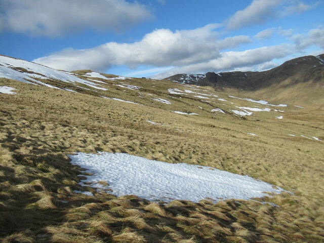
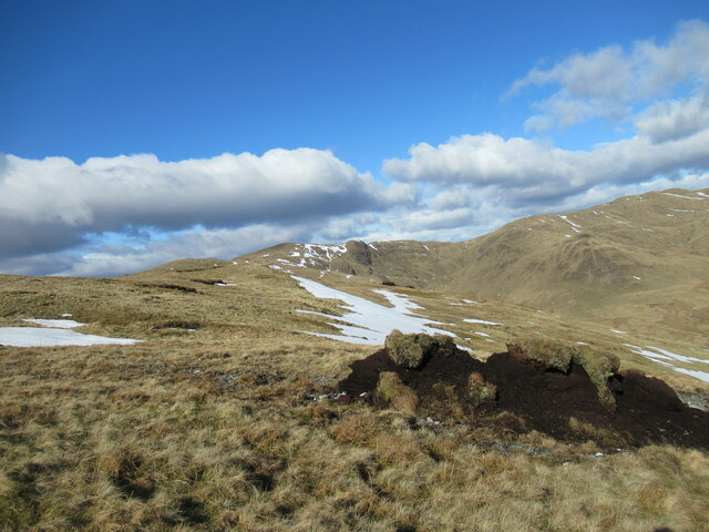
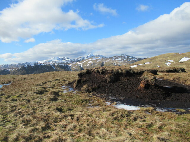
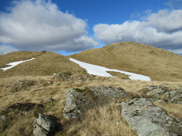
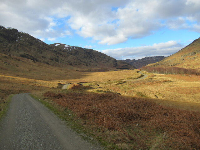
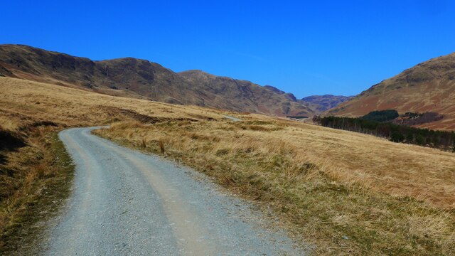
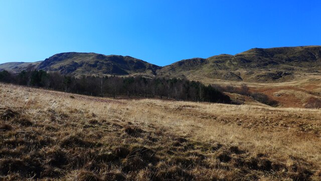
Sròn na Maoile is a hill located in Perthshire, Scotland. It stands at an elevation of 854 meters (2,802 feet) and is part of the Grampian Mountains range. The hill is known for its rugged terrain, with steep slopes and rocky outcrops, making it a popular destination for hikers and climbers looking for a challenge.

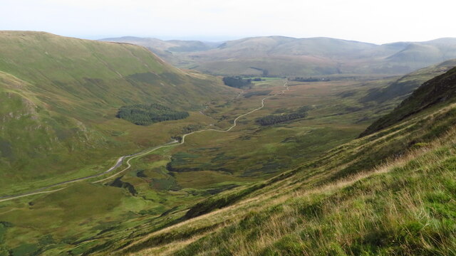
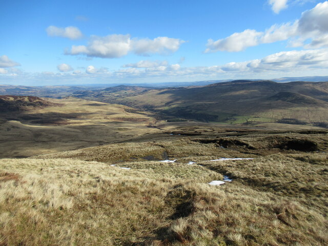
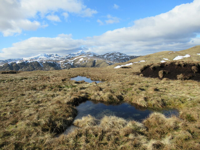
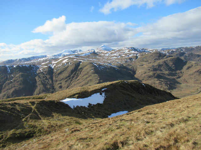
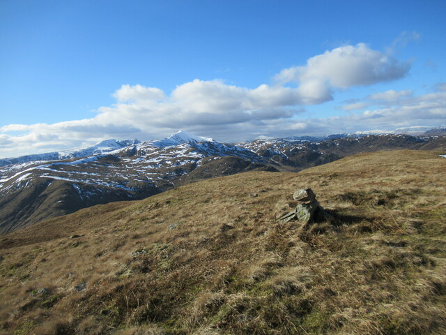
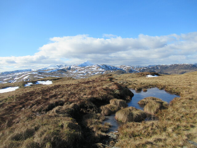
The summit of Sròn na Maoile offers stunning panoramic views of the surrounding countryside, including the nearby Loch Tay and Ben Lawers, the highest peak in the southern Highlands. On a clear day, visitors can also see as far as the Cairngorms and the Trossachs National Park.

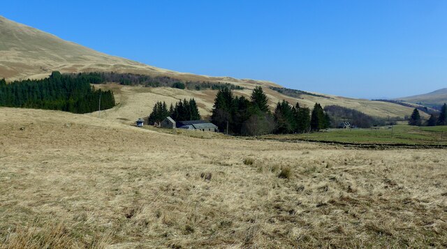
The hill is home to a variety of wildlife, including red deer, mountain hares, and golden eagles. The heather-covered slopes provide a habitat for a diverse range of plant species, adding to the natural beauty of the area.

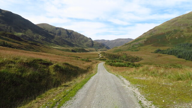
Access to Sròn na Maoile is via a network of hiking trails that wind their way up the hill, offering different levels of difficulty for all abilities. Whether you are an experienced mountaineer or a casual walker, Sròn na Maoile offers a challenging and rewarding outdoor experience in the heart of Perthshire.

If you have any feedback on the listing, please let us know in the comments section below.

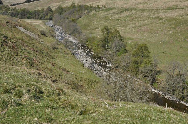
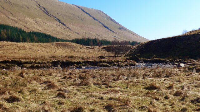
Sròn na Maoile Images

Images are sourced within 2km of 56.332272/-4.1193871 or Grid Reference NN6917. Thanks to Geograph Open Source API. All images are credited.

Water of Ruchill The river is low after a prolonged dry spell.
Water of Ruchill
The river is low after a prolonged dry spell.
Srath a' Ghlinne leading down to Glen Artney
View north along track through Srath a' Ghlinne
Slopes of Sròn na Maoile Looking towards Coire a' Choire, on Beinn Dearg, in Glen Artney.
Slopes of Sròn na Maoile
Looking towards Coire a' Choire, on Beinn Dearg, in Glen Artney.
Looking down Sròn nan Cabar into Glen Artney Sròn nan Cabar means 'nose (or promontory) of the logs'. The word 'caber', better known from being tossed at Highland Games events, derives from this Gaelic word, 'cabar'.
Looking down Sròn nan Cabar into Glen Artney
Sròn nan Cabar means 'nose (or promontory) of the logs'. The word 'caber', better known from being tossed at Highland Games events, derives from this Gaelic word, 'cabar'.
Peat hag and snow patches on Sròn na Maoile Remnants of eroded peat on Beinn Dearg, above Glen Artney.
Peat hag and snow patches on Sròn na Maoile
Remnants of eroded peat on Beinn Dearg, above Glen Artney.
Half-frozen bog pools north-west of Sròn na Maoile Some eroded peat hags are visible on the right, and in the distance, with the pointed snow-covered peak of Ben Vorlich prominent in the distance.
Half-frozen bog pools north-west of Sròn na Maoile
Some eroded peat hags are visible on the right, and in the distance, with the pointed snow-covered peak of Ben Vorlich prominent in the distance.
Peat hags north-west of Sròn na Maoile Eroded remnants of peat cover on the hillside, with the snowy peak of Ben Vorlich prominent in the distance.
Peat hags north-west of Sròn na Maoile
Eroded remnants of peat cover on the hillside, with the snowy peak of Ben Vorlich prominent in the distance.
Sròn nam Broighleag One of a succession of lumps and bumps at the western end of the Beinn Dearg in Glen Artney, Sròn nam Broighleag translates from Gaelic as 'nose (or promontory) of the blaeberries'.
Sròn nam Broighleag
One of a succession of lumps and bumps at the western end of the Beinn Dearg in Glen Artney, Sròn nam Broighleag translates from Gaelic as 'nose (or promontory) of the blaeberries'.
Spur leading off Sròn na Broighleag Sròn na Broighleag translates from Gaelic as 'nose (or promontory) of the blaeberries.

The snowy peak of Ben Vorlich is prominent in the distance.
Spur leading off Sròn na Broighleag
Sròn na Broighleag translates from Gaelic as 'nose (or promontory) of the blaeberries. The snowy peak of Ben Vorlich is prominent in the distance.
Western top of Beinn Dearg A resurvey carried out in the last few years has concluded that this is actually the highest point on Beinn Dearg, rather than the top to the north-east as previously thought. This is, therefore, the Graham summit.
Western top of Beinn Dearg
A resurvey carried out in the last few years has concluded that this is actually the highest point on Beinn Dearg, rather than the top to the north-east as previously thought. This is, therefore, the Graham summit.
Part-frozen bog pool near the summit of Beinn Dearg The snowy peak of Ben Vorlich is prominent in the distance.
Part-frozen bog pool near the summit of Beinn Dearg
The snowy peak of Ben Vorlich is prominent in the distance.
View up Srath a' Ghlinne A wide hill-flanked valley running roughly north-west to south-east from upper Glen Artney.
View up Srath a' Ghlinne
A wide hill-flanked valley running roughly north-west to south-east from upper Glen Artney.
Buildings at Auchinner
The track up Strath a' Ghlinne This is an excellent track and much improved since 2006;  see <a title="https://www.geograph.org.uk/photo/296308" href="https://www.geograph.org.uk/photo/296308">Link</a>
The track up Strath a' Ghlinne
This is an excellent track and much improved since 2006; see Link
Looking up to Carn Labhruinn from the Strath a' Ghlinne
Footbridge over the Allt Strath a' Ghlinne
Water of Ruchill At Auchinner.
Water of Ruchill
At Auchinner.
Show me another place!

Sròn na Maoile is located at Grid Ref: NN6917 (Lat: 56.332272, Lng: -4.1193871)

Unitary Authority: Perth and Kinross

Police Authority: Tayside

What 3 Words

///final.demanding.standing. Near Comrie, Perth & Kinross

Related Wikis

Glen Artney

Glen Artney or Glenartney is a valley in Perthshire, Scotland.Several ships have been named Glenartney: SS Glenartney (1869), an iron-hulled steamship...

Beinn nan Eun (Perth and Kinross)

Beinn nan Eun is a hill in the Glen Artney Hills range immediately south of the Highland Boundary Fault, part of the Central Lowlands of Scotland. The...

Uamh Bheag

Uamh Bheag is a hill in the Glen Artney Hills range immediately south of the Highland Boundary Fault, part of the Central Lowlands of Scotland. The highest...

Dundurn, Scotland

Dundurn is the site of a Pictish hillfort in what is now Strathearn in Perth and Kinross, Scotland. The fort was situated on a hill with the River Earn...

Have you been to Sròn na Maoile?

Leave your review of Sròn na Maoile below (or comments, questions and feedback).