Sìdhean Mór Dail a' Chaorainn

Hill, Mountain in Inverness-shire

Scotland

Sìdhean Mór Dail a' Chaorainn

A rather grey hut The Red Hut, (as it's known), is passed on certain ascents of A' Chailleach from Glen Balloch; it's on the southern slope of the mountain. It's seen here as it was in the October of 1992.
A rather grey hut Credit: Trevor Littlewood

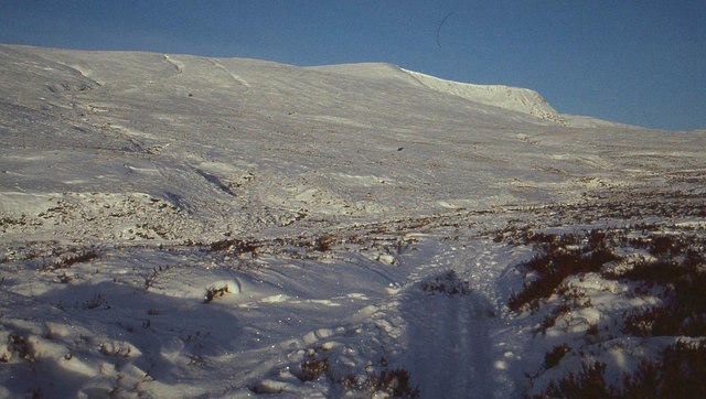
Sìdhean Mór Dail a' Chaorainn is a prominent hill located in Inverness-shire, Scotland. Standing at an elevation of 743 meters (2,438 feet), it offers stunning panoramic views of the surrounding landscape. The hill is part of the Scottish Highlands and is a popular destination for hikers and outdoor enthusiasts.

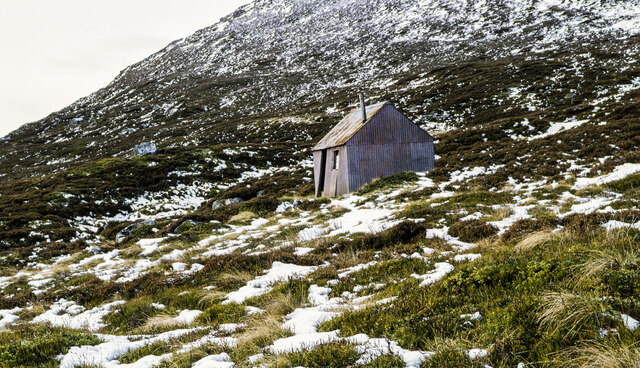
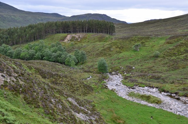
Sìdhean Mór Dail a' Chaorainn is known for its rugged terrain, with rocky slopes and grassy meadows covering its slopes. The hill is home to a variety of wildlife, including red deer, mountain hares, and numerous bird species, making it a great spot for nature lovers.

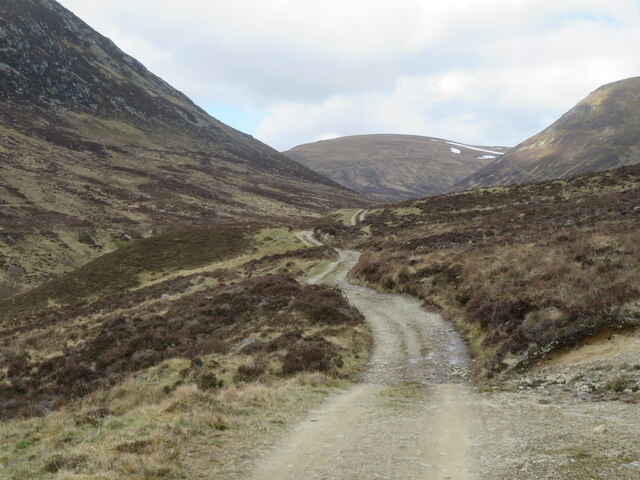
The hill is accessible via several walking trails, with the most popular route starting from the nearby village of Newtonmore. The climb to the summit can be challenging, but the breathtaking views from the top make it well worth the effort.

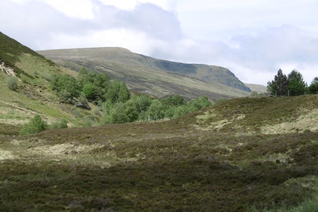
Overall, Sìdhean Mór Dail a' Chaorainn is a beautiful and rewarding destination for those looking to explore the natural beauty of the Scottish Highlands.

If you have any feedback on the listing, please let us know in the comments section below.

Sìdhean Mór Dail a' Chaorainn Images

Images are sourced within 2km of 57.075868/-4.1616242 or Grid Reference NH6900. Thanks to Geograph Open Source API. All images are credited.
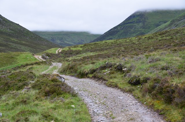
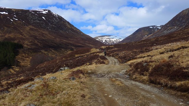
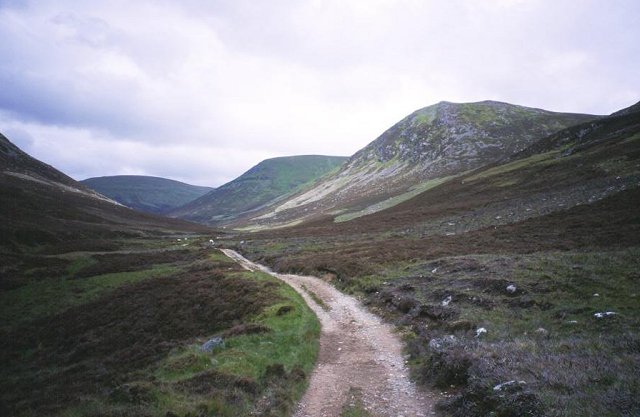
A rather grey hut The Red Hut, (as it's known), is passed on certain ascents of A' Chailleach from Glen Balloch; it's on the southern slope of the mountain. It's seen here as it was in the October of 1992.
A rather grey hut
The Red Hut, (as it's known), is passed on certain ascents of A' Chailleach from Glen Balloch; it's on the southern slope of the mountain. It's seen here as it was in the October of 1992.
View from the first steep section of track above Glenbanchor After an easy approach across sheep nibbled pastures, the track into the side valley of the Allt-Fionndrigh ascends a short steep [to those in their 8th decade] hill before levelling out. The view is back into Glen Banchor where a plantation of conifers has suffered damage during winter gales.
View from the first steep section of track above Glenbanchor
After an easy approach across sheep nibbled pastures, the track into the side valley of the Allt-Fionndrigh ascends a short steep [to those in their 8th decade] hill before levelling out. The view is back into Glen Banchor where a plantation of conifers has suffered damage during winter gales.
Track into an unnamed glen This side glen, an offshoot of Glen Banchor is unnamed on maps, but carries a strong burn, the Allt-Fionndrigh which is hidden in a deep cleft to the left of this photo.
Track into an unnamed glen
This side glen, an offshoot of Glen Banchor is unnamed on maps, but carries a strong burn, the Allt-Fionndrigh which is hidden in a deep cleft to the left of this photo.
The Allt-Fionndrigh Looking downstream towards where the burn meets the main valley of Glen Banchor.
The Allt-Fionndrigh
Looking downstream towards where the burn meets the main valley of Glen Banchor.
The 'red hut' below A' Chailleach This ramshackle, rusty bothy is a landmark en route to A' Chailleach.
The 'red hut' below A' Chailleach
This ramshackle, rusty bothy is a landmark en route to A' Chailleach.
An Stac viewed from Glen Banchor track An Stac ('the precipice') is the simple name given to this small rocky precipice.
An Stac viewed from Glen Banchor track
An Stac ('the precipice') is the simple name given to this small rocky precipice.
Track by the Allt Fionndrigh Cloud base is about 800m, cutting off the tops of Meall na Ceardaich (ahead) and Geal Charn (R).
Track by the Allt Fionndrigh
Cloud base is about 800m, cutting off the tops of Meall na Ceardaich (ahead) and Geal Charn (R).
Allt Fionndrigh, looking downstream The burn in the lower part of the glen where a number of broadleaved trees have become established on the banks, as well as the plantation on the W side.
Allt Fionndrigh, looking downstream
The burn in the lower part of the glen where a number of broadleaved trees have become established on the banks, as well as the plantation on the W side.
Allt a' Chaorainn Deep cold in the Monadhliath - the car batteries did not like it and we had issues getting started again on return from an ascent of A' Cailleach (background).
Allt a' Chaorainn
Deep cold in the Monadhliath - the car batteries did not like it and we had issues getting started again on return from an ascent of A' Cailleach (background).
Allt a' Chaoruinn The usual approach to A' Chailleach.
Allt a' Chaoruinn
The usual approach to A' Chailleach.
The track up the glen of the Allt Fionndrigh Snow is lying on Meall na Ceardaich directly ahead.
The track up the glen of the Allt Fionndrigh
Snow is lying on Meall na Ceardaich directly ahead.
Moorland near Creag Bheag Looking north-westward.
Moorland near Creag Bheag
Looking north-westward.
Glen of the Allt a'Chaorainn A'Chailleach  and the Allt a'Chaorainn track in the Monadhliath, behind Newtonmore.
Glen of the Allt a'Chaorainn
A'Chailleach and the Allt a'Chaorainn track in the Monadhliath, behind Newtonmore.
Allt a' Chaorainn The burn starts to downcut to Glen Banchor from its higher hanging valley
Allt a' Chaorainn
The burn starts to downcut to Glen Banchor from its higher hanging valley
Allt Fionndrigh Under the slopes of the southern tops of A'Cailleach, a tributary glen of Glen Banchor leads to the higher reaches of the Monadh Liath.
Allt Fionndrigh
Under the slopes of the southern tops of A'Cailleach, a tributary glen of Glen Banchor leads to the higher reaches of the Monadh Liath.
Red Hut in summer Landmark on ascent of A Chailleach from Glen Balloch
Red Hut in summer
Landmark on ascent of A Chailleach from Glen Balloch
Track to A'Chailleach A'Chailleach (930m) is the one with the snow on the top.
Track to A'Chailleach
A'Chailleach (930m) is the one with the snow on the top.
Allt a' Chaorainn Taken from the bridge that crosses the river on the path up A' Chailleach.
Allt a' Chaorainn
Taken from the bridge that crosses the river on the path up A' Chailleach.
Show me another place!

Sìdhean Mór Dail a' Chaorainn is located at Grid Ref: NH6900 (Lat: 57.075868, Lng: -4.1616242)

Unitary Authority: Highland

Police Authority: Highlands and Islands

What 3 Words

///courtyard.tribe.nourished. Near Newtonmore, Highland

Related Wikis

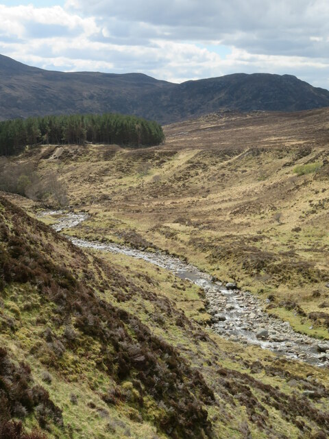
River Calder, Highland

The River Calder (Scottish Gaelic: Caladar) is a left bank tributary of the River Spey in the Scottish Highlands. Its headwaters are the t-Allt Ballach...

Newtonmore

Newtonmore (Scottish Gaelic: Baile Ùr an t-Slèibh [ˈpˠalʲ uːɾˠ ən̪ˠ ˈt̪ʰlʲeːv]) is a village in the Highland council area of Scotland. The village is only...

The Eilan

The Eilan (Scottish Gaelic: Eilean Bheannchair) is a shinty stadium in the town of Newtonmore, Scotland. It is the home of Newtonmore Camanachd and has...

Newtonmore railway station

Newtonmore railway station serves the village of Newtonmore, Highland, Scotland. The station is managed by ScotRail and is on the Highland Main Line. The...

Nearby Amenities

Located within 500m of 57.075868,-4.1616242
Sidhean Mor Dail a' Chaorainn
Archaeological Site: fortification
Ele: 397
Fortification Type: hill_fort
Historic: archaeological_site
Loc Name: Johnny Blair's Garden
Natural: peak
Source: local_knowledge
Lat/Long: 57.0758153/-4.161668
Dalchirnmore
Historic: archaeological_site
Note: Evictions carried out by James Macpherson, the younger in 1806
Place: locality
Lat/Long: 57.0715733/-4.160884
Bench
Material: wood
Lat/Long: 57.0743296/-4.1583145
Historic: monument
Lat/Long: 57.0744812/-4.1582179
The data included in this document is from www.openstreetmap.org. The data is made available under ODbL.

Have you been to Sìdhean Mór Dail a' Chaorainn?

Leave your review of Sìdhean Mór Dail a' Chaorainn below (or comments, questions and feedback).