Bamburgh
Settlement in Northumberland
England
Bamburgh

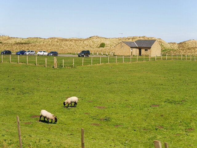
Bamburgh is a small coastal village located in the county of Northumberland, England. Situated on the northeast coast, it lies approximately 16 miles northeast of Alnwick and 24 miles southeast of Berwick-upon-Tweed. The village is renowned for its historical significance and stunning natural beauty, making it a popular tourist destination.
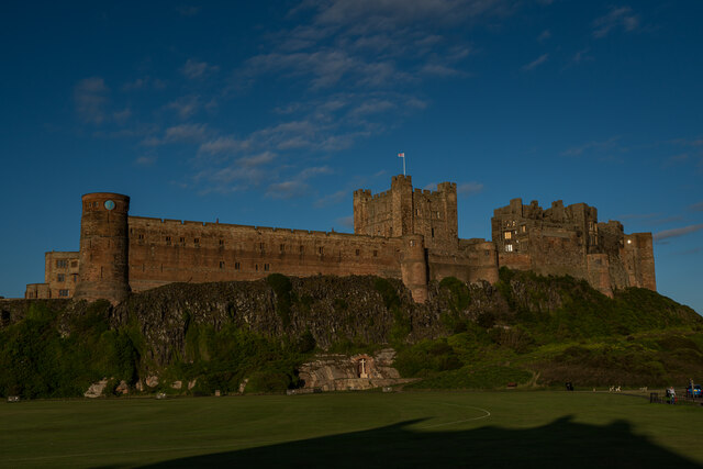
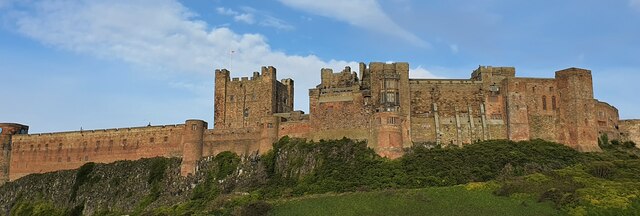
One of the main attractions in Bamburgh is its majestic castle, which dominates the skyline. Built on a rocky outcrop overlooking the North Sea, Bamburgh Castle is a Grade I listed building and has a history dating back over 1,400 years. Visitors can explore the castle's many rooms and exhibits, which showcase its rich heritage.
The village itself is quaint and picturesque, with charming stone houses and narrow winding streets. It is home to a small population, with a close-knit community that takes pride in preserving the village's traditional character. Bamburgh also offers a range of amenities, including cozy pubs, quaint tearooms, and unique shops selling local crafts and produce.
The coastline near Bamburgh is truly breathtaking, with miles of golden sandy beaches and dramatic dunes. The village is located within the Northumberland Coast Area of Outstanding Natural Beauty, ensuring the preservation of its stunning landscapes and diverse wildlife. Visitors can enjoy long walks along the beach, explore the nearby sand dunes, or take part in water sports such as surfing and kiteboarding.
Overall, Bamburgh is a charming village that seamlessly blends its rich history with natural beauty. It offers a unique experience for visitors, with its iconic castle, scenic coastline, and traditional village charm.
If you have any feedback on the listing, please let us know in the comments section below.
Bamburgh Images
Images are sourced within 2km of 55.60776/-1.714292 or Grid Reference NU1834. Thanks to Geograph Open Source API. All images are credited.


Bamburgh is located at Grid Ref: NU1834 (Lat: 55.60776, Lng: -1.714292)
Unitary Authority: Northumberland
Police Authority: Northumbria
What 3 Words
///juggles.trout.cowboys. Near Bamburgh, Northumberland
Related Wikis
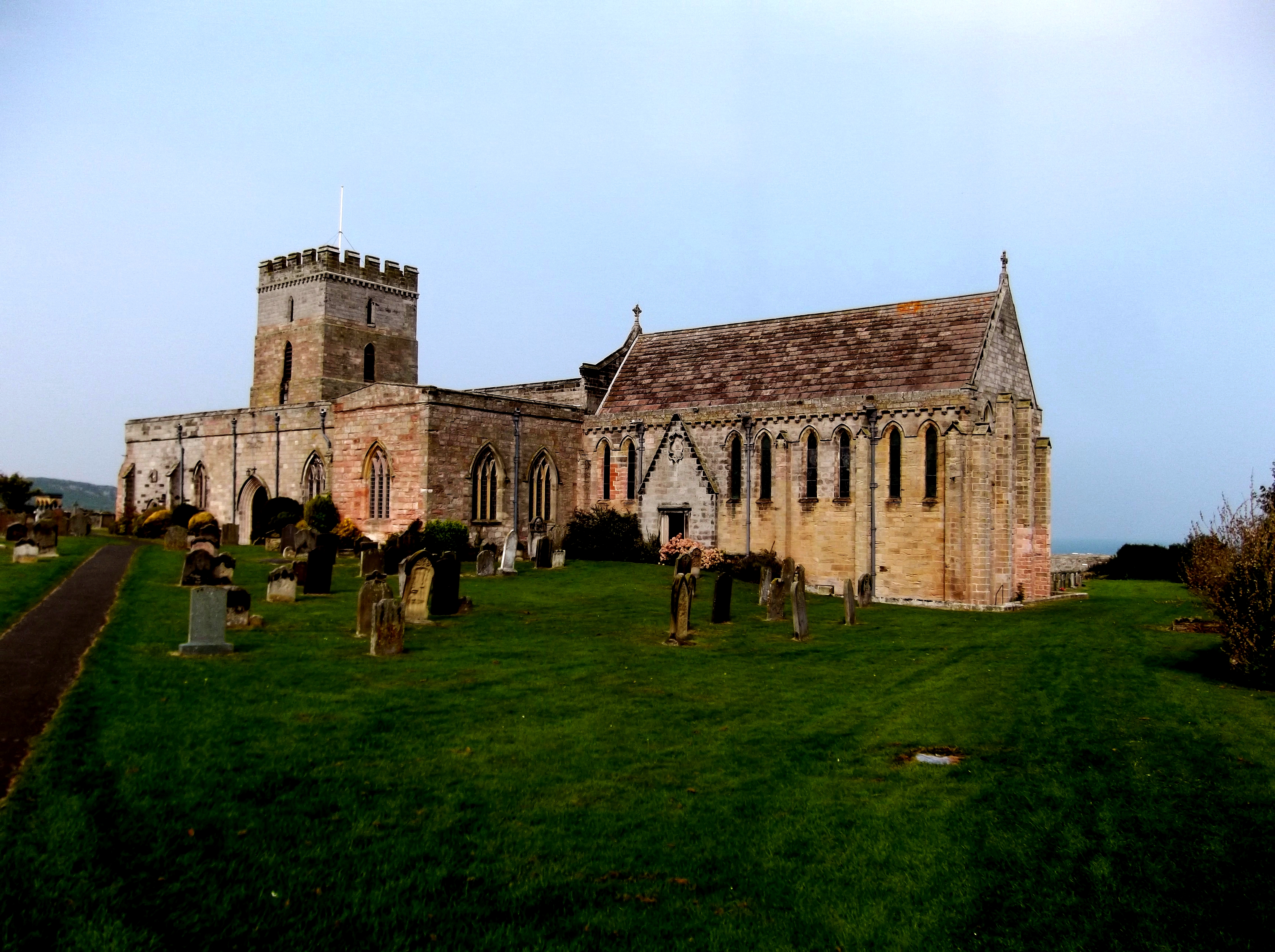
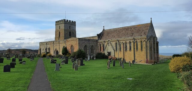
St Aidan's Church, Bamburgh
St Aidan's Church is a Grade I listed Church of England building in the Diocese of Newcastle. == History == According to Bede, St Aidan built a wooden...

Bamburgh Sword
The Bamburgh Sword is an Anglo-Saxon artefact from the seventh century. It was uncovered during an archaeological excavation at Bamburgh Castle in 1960...

Monument to Grace Darling
The Monument to Grace Darling, in the churchyard of St Aidan's Church, Bamburgh, Northumberland is a Victorian Gothic memorial. The monument was designed...
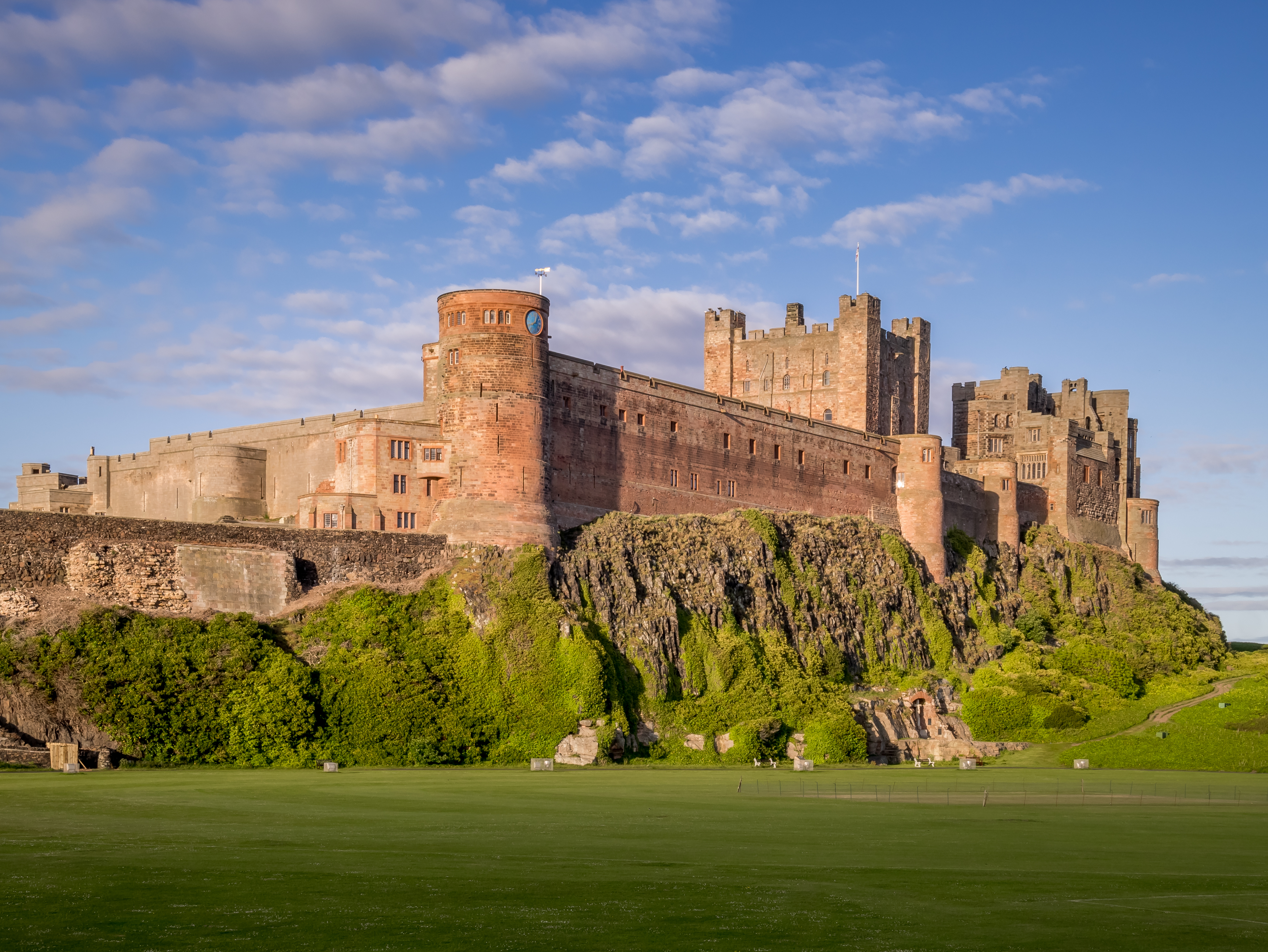
Bamburgh Castle
Bamburgh Castle is a castle on the northeast coast of England, by the village of Bamburgh in Northumberland. It is a Grade I listed building.The site was...

Bamburgh
Bamburgh ( BAM-bər-ə) is a village and civil parish on the coast of Northumberland, England. It had a population of 454 in 2001, decreasing to 414 at the...

Bamburgh Dunes
Bamburgh Dunes are a region of coastal sand dunes with an area of over 40 hectares situated around the village of Bamburgh in Northumberland, England....
Bamburgh Coast and Hills
Bamburgh Coast and Hills is the name given to a Site of Special Scientific Interest (SSSI) on the coast of north Northumberland, England. The site is one...
Burton, Northumberland
Burton is a hamlet and former civil parish, now in the parish of Bamburgh, in the county of Northumberland, England. It is situated to the south of the...
Nearby Amenities
Located within 500m of 55.60776,-1.714292Have you been to Bamburgh?
Leave your review of Bamburgh below (or comments, questions and feedback).