Bamber Bridge

Settlement in Lancashire South Ribble

England

Bamber Bridge

A6 London Way, northbound
A6 London Way, northbound Credit: Colin Pyle

Bamber Bridge is a small town located in Lancashire, England. It is situated approximately 5 miles south of the city of Preston and falls within the borough of South Ribble. With a population of around 12,000 people, Bamber Bridge is a vibrant and close-knit community.

Historically, Bamber Bridge was a rural village with mainly agricultural activities. However, with the advent of the Industrial Revolution, the town saw significant growth and development. Today, it is a mix of both old and new, with quaint cottages and modern housing estates coexisting side by side.

The town has a range of amenities and facilities to cater to the needs of its residents. There are several schools, including primary and secondary schools, ensuring that education is easily accessible for families. Bamber Bridge also boasts a variety of shops, supermarkets, and local businesses, providing convenient options for shopping and services.

For leisure and recreation, residents can enjoy the beautiful local parks and green spaces, such as Cuerden Valley Park and Withy Grove Park. These areas offer opportunities for walking, picnicking, and other outdoor activities. Bamber Bridge is also home to various sports clubs and facilities, catering to a range of interests including football, cricket, and rugby.

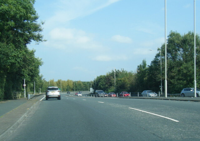
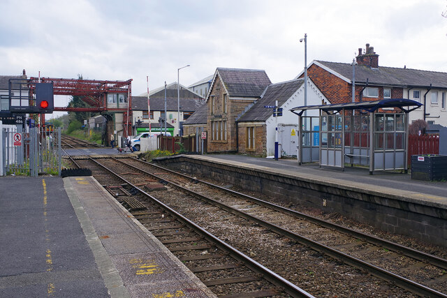
Transportation links in Bamber Bridge are well-established, with the M6 motorway running nearby and the town having its own railway station. This provides easy access to neighboring towns and cities, making it convenient for commuting or exploring the wider region.

In summary, Bamber Bridge is a charming town with a rich history and a strong sense of community. Its range of amenities, beautiful surroundings, and convenient location make it an attractive place to live for both families and individuals.

If you have any feedback on the listing, please let us know in the comments section below.

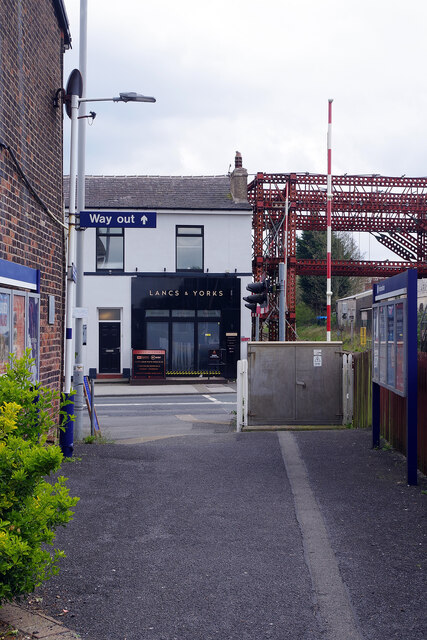
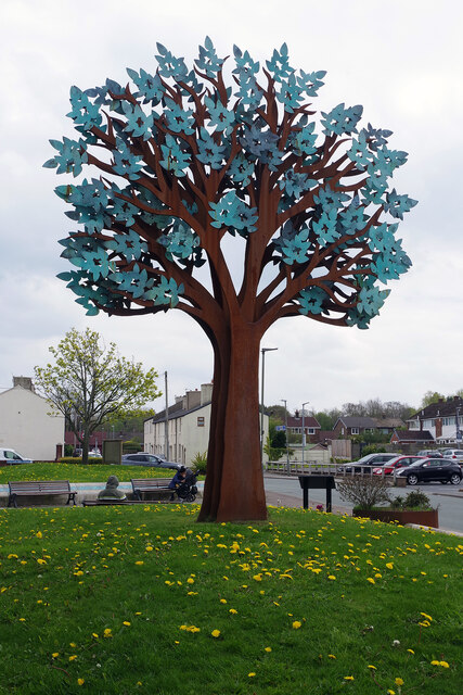
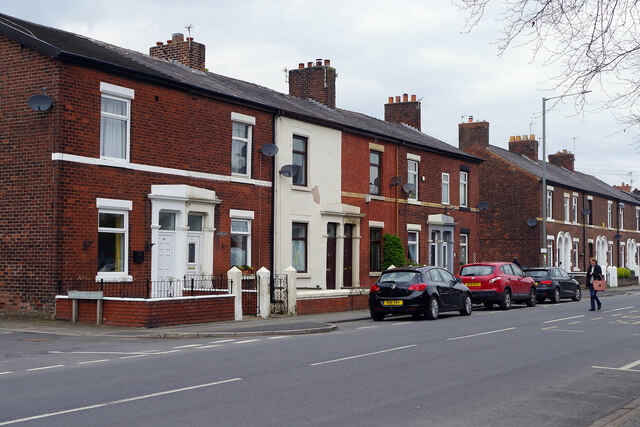
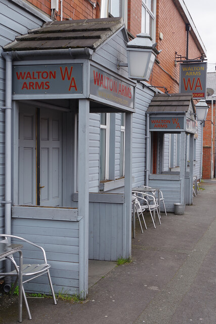
Bamber Bridge Images

Images are sourced within 2km of 53.731332/-2.681327 or Grid Reference SD5526. Thanks to Geograph Open Source API. All images are credited.

A6 London Way, northbound
Lostock Hall Station
Triangle of land in the middle of Whitehouse Junction Surrounded by three former railway embankment. This is now part of Preston Junction local nature reserve.
Triangle of land in the middle of Whitehouse Junction
Surrounded by three former railway embankment. This is now part of Preston Junction local nature reserve.
Silver birch on a former railway embankment Often the first trees to colonise abandoned land. Fast growing and short-lived, their rotting trunks improve the soil for other more long-lived trees.
Silver birch on a former railway embankment
Often the first trees to colonise abandoned land. Fast growing and short-lived, their rotting trunks improve the soil for other more long-lived trees.
The old tram road, near Carr Wood Now a tree-lined public footpath and traffic-free cycle route. But built as a freight route, by a canal company, to link the two separate parts of the Lancaster Canal. For more information see <a href="https://www.geograph.org.uk/photo/4337430">SD5427 : The Old Tram Road Towards Preston</a>.
The old tram road, near Carr Wood
Now a tree-lined public footpath and traffic-free cycle route. But built as a freight route, by a canal company, to link the two separate parts of the Lancaster Canal. For more information see SD5427 : The Old Tram Road Towards Preston.
Rootplate of a fallen tree, Old Tram Road The tree had grown on the side of the tramroad embankment, and seems to have toppled after wet weather.
Rootplate of a fallen tree, Old Tram Road
The tree had grown on the side of the tramroad embankment, and seems to have toppled after wet weather.
Old Bridge Marker on Todd Lane South, Lostock Hall Bridge Marker in the parapet of Stone Bridge, River Lostock, on the east side of Todd Lane South in Lostock Hall. 

Milestone Society National ID: LA_CUERD01br
Old Bridge Marker on Todd Lane South, Lostock Hall
Bridge Marker in the parapet of Stone Bridge, River Lostock, on the east side of Todd Lane South in Lostock Hall. Milestone Society National ID: LA_CUERD01br
Bamber Bridge Station Bamber Bridge station is on the line between Preston and Blackburn. There is a busy level crossing at the eastern end of the platforms. Note the steel work that is currently necessary to support the signal box.
Bamber Bridge Station
Bamber Bridge station is on the line between Preston and Blackburn. There is a busy level crossing at the eastern end of the platforms. Note the steel work that is currently necessary to support the signal box.
The Lancs & Yorks, Bamber Bridge Passengers from Preston arriving at Bamber Bridge station might find the Lancs & Yorks pub very convenient for a stop off on the way home. Its story is an unusual one. For many years known as the Lancashire and Yorkshire (later shortened to Lancs & Yorks), taking its name from the company that ran the adjacent railway, it closed in 2013. The building was then divided into two retail units and it looked as though it had joined the ever-growing ranks of former pubs forever. However, eight years later in 2021 one of the units reopened as a microbar, taking the old name, and now appears to be thriving with regular live music and other entertainment - good news indeed for those who love the institution of the British pub. 

This photograph shows it as it was in 1992 when it was a William Younger's house and looked smart: <a href="https://www.geograph.org.uk/photo/202650">SD5625 : Lancs & Yorks, Bamber Bridge</a>. 20 years later, shortly before closure, it was beginning to look distinctly down at heel: <a href="https://www.geograph.org.uk/photo/2820751">SD5625 : Lancs & Yorks, Bamber Bridge</a>.
The Lancs & Yorks, Bamber Bridge
Passengers from Preston arriving at Bamber Bridge station might find the Lancs & Yorks pub very convenient for a stop off on the way home. Its story is an unusual one. For many years known as the Lancashire and Yorkshire (later shortened to Lancs & Yorks), taking its name from the company that ran the adjacent railway, it closed in 2013. The building was then divided into two retail units and it looked as though it had joined the ever-growing ranks of former pubs forever. However, eight years later in 2021 one of the units reopened as a microbar, taking the old name, and now appears to be thriving with regular live music and other entertainment - good news indeed for those who love the institution of the British pub. This photograph shows it as it was in 1992 when it was a William Younger's house and looked smart: SD5625 : Lancs & Yorks, Bamber Bridge. 20 years later, shortly before closure, it was beginning to look distinctly down at heel: SD5625 : Lancs & Yorks, Bamber Bridge.
McNamara Gardens, Bamber Bridge The somewhat strange-looking tree sculpture on a patch of dandelion-covered grass constitutes a memorial to John McNamara, a local man who was awarded the Victoria Cross in the First World War. A tree design was chosen because the name Bamber Bridge derives from the Old English 'bēam' and 'brycg', meaning a tree-trunk bridge.
McNamara Gardens, Bamber Bridge
The somewhat strange-looking tree sculpture on a patch of dandelion-covered grass constitutes a memorial to John McNamara, a local man who was awarded the Victoria Cross in the First World War. A tree design was chosen because the name Bamber Bridge derives from the Old English 'bēam' and 'brycg', meaning a tree-trunk bridge.
Station Road, Bamber Bridge This line of terraced houses stands opposite St Aidan's Church in Bamber Bridge. Balshaw Street leads off to the left. Station Road is nowadays the B6258 but was previously a stretch of the A6.
Station Road, Bamber Bridge
This line of terraced houses stands opposite St Aidan's Church in Bamber Bridge. Balshaw Street leads off to the left. Station Road is nowadays the B6258 but was previously a stretch of the A6.
Walton Arms, Bamber Bridge This pub, tucked away on St Aidan's Road, was formerly the School Lane Club and became a pub in 2015. The interior decor is in the very trendy 'steampunk' style.
Walton Arms, Bamber Bridge
This pub, tucked away on St Aidan's Road, was formerly the School Lane Club and became a pub in 2015. The interior decor is in the very trendy 'steampunk' style.
Turf zone "Winery" Path of Winery Lane towards Preston.
Turf zone "Winery"
Path of Winery Lane towards Preston.
Turf zone "CloseToDarwen" Path near Walton Hall Farm, Walton-le-Dale.
Turf zone "CloseToDarwen"
Path near Walton Hall Farm, Walton-le-Dale.
Turf zone "WhyHere" Path leading to Hennel Lane, Walton-le-Dale.
Turf zone "WhyHere"
Path leading to Hennel Lane, Walton-le-Dale.
Turf zone "Hennel" Footbridge over the A6, London Way, Walton-le-Dale.
Turf zone "Hennel"
Footbridge over the A6, London Way, Walton-le-Dale.
Turf zone "NotLost" Path in Dog Kennel Wood towards Bamber Bridge.
Turf zone "NotLost"
Path in Dog Kennel Wood towards Bamber Bridge.
Turf zone "Selkirk" Path leading to Brown Edge, Bamber Bridge.
Turf zone "Selkirk"
Path leading to Brown Edge, Bamber Bridge.
Show me another place!

Bamber Bridge is located at Grid Ref: SD5526 (Lat: 53.731332, Lng: -2.681327)

Administrative County: Lancashire

District: South Ribble

Police Authority: Lancashire

What 3 Words

///asks.flesh.pints. Near Leyland, Lancashire

Related Wikis

Todd Lane Junction railway station

Todd Lane Junction, previously called Preston Junction until 1952, was a railway station between Preston and Bamber Bridge which closed to passenger traffic...

Lostock Hall Academy

Lostock Hall Academy (formerly Lostock Hall Community High School) is a mixed secondary school located in Lostock Hall in the English county of Lancashire...

Bamber Bridge F.C.

Bamber Bridge Football Club is a football club based in Bamber Bridge, near Preston, Lancashire, England. They are currently members of the Northern Premier...

Blackburn Rovers W.F.C.

Blackburn Rovers Women Football Club is a women's football club based in Bamber Bridge, Lancashire, England, that competes in the Women's Championship...

Nearby Amenities

Located within 500m of 53.731332,-2.681327
Note: site of station (Preston Junction?)
Source: npe
Lat/Long: 53.7316982/-2.6801594
Crossing
Crossing: unmarked
Tactile Paving: no
Lat/Long: 53.7295967/-2.6746621
Traffic Signals
Lat/Long: 53.7274287/-2.6818749
Post Box
Addr City: Preston
Collection Times: Mo-Fr 09:00; Sa 07:00; Su off
Drive Through: no
Operator: Royal Mail
Post Box Design: type_k
Post Box Type: pillar
Ref: PR5 175
Royal Cypher: EIIR
Royal Cypher Wikidata: Q33102113
Lat/Long: 53.7275106/-2.6816017
Bus Stop
Lyndale Avenue
Bench: no
Bus: yes
Departures Board: timetable
Public Transport: platform
Ref: landjadg
Shelter: no
Source: survey
Tactile Paving: no
Lat/Long: 53.7339822/-2.6812959
Barrier: kissing_gate
Foot: yes
Lat/Long: 53.7340634/-2.6867852
Turning Circle
Source: Bing
Lat/Long: 53.7324808/-2.6787647
Crossing
Crossing: unmarked
Tactile Paving: no
Lat/Long: 53.7296798/-2.6744522
Barrier: cycle_barrier
Lat/Long: 53.7277063/-2.6782386
Barrier: kerb
Kerb: lowered
Tactile Paving: no
Lat/Long: 53.7297065/-2.6743223
Crossing
Crossing: unmarked
Lat/Long: 53.7319251/-2.6759052
Barrier: kissing_gate
Lat/Long: 53.7332081/-2.6764003
Barrier: kissing_gate
Lat/Long: 53.7332432/-2.6783469
Crossing
Crossing: unmarked
Lat/Long: 53.7332659/-2.6766537
Crossing
Crossing: unmarked
Lat/Long: 53.7333015/-2.6765077
Crossing
Crossing: zebra
Crossing Island: no
Tactile Paving: yes
Lat/Long: 53.7274517/-2.6850278
Crossing
Crossing: unmarked
Lat/Long: 53.7318569/-2.6760314
Barrier: kissing_gate
Lat/Long: 53.7341473/-2.6767237
Barrier: kissing_gate
Foot: yes
Lat/Long: 53.7347264/-2.6809854
Generator Method: photovoltaic
Generator Output Electricity: yes
Generator Source: solar
Generator Type: solar_photovoltaic_panel
Location: roof
Power: generator
Lat/Long: 53.7305956/-2.6875815
Post Box
Addr City: Preston
Collection Times: Mo-Fr 09:00; Sa 07:00; Su off
Operator: Royal Mail
Post Box Mounting: brick_pillar
Post Box Type: wall
Ref: PR5 336
Royal Cypher: GVIR
Royal Cypher Wikidata: Q33102169
Lat/Long: 53.7331479/-2.681162
Traffic Sign: GB:616
Traffic Sign Direction: backward
Lat/Long: 53.7286285/-2.6865202
Traffic Sign: GB:652
Traffic Sign Direction: forward
Lat/Long: 53.7299129/-2.6864349
Crossing
Crossing: marked
Crossing Island: no
Crossing Ref: pelican
Tactile Paving: yes
Lat/Long: 53.7274333/-2.6822162
Crossing
Crossing: marked
Crossing Island: no
Crossing Ref: pelican
Tactile Paving: yes
Lat/Long: 53.7275755/-2.6818168
Crossing
Crossing: marked
Crossing Island: no
Crossing Ref: pelican
Tactile Paving: yes
Lat/Long: 53.7274187/-2.6815515
Crossing
Crossing: marked
Crossing Island: no
Crossing Ref: pelican
Tactile Paving: yes
Lat/Long: 53.7273344/-2.681889
Bus Stop
Four Lane Ends
Bench: yes
Bus: yes
Departures Board: timetable
Naptan AtcoCode: 2500DCL3247
Naptan Bearing: E
Naptan CommonName: Four Lane Ends
Naptan Indicator: by
Naptan NaptanCode: landgwma
Public Transport: platform
Ref: landgwma
Shelter: yes
Tactile Paving: no
Lat/Long: 53.727384/-2.6807292
Bus Stop
Graham Avenue
Bench: no
Bus: yes
Departures Board: timetable
Naptan AtcoCode: 2500DCL3248
Naptan Bearing: W
Naptan CommonName: Brownedge Road
Naptan Indicator: by
Naptan NaptanCode: landgwmd
Public Transport: platform
Ref: landgwmd
Shelter: no
Tactile Paving: no
Lat/Long: 53.7272789/-2.6802425
Waste Basket
Colour: blue
Material: metal
Operator: South Ribble Borough Council
Source: survey
Waste: trash;dog_excrement
Lat/Long: 53.7274111/-2.6808158
Bus Stop
Green Drive
Bench: no
Bus: yes
Departures Board: timetable
Naptan AtcoCode: 2500DCL3269
Naptan Bearing: SW
Naptan CommonName: Green Drive
Naptan Indicator: by
Naptan NaptanCode: landjada
Public Transport: platform
Ref: landjada
Shelter: no
Tactile Paving: no
Lat/Long: 53.7281625/-2.6813329
Bus Stop
Opp Green Drive
Bench: no
Bus: yes
Departures Board: timetable
Naptan AtcoCode: 250012362
Naptan Bearing: NE
Naptan CommonName: Green Drive
Naptan Indicator: by
Naptan NaptanCode: lanajatp
Public Transport: platform
Ref: lanajatp
Shelter: no
Tactile Paving: no
Lat/Long: 53.7283601/-2.6813513
Bus Stop
Opp Lostock Hall High School
Bench: no
Bus: yes
Departures Board: timetable
Naptan AtcoCode: 25001466
Naptan Bearing: S
Naptan CommonName: High School
Naptan Indicator: opp
Naptan NaptanCode: lanamwjt
Public Transport: platform
Ref: lanamwjt
Shelter: no
Tactile Paving: no
Lat/Long: 53.7307564/-2.6804048
Bus Stop
Glendale Avenue
Bench: no
Bus: yes
Departures Board: timetable
Naptan AtcoCode: 250012361
Naptan Bearing: N
Naptan CommonName: Glendale Avenue
Naptan Indicator: by
Naptan NaptanCode: lanajatm
Public Transport: platform
Ref: lanajatm
Shelter: no
Tactile Paving: no
Lat/Long: 53.7311054/-2.6806833
Bus Stop
Lyndale Avenue
Bench: no
Bus: yes
Departures Board: timetable
Naptan AtcoCode: 250012365
Naptan NaptanCode: lanajatw
Public Transport: platform
Ref: landjatw
Shelter: no
Source: survey
Tactile Paving: no
Lat/Long: 53.7344308/-2.6814381
Carpet and Furniture Supplies
Addr City: Preston
Addr District: Lostock Hall
Addr Housenumber: 144-146
Addr Postcode: PR5 5AE
Addr Street: Brownedge Road
Opening Hours: Mo-Fr 09:00-17:30; Sa 09:30-17:00; Su off
Phone: +441772336118
Shop: furniture
Website: https://www.carpetandfurniture.com/
Lat/Long: 53.7272403/-2.6828045
Preston Junction
Railway: junction
Lat/Long: 53.7311811/-2.6791226
Compressed Air
Lat/Long: 53.7272919/-2.6820816
Water Point
Lat/Long: 53.7273141/-2.6821151
Clayton Park Deli
Shop: deli
Lat/Long: 53.7271094/-2.6823431
Graham Eyes
Shop: butcher
Lat/Long: 53.7272133/-2.6824705
Spar
Brand: Spar
Brand Wikidata: Q610492
Opening Hours: Sa-Su 06:00-23:00
Shop: convenience
Wheelchair: yes
Lat/Long: 53.7271499/-2.6824182
Fuel
Lansdown Service Station
Brand: Shell
Brand Wikidata: Q110716465
Fuel Diesel: no
Opening Hours: Mo-Su 06:00-23:00
Shop: convenience
Website: https://find.shell.com/gb/fuel/12786352-gem-lostock-hall
Lat/Long: 53.7272657/-2.6821889
The data included in this document is from www.openstreetmap.org. The data is made available under ODbL.

Have you been to Bamber Bridge?

Leave your review of Bamber Bridge below (or comments, questions and feedback).