Beardown Hill

Hill, Mountain in Devon West Devon

England

Beardown Hill

Two Bridges Hotel Historic Dartmoor hotel which takes its name from two old bridges which crossed the Cowsic and West Dart Rivers. Note the Union Jack and the Devon flags.
<span class="nowrap"><a title="www.twobridges.co.uk" rel="nofollow ugc noopener" href="http://www.twobridges.co.uk">Link</a><img style="margin-left:2px;" alt="External link" title="External link - shift click to open in new window" src="https://s1.geograph.org.uk/img/external.png" width="10" height="10"/></span>
Two Bridges Hotel Credit: Colin Smith

Beardown Hill is a prominent geological feature located in the county of Devon, in southwestern England. Standing at an elevation of approximately 1,540 feet (469 meters), it is considered one of the highest hills in the region. The hill is situated within Dartmoor National Park, a vast moorland known for its stunning landscapes and rich cultural heritage.

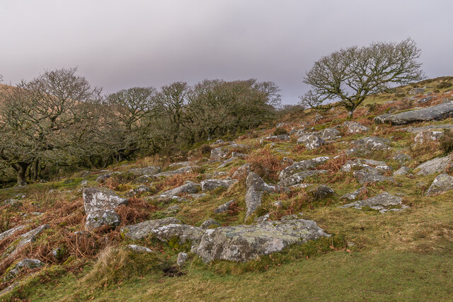
Beardown Hill is characterized by its rugged and rocky terrain, covered with dense vegetation, including heather, gorse, and grasses. The hill is composed mainly of granite, a common rock type in this part of the country, giving it a distinctive appearance. The hill's steep slopes offer challenging opportunities for outdoor enthusiasts, such as hikers and climbers, who seek to explore the area.

From the summit of Beardown Hill, visitors are rewarded with breathtaking panoramic views of the surrounding landscape. On clear days, one can see across the expanses of Dartmoor, with its rolling hills, valleys, and meandering rivers. The hill is also known for its diverse wildlife, including species like skylarks, meadow pipits, and red grouse.

Beardown Hill, with its natural beauty and tranquil atmosphere, attracts visitors who seek solace in nature and enjoy outdoor activities. Its location within Dartmoor National Park provides ample opportunities for exploration and discovery, making it a popular destination for both locals and tourists alike.

If you have any feedback on the listing, please let us know in the comments section below.

Beardown Hill Images

Images are sourced within 2km of 50.568127/-3.9717942 or Grid Reference SX6076. Thanks to Geograph Open Source API. All images are credited.

Two Bridges Hotel Historic Dartmoor hotel which takes its name from two old bridges which crossed the Cowsic and West Dart Rivers. Note the Union Jack and the Devon flags.
<span class="nowrap"><a title="www.twobridges.co.uk" rel="nofollow ugc noopener" href="http://www.twobridges.co.uk">Link</a><img style="margin-left:2px;" alt="External link" title="External link - shift click to open in new window" src="https://s1.geograph.org.uk/img/external.png" width="10" height="10"/></span>
Two Bridges Hotel
Historic Dartmoor hotel which takes its name from two old bridges which crossed the Cowsic and West Dart Rivers. Note the Union Jack and the Devon flags. LinkExternal link
Two Bridges Hotel Entrance from the north to this historic Dartmoor hotel which takes its name from two old bridges that cross the Cowsic and West Dart Rivers.
<span class="nowrap"><a title="www.twobridges.co.uk" rel="nofollow ugc noopener" href="http://www.twobridges.co.uk">Link</a><img style="margin-left:2px;" alt="External link" title="External link - shift click to open in new window" src="https://s1.geograph.org.uk/img/external.png" width="10" height="10"/></span>.
Two Bridges Hotel
Entrance from the north to this historic Dartmoor hotel which takes its name from two old bridges that cross the Cowsic and West Dart Rivers. LinkExternal link.
Two Bridges - Cowsic River Bridge The old bridge stands in front of the Two Bridges Hotel.
<span class="nowrap"><a title="www.dartmoor.gov.uk" rel="nofollow ugc noopener" href="http://www.dartmoor.gov.uk">Link</a><img style="margin-left:2px;" alt="External link" title="External link - shift click to open in new window" src="https://s1.geograph.org.uk/img/external.png" width="10" height="10"/></span>
Two Bridges - Cowsic River Bridge
The old bridge stands in front of the Two Bridges Hotel. LinkExternal link
Two Bridges - Milestone Historic milestone to the west of the Old Cowsic Bridge at Two Bridges Hotel.
To Ashburton 12 miles, Moretonhampstead 12, Tavistock 8.
<span class="nowrap"><a title="www.dartmoor.gov.uk" rel="nofollow ugc noopener" href="http://www.dartmoor.gov.uk">Link</a><img style="margin-left:2px;" alt="External link" title="External link - shift click to open in new window" src="https://s1.geograph.org.uk/img/external.png" width="10" height="10"/></span>
Two Bridges - Milestone
Historic milestone to the west of the Old Cowsic Bridge at Two Bridges Hotel. To Ashburton 12 miles, Moretonhampstead 12, Tavistock 8. LinkExternal link
Two Bridges - Old Turnpike Road Approaching the old bridge and the Two Bridges Hotel from the west.
<span class="nowrap"><a title="www.dartmoor.gov.uk" rel="nofollow ugc noopener" href="http://www.dartmoor.gov.uk">Link</a><img style="margin-left:2px;" alt="External link" title="External link - shift click to open in new window" src="https://s1.geograph.org.uk/img/external.png" width="10" height="10"/></span>
Two Bridges - Old Turnpike Road
Approaching the old bridge and the Two Bridges Hotel from the west. LinkExternal link
Two Bridges View downstream from the new bridge towards the old bridge.
<span class="nowrap"><a title="www.dartmoor.gov.uk" rel="nofollow ugc noopener" href="http://www.dartmoor.gov.uk">Link</a><img style="margin-left:2px;" alt="External link" title="External link - shift click to open in new window" src="https://s1.geograph.org.uk/img/external.png" width="10" height="10"/></span>
Two Bridges
View downstream from the new bridge towards the old bridge. LinkExternal link
Two Bridges - Seven Geese A flotilla of white geese on the river at Two Bridges.
Two Bridges - Seven Geese
A flotilla of white geese on the river at Two Bridges.
West Dart valley Valley of the West Dart River above Two Bridges.  In the right background is Wistman's Wood.  On the left-hand hillside is the line of the Devonport Leat, a channel built in the 1790s to carry freshwater to Plymouth.
West Dart valley
Valley of the West Dart River above Two Bridges. In the right background is Wistman's Wood. On the left-hand hillside is the line of the Devonport Leat, a channel built in the 1790s to carry freshwater to Plymouth.
Wistman's Wood A small group of trees at the southern end of Wistman's Wood.  Across the hillside in the background can be seen the line of the Devonport Leat, a channel built in the 1790s to carry freshwater to Plymouth.
Wistman's Wood
A small group of trees at the southern end of Wistman's Wood. Across the hillside in the background can be seen the line of the Devonport Leat, a channel built in the 1790s to carry freshwater to Plymouth.
Wistman's Wood The southern edge of Wistman's Wood, with boulders covering the foreground.
Wistman's Wood
The southern edge of Wistman's Wood, with boulders covering the foreground.
Wistman's Wood The southern edge of Wistman's Wood, with boulders covering the foreground.
Wistman's Wood
The southern edge of Wistman's Wood, with boulders covering the foreground.
Wistman's Wood The southern edge of Wistman's Wood.  Across the hillside in the background can be seen the line of the Devonport Leat, a channel built in the 1790s to carry freshwater to Plymouth.
Wistman's Wood
The southern edge of Wistman's Wood. Across the hillside in the background can be seen the line of the Devonport Leat, a channel built in the 1790s to carry freshwater to Plymouth.
Wistman's Wood Looking down the valley of the West Dart, with part of Wistman's Wood on the right.  Across the hillside in the background can be seen the line of the Devonport Leat, a channel built in the 1790s to carry freshwater to Plymouth.
Wistman's Wood
Looking down the valley of the West Dart, with part of Wistman's Wood on the right. Across the hillside in the background can be seen the line of the Devonport Leat, a channel built in the 1790s to carry freshwater to Plymouth.
Wistman's Wood A tree on the eastern edge of Wistman's Wood.
Wistman's Wood
A tree on the eastern edge of Wistman's Wood.
Wistman's Wood Lichen and moss on the branch of a tree in Wistman's Wood.
Wistman's Wood
Lichen and moss on the branch of a tree in Wistman's Wood.
Wistman's Wood Lichen, moss and ferns on a tree in Wistman's Wood.
Wistman's Wood
Lichen, moss and ferns on a tree in Wistman's Wood.
Wistman's Wood Lichen, moss and ferns on a tree in Wistman's Wood with moss-covered boulders below.
Wistman's Wood
Lichen, moss and ferns on a tree in Wistman's Wood with moss-covered boulders below.
Show me another place!

Beardown Hill is located at Grid Ref: SX6076 (Lat: 50.568127, Lng: -3.9717942)

Administrative County: Devon

District: West Devon

Police Authority: Devon and Cornwall

What 3 Words

///cookbooks.convinced.fools. Near Princetown, Devon

Nearby Locations

Beardown Hill

Related Wikis

Crockern Tor

Crockern Tor is a tor in Dartmoor National Park, Devon, England. Composed of two large outcrops of rock, it is 396 metres above sea level. The lower outcrop...

Two Bridges, Devon

Two Bridges is an isolated location on the river West Dart in the heart of Dartmoor National Park in Devon, England. It is situated around 2.5 km (1.6...
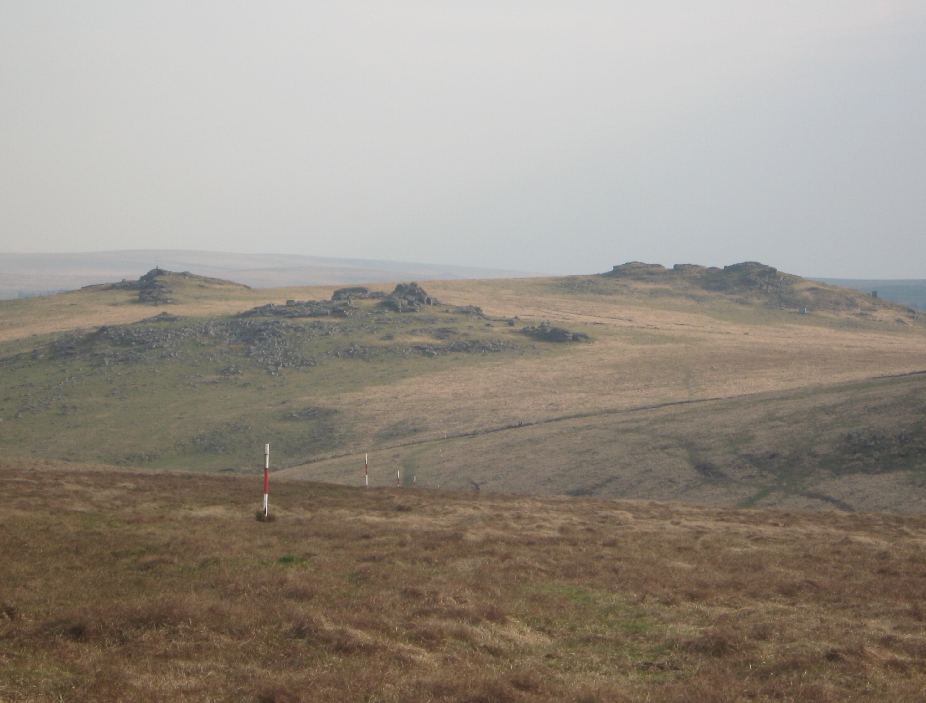
Beardown Tors

Beardown Tors is the 14th highest summit of Dartmoor with a height of 513 metres (1,683 ft). == References == OS OL20 Map Beardown Tors-Mountains Britain

Wistman's Wood

Wistman's Wood is one of three remote high-altitude oakwoods on Dartmoor in Devon, England. == Geography == The wood lies at an altitude of 380–410 metres...

Devonport Leat

The Devonport Leat is a leat in Devon constructed in the 1790s to carry fresh drinking water from the high ground of Dartmoor to the expanding dockyards...
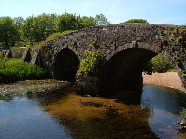
Dartmoor

Dartmoor is an upland area in southern Devon, South West England. The moorland and surrounding land has been protected by National Park status since 1951...

Dartmoor kistvaens

Dartmoor kistvaens are burial tombs or cists from the late Neolithic and early Bronze Age, i.e. from c. 2500 BC to c. 1500 BC. Kistvaens have been found...
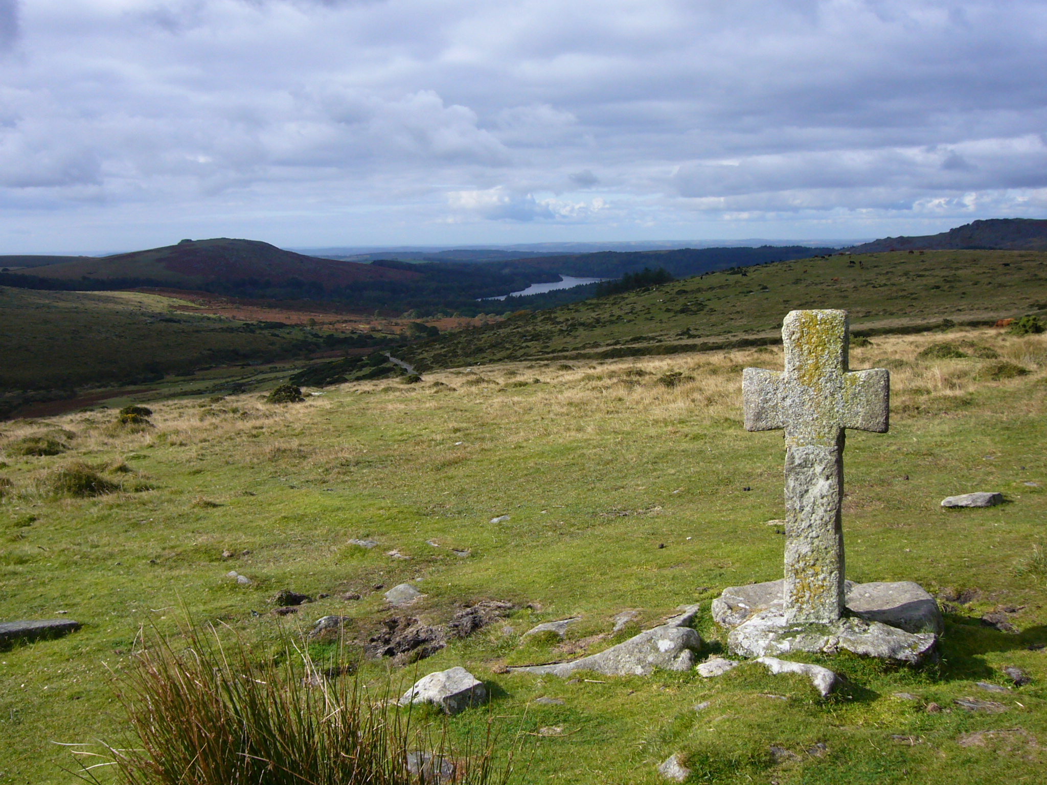
Dartmoor crosses

The Dartmoor crosses are a series of stone crosses found in Dartmoor National Park in the centre of Devon, England. Many of them are old navigational aids...

Nearby Amenities

Located within 500m of 50.568127,-3.9717942
Barrier: stile
Lat/Long: 50.5636304/-3.9717668
Barrier: stile
Lat/Long: 50.563854/-3.9712097
Barrier: stile
Lat/Long: 50.5643518/-3.9696097
Barrier: stile
Lat/Long: 50.5669815/-3.9664154
The data included in this document is from www.openstreetmap.org. The data is made available under ODbL.

Have you been to Beardown Hill?

Leave your review of Beardown Hill below (or comments, questions and feedback).