Bochastle Hill

Hill, Mountain in Perthshire

Scotland

Bochastle Hill

Roadworks on the A84 approaching Callander
Roadworks on the A84 approaching Callander Credit: Steven Brown

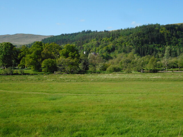
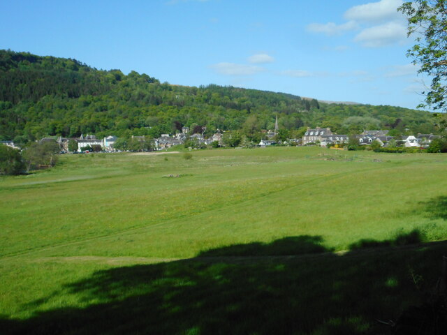
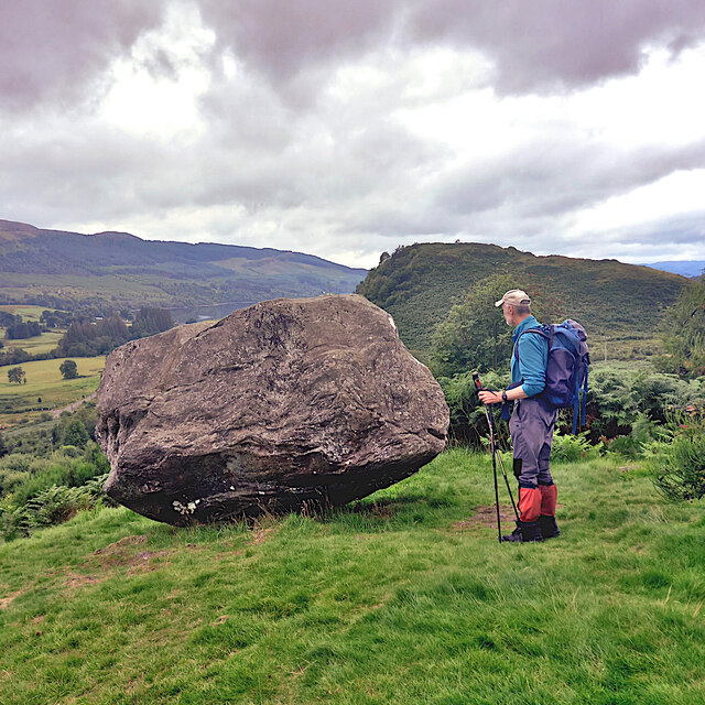
Bochastle Hill is a prominent hill located in Perthshire, Scotland. It is situated near the village of Kilmahog and offers stunning views of the surrounding countryside. The hill is part of the Trossachs National Park and is a popular destination for hikers and nature enthusiasts.

Bochastle Hill is known for its diverse wildlife, including red deer, birds of prey, and rare plant species. The hill is covered in heather and grasslands, making it an important habitat for many species of flora and fauna.

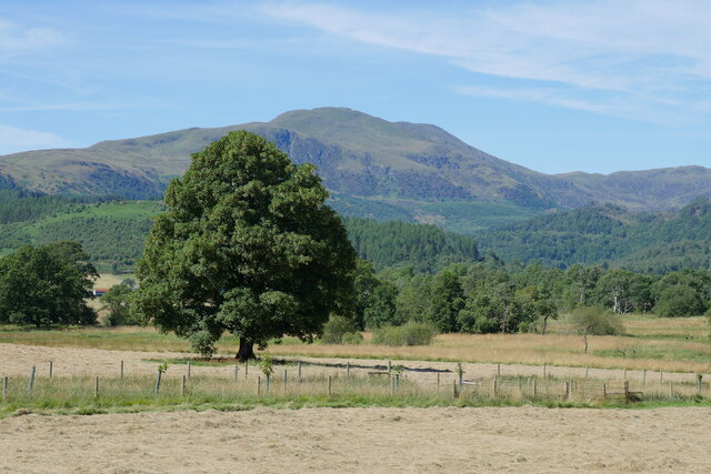
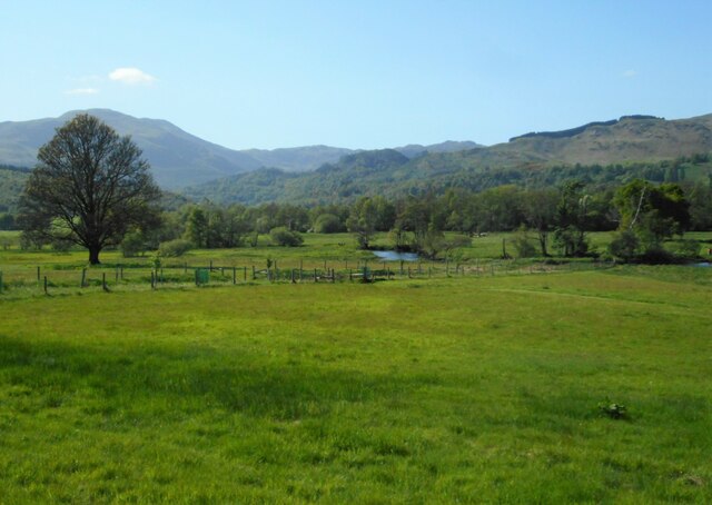
At the summit of Bochastle Hill, visitors can enjoy panoramic views of the surrounding mountains and valleys. On a clear day, it is possible to see as far as Loch Lomond and the Ben Lomond mountain range.

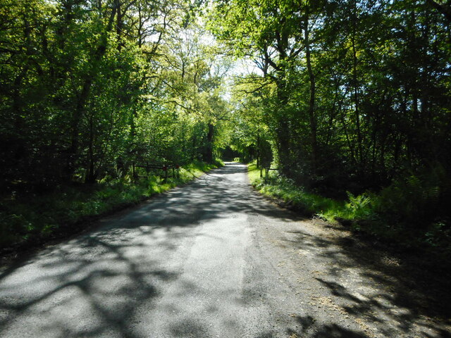
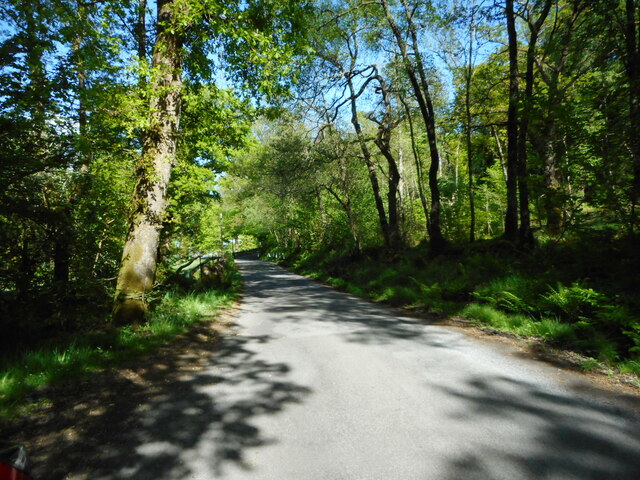
The hill is easily accessible by foot, with several well-marked trails leading to the summit. Hikers can expect a moderate climb, with some steep sections along the way. The summit offers a peaceful and secluded spot to enjoy a picnic or simply take in the natural beauty of the Scottish countryside. Bochastle Hill is a must-visit destination for anyone looking to experience the beauty of Perthshire's landscape.

If you have any feedback on the listing, please let us know in the comments section below.

Bochastle Hill Images

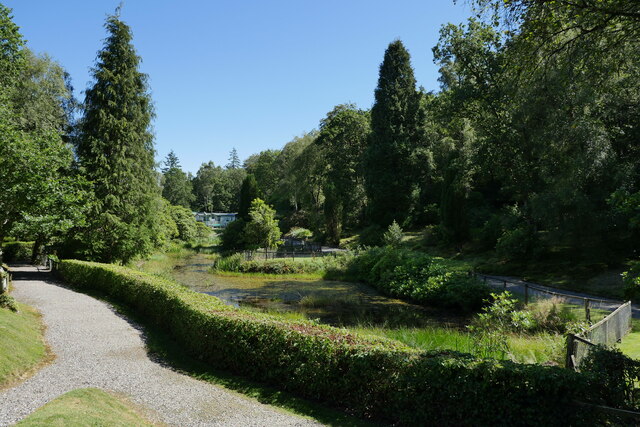
Images are sourced within 2km of 56.242968/-4.2532957 or Grid Reference NN6007. Thanks to Geograph Open Source API. All images are credited.

Roadworks on the A84 approaching Callander
Making hay whilst the sun shines Hay fields by the Eas Gobhain at Callander, with the backdrop of Ben Ledi.

This photograph was taken during the Coronavirus (COVID-19) pandemic of 2020/21/22.
Making hay whilst the sun shines
Hay fields by the Eas Gobhain at Callander, with the backdrop of Ben Ledi. This photograph was taken during the Coronavirus (COVID-19) pandemic of 2020/21/22.
The pond in Callander Holiday Park There have been quite a few changes in the site since I holidayed there 30 years previously.  The pond still remains, with grounds more neatly manicured now.

This photograph was taken during the Coronavirus (COVID-19) pandemic of 2020/21/22.
The pond in Callander Holiday Park
There have been quite a few changes in the site since I holidayed there 30 years previously. The pond still remains, with grounds more neatly manicured now. This photograph was taken during the Coronavirus (COVID-19) pandemic of 2020/21/22.
Road to Gartchonzie Bridge A minor road off the A821 which crosses the Eas Gobhain at Gartchonzie Bridge (just visible in the distance). The bridge has a 13 ton weight limit.
Road to Gartchonzie Bridge
A minor road off the A821 which crosses the Eas Gobhain at Gartchonzie Bridge (just visible in the distance). The bridge has a 13 ton weight limit.
Road to Gartchonzie Bridge The road crosses the Eas Gobhain at Gartchonzie Bridge, which has a 13 ton weight limit.
Road to Gartchonzie Bridge
The road crosses the Eas Gobhain at Gartchonzie Bridge, which has a 13 ton weight limit.
Dunmore A hill fort just northwest of the A821. It is a Scheduled Monument. See Canmore <span class="nowrap"><a title="https://canmore.org.uk/site/24375/dunmore" rel="nofollow ugc noopener" href="https://canmore.org.uk/site/24375/dunmore">Link</a><img style="margin-left:2px;" alt="External link" title="External link - shift click to open in new window" src="https://s1.geograph.org.uk/img/external.png" width="10" height="10"/></span> for more information.
Dunmore
A hill fort just northwest of the A821. It is a Scheduled Monument. See Canmore LinkExternal link for more information.
Gartchonzie Bridge The bridge dates from 1777 and is Category B listed <span class="nowrap"><a title="https://portal.historicenvironment.scot/designation/LB3984" rel="nofollow ugc noopener" href="https://portal.historicenvironment.scot/designation/LB3984">Link</a><img style="margin-left:2px;" alt="External link" title="External link - shift click to open in new window" src="https://s1.geograph.org.uk/img/external.png" width="10" height="10"/></span>. It crosses the Eas Gobhain. The hill fort of Dunmore <a href="https://www.geograph.org.uk/photo/7496623">NN6007 : Dunmore</a> is in the distance.
Gartchonzie Bridge
The bridge dates from 1777 and is Category B listed LinkExternal link. It crosses the Eas Gobhain. The hill fort of Dunmore NN6007 : Dunmore is in the distance.
Eas Gobhain Looking downstream from Gartchonzie Bridge.
Eas Gobhain
Looking downstream from Gartchonzie Bridge.
Gartchonzie Bridge The Category B listed bridge <span class="nowrap"><a title="https://portal.historicenvironment.scot/designation/LB3984" rel="nofollow ugc noopener" href="https://portal.historicenvironment.scot/designation/LB3984">Link</a><img style="margin-left:2px;" alt="External link" title="External link - shift click to open in new window" src="https://s1.geograph.org.uk/img/external.png" width="10" height="10"/></span> over the Eas Gobhain dates from 1777.  The south-facing side of the bridge is covered by fairy foxgloves, giving the bridge a tinge of pinkish-purple, although difficult to see in the photograph.
Gartchonzie Bridge
The Category B listed bridge LinkExternal link over the Eas Gobhain dates from 1777. The south-facing side of the bridge is covered by fairy foxgloves, giving the bridge a tinge of pinkish-purple, although difficult to see in the photograph.
Fairy foxgloves Large numbers of these fairy foxglove, Erinus alpinus, plants are growing on the south-facing walls of Gartchonzie Bridge <a href="https://www.geograph.org.uk/photo/7497011">NN6007 : Gartchonzie Bridge</a>, giving it a tinge of pinkish-purple.
Fairy foxgloves
Large numbers of these fairy foxglove, Erinus alpinus, plants are growing on the south-facing walls of Gartchonzie Bridge NN6007 : Gartchonzie Bridge, giving it a tinge of pinkish-purple.
Bridge Pool A pool in the Eas Gobhain beside Gartchonzie Bridge. A renowned sea trout and salmon river, the fishing is private.
Bridge Pool
A pool in the Eas Gobhain beside Gartchonzie Bridge. A renowned sea trout and salmon river, the fishing is private.
Minor road to Gartchonzie From Callander.
Minor road to Gartchonzie
From Callander.
Minor road to Callander From Gartchonzie.
Minor road to Callander
From Gartchonzie.
Eas Gobhain The river meanders slightly just before being joined by the Garbh Uisge, just out of view to the right.
Eas Gobhain
The river meanders slightly just before being joined by the Garbh Uisge, just out of view to the right.
Hidden confluence The Eas Gobhain is joined by the Garbh Uisge (just visible on the right).
Hidden confluence
The Eas Gobhain is joined by the Garbh Uisge (just visible on the right).
View towards Callander With the Eas Gobhain flowing through the left centre of the view.
View towards Callander
With the Eas Gobhain flowing through the left centre of the view.
Samson's Stone Glacial erratic near the summit of Bochastle Hill.
The Knoll behind is Dunmore Hillfort.
Dunmore Hillfort is set on the slopes below Ben Ledi. Its western side, which would otherwise have been the most easily accessible, is defended by a system of banks and ditches.
Dunmore <span class="nowrap"><a title="https://canmore.org.uk/site/24375/dunmore" rel="nofollow ugc noopener" href="https://canmore.org.uk/site/24375/dunmore">Link</a><img style="margin-left:2px;" alt="External link" title="External link - shift click to open in new window" src="https://s1.geograph.org.uk/img/external.png" width="10" height="10"/></span>
Samson's Stone
Glacial erratic near the summit of Bochastle Hill. The Knoll behind is Dunmore Hillfort. Dunmore Hillfort is set on the slopes below Ben Ledi. Its western side, which would otherwise have been the most easily accessible, is defended by a system of banks and ditches. Dunmore LinkExternal link
Coach Park, Kilmahog Woollen Mill "Destinations" coach PIW3836 is the only occupant of the coach park at Kilmahog Woollen Mill.
Coach Park, Kilmahog Woollen Mill
"Destinations" coach PIW3836 is the only occupant of the coach park at Kilmahog Woollen Mill.
Show me another place!

Bochastle Hill is located at Grid Ref: NN6007 (Lat: 56.242968, Lng: -4.2532957)

Unitary Authority: Stirling

Police Authority: Forth Valley

What 3 Words

///guru.pickup.variety. Near Callander, Stirling

Nearby Locations

Bochastle Hill

Related Wikis

Kilmahog

Kilmahog (Scottish Gaelic: Cille MoChùig: Cell of St. Chug) is a hamlet situated half a mile to the west of Callander, Scotland. == Toponym == Kilmahog...

Stirlingshire

Stirlingshire or the County of Stirling (Scottish Gaelic: Siorrachd Sruighlea [ˈʃirˠəxk ˈs̪t̪ɾuʝlə]) is a historic county and registration county of Scotland...

Garbh Uisge

Garbh Uisge is a river of approximately 7 km in the Trossachs of Scotland just north-west Callander. It is the outflow of Loch Lubnaig and joins with Eas...
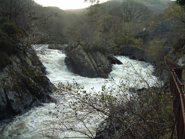
Falls of Leny

The Falls of Leny are a series of waterfalls in the Trossachs of Scotland on the course of the Garbh Uisge, otherwise known as the River Leny, where the...

Nearby Amenities

Located within 500m of 56.242968,-4.2532957
Crossing
Crossing: unmarked
Crossing Island: no
Tactile Paving: no
Lat/Long: 56.2458625/-4.2482125
Parking
Source: OS_OpenData_StreetView
Lat/Long: 56.2453521/-4.2486978
Dunmore Hillfort
Historic: archaeological_site
Lat/Long: 56.2400927/-4.2581956
Samson's Putting Stone
Natural: stone
Lat/Long: 56.2423374/-4.2541937
Leisure: picnic_table
Lat/Long: 56.2454192/-4.248851
Leisure: picnic_table
Lat/Long: 56.2453834/-4.2488309
Leisure: picnic_table
Lat/Long: 56.2454639/-4.2488651
Waste Basket
Lat/Long: 56.2454383/-4.2475835
Bench
Colour: blue
Material: wood
Seats: 3
Lat/Long: 56.2427403/-4.2473947
Barrier: cycle_barrier
Lat/Long: 56.2459023/-4.2483408
Power: pole
Lat/Long: 56.2394808/-4.2504671
Power: pole
Lat/Long: 56.2401189/-4.2518748
Power: pole
Lat/Long: 56.2408617/-4.2535441
Power: pole
Lat/Long: 56.2414162/-4.2548179
Power: pole
Lat/Long: 56.2420775/-4.2552959
Power: pole
Lat/Long: 56.242926/-4.2558899
Power: pole
Lat/Long: 56.2439663/-4.2566053
Power: pole
Lat/Long: 56.2446532/-4.2574608
Power: pole
Lat/Long: 56.241601/-4.2601791
Power: pole
Lat/Long: 56.2415649/-4.2590516
Power: pole
Lat/Long: 56.2415312/-4.2579032
Power: pole
Lat/Long: 56.2414719/-4.2567925
Power: pole
Lat/Long: 56.2411767/-4.2558638
Power: pole
Lat/Long: 56.2408559/-4.2548472
Power: pole
Lat/Long: 56.2405572/-4.2538808
Power: pole
Lat/Long: 56.2402666/-4.2528998
Power: pole
Lat/Long: 56.239955/-4.2519481
Power: pole
Lat/Long: 56.2400596/-4.2504964
Power: pole
Lat/Long: 56.2401433/-4.2495363
Power: pole
Lat/Long: 56.2403712/-4.2482896
Power: pole
Lat/Long: 56.2406002/-4.2470513
The data included in this document is from www.openstreetmap.org. The data is made available under ODbL.

Have you been to Bochastle Hill?

Leave your review of Bochastle Hill below (or comments, questions and feedback).