Reppoch Knowe
Hill, Mountain in Ayrshire
Scotland
Reppoch Knowe
Reppoch Knowe is a small hill located in the county of Ayrshire, Scotland. It is situated near the village of Drongan, about 10 miles east of the town of Ayr. With an elevation of approximately 1,063 feet (324 meters), it is categorized as a hill rather than a mountain.
Reppoch Knowe is part of the wider landscape known as the Lowther Hills, which form a range of rolling hills in the southern uplands of Scotland. The hill itself is covered in heather and grass, providing a picturesque and serene environment for visitors. It offers panoramic views of the surrounding countryside, including the nearby towns and villages, as well as glimpses of the distant Scottish coastline.
The hill is accessible via a network of footpaths and trails, making it a popular destination for hikers and nature enthusiasts. The ascent to the summit is moderately challenging, but the rewarding views make it worth the effort. Along the way, visitors may encounter various species of wildlife, including birds, rabbits, and deer.
Reppoch Knowe is also steeped in local folklore and history. It is believed to have been a site of ancient settlements and has been mentioned in historical documents dating back several centuries. Today, it remains a cherished natural landmark, offering a peaceful retreat and an opportunity to connect with the region's rich heritage.
If you have any feedback on the listing, please let us know in the comments section below.
Reppoch Knowe Images
Images are sourced within 2km of 55.546792/-4.2303726 or Grid Reference NS5930. Thanks to Geograph Open Source API. All images are credited.

Reppoch Knowe is located at Grid Ref: NS5930 (Lat: 55.546792, Lng: -4.2303726)
Unitary Authority: East Ayrshire
Police Authority: Ayrshire
What 3 Words
///submits.corrosive.ounce. Near Darvel, East Ayrshire
Nearby Locations
Related Wikis

Garpel Linn
Garpel Linn is a waterfall of Scotland. == See also == Waterfalls of Scotland == References ==
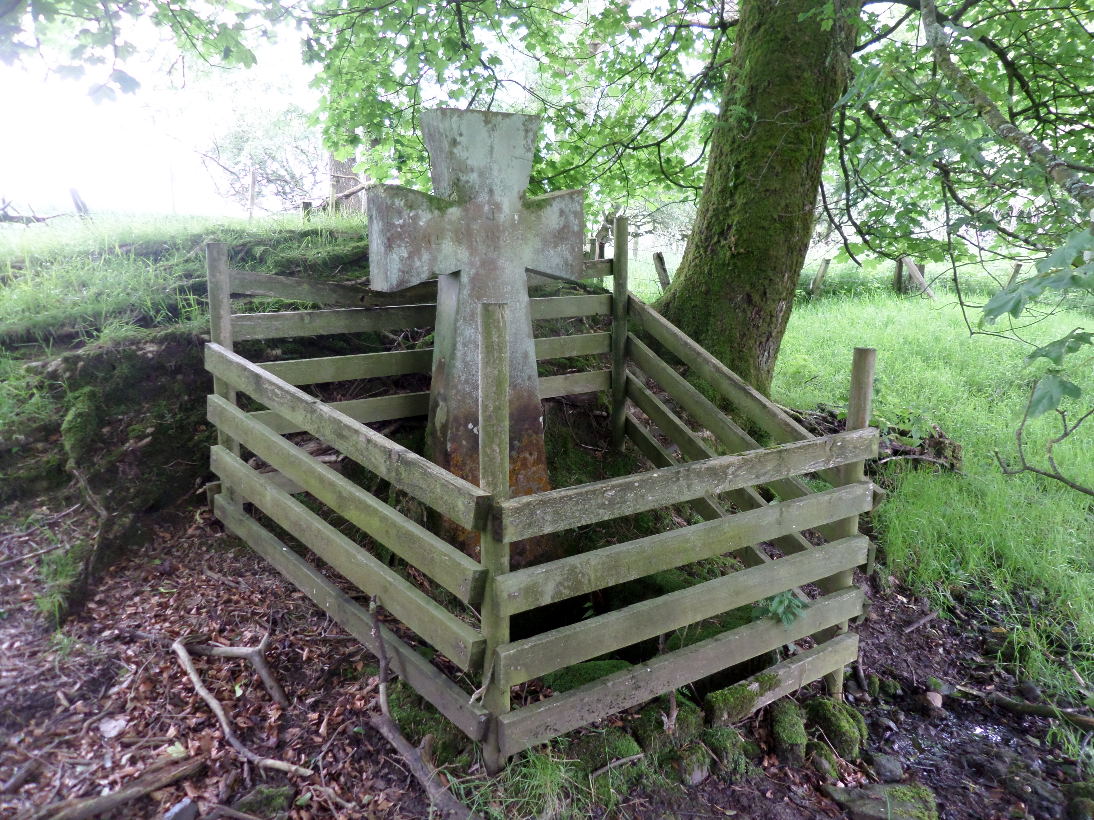
Lady's Well, Auchmannoch
The Lady's Well is a natural spring surmounted by a large cross that stands beside the Stra Burn Ford (NS254630) near Auchmannoch House in the Parish of...
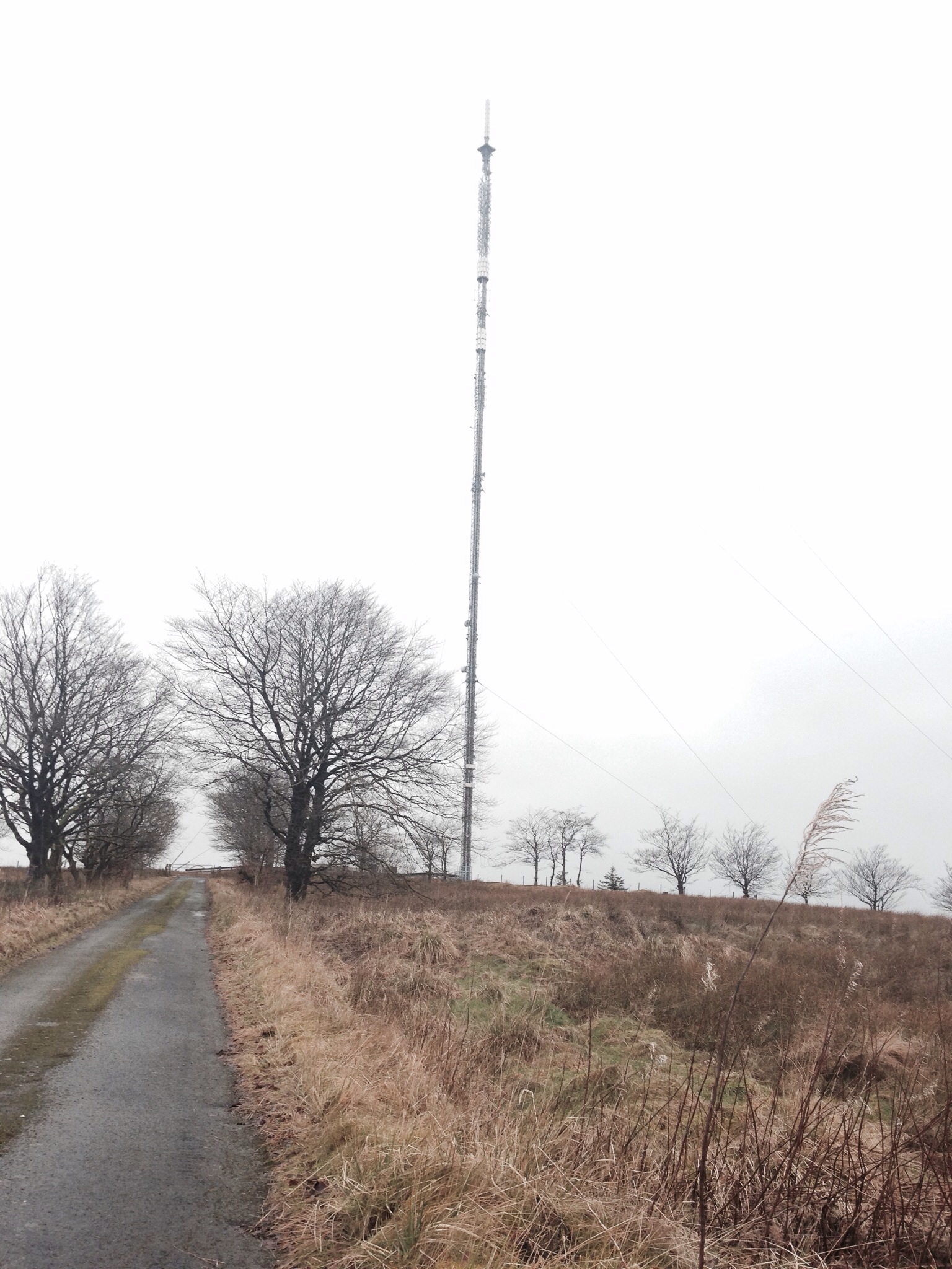
Darvel transmitting station
Darvel transmitting station is a broadcasting and telecommunications facility located near Darvel, East Ayrshire, Scotland (grid reference NS5567234132...

Greenock Water
Greenock Water is a river in East Ayrshire, Scotland. It flows out of the Dippal Burn, about 2 miles south of Dungavel Hill. A tributary of the River Ayr...
Nearby Amenities
Located within 500m of 55.546792,-4.2303726Have you been to Reppoch Knowe?
Leave your review of Reppoch Knowe below (or comments, questions and feedback).