Henshaw Hill

Hill, Mountain in Ayrshire

Scotland

Henshaw Hill

Track to High Overmuir One of the many turbines of the Whitelee Wind Farm is visible on the left-hand side.
Track to High Overmuir Credit: Alan O'Dowd

Henshaw Hill is a prominent hill located in Ayrshire, a historic county in southwest Scotland. Rising to an elevation of approximately 1,100 feet (335 meters), it is considered one of the notable peaks in the region.

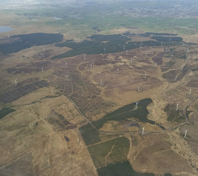
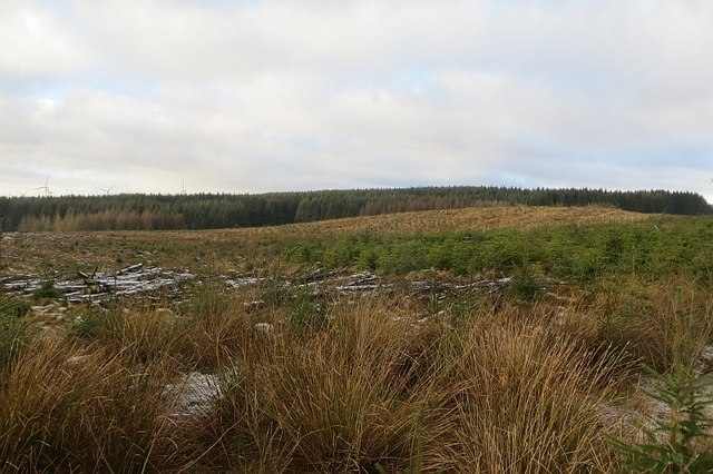
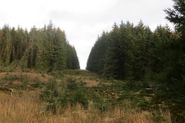
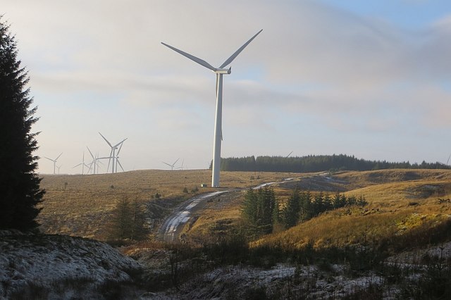
Situated near the town of Coylton, Henshaw Hill offers breathtaking views of the surrounding countryside. Its summit provides panoramic vistas of the picturesque Ayrshire landscape, featuring rolling green hills, vast farmland, and distant views of the Ayrshire coast. On clear days, visitors can even catch a glimpse of the Isle of Arran, located in the Firth of Clyde.

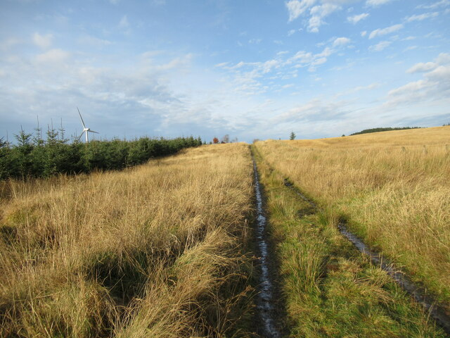
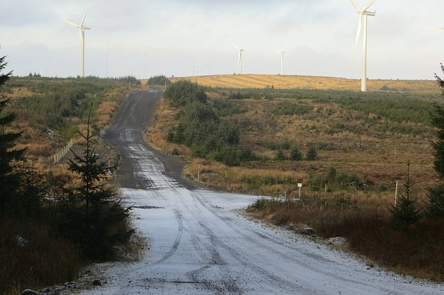
The hill is easily accessible, with a well-defined path leading to the top. It is a popular destination for outdoor enthusiasts, such as hikers and nature lovers, who appreciate the opportunity to explore the natural beauty of this area. The ascent is moderately challenging, with some steep sections, but the effort is rewarded with stunning views from the summit.

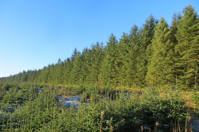
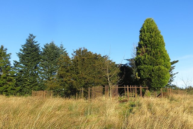
Henshaw Hill is also known for its rich biodiversity, attracting a variety of wildlife. It is home to a diverse range of plant species, including heather, gorse, and wildflowers, which create a vibrant and colorful landscape throughout the seasons. Birdwatchers often visit the hill to spot various avian species, such as buzzards, kestrels, and meadow pipits.

Overall, Henshaw Hill offers a splendid opportunity for outdoor enthusiasts to immerse themselves in the natural beauty of Ayrshire, enjoy breathtaking views, and appreciate the diverse flora and fauna that thrive in this scenic location.

If you have any feedback on the listing, please let us know in the comments section below.
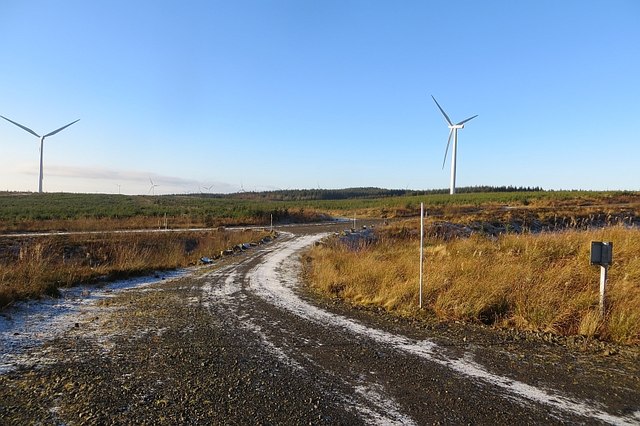
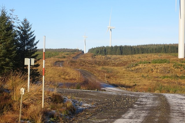
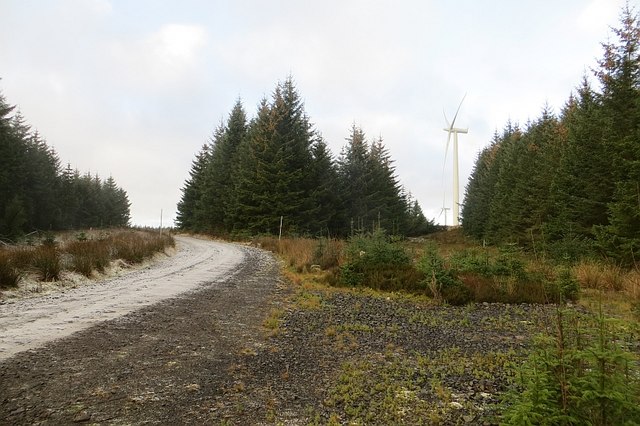
Henshaw Hill Images

Images are sourced within 2km of 55.663193/-4.2451001 or Grid Reference NS5843. Thanks to Geograph Open Source API. All images are credited.

Track to High Overmuir One of the many turbines of the Whitelee Wind Farm is visible on the left-hand side.
Track to High Overmuir
One of the many turbines of the Whitelee Wind Farm is visible on the left-hand side.
Whitelee wind farm from the air Whitelee Windfarm is the UK's largest onshore windfarm. It is located on Eaglesham Moor just 20 minutes south of central Glasgow. The windfarm has 215 turbines which can generate 539MW of electricity, enough to power over 300,000 homes.

You can access the windfarm for free and experience the wind turbines up close with over 130kms of trails to explore.  The Visitor Centre <span class="nowrap"><a title="https://www.scottishpower.co.uk/whitelee/visitor-centre" rel="nofollow ugc noopener" href="https://www.scottishpower.co.uk/whitelee/visitor-centre">Link</a><img style="margin-left:2px;" alt="External link" title="External link - shift click to open in new window" src="https://s1.geograph.org.uk/img/external.png" width="10" height="10"/></span> is also free and has an interactive exhibition and a Cafe to relax after the long walk on the windfarm.
Whitelee wind farm from the air
Whitelee Windfarm is the UK's largest onshore windfarm. It is located on Eaglesham Moor just 20 minutes south of central Glasgow. The windfarm has 215 turbines which can generate 539MW of electricity, enough to power over 300,000 homes. You can access the windfarm for free and experience the wind turbines up close with over 130kms of trails to explore. The Visitor Centre LinkExternal link is also free and has an interactive exhibition and a Cafe to relax after the long walk on the windfarm.
Whitelee Forest Most of the forest is young after widespread felling around the time of the wind farm construction.
Whitelee Forest
Most of the forest is young after widespread felling around the time of the wind farm construction.
Memorial enclosure, Whitelee Forest Once this would have been moorland, some distance, as now, from habitation. The monument in the decayed fenced enclosure reads:
Euphemia Whyte
In memory of her husband
William Smith
Of Townhead, Newmilns
Born 31st August 1825
Died 11th April 1895
The above
Euphemia Whyte
Born 18th February  1838
Died 19th September 1908

Mr Smith was a Commissioner of Supply in Ayrshire and had an estate in Newmilns. I have not found out why there is a memorial and possible grave out here.
Memorial enclosure, Whitelee Forest
Once this would have been moorland, some distance, as now, from habitation. The monument in the decayed fenced enclosure reads: Euphemia Whyte In memory of her husband William Smith Of Townhead, Newmilns Born 31st August 1825 Died 11th April 1895 The above Euphemia Whyte Born 18th February 1838 Died 19th September 1908 Mr Smith was a Commissioner of Supply in Ayrshire and had an estate in Newmilns. I have not found out why there is a memorial and possible grave out here.
Clearing, Whitelee Forest Looking past one of Whitelee's turbines (off shot) to some of the newer, bigger Browncastle turbines outside the forest.
Clearing, Whitelee Forest
Looking past one of Whitelee's turbines (off shot) to some of the newer, bigger Browncastle turbines outside the forest.
Turbines, Rough Hill The 1:25,000 map shows this to be the southern extent of the road, but a branch has since appeared running further south. Diggers could be heard towards the end.
Turbines, Rough Hill
The 1:25,000 map shows this to be the southern extent of the road, but a branch has since appeared running further south. Diggers could be heard towards the end.
Henshaw Hill A short walk beyond a turbine gets into the square and a view over some replanted blocks of conifers.
Henshaw Hill
A short walk beyond a turbine gets into the square and a view over some replanted blocks of conifers.
Ride, Whitelee Forest
Whitelee Forest A replanted block amongst the turbines.
Whitelee Forest
A replanted block amongst the turbines.
Whyte / Smith  Memorial An enclosed memorial deep in what is now Whitelee Forest.
 The monument in the decayed fenced enclosure reads:
Eupehmia Whyte
In memory of her husband
William Smith
Of Townhead, Newmilns
Born 31st August 1825
Died 11th April 1895
The above
Euphemia Whyte
Born 18th February 1838
Died 19th September 1908
Whyte / Smith Memorial
An enclosed memorial deep in what is now Whitelee Forest. The monument in the decayed fenced enclosure reads: Eupehmia Whyte In memory of her husband William Smith Of Townhead, Newmilns Born 31st August 1825 Died 11th April 1895 The above Euphemia Whyte Born 18th February 1838 Died 19th September 1908
Whyte / Smith  Memorial Whyte / Smith Memorial
An enclosed memorial deep in what is now Whitelee Forest.
The monument in the decayed fenced enclosure reads:
Eupehmia Whyte
In memory of her husband
William Smith
Of Townhead, Newmilns
Born 31st August 1825
Died 11th April 1895
The above
Euphemia Whyte
Born 18th February 1838
Died 19th September 1908
Whyte / Smith Memorial
Whyte / Smith Memorial An enclosed memorial deep in what is now Whitelee Forest. The monument in the decayed fenced enclosure reads: Eupehmia Whyte In memory of her husband William Smith Of Townhead, Newmilns Born 31st August 1825 Died 11th April 1895 The above Euphemia Whyte Born 18th February 1838 Died 19th September 1908
Whitelee Forest Looking over the march into Ayrshire. Whitelee Wind Farm has expanded southwards and now covers most of the forest.
Whitelee Forest
Looking over the march into Ayrshire. Whitelee Wind Farm has expanded southwards and now covers most of the forest.
Road, Whitelee Forest The road runs along the Lanarkshire / Ayrshire march.
Road, Whitelee Forest
The road runs along the Lanarkshire / Ayrshire march.
Road, Whitelee Forest Leading along the Lanarkshire / Ayrshire march towards a recent southwards extension of Whitelees Wind Farm.
Road, Whitelee Forest
Leading along the Lanarkshire / Ayrshire march towards a recent southwards extension of Whitelees Wind Farm.
Lanarkshire - Ayrshire march Whitelee Forest, a ride runs along the county boundary which would have almost certainly had a fence on it before the forest was planted. There is a view towards a turbine on Snab Bent.
Lanarkshire - Ayrshire march
Whitelee Forest, a ride runs along the county boundary which would have almost certainly had a fence on it before the forest was planted. There is a view towards a turbine on Snab Bent.
Wham Brae, White Lee Turbines and clear fell, Whitelee Forest.
Wham Brae, White Lee
Turbines and clear fell, Whitelee Forest.
Quarry, Whitelee Forest Dug for building material for the wind farm. Lots of new roads have been built.
Quarry, Whitelee Forest
Dug for building material for the wind farm. Lots of new roads have been built.
Wind farm roads, Whitelee Whitelee Forest and its enormous wind farm.
Wind farm roads, Whitelee
Whitelee Forest and its enormous wind farm.
Show me another place!

Henshaw Hill is located at Grid Ref: NS5843 (Lat: 55.663193, Lng: -4.2451001)

Unitary Authority: East Ayrshire

Police Authority: Ayrshire

What 3 Words

///redeemed.baroness.interacts. Near Darvel, East Ayrshire

Related Wikis

Whitelee Wind Farm

Whitelee Wind Farm is a windfarm on the Eaglesham moor in Scotland. The main visitor centre is located in East Renfrewshire, but the majority of turbines...

Corse Hill

Corse Hill is a hill located between East Renfrewshire and South Lanarkshire of Scotland. With a height of 376 m (1,234 ft), it is the highest point in...

Battle of Drumclog

The Battle of Drumclog was fought on 1 June 1679, between a group of Covenanters and the forces of John Graham of Claverhouse, at Drumclog, in South Lanarkshire...

Drumclog Moss

Drumclog Moss is a flat wilderness of broken bog and quagmire in Lanarkshire, Scotland. The Covenanters defeated Claverhouse's dragoons at the site in...

Nearby Amenities

Located within 500m of 55.663193,-4.2451001
20
Generator Method: wind_turbine
Generator Output Electricity: 2.3 MW
Generator Source: wind
Generator Type: horizontal_axis
Power: generator
Source: bing
Lat/Long: 55.662167/-4.2430343
37
Generator Method: wind_turbine
Generator Output Electricity: 2.3 MW
Generator Source: wind
Generator Type: horizontal_axis
Power: generator
Source: bing
Lat/Long: 55.6660999/-4.2424433
The data included in this document is from www.openstreetmap.org. The data is made available under ODbL.

Have you been to Henshaw Hill?

Leave your review of Henshaw Hill below (or comments, questions and feedback).