Hither Green
Settlement in Kent
England
Hither Green

Hither Green is a suburban area located in the borough of Lewisham, within the county of Kent, England. Situated approximately 7.5 miles southeast of central London, it is a residential area known for its peaceful and family-friendly atmosphere.
The area of Hither Green is mainly comprised of residential properties, consisting of a mix of Victorian and Edwardian houses, as well as some more modern developments. The housing stock in Hither Green offers a range of options, from spacious family homes to smaller apartments, catering to various lifestyles.
Hither Green benefits from excellent transport links, making it a desirable location for commuters. The Hither Green railway station, situated in Zone 3 of London's travel system, provides frequent train services to London Bridge, Charing Cross, and Cannon Street, allowing residents easy access to the city center. Additionally, several bus routes pass through the area, connecting it to neighboring towns and areas.
The local amenities in Hither Green include a variety of shops, cafes, and restaurants, providing residents with convenient options for their day-to-day needs. The area also boasts several green spaces, such as Mountsfield Park and Manor Park, offering opportunities for outdoor activities and recreational pursuits.
Hither Green is home to a diverse community, with a mix of young professionals, families, and older residents. The area is known for its friendly community spirit, with various local events and activities organized throughout the year.
Overall, Hither Green offers a balanced and comfortable suburban lifestyle, combining the benefits of proximity to central London with a peaceful residential setting.
If you have any feedback on the listing, please let us know in the comments section below.
Hither Green Images
Images are sourced within 2km of 51.450126/-0.001003 or Grid Reference TQ3974. Thanks to Geograph Open Source API. All images are credited.


Hither Green is located at Grid Ref: TQ3974 (Lat: 51.450126, Lng: -0.001003)
Unitary Authority: Lewisham
Police Authority: Metropolitan
What 3 Words
///stored.banana.smooth. Near Catford, London
Nearby Locations
Related Wikis
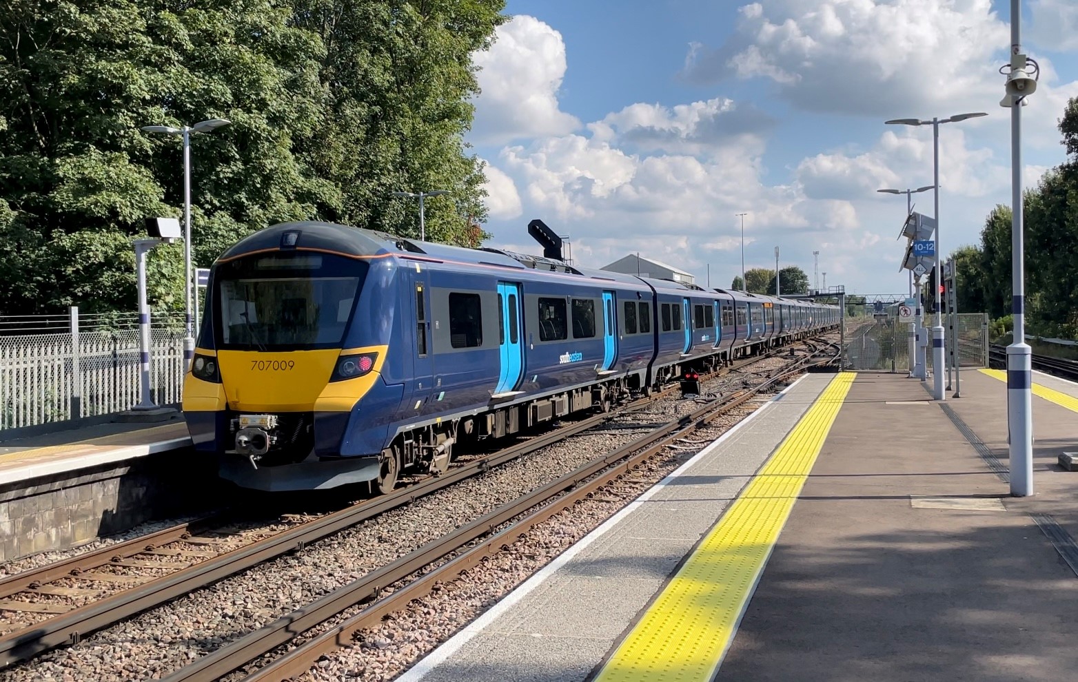
Hither Green railway station
Hither Green is a railway station located in Hither Green in the London Borough of Lewisham, south-east London. It is 7 miles 16 chains (11.6 km) down...

Hither Green
Hither Green is a district in south-east London, England, in the London Borough of Lewisham. It forms the southern part of Lewisham, 6.6 miles (10.6 km...

Hither Green TMD
Hither Green (London) Traction Maintenance Depot or Hither Green (London) TMD is a railway depot used for the maintenance and servicing of freight trains...
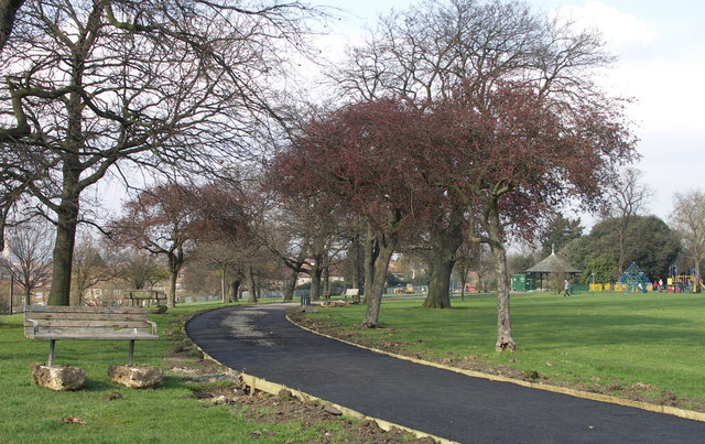
Mountsfield Park
Mountsfield Park is a public park in Catford, near to Hither Green within the London Borough of Lewisham. It opened in 1905 and has been greatly enlarged...
Nearby Amenities
Located within 500m of 51.450126,-0.001003Have you been to Hither Green?
Leave your review of Hither Green below (or comments, questions and feedback).