Lee
Settlement in Kent
England
Lee

Lee is a small village located in the county of Kent, England. Situated in the southeastern part of the country, Lee is part of the Ashford district and lies approximately 10 miles south of the town of Ashford. The village is nestled in the picturesque landscape of the Kent Downs Area of Outstanding Natural Beauty, surrounded by rolling hills, farmland, and woodlands.
With its origins dating back to medieval times, Lee has a rich history that is still visible today. The village is home to several old buildings, including St. Mary's Church, a Grade II listed structure that dates back to the 12th century. The church is known for its beautiful stained glass windows and its role as a place of worship for the local community.
Despite its small size, Lee offers a range of amenities to its residents and visitors. The village has a local pub, The Five Bells, which is a popular gathering spot for locals and tourists alike. Additionally, there are a few small shops and services catering to the needs of the community.
Lee is well-positioned for those who enjoy outdoor activities and rural living. The surrounding area provides ample opportunities for walking, hiking, and cycling. The nearby Kent Downs offer stunning views and a tranquil environment for those looking to escape the hustle and bustle of city life.
Overall, Lee is a charming and peaceful village that combines natural beauty with a sense of history. It provides a welcoming environment for residents and visitors alike, offering a taste of rural life in the heart of the Kent countryside.
If you have any feedback on the listing, please let us know in the comments section below.
Lee Images
Images are sourced within 2km of 51.450379/0.010522 or Grid Reference TQ3974. Thanks to Geograph Open Source API. All images are credited.


Lee is located at Grid Ref: TQ3974 (Lat: 51.450379, Lng: 0.010522)
Unitary Authority: Lewisham
Police Authority: Metropolitan
What 3 Words
///glare.notes.pokers. Near Blackheath, London
Nearby Locations
Related Wikis
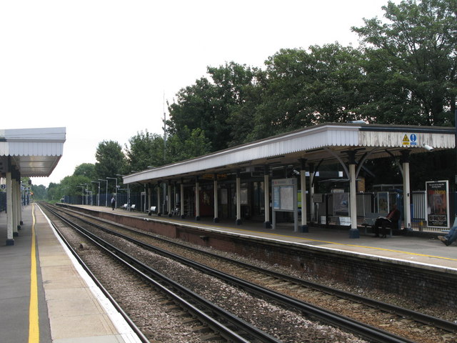
Lee railway station
Lee station is a suburban station on Burnt Ash Hill in Lee in south-east London, England, between Hither Green and Mottingham on the Dartford loop (also...

Lee, London
Lee, also known as Lee Green, is an area of South East London, England, straddling the border of the London Borough of Lewisham and the Royal Borough of...

Hither Green TMD
Hither Green (London) Traction Maintenance Depot or Hither Green (London) TMD is a railway depot used for the maintenance and servicing of freight trains...

Trinity Church of England School
Trinity Church of England School is a coeducational Church of England all-through school based over two sites in the London Borough of Lewisham, England...
Hither Green rail crash
On 5 November 1967, a busy Sunday evening train service from Hastings to London Charing Cross derailed near the Hither Green maintenance depot in London...
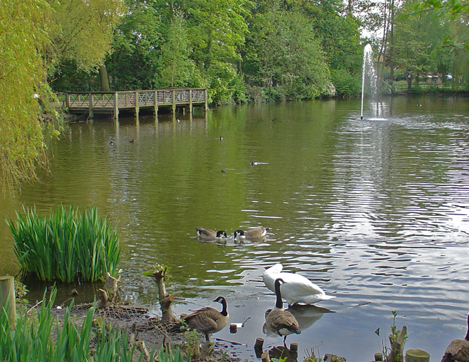
Manor House Gardens
Manor House Gardens is a 3.34-hectare public park and gardens situated in Lee, in south east London. The park features a walled flower garden, ornamental...
Colfe's School
Colfe's School, previously Colfe's Grammar School, is a co-educational private day school in Lee in the London Borough of Lewisham, in southeast London...

Hither Green
Hither Green is a district in south-east London, England, in the London Borough of Lewisham. It forms the southern part of Lewisham, 6.6 miles (10.6 km...
Nearby Amenities
Located within 500m of 51.450379,0.010522Have you been to Lee?
Leave your review of Lee below (or comments, questions and feedback).