Balsall Heath

Settlement in Worcestershire

England

Balsall Heath

Moseley Park Moseley Park was originally the grounds of Moseley Hall but was cut off by the building of Salisbury Road in the 1890s. It is now owned by local residents and sometimes used for small music festivals like this L'Esprit Manouche.
Moseley Park Credit: Penny Mayes

Balsall Heath is a vibrant and diverse inner-city neighborhood located in the city of Birmingham, West Midlands, England. Despite its geographical proximity to Worcestershire, it is actually a part of Birmingham and not located within the county. Balsall Heath is situated approximately two miles southeast of Birmingham city center.

The area has a rich history, originally being a rural village before experiencing significant urbanization during the 19th century. Today, it is a densely populated residential area with a population comprising a diverse mix of ethnicities and cultures. Balsall Heath has earned a reputation for being a multicultural hub, with residents hailing from various backgrounds including Pakistani, Bangladeshi, Afro-Caribbean, and Eastern European communities.

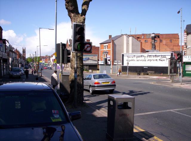
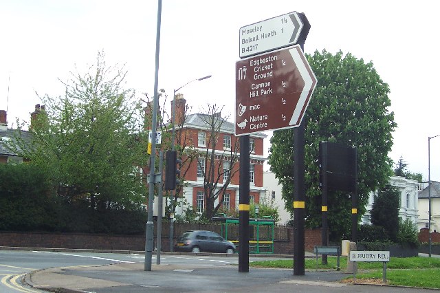
The neighborhood is renowned for its vibrant atmosphere, bustling markets, and diverse range of shops, eateries, and businesses. The famous Moseley Road runs through the heart of Balsall Heath, offering a range of amenities including local shops, pharmacies, banks, and restaurants. Additionally, it is home to the historic Moseley Road Baths, a Grade II listed swimming pool that showcases stunning Edwardian architecture.

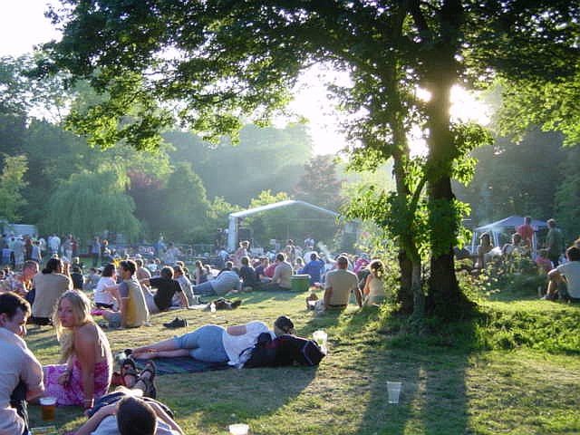
Balsall Heath is also known for its strong sense of community and has numerous community organizations and centers that actively work towards improving the lives of its residents. The neighborhood hosts cultural events and festivals throughout the year, celebrating the diverse heritage of its inhabitants.

Overall, Balsall Heath is a lively and culturally diverse neighborhood, offering a unique blend of history, community spirit, and ethnic diversity.

If you have any feedback on the listing, please let us know in the comments section below.

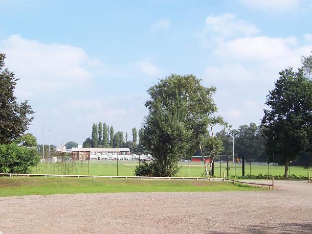
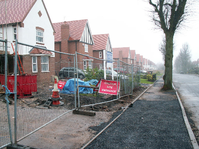
Balsall Heath Images

Images are sourced within 2km of 52.456656/-1.885767 or Grid Reference SP0784. Thanks to Geograph Open Source API. All images are credited.

Moseley Park Moseley Park was originally the grounds of Moseley Hall but was cut off by the building of Salisbury Road in the 1890s. It is now owned by local residents and sometimes used for small music festivals like this L'Esprit Manouche.
Moseley Park
Moseley Park was originally the grounds of Moseley Hall but was cut off by the building of Salisbury Road in the 1890s. It is now owned by local residents and sometimes used for small music festivals like this L'Esprit Manouche.
Sampson Road Wharf The warehouses on the right were the limit of navigation for broad-beamed boats from the South following the widening of the Grand Union canal in the 1930s.  The narrow lock on the right leads up from the extensive Birmingham Canal Navigations.
Sampson Road Wharf
The warehouses on the right were the limit of navigation for broad-beamed boats from the South following the widening of the Grand Union canal in the 1930s. The narrow lock on the right leads up from the extensive Birmingham Canal Navigations.
Bordesley The canal used to go straight ahead here through another lock and on towards the railway viaduct in the distance. When the Birmingham Middle ring road was built in the 1990s the canal was diverted to the left with dog-leg to use a brand new lock so as to make space for the road
Bordesley
The canal used to go straight ahead here through another lock and on towards the railway viaduct in the distance. When the Birmingham Middle ring road was built in the 1990s the canal was diverted to the left with dog-leg to use a brand new lock so as to make space for the road
Stratford Road, Sparkbrook, Birmingham At this point Stratford Road is also the A34. The junction with Warwick Road (the A41) is visible on the right, below a poster from the general election campaign that culminated three days previously. This area has a large Pakistani population and there are a large number of shops on Stratford Road serving that community.
Stratford Road, Sparkbrook, Birmingham
At this point Stratford Road is also the A34. The junction with Warwick Road (the A41) is visible on the right, below a poster from the general election campaign that culminated three days previously. This area has a large Pakistani population and there are a large number of shops on Stratford Road serving that community.
The Farm Driving through on the main road, Sparkbrook looks like one of the grottiest places in Birmingham, but it's not such a bad place to live. There are lots of quiet streets, on one of which can be found one of the city's hidden gems: The Farm, the oddly named residence of the bank-founding Lloyd family. This is the rear view.
The Farm
Driving through on the main road, Sparkbrook looks like one of the grottiest places in Birmingham, but it's not such a bad place to live. There are lots of quiet streets, on one of which can be found one of the city's hidden gems: The Farm, the oddly named residence of the bank-founding Lloyd family. This is the rear view.
A busy corner in Edgbaston Here the B4217 meets the A38 Bristol Road. Many of the opulent villas in the area have been converted to offices.
A busy corner in Edgbaston
Here the B4217 meets the A38 Bristol Road. Many of the opulent villas in the area have been converted to offices.
Peacock at the Birmingham Nature Centre, Pershore Road The Nature Centre is situated 2 miles south of Birmingham City Centre, between Cannon Hill Park and the Pershore Road, and covers over six acres. This peacock freely roams the site.
Peacock at the Birmingham Nature Centre, Pershore Road
The Nature Centre is situated 2 miles south of Birmingham City Centre, between Cannon Hill Park and the Pershore Road, and covers over six acres. This peacock freely roams the site.
The Bristol Road arrives at the Middleway Traffic approaching the city centre on the A38 crosses the A4540 ring road.
The Bristol Road arrives at the Middleway
Traffic approaching the city centre on the A38 crosses the A4540 ring road.
Tally-Ho Seen from the Nature Centre car park.
Tally-Ho
Seen from the Nature Centre car park.
Birmingham Wholesale Markets (Feeding the City) The Entrance To Birmingham Wholesale Markets Precinct
Birmingham Wholesale Markets (Feeding the City)
The Entrance To Birmingham Wholesale Markets Precinct
Ladypool School, Stratford Road, Sparkbrook, Birmingham This beautiful school was damaged by the F3 tornado which hit South Birmingham on the afternoon of 28th July, 2005.
Ladypool School, Stratford Road, Sparkbrook, Birmingham
This beautiful school was damaged by the F3 tornado which hit South Birmingham on the afternoon of 28th July, 2005.
The Old Crown, Deritend Built in the 15th century, this is one of Birmingham's oldest buildings. <span class="nowrap"><a title="http://www.birmingham.gov.uk/GenerateContent?CONTENT_ITEM_ID=42811&CONTENT_ITEM_TYPE=0&MENU_ID=13150" rel="nofollow ugc noopener" href="http://www.birmingham.gov.uk/GenerateContent?CONTENT_ITEM_ID=42811&CONTENT_ITEM_TYPE=0&MENU_ID=13150">Link</a><img style="margin-left:2px;" alt="External link" title="External link - shift click to open in new window" src="https://s1.geograph.org.uk/img/external.png" width="10" height="10"/></span>
The Old Crown, Deritend
Built in the 15th century, this is one of Birmingham's oldest buildings. LinkExternal link
Camp Hill Flyover
Camp Hill Flyover
New build detached houses on Reddings Road The Reddings development by Bryant Homes is situated on the former home of Moseley Rugby Club. The club moved to Billesley Common after financial problems led to the sale of the site for housing.
New build detached houses on Reddings Road
The Reddings development by Bryant Homes is situated on the former home of Moseley Rugby Club. The club moved to Billesley Common after financial problems led to the sale of the site for housing.
Gooch St. Taken from outside the old pub site of the Ale Stake pub looking towards the city centre.
Gooch St.
Taken from outside the old pub site of the Ale Stake pub looking towards the city centre.
Small Heath Bridge Photo taken from Bolton Road of Small Heath Bridge which goes over the Small Heath Highway and the railway lines.
Small Heath Bridge
Photo taken from Bolton Road of Small Heath Bridge which goes over the Small Heath Highway and the railway lines.
Railway Bridge Railway bridge over Sampson Road North.
Railway Bridge
Railway bridge over Sampson Road North.
Tin Tabernacle, Greet This is the Church of the Seventh Day Baptists in Birmingham.  It is beside the Warwick Road and appears quite extensive compared with the more usual corrugated iron clad churches.
Tin Tabernacle, Greet
This is the Church of the Seventh Day Baptists in Birmingham. It is beside the Warwick Road and appears quite extensive compared with the more usual corrugated iron clad churches.
Show me another place!

Balsall Heath is located at Grid Ref: SP0784 (Lat: 52.456656, Lng: -1.885767)

Unitary Authority: Birmingham

Police Authority: West Midlands

What 3 Words

///snows.mass.cups. Near Birmingham, West Midlands

Nearby Locations

Balsall Heath

Related Wikis

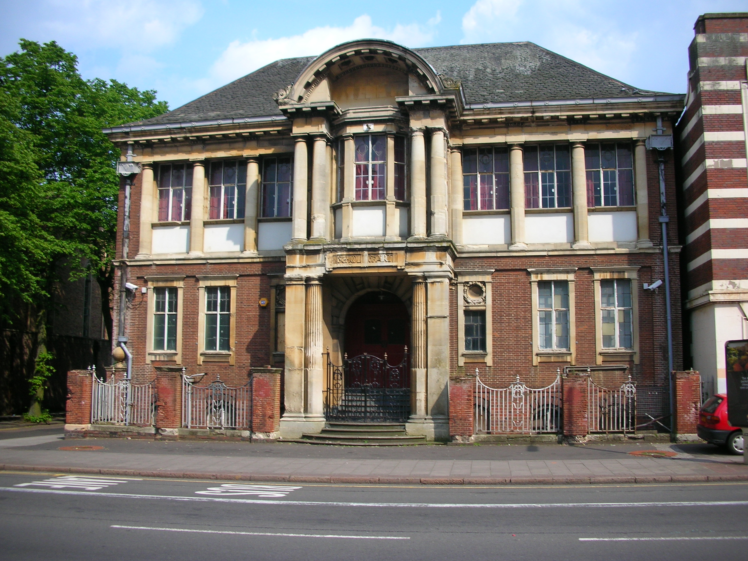
The Moseley School of Art, Balsall Heath

The Moseley School of Art (grid reference SP078843) on Moseley Road, Balsall Heath, Birmingham, England was built as the first municipal branch School...

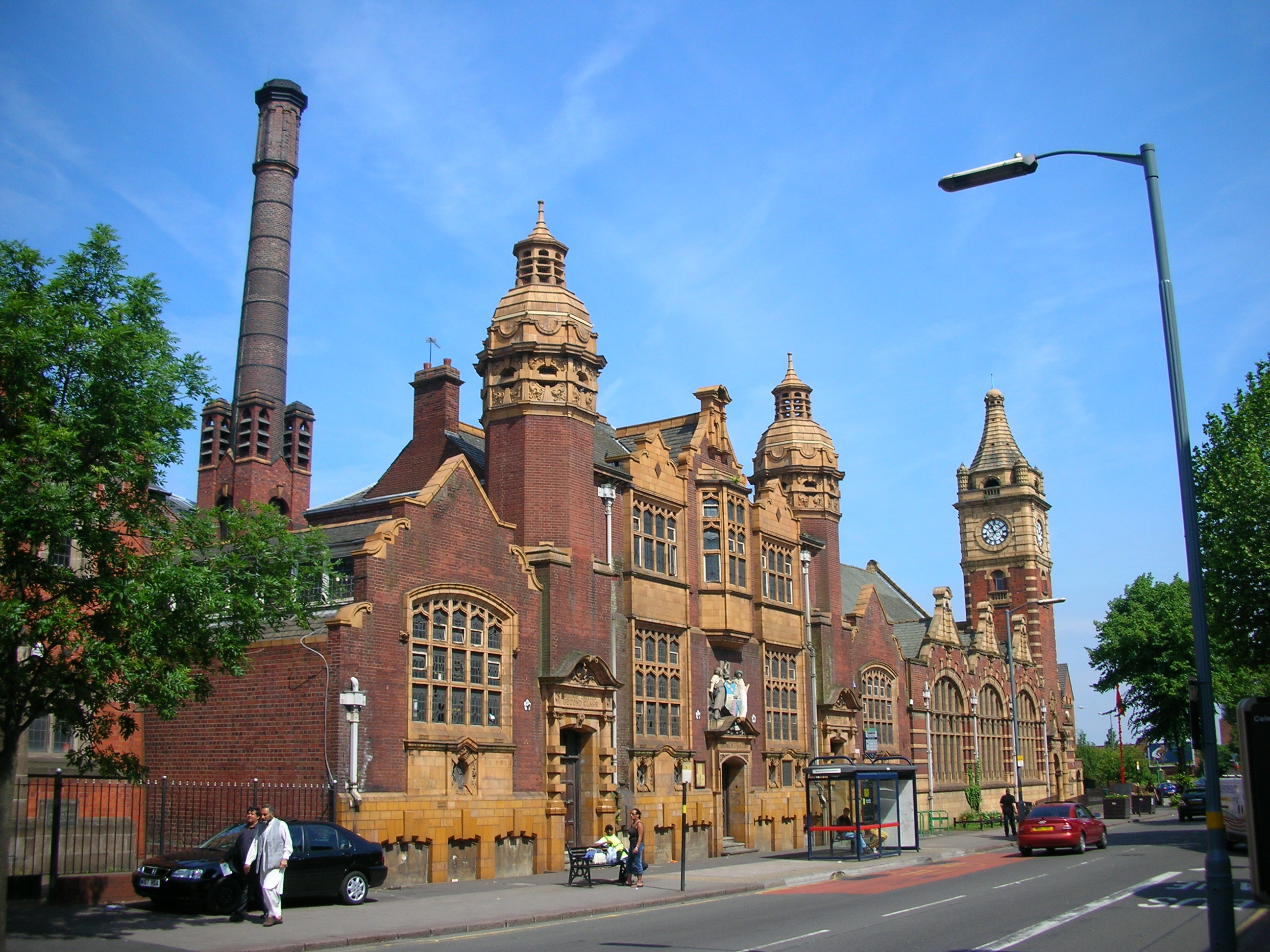
Public Library and Baths, Balsall Heath

The Public Library and Baths (grid reference SP078843) on Moseley Road, Balsall Heath, form one of many pairings of baths and libraries in Birmingham,...

Brighton Road railway station

Brighton Road railway station is a former railway station in Balsall Heath, Birmingham. It was originally opened in 1875 before being closed to passengers...

St Paul's Church, Balsall Heath

St Paul's Church, Balsall Heath is a parish church in the Church of England in Birmingham. == History == The foundation stone for the first church building...

Nearby Amenities

Located within 500m of 52.456656,-1.885767
Brighton Road
Alt Name: Balsall Heath
Historic Railway: station
Railway: site
Wikidata: Q23020263
Wikipedia: en:Brighton Road railway station
Lat/Long: 52.4550796/-1.8831851
Source: bing
Traffic Calming: bump
Lat/Long: 52.4547214/-1.888816
Source: bing
Traffic Calming: bump
Lat/Long: 52.454171/-1.8900761
Balsall Heath
Place: village
Wikidata: Q4852528
Wikipedia: en:Balsall Heath
Lat/Long: 52.4572246/-1.8832067
Mini Roundabout
Direction: clockwise
Lat/Long: 52.4542296/-1.8913777
Source: bing
Traffic Calming: bump
Lat/Long: 52.4540262/-1.8818074
Barrier: bollard
Source: survey
Lat/Long: 52.4597096/-1.88694
Mini Roundabout
Direction: clockwise
Source: survey
Lat/Long: 52.4577585/-1.8920905
Noexit: yes
Source: survey
Lat/Long: 52.4542302/-1.889297
Check Date: 2010-10-20
Disused Amenity: pub
Old Name: Coach and Horses
Source: survey
Lat/Long: 52.4576157/-1.89193
Telephone
Booth: KX100
Covered: booth
Source: survey
Lat/Long: 52.454511/-1.8914299
Bus Stop
Moseley Rd / St Pauls Rd
NaPTANAreaCode: 43000218101
Asset Ref: 609042
Bus: yes
Naptan AtcoCode: 43000218101
Naptan Bearing: S
Naptan BusStopType: MKD
Naptan CommonName: St Pauls Rd
Naptan Indicator: adj
Naptan NaptanCode: nwmajpwm
Naptan PlusbusZoneRef: BHAMNWS
Naptan Status: ACT
Naptan StopType: BCT
Naptan Street: MOSELEY RD
Naptan Towards: Moseley
Public Transport: platform
Route Ref: 50;50A;150
Shelter: yes
Shelter Ref: 609042
Source: WMCA
Lat/Long: 52.4590935/-1.8849044
Bus Stop
Moseley Rd / St Pauls Rd
NaPTANAreaCode: 43000218102
Asset Ref: 609052
Bus: yes
Naptan AtcoCode: 43000218102
Naptan Bearing: N
Naptan BusStopType: MKD
Naptan CommonName: St Pauls Rd
Naptan Indicator: opp
Naptan NaptanCode: nwmajpwp
Naptan PlusbusZoneRef: BHAMNWS
Naptan Status: ACT
Naptan StopType: BCT
Naptan Street: MOSELEY RD
Naptan Towards: Birmingham
Public Transport: platform
Route Ref: 50;50A;150
Shelter: yes
Shelter Ref: 609052
Source: WMCA
Lat/Long: 52.4591176/-1.8850574
Bus Stop
Moseley Rd / Edward Rd
NaPTANAreaCode: 43000218201
Asset Ref: 609043
Bus: yes
Naptan AtcoCode: 43000218201
Naptan Bearing: S
Naptan BusStopType: MKD
Naptan CommonName: Edward Rd
Naptan Indicator: opp
Naptan NaptanCode: nwmajpwt
Naptan PlusbusZoneRef: BHAMNWS
Naptan Status: ACT
Naptan StopType: BCT
Naptan Street: MOSELEY RD
Naptan Towards: Moseley
Public Transport: platform
Route Ref: 50;50A;150
Shelter: yes
Shelter Ref: 609043
Source: WMCA
Lat/Long: 52.4562785/-1.8859669
Bus Stop
Moseley Rd / Edward Rd
NaPTANAreaCode: 43000218202
Bus: yes
Naptan AtcoCode: 43000218202
Naptan Bearing: N
Naptan BusStopType: MKD
Naptan CommonName: Edward Rd
Naptan Indicator: adj
Naptan Landmark: Swimming Baths
Naptan NaptanCode: nwmajtad
Naptan PlusbusZoneRef: BHAMNWS
Naptan Status: ACT
Naptan StopType: BCT
Naptan Street: MOSELEY RD
Naptan Towards: Birmingham
Public Transport: platform
Route Ref: 50;50A;150
Shelter: yes
Shelter Ref: 609068
Source: WMCA
Lat/Long: 52.4572618/-1.8857927
Bus Stop
Moseley Rd / Trafalgar Rd
NaPTANAreaCode: 43000218301
Asset Ref: 609021
Bus: yes
Naptan AtcoCode: 43000218301
Naptan Bearing: S
Naptan BusStopType: MKD
Naptan CommonName: Trafalgar Rd
Naptan Indicator: adj
Naptan NaptanCode: nwmajtag
Naptan PlusbusZoneRef: BHAMNWS
Naptan Status: ACT
Naptan StopType: BCT
Naptan Street: MOSELEY RD
Naptan Towards: Moseley
Public Transport: platform
Route Ref: 50;50A;150
Shelter: yes
Shelter Ref: 609021
Source: WMCA
Lat/Long: 52.4539371/-1.8868795
Bus Stop
Moseley Rd / Trafalgar Rd
NaPTANAreaCode: 43000218302
Asset Ref: 609069
Bench: yes
Bin: yes
Bus: yes
Image: https://storage11.openstreetcam.org/files/photo/2019/1/27/lth/1330533_6b60f_1764.jpg
Naptan AtcoCode: 43000218302
Naptan Bearing: N
Naptan BusStopType: MKD
Naptan CommonName: Trafalgar Rd
Naptan Indicator: adj
Naptan Landmark: Malcolm House
Naptan NaptanCode: nwmajtaj
Naptan PlusbusZoneRef: BHAMNWS
Naptan Status: ACT
Naptan StopType: BCT
Naptan Street: MOSELEY RD
Naptan Towards: Birmingham
Public Transport: platform
Route Ref: 50;50A;150
Shelter: yes
Shelter Ref: 609069
Source: WMCA
Survey Date: 2019-01-27
Towards: Birmingham
Lat/Long: 52.4544685/-1.8868455
Bus Stop
Alcester Rd / Louise Lorne Rd
NaPTANAreaCode: 43000218402
Asset Ref: 609051
Bench: yes
Bin: yes
Bus: yes
Image: https://storage11.openstreetcam.org/files/photo/2019/1/27/lth/1330533_6b60f_1782.jpg
Naptan AtcoCode: 43000218402
Naptan Bearing: N
Naptan BusStopType: MKD
Naptan CommonName: Louise Lorne Rd
Naptan Indicator: opp
Naptan NaptanCode: nwmajtap
Naptan PlusbusZoneRef: BHAMNWS
Naptan Status: ACT
Naptan StopType: BCT
Naptan Street: ALCESTER RD
Naptan Towards: Birmingham
Public Transport: platform
Route Ref: 50;50A;150
Shelter: yes
Shelter Ref: 609051
Source: WMCA
Survey Date: 2019-01-27
Towards: Birmingham
Lat/Long: 52.4527098/-1.8874969
Post Box
Ref: B13 354
Source: GPS Survey
Lat/Long: 52.4534239/-1.8872739
Restaurant
Diwan
Cuisine: indian
Source: survey
Lat/Long: 52.4536341/-1.8873048
Telephone
Note: not BT
Source: GPS Survey
Lat/Long: 52.4553716/-1.8865307
Crossing
Crossing: traffic_signals
Lat/Long: 52.455561/-1.8863381
Pharmacy
Merali
Healthcare: pharmacy
Source: survey
Lat/Long: 52.4564531/-1.8861847
Crossing
Button Operated: yes
Crossing: traffic_signals
Crossing Island: no
Crossing Ref: pelican
Source: survey
Source Type: BCC_CycleData
Tactile Paving: yes
Traffic Signals Sound: yes
Traffic Signals Vibration: no
Lat/Long: 52.4567545/-1.8858881
Restaurant
Ashiana
Source: survey
Lat/Long: 52.4566396/-1.8861207
Fast Food
Little Kitchen
Cuisine: chinese
Source: survey
Lat/Long: 52.4566806/-1.8861085
Addr City: Birmingham
Addr Housenumber: 544
Addr Postcode: B12 9AD
Addr Street: Moseley Road
Source: survey
Lat/Long: 52.4556716/-1.8859499
Addr City: Birmingham
Addr Housenumber: 562
Addr Postcode: B12 9AD
Addr Street: Moseley Road
Source: survey
Lat/Long: 52.455158/-1.8861823
Man Made: surveillance
Source: survey
Lat/Long: 52.4551498/-1.8863691
Addr City: Birmingham
Addr Housenumber: 2
Addr Postcode: B13 8BE
Addr Street: Alcester Road
Source Addr Postcode: code-point_open
Lat/Long: 52.4539261/-1.8865511
Noexit: yes
Source: survey
Lat/Long: 52.4555265/-1.8855972
Addr City: Birmingham
Addr Housenumber: 37
Addr Postcode: B12 8PU
Addr Street: Brighton Road
Source: survey
Lat/Long: 52.4539534/-1.8820965
Addr City: Birmingham
Addr Housenumber: 39
Addr Postcode: B12 8PU
Addr Street: Brighton Road
Source: survey
Lat/Long: 52.453942/-1.8820258
Brand: National Grid
Brand Wikidata: Q1465461
Operator: National Grid Electricity Distribution Plc
Operator Old: Western Power Distribution
Operator Wikidata: Q7988183
Owner: National Grid Electricity Distribution (West Midlands) Plc
Owner Wikidata: Q114397791
Power: substation
Ref: 6639
Source: survey
Lat/Long: 52.4540155/-1.8824364
Maxheight: 4.19
Note: sign reads 13'9"
Source: survey
Lat/Long: 52.4543954/-1.8831703
Addr City: Birmingham
Addr Housenumber: 145-50
Addr Postcode: B12 8QN
Addr Street: Brighton Road
Source: survey
Lat/Long: 52.4544906/-1.8826722
Addr City: Birmingham
Addr Housenumber: 180
Addr Postcode: B12 8QN
Addr Street: Brighton Road
Source: survey
Lat/Long: 52.455075/-1.8857501
Addr City: Birmingham
Addr Housenumber: 183
Addr Postcode: B12 8QN
Addr Street: Brighton Road
Source: survey
Lat/Long: 52.455133/-1.8860244
Addr City: Birmingham
Addr Housenumber: 545
Addr Postcode: B12 9BU
Addr Street: Moseley Road
Source: survey
Lat/Long: 52.4563507/-1.8863044
Post Box
Collection Times: Mo-Fr 09:00, Sa 07:00
Post Box Type: pillar
Postal Code: B12
Ref: B12 163
Royal Cypher: EIIR
Royal Cypher Wikidata: Q33102113
Source: GPS Survey
Lat/Long: 52.4569656/-1.886519
Man Made: surveillance
Source: survey
Lat/Long: 52.4567544/-1.8880098
Barrier: lift_gate
Source: survey
Lat/Long: 52.4572076/-1.888452
Man Made: surveillance
Source: survey
Lat/Long: 52.4571882/-1.888515
Addr City: Birmingham
Addr Housenumber: 110
Addr Postcode: B12 9LS
Addr Street: Edward Road
Source: survey
Lat/Long: 52.4575005/-1.8910931
Addr City: Birmingham
Addr Housenumber: 138
Addr Postcode: B12 9LS
Addr Street: Edward Road
Source: survey
Lat/Long: 52.4575213/-1.8914742
Addr City: Birmingham
Addr Housenumber: 100
Addr Postcode: B12 9LS
Addr Street: Edward Road
Source: survey
Lat/Long: 52.4574186/-1.890369
Addr City: Birmingham
Addr Housenumber: 129
Addr Postcode: B12 9JQ
Addr Street: Edward Road
Source: survey
Lat/Long: 52.4577631/-1.8908372
Man Made: surveillance
Source: survey
Lat/Long: 52.4575103/-1.8899757
Addr City: Birmingham
Addr Housenumber: 142
Addr Postcode: B12 9LX
Addr Street: Edward Road
Source: survey
Lat/Long: 52.4577299/-1.8924363
Kindergarten
Al-Hira Neighbourhood Day Nursery
Source: survey
Lat/Long: 52.4606268/-1.8829033
Maxheight: 4.26
Note: sign reads 14 feet
Lat/Long: 52.4608551/-1.8831585
Brand: National Grid
Brand Wikidata: Q1465461
Operator: National Grid Electricity Distribution Plc
Operator Old: Western Power Distribution
Operator Wikidata: Q7988183
Owner: National Grid Electricity Distribution (West Midlands) Plc
Owner Wikidata: Q114397791
Power: substation
Source: survey
Lat/Long: 52.456514/-1.8815741
Tilton Auto Services
Shop: car_repair
Source: survey
Lat/Long: 52.4592808/-1.8824985
Fixme: better tag than TC:chicane, for narrow under bridge?
Maxheight: 4.11
Note: sign reads 13'6"
Traffic Calming: chicane
Lat/Long: 52.4585536/-1.8835247
Balsall Heath Initiative Centre
Building: public
Source: survey
Lat/Long: 52.4560894/-1.881347
Moseley Auto Parts
Shop: car_repair
Source: survey
Lat/Long: 52.4609896/-1.8840474
BR Car Care Centre
Shop: car_repair
Source: survey
Lat/Long: 52.4610722/-1.8846804
Rise 4 Ltd
Office: company
Source: survey
Lat/Long: 52.4565058/-1.890759
D Groves
Man Made: works
Source: survey
Lat/Long: 52.4572106/-1.8904465
Sy Motors
Shop: car_repair
Source: survey
Lat/Long: 52.4570503/-1.8905178
Man Made: surveillance
Note: not in use, disputed by community
Source: survey
Lat/Long: 52.4568332/-1.8856995
Regal Gates & Fencing
Man Made: works
Source: survey
Lat/Long: 52.4553198/-1.8895343
Make It Zone Artisan Workshops
Man Made: works
Source: survey
Lat/Long: 52.4568958/-1.8849041
B K Solicitors
Office: solicitor
Source: survey
Lat/Long: 52.4560449/-1.8909618
Restaurant
Desi Masala
Source: survey
Lat/Long: 52.4581689/-1.8849684
Moughal & Co
Office: accountant
Source: survey
Lat/Long: 52.4564123/-1.8907973
Autostar 02
Shop: car_repair
Source: survey
Lat/Long: 52.4589738/-1.8854437
School
Redstone Educational Academy
Source: survey
Lat/Long: 52.4579635/-1.885036
Express Carpets
Shop: carpet
Lat/Long: 52.457753/-1.885164
Training
ITNet Academy
Lat/Long: 52.4578517/-1.8851115
Blue Star Engines
Shop: car_repair
Lat/Long: 52.4601731/-1.8841123
Al-Murad Tiles
Shop: doityourself
Source: survey
Lat/Long: 52.460533/-1.8847059
Warwick Brass Founders & Engineering Co
Man Made: works
Source: survey
Lat/Long: 52.4606616/-1.8855863
First press (Plastic Moulders) Ltd
Man Made: works
Source: survey
Lat/Long: 52.4605629/-1.8854604
World of Picture Frames Ltd
Man Made: works
Source: survey
Lat/Long: 52.4603822/-1.8850968
Fast Food
Soup 'a' Sammys
Source: survey
Lat/Long: 52.4594607/-1.8850191
Scanway Eng Ltd
Man Made: works
Source: survey
Lat/Long: 52.4591936/-1.8856465
Barrier: bollard
Source: survey
Lat/Long: 52.4605794/-1.8867618
Fast Food
Moseley Delight
Source: survey
Lat/Long: 52.459404/-1.8850465
N Wheatley & Sons
Shop: funeral_directors
Source: survey
Lat/Long: 52.4593204/-1.8846113
Dawn Printers
Man Made: works
Source: survey
Lat/Long: 52.4597826/-1.884421
Barrier: bollard
Source: survey
Lat/Long: 52.4601736/-1.88659
J J Crowhurst Ltd
Man Made: works
Source: survey
Lat/Long: 52.4596088/-1.8855604
Jays News
Shop: newsagent
Source: survey
Lat/Long: 52.459556/-1.8845541
Fast Food
Moseley Fish Bar
Source: survey
Lat/Long: 52.4594607/-1.8845858
A W Appliances
Man Made: works
Source: survey
Lat/Long: 52.4595973/-1.8859985
Barrier: bollard
Source: survey
Lat/Long: 52.46082/-1.8869209
Fast Food
The Sandwich Bar
Source: survey
Lat/Long: 52.4595199/-1.885
Man Made: surveillance
Note: not in use - disputed by community
Source: survey
Lat/Long: 52.4553942/-1.8923259
Maxheight: 4.19
Note: sign reads 13'9"
Source: survey
Lat/Long: 52.4564921/-1.8833736
Maxheight: 4.19
Note: sign reads 13'9"
Source: survey
Lat/Long: 52.4553717/-1.8832638
Amex Wines
Shop: alcohol
Source: survey
Lat/Long: 52.4544954/-1.8915202
George Street News
Shop: convenience
Source: survey
Lat/Long: 52.4546302/-1.8914469
Sharpz Supplies
Man Made: works
Lat/Long: 52.454519/-1.8882894
News Link
Shop: convenience
Source: survey
Lat/Long: 52.4537155/-1.8872005
Restaurant
Saba
Cuisine: indian
Source: survey
Lat/Long: 52.4551944/-1.8867337
Birmingham Optical Group
Man Made: works
Source: survey
Lat/Long: 52.4544516/-1.8873691
Dentist
Healthcare: dentist
Source: survey
Lat/Long: 52.4551792/-1.8868925
Bicycle Parking
Source: survey
Lat/Long: 52.4568634/-1.8828207
Man Made: works
Source: survey
Website: https://www.chromefix.co.uk/
Lat/Long: 52.4568784/-1.8814364
Buy Wise Express
Shop: convenience
Source: survey
Lat/Long: 52.4565607/-1.8861516
Addr City: Birmingham
Addr Housenumber: 15
Addr Postcode: B12 8NP
Addr Street: Brunswick Road
Source: survey
Lat/Long: 52.4571557/-1.8820229
Brand: National Grid
Brand Wikidata: Q1465461
Operator: National Grid Electricity Distribution Plc
Operator Old: Western Power Distribution
Operator Wikidata: Q7988183
Owner: National Grid Electricity Distribution (West Midlands) Plc
Owner Wikidata: Q114397791
Power: substation
Source: survey
Lat/Long: 52.4555511/-1.8855395
British Yemeni Foundation
Addr City: Birmingham
Addr Postcode: B12 9LS
Office: ngo
Source: survey
Lat/Long: 52.4574501/-1.8906367
Man Made: tower
Tower Type: communication
Lat/Long: 52.4568387/-1.8854872
Zam Zam Mini Market
Shop: convenience
Source: survey
Lat/Long: 52.4577345/-1.8903119
Shop: butcher
Source: survey
Lat/Long: 52.4577154/-1.8904672
Bicycle Parking
Bicycle Parking: stands
Capacity: 8
Covered: no
Fee: no
Lat/Long: 52.4551672/-1.8864168
Noexit: yes
Lat/Long: 52.4528959/-1.8873522
Small Car Park
Lat/Long: 52.4568086/-1.8897365
Give Way
Lat/Long: 52.4593835/-1.8810332
Source: bing
Traffic Calming: bump
Lat/Long: 52.4606211/-1.8823268
Source: bing
Traffic Calming: bump
Lat/Long: 52.4607172/-1.8826616
Source: bing
Traffic Calming: bump
Lat/Long: 52.4538253/-1.8811294
Source: bing
Traffic Calming: bump
Lat/Long: 52.4542558/-1.8825899
Crossing
Crossing: traffic_signals
Crossing Ref: pelican
Source: BING;BCC_CycleData
Lat/Long: 52.4589887/-1.8859741
Man Made: surveillance
Source: survey
Lat/Long: 52.4542891/-1.8913521
Traffic Calming: bump
Lat/Long: 52.4543892/-1.8893295
Source: bing
Traffic Calming: bump
Lat/Long: 52.4549752/-1.8877429
Source: bing
Traffic Calming: bump
Lat/Long: 52.4547714/-1.8846841
Source: bing
Traffic Calming: bump
Lat/Long: 52.4550171/-1.8859332
Pharmacy
Balsall Heath Pharmacy
Healthcare: pharmacy
Lat/Long: 52.4570947/-1.8862961
Beautiful
Shop: hairdresser
Lat/Long: 52.4551937/-1.8870015
Kurdistan Mini Market
Shop: convenience
Lat/Long: 52.4566033/-1.8861359
Saifee
Shop: hardware
Lat/Long: 52.4563368/-1.8862349
Restaurant
Sheereen Kadah
Lat/Long: 52.4563965/-1.8862084
WK Solicitors
Office: lawyer
Lat/Long: 52.4537779/-1.8872098
Wilf Gilbert
Shop: bookmaker
Lat/Long: 52.4565833/-1.8861437
Shop: antiques
Lat/Long: 52.4548482/-1.8863603
A&Z Properties Ltd
Office: estate_agent
Lat/Long: 52.4570766/-1.8861732
Crystal
Shop: hairdresser
Lat/Long: 52.4561056/-1.8859341
Fitness for Ladies
Leisure: fitness_centre
Lat/Long: 52.4580566/-1.885018
Theatre School
Hazelle Stage School
Lat/Long: 52.4547854/-1.8864008
Hookahs
Fixme: Shisha lounge, Smoking
Lat/Long: 52.4577107/-1.885185
M.B.A.
Shop: car_parts
Lat/Long: 52.4546519/-1.8864122
Moseley Dance Centre
Leisure: dance
Lat/Long: 52.454804/-1.8863926
Moseley General Stores
Shop: convenience
Lat/Long: 52.4561636/-1.8859172
Arts Centre
Museum of Islamic Arts and Heritage
Lat/Long: 52.4572361/-1.8854525
Sanapost
Office: company
Lat/Long: 52.4571582/-1.8854611
Fast Food
The Waffle Project
Cuisine: waffle
Lat/Long: 52.4577963/-1.8851449
Urban Opticians
Shop: optician
Lat/Long: 52.4560649/-1.8859578
Xpress Carpets & Beds
Shop: carpet
Lat/Long: 52.457886/-1.8850844
Post Box
Post Box Type: pillar
Ref: B12 27
Royal Cypher: EIIR
Royal Cypher Wikidata: Q33102113
Lat/Long: 52.453993/-1.8818443
Post Box
Post Box Type: pillar
Ref: B12 125D
Royal Cypher: VR
Royal Cypher Wikidata: Q33102356
Source: survey
Lat/Long: 52.4577806/-1.8804029
War Memorial
Historic: memorial
Lat/Long: 52.457812/-1.8914476
Post Box
Post Box Type: pillar
Ref: B12 126D
Royal Cypher: VR
Royal Cypher Wikidata: Q33102356
Source: survey
Lat/Long: 52.4543637/-1.8913603
Give Way
Source: bing
Lat/Long: 52.4543872/-1.8914169
Post Box
Post Box Type: pillar
Ref: B12 68
Royal Cypher: GR
Royal Cypher Wikidata: Q33102273
Source: survey
Lat/Long: 52.4552465/-1.886571
Source: survey
Tourism: artwork
Lat/Long: 52.457812/-1.8917914
Post Box
Collection Times: Mo-Fr 09:00, Sa 07:00
Post Box Type: pillar
Ref: B12 1313
Royal Cypher: GR
Royal Cypher Wikidata: Q33102273
Source: survey
Lat/Long: 52.4579899/-1.8919219
Man Made: monitoring_station
Monitoring Traffic: yes
Operator: bcc
Traffic Scoot Node Ref: E1509
Traffic Scoot Region Ref: D1
Traffic Sensor: loop
Traffic Sensor Ref: N14111X
Lat/Long: 52.459828/-1.8866389
Man Made: monitoring_station
Monitoring Traffic: yes
Operator: bcc
Traffic Scoot Node Ref: E1519
Traffic Scoot Region Ref: D1
Traffic Sensor: loop
Traffic Sensor Ref: N14122C
Lat/Long: 52.4575728/-1.8855848
Man Made: monitoring_station
Monitoring Traffic: yes
Operator: bcc
Traffic Scoot Node Ref: E1509
Traffic Scoot Region Ref: D1
Traffic Sensor: loop
Traffic Sensor Ref: N14111Y
Lat/Long: 52.4581954/-1.8854588
Man Made: monitoring_station
Monitoring Traffic: yes
Operator: bcc
Traffic Scoot Node Ref: E1511
Traffic Scoot Region Ref: D1
Traffic Sensor: loop
Traffic Sensor Ref: N14121F
Lat/Long: 52.456566/-1.8859595
Man Made: monitoring_station
Monitoring Traffic: yes
Operator: bcc
Traffic Scoot Node Ref: E1519
Traffic Scoot Region Ref: D1
Traffic Sensor: loop
Traffic Sensor Ref: N14122D
Lat/Long: 52.4561176/-1.8861437
Man Made: monitoring_station
Monitoring Traffic: yes
Operator: bcc
Traffic Scoot Node Ref: E1511
Traffic Scoot Region Ref: D1
Traffic Sensor: loop
Traffic Sensor Ref: N14121E
Lat/Long: 52.4549433/-1.8879258
Source: survey
Tourism: artwork
Lat/Long: 52.4548131/-1.886448
Traffic Signals
Source: survey
Traffic Signals Direction: backward
Lat/Long: 52.4549388/-1.8865645
Traffic Signals
Source: survey
Traffic Signals Direction: forward
Lat/Long: 52.4550958/-1.8863335
Traffic Signals
Source: survey
Traffic Signals Direction: backward
Lat/Long: 52.4551239/-1.8866555
Traffic Signals
Source: survey
Traffic Signals Direction: forward
Lat/Long: 52.4552246/-1.8864525
24/7 Gym
Leisure: sports_centre
Lat/Long: 52.457646/-1.8841484
Give Way
Source: bing
Lat/Long: 52.4585004/-1.8854368
Give Way
Source: bing
Lat/Long: 52.4538829/-1.887036
Give Way
Source: bing
Lat/Long: 52.4541632/-1.8867651
Give Way
Source: bing
Lat/Long: 52.4528482/-1.8874799
Give Way
Source: bing
Lat/Long: 52.4592643/-1.8861254
Give Way
Source: bing
Lat/Long: 52.4574175/-1.8855809
Give Way
Source: bing
Lat/Long: 52.4565937/-1.8858947
Give Way
Source: bing
Lat/Long: 52.4569353/-1.8858786
Fire Hydrant
Emergency: fire_hydrant
Fire Hydrant Type: underground
Operator: WMFS
Source: survey
Lat/Long: 52.4560094/-1.8924017
Barrier: bollard
Lat/Long: 52.4528783/-1.8872332
Generator Method: photovoltaic
Generator Output Electricity: yes
Generator Source: solar
Generator Type: solar_photovoltaic_panel
Location: roof
Power: generator
Lat/Long: 52.4558492/-1.8894124
Generator Method: photovoltaic
Generator Output Electricity: yes
Generator Source: solar
Generator Type: solar_photovoltaic_panel
Location: roof
Power: generator
Lat/Long: 52.4559767/-1.8893051
Generator Method: photovoltaic
Generator Output Electricity: yes
Generator Source: solar
Generator Type: solar_photovoltaic_panel
Location: roof
Power: generator
Lat/Long: 52.4559898/-1.8890208
Generator Method: photovoltaic
Generator Output Electricity: yes
Generator Source: solar
Generator Type: solar_photovoltaic_panel
Location: roof
Power: generator
Lat/Long: 52.4560127/-1.8889537
Generator Method: photovoltaic
Generator Output Electricity: yes
Generator Source: solar
Generator Type: solar_photovoltaic_panel
Location: roof
Power: generator
Lat/Long: 52.4562971/-1.8875966
Generator Method: photovoltaic
Generator Output Electricity: yes
Generator Source: solar
Generator Type: solar_photovoltaic_panel
Location: roof
Power: generator
Lat/Long: 52.4568658/-1.8875456
Generator Method: photovoltaic
Generator Output Electricity: yes
Generator Source: solar
Generator Type: solar_photovoltaic_panel
Location: roof
Power: generator
Lat/Long: 52.4573529/-1.8878433
Generator Method: photovoltaic
Generator Output Electricity: yes
Generator Source: solar
Generator Type: solar_photovoltaic_panel
Location: roof
Power: generator
Lat/Long: 52.4580263/-1.8877441
Generator Method: photovoltaic
Generator Output Electricity: yes
Generator Source: solar
Generator Type: solar_photovoltaic_panel
Location: roof
Power: generator
Lat/Long: 52.4580116/-1.889568
Generator Method: photovoltaic
Generator Output Electricity: yes
Generator Source: solar
Generator Type: solar_photovoltaic_panel
Location: roof
Power: generator
Lat/Long: 52.4589301/-1.8918881
Generator Method: photovoltaic
Generator Output Electricity: yes
Generator Source: solar
Generator Type: solar_photovoltaic_panel
Location: roof
Power: generator
Lat/Long: 52.4548326/-1.8844704
Addr City: Birmingham
Addr Postcode: B12 9TZ
Addr Street: Haden Way
Lat/Long: 52.4584512/-1.8859282
Bicycle Parking
Bicycle Parking: stands
Capacity: 4
Covered: no
Fee: no
Lat/Long: 52.4554825/-1.8864966
Bicycle Parking
Bicycle Parking: stands
Capacity: 6
Covered: no
Fee: no
Lat/Long: 52.4557151/-1.8864078
Give Way
Lat/Long: 52.4593166/-1.8810828
Traffic Calming: bump
Lat/Long: 52.4592373/-1.8808575
Generator Method: photovoltaic
Generator Output Electricity: yes
Generator Solar Modules: 10
Generator Source: solar
Generator Type: solar_photovoltaic_panel
Location: roof
Power: generator
Lat/Long: 52.4597448/-1.8883798
Bicycle Parking
Access: yes
Bicycle Parking: post_hoop
Capacity: 1
Covered: no
Fee: no
Lat/Long: 52.4563293/-1.8861472
Bicycle Parking
Access: yes
Bicycle Parking: stands
Capacity: 22
Covered: no
Fee: no
Lat/Long: 52.4571245/-1.8856148
Bicycle Parking
Access: yes
Bicycle Parking: stands
Capacity: 2
Covered: no
Fee: no
Lat/Long: 52.4573018/-1.8857697
Bench
Backrest: yes
Lat/Long: 52.4573329/-1.8857623
Bicycle Parking
Access: yes
Bicycle Parking: stands
Capacity: 6
Covered: no
Fee: no
Lat/Long: 52.4575062/-1.8857196
Bicycle Parking
Access: yes
Bicycle Parking: stands
Capacity: 4
Covered: no
Fee: no
Lat/Long: 52.4577367/-1.8856163
Social Facility
Balsall Heath, Sparkhill Foodbank
Addr City: Birmingham
Addr Housename: Balsall Heath Church Centre
Addr Housenumber: 100
Addr Postcode: B12 9JU
Addr Street: Mary Street
Addr Suburb: Balsall Heath
Email: foodbank@narthex.org.uk
Foodbank Url: https://www.givefood.org.uk/needs/at/sparkhill/
Network: Trussell Trust
Parliamentary Constituency: Birmingham, Hall Green
Phone: +44 1217081398
Social Facility: food_bank
Social Facility For: underprivileged
Source: give_food
Website: https://www.givefood.org.uk/needs/at/sparkhill/balsall-heath/
Lat/Long: 52.4580573/-1.8916976
Bicycle Parking
Access: yes
Bicycle Parking: stands
Capacity: 8
Covered: no
Fee: no
Lat/Long: 52.4582748/-1.8852989
Bicycle Parking
Bicycle Parking: stands
Capacity: 4
Covered: no
Fee: no
Lat/Long: 52.4588718/-1.8853574
Cafe
Café Valor
Lat/Long: 52.4576406/-1.8852429
Cafe
Gap
Lat/Long: 52.4571126/-1.8855098
Bicycle Parking
Bicycle Parking: hoop
Capacity: 1
Lat/Long: 52.4574713/-1.8855067
Bicycle Parking
Access: yes
Bicycle Parking: post_hoop
Capacity: 1
Lat/Long: 52.4561531/-1.8860137
Bicycle Parking
Bicycle Parking: stands
Capacity: 1
Lat/Long: 52.4561893/-1.8862122
Mj Barberz
Addr Housenumber: 427,429
Addr Street: Moseley Road
Contact Facebook: https://www.facebook.com/Mjbarberz
Contact Instagram: https://www.instagram.com/Mjbarberzz
Contact Twitter: https://twitter.com/Mjbarberz
Payment Apple Pay: yes
Payment Cash: yes
Payment Credit Cards: yes
Payment Debit Cards: yes
Payment Google Pay: yes
Payment Samsung Pay: yes
Phone: +44 7940 406550
Shop: hairdresser
Website: https://mjbarberz.mytreatwell.co.uk/
Lat/Long: 52.4595887/-1.8849768
The data included in this document is from www.openstreetmap.org. The data is made available under ODbL.

Have you been to Balsall Heath?

Leave your review of Balsall Heath below (or comments, questions and feedback).